Nora Archaeological Park: A Phoenician, Punic, and Roman City in Italy

Site at a Glance
- Rating
- 4.6
- Popularity
- Medium
- Country
- Italy
- Primary era
- Classical
- External website
- Open
- Eras represented
- Bronze Age, Iron Age, Classical, Medieval, Early Modern
- Civilizations
- Carthaginian, Nuragic, Phoenician, Roman, Spanish
- Site type
- City
On this page22 sections
History
Nora Archaeological Park in Italy preserves the remains of a settlement on Sardinia’s southern coast, developed successively by Nuragic, Phoenician, Punic, and Roman communities from the late seventh century BC through late antiquity. Traditionally regarded as Sardinia’s oldest city, Nora was associated in legend with Norace, a founder linked to an Iberian settlement tradition, while archaeological evidence points to an earlier Nuragic presence followed by Phoenician occupation.
Nuragic and Phoenician beginnings
A Nuragic well near the Baths by the Sea, together with imported Mycenaean pottery, shows that the peninsula was occupied during the Nuragic period. The first clear Phoenician installations belong to the late seventh century BC. Postholes in the eastern part of the peninsula mark tents and other temporary buildings made from perishable materials. These installations formed a seasonal trading station used by merchants whose maritime networks connected eastern Mediterranean communities with Sardinian producers of metals and other raw materials.
The Nora Stone, generally dated from the second half of the ninth to the first quarter of the eighth century BC, is the earliest written evidence associated with the site. Its Phoenician inscription contains the oldest known written occurrence of the name Sardinia. The later settlement replaced the temporary trading station with an organized quarter of houses and warehouses served by a straight road. Nora’s port then developed into an important center of maritime trade, while the settlement expanded westward toward an older harbor inlet.
Punic development
Sardinia came definitively under Carthaginian control toward the end of the sixth century BC. Punic refers to the culture and political sphere of Carthage, the North African power that dominated the island before Rome. Nora developed fully under Punic rule during the fourth century BC, when residential and craft districts expanded, chamber-tomb cemeteries were established, and a tophet, a sacred cemetery or ritual precinct, served the community. Intensive quarrying also took place on the nearby peninsula of Is Fradis Minoris.
Rome conquered Nora in 238 BC. After the creation of the province of Sardinia and Corsica in 227 BC, the settlement entered Rome’s political sphere, although its local institutions and urban plan did not immediately change. Nora probably received the status of a Roman municipium during the late first century BC or the first century AD. A municipium was a Roman city whose inhabitants held Roman citizenship and whose local government operated within the Roman administrative system.
Roman urban transformation
Nora’s first major Roman monumental phase began in the second half of the first century BC. The forum was built at the center of the settlement, and the earlier warehouse district beneath it was systematically destroyed and buried. During the first and second centuries AD, public buildings, residences, workshops, roads, waterworks, and religious complexes expanded. The city reached its greatest prosperity during the Severan period and the following decades, when ceramic imports, artistic production, especially mosaics, and public and private construction flourished.
Nora was described as having about 8,000 inhabitants and as a caput viae, the starting point or principal node of the island’s road network. Its political and commercial importance is also reflected in its appearance in the Tabula Peutingeriana, a late-antique map of the Roman road system.
In the late second and early third centuries AD, the forum was enlarged, its civic basilica was restored, and two monumental entrance arches were added. The large Roman Temple, the public aqueduct, and several bath complexes also belonged to this period of development. During the fourth century AD, the Eastern Baths were built or refurbished, the Sanctuary of Esculapius was monumentalized, the large multifunctional commercial and residential complex in the northwestern quarter was doubled in size, and the Small Baths were enlarged.
Late antique decline and later memory
Repairs to the forum’s western portico and to the aqueduct during the first half of the fifth century AD were among the final recorded public building works before the Vandal conquest of Sardinia. Nora then declined, although parts of the central and northwestern residential districts continued in use with altered functions and modified structures. Ceramic imports show that the port remained active and that some economic recovery continued into the first decades of the sixth century AD.
By the seventh century, Nora was described as a praesidium, meaning a fortified place, rather than as a city. After losing its economic role, it appears to have been abandoned during the eighth century. The peninsula nevertheless remained connected with the tradition of Saint Efisio’s martyrdom. A small church dedicated to him was erected in 1089, and the site continues to be associated with the annual Saint Efisio pilgrimage and procession. The sixteenth-century Spanish Tower of Saint Efisio, also called the Coltellazzo Tower, belongs to a later defensive phase.
Rediscovery and excavation
The surviving ruins were identified as Nora by the sixteenth-century scholar Giovanni Francesco Fara and were noted by nineteenth-century travelers. Excavations began in 1889 after a coastal storm exposed the Phoenician-Punic cemetery. Investigations by Giovanni Spano, Filippo Vivanet, and Filippo Nissardi followed in the late nineteenth and early twentieth centuries. Giovanni Patroni excavated the so-called Temple of Tanit in 1901, while Gennaro Pesce directed systematic excavations from 1952 to 1960. The archaeological park now preserves the principal Phoenician, Punic, and especially Roman monuments of Nora. Much of the ancient settlement remains underwater, and another substantial portion on Italian Army land has not been excavated.
Remains
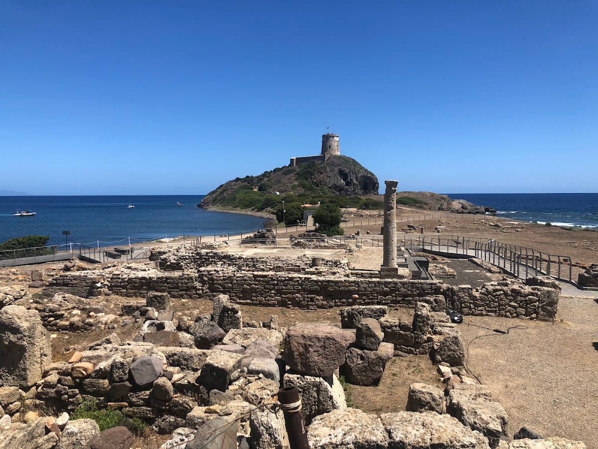
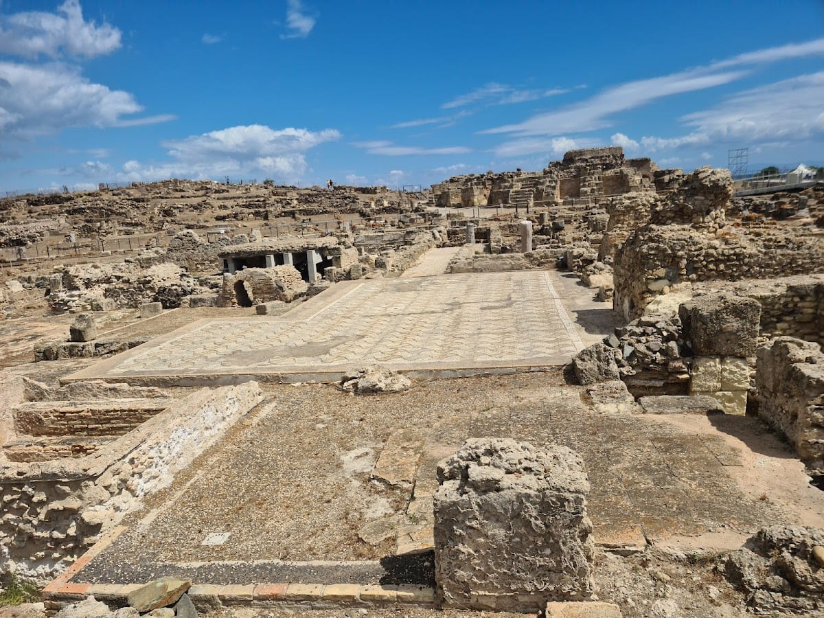
Nora occupies the Capo Pula peninsula and its isthmus, covering approximately 200,000 square metres. The ancient settlement extended around two protected harbors, one on either side of the peninsula. Its surviving remains include planned roads, public buildings, residences, workshops, sacred areas, cemeteries, quarries, and harbor installations. Much of the former city is now submerged as southern Sardinia sinks into the Mediterranean. Roman roads and other remains can be seen on the seabed around Punta del Coltellazzo, while the excavated land forms an open-air archaeological park.
Phoenician and Punic settlement
Trading quarter and residential districts
The eastern sector preserves the postholes of the earliest Phoenician tents and other temporary structures. The later Punic settlement developed a straight planned road, warehouses, houses, workshops, craft districts, sacred areas, and an enlarged harbor zone. A warehouse and residential quarter lay beneath the Roman Forum, while further houses and workshops occupied the central and southern parts of the peninsula. The so-called Kasbah spread across the southern and southwestern slopes of the so-called Hill of Tanit, with additional residential and artisanal areas extending toward the former harbor inlet.
Necropolis and tophet
The Phoenician and Punic necropolis included chamber tombs in the isthmus area. The tophet stood in the suburban sector near the small Romanesque church. Its sandstone stelae, generally dated from the fifth to the fourth or third century BC, often display symbolic designs within small aedicules. Many show a betyl, a sacred stone associated with a deity, together with the sign of Tanit, a major goddess of the Carthaginian religious tradition. Solar and lunar symbols also appear, and the surviving stelae range from small pieces to monuments more than one metre high.
Sacred areas and the Nora Stone
The so-called Temple of Tanit occupies the summit of one of the peninsula’s principal elevations. Its substantial remains were brought to light by Giovanni Patroni in 1901, although the identification with Tanit’s temple remains conventional rather than certain. Other Punic sacred areas lay at Coltellazzo and Sa Punta ’e su Coloru. The Nora Stone, found at the site and now preserved in the National Archaeological Museum of Cagliari, carries the Phoenician inscription that contains the earliest known written occurrence of the name Sardinia.
Roman public buildings
Forum and temples
The Roman Forum occupies the central part of the settlement between the so-called Hill of Tanit and the Coltellazzo promontory. Its construction permanently buried the earlier warehouse quarter. Erosion along the southern side of the square and poor preservation limit the reconstruction of its original plan. A temple near the forum had a six-column entrance porch, or pronaos, while the wider complex included a civic basilica, a western portico, and monumental entrance arches.
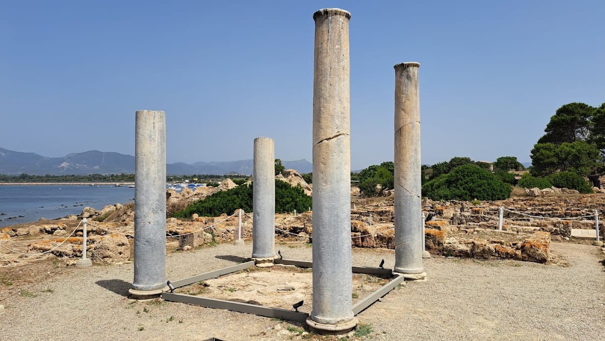
The so-called Roman Temple is an imposing six-column, or hexastyle, building on the southeastern slope of the Hill of Tanit. Other sacred structures occupied central and coastal parts of the settlement. A sacred deposit from this temple contained silver didrachms and a terracotta mask, probably placed as devotional offerings during the early Roman period.
Theatre and amphitheatre
The masonry Roman theatre stands near the Forum. It was probably built during the first century AD, or as early as the Augustan period, on the site of earlier buildings. The preserved seating area could accommodate approximately 1,100 to 1,200 spectators. At the entrance to the settlement, where the isthmus begins, a small amphitheatre had twenty tiers and could hold about 1,000 people. It was originally faced with marble, although its date remains uncertain.
Water supply and roads
A public Roman aqueduct supplied a castellum aquae, a water-distribution tank, as well as a fountain and three bath complexes: the Central Baths, the large Baths by the Sea, and the Small Baths. The Eastern Baths were constructed or refurbished during the fourth century AD. Much of Nora’s road system was paved during the imperial period, with drains running beneath the paving. These roads continued in use after Roman urban life declined, while neighboring buildings were altered.
Residences and commercial buildings
Coastal and central houses
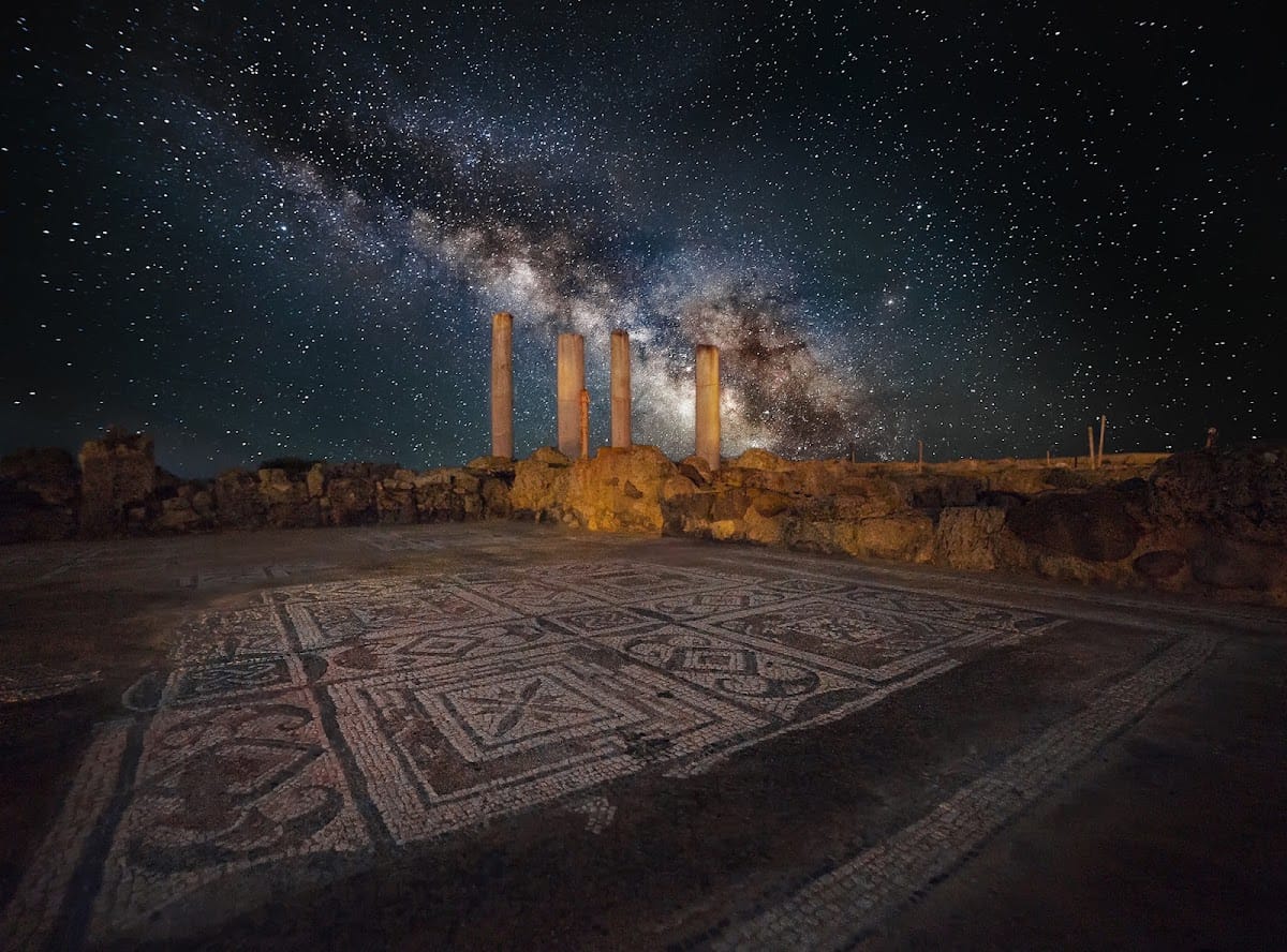
The southern coastal area contains the House of the Tetrastyle Atrium, a wealthy third-century AD residence with a four-columned portico. Its rooms were decorated with mosaics, including a scene of a Nereid riding a marine centaur. Two other wealthy residences were built or substantially developed in the central-southern sector during the Severan period. The northwestern quarter contained a regular district of houses and workshops intended for the residential and commercial needs of the middle class.
Multifunctional complex and workshops
The large multifunctional complex in the northwestern quarter is variously identified as a macellum and horreum, or as Insula A. It combined commercial and residential functions and was later doubled in extent. Other private and residential components include the House of Director Tronchetti, the so-called Fullonica immediately west of the Forum, the so-called Ninfeo, late-antique houses in the central quarter, the eastern building beside the Forum, and houses along the southern shore.
Sanctuaries and Christian buildings
Sanctuary of Esculapius
The Sanctuary of Esculapius occupied the southern point of the settlement and was built on several levels. Esculapius was the Roman healing deity associated with the Greek Asclepius. The sanctuary contains imperial-period rooms with mosaic floors and an apse on the southern side. A partition dividing the inner sanctuary into two spaces may indicate an earlier Punic phase.
Excavations produced four small and two larger ceramic statuettes dating to the second century BC. They represent devotees and include a larger sleeping man with a serpent coiled around his body, an image associated with the sanctuary’s healing deity and incubation rituals. In incubation, worshippers slept in a sacred precinct while seeking a divine revelation or cure, often through a dream. A mosaic-paved terrace dates to the fourth century AD and may have served such rituals. The precise sequence of the sanctuary’s intermediate building phases remains uncertain.
Christian Basilica and later church
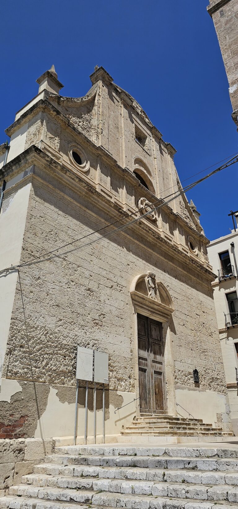
The Christian Basilica stood in the western part of the peninsula at the beginning of the road leading to the harbor. It had three aisles and was probably built during the fifth century AD. Near the former tophet, the Church of Saint Efisio preserves the later religious tradition associated with the peninsula. The sixteenth-century Spanish Tower of Saint Efisio, also known as the Coltellazzo Tower, stands at Punta del Coltellazzo.
Harbors and quarrying
The settlement’s two protected harbors shaped its development from the Phoenician trading station through the Punic and Roman periods. The harbor zone expanded as Nora grew westward toward an older inlet. The southern and western landscape also includes the Wall of Grecale, the sacred area of Coltellazzo, and the quarries of Is Fradis Minoris. Together with the submerged roads and structures around Punta del Coltellazzo, these features extend the archaeological setting beyond the excavated streets and buildings on land.