Nizhny Arkhyz Archaeological Site: An Alanian Urban and Religious Center
Site at a Glance
- Rating
- 4
- Popularity
- Very Low
- Country
- Russia
- Primary era
- Medieval
- Eras represented
- Medieval
- Civilizations
- Unclassified
- Site type
- City
On this page17 sections
History
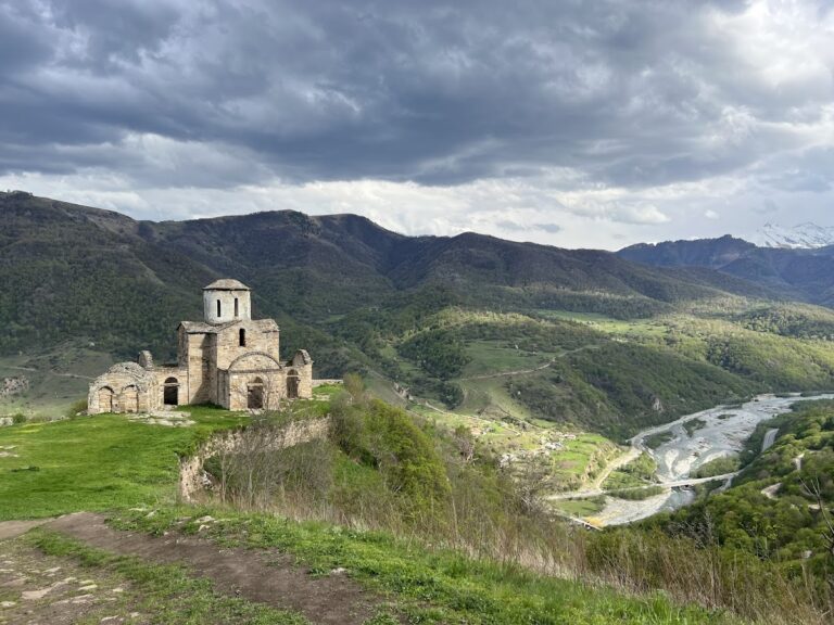
The Nizhny Arkhyz archaeological site in Russia preserves the remains of a large Alanian settlement dating mainly from the tenth to the twelfth centuries. The Alans were an Iranian-speaking people who formed a powerful polity in the North Caucasus during late antiquity and the medieval period. Nizhny Arkhyz was probably an important urban and religious center of medieval Alania, although the proposal that it was Magas, the Alanian capital described by the Arab historian al-Masudi, remains conjectural.
The Alanian settlement
The settlement combined residential, domestic, agricultural, and production areas with Christian churches, chapels, cemeteries, and burial grounds associated with earlier religious traditions. Its position in a mountain valley protected by wooded ranges and the Bolshoi Zelenchuk River also gave it access to routes leading toward the Ciscaucasian plains and the passes of the western Caucasus.
The main settlement ceased to exist at the end of the twelfth century, apparently in connection with internal processes that contributed to the decline of western Alania. The Alanian diocesan settlement continued into the second half of the fourteenth century. Christian institutions therefore remained active after the principal urban phase had ended.
Christian Alania
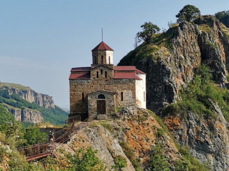
The three major Zelenchuk churches belong to the Abkhazian-Byzantine architectural tradition and are generally dated to the tenth century. The North and Middle churches were probably built during the first half of that century, although their order of construction is uncertain. The South Church is generally considered later, probably dating from the second half of the tenth century.
The North Church was probably the cathedral of the Alanian diocese, an ecclesiastical jurisdiction serving the Christian Alanian population. Its dedication has been debated. An inscription reportedly seen by Alexei Potemkin led earlier scholars to associate it with Saint Nicholas, while another reading connected Potemkin’s reference with the South Church. More recent studies of the church’s orientation support the dedication to Saint Nicholas, although uncertainty remains. Worship is currently held there once a year, on 6 May, the feast of Saint George the Victorious.
The Middle Church may have served as a cathedral for the Christian population of the city. Its sanctuary seating, baptistery, and features associated with a choir support this interpretation. Traditions recorded in the nineteenth century also connected the site with an earlier monastery. Monks later rededicated the church to the Holy and Life-Giving Trinity, and services are held on the second day of that feast, known as the Day of the Holy Spirit.
The South Church probably served the religious needs of the urban population or part of it, possibly including the feudal elite. Its nineteenth-century restoration dedicated it to Prince Alexander Nevsky and made it the monastery’s heated winter church. Modern orientation studies suggest an earlier dedication to Saint Elijah, a name preserved at the church’s last consecration in 1991. The church is described as the oldest functioning Christian church in Russia.
Exploration and archaeological work
Interest in the ruins increased during the nineteenth century. In 1802, Major General Alexei Potemkin inspected the churches and other remains, prepared drawings, and produced a general plan of the area. His materials later passed through Pyotr Butkov and Pyotr Keppen before publication.
During the Russo-Turkish War of 1828 to 1829, General Georgy Emmanuel asked Giuseppe Bernardazzi, an Italian architect working in Russia, to investigate the ancient churches of the Upper Kuban. Bernardazzi surveyed the Zelenchuk, Shoana, and Senty churches and prepared plans and drawings. Emmanuel then petitioned Emperor Nicholas I for their restoration, but General Alexei Velyaminov replied that work in the region was considered dangerous under the conditions of the time.
The Naryshkin brothers carried out small excavations at the North Zelenchuk Church in 1867 and published drawings, a plan, and illustrations of objects found there. In 1888, the Moscow Archaeological Society sent Dmitry Strukov, an artist-restorer and archaeologist, to the site. He found a stone slab with an Alanian inscription written in Greek letters and painted watercolors of frescoes visible in the churches. Vasily Sysoev later excavated at the settlement and published plans and photographs of the churches.
An expedition led by Konstantin Petrelevich excavated near the North Church in 1940 and discovered the Zelenchuk hoard. It included gold jewelry and a ninth-century almandine seal bearing an Arabic inscription associated with the Armenian king Ashot. The hoard is now held by the State Historical Museum.
Vladimir Kuznetsov directed extensive archaeological work at Nizhny Arkhyz. Rescue excavations took place from 1961 to 1972 and again in 1978, after ancient burials were found near the North Church during restoration work led by Vladimir Borodin in 1959. Kuznetsov later summarized the results in Alania in the Tenth to Thirteenth Centuries.
Monastery and modern protection
The Alexander Nevsky Athonite Zelenchuk Monastery was established at the site in the late nineteenth century by decision of the Holy Synod in 1889. The Athonite designation referred to the monastic tradition associated with Mount Athos, a major center of Eastern Orthodox monasticism. The monastery was intended to preserve the surviving churches and promote the revival of Christianity among the local population. It included an almshouse for ten elderly soldiers and an icon-painting school attended mainly by children of priests from the Stavropol Diocese. The monastery closed after 1917.
By a decree of 28 January 1988, the Nizhny Arkhyz historical, architectural, and archaeological complex became part of the Karachay-Cherkessia Historical, Cultural, and Natural Museum-Reserve. A presidential decree of 20 February 1995 recognized it as a monument of federal significance and a federally protected cultural-heritage site. In 2018, the complex was transferred to the Alanian Christian Center of the North Caucasus, established in 2017. The transfer was criticized by the Congress of the Karachay people, which argued that it was unlawful and questioned the center’s experience and qualifications for preserving and using such monuments.
Remains
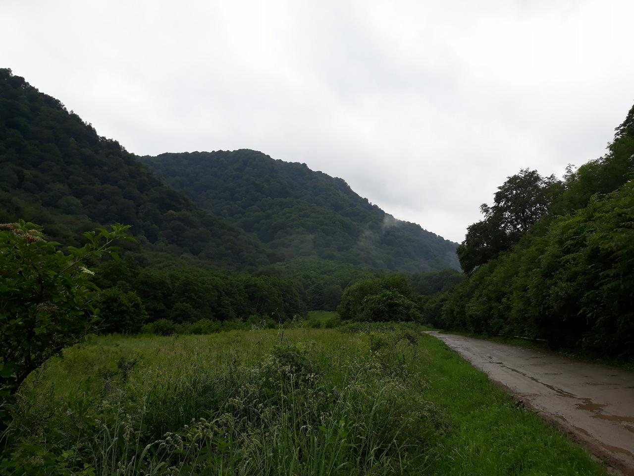
Nizhny Arkhyz occupies more than 60 hectares in a mountain valley over three kilometers long, extending from southwest to northeast along the right bank of the Bolshoi Zelenchuk River. The valley averages 250 to 300 meters in width and lies at about 1,150 meters above sea level between the Mytseshta Range and the Uzhum Range. Ravines and streams descend from the wooded mountains into the river, while the valley route connects the settlement with the Ciscaucasian plains and older routes toward the Sancharo and Tsagerker passes and Sukhumi.
Settlement organization
The archaeological landscape is divided into six topographic sectors: two agricultural areas, the Alanian diocesan settlement, the central city, a pagan cemetery on the Uzhum slopes, and a pagan necropolis on the Mytseshta slopes. The first agricultural area extended for about 600 meters between two defensive walls. The second occupied a level tract of about 750 meters and approximately 15 hectares.
The diocesan settlement lay beyond the second defensive wall, beginning near Church Ravine. It included the North Church, five nearby small one-nave churches, three mountain churches on the Uzhum foothills, fortification remains, residential and agricultural buildings, and a Christian cemetery. The central city began near Hassan Ravine and the Middle Church. Its buildings followed three narrow, traceable streets. Central Street ran from Podorvanaya Ravine through the settlement to the river and the Stone Circle. Podgornaya Street branched from it and continued along the Uzhum foothills, while Embankment Street extended for more than 500 meters beside the river-facing escarpment before joining Central Street.
The city sector contains the South Church, three small one-apse churches, residential and production buildings, and Christian cemeteries. Quarries, smelting furnaces, pottery facilities, mines, livestock enclosures, an ancient Alanian road, and watchtowers on the mountain slopes formed part of the wider settlement economy and infrastructure.
The principal Zelenchuk churches
North Zelenchuk Church
The North Zelenchuk Church stands about 800 meters from the central city in the Alanian diocesan settlement. It is a three-apse, cross-domed building, meaning that a central dome rises above a cross-shaped internal arrangement. Dressed stone blocks and slabs were laid in lime mortar. Two pairs of quadrangular piers divide the interior into three longitudinal naves, with the central nave and apse wider and projecting farther east than the lateral spaces. Stone-vaulted narthexes, or entrance halls, adjoin the church on three sides. The building measures 25.5 by 19.5 meters with the narthexes and 21 by 10.5 meters without them.
The church follows a carefully regulated plan. Its width without the narthexes is half its length, while the dome square, cross arms, narthex, and wall thickness follow related modular dimensions. The original roof used stone barrel vaults with single- and double-pitched coverings made from thin overlapping slabs. One surviving roof section contained a birch-bark waterproofing layer, a technique not otherwise identified among the architectural monuments of the Caucasus and Crimea.
A dressed stone burial box beneath the south nave floor is interpreted as the remains of a looted burial belonging to a person of high status. The northwest corner of the narthex contains a stone baptistery, a basin or space used for Christian baptism. It measures 90 by 72 centimeters and stands on a platform 1.15 meters above the floor. Four steps lead to the font, whose mortar-coated base has a five-centimeter drainage hole.
Two brick arches and paired pilasters indicate that the church once had wooden galleries or choir seating, reached by a wooden stairway from the baptistery platform. Strukov’s 1888 watercolors recorded frescoes on the north and northeast walls, including saints in pointed monastic headgear, a praying figure with raised arms, and a blessing saint holding a Gospel. Ornamental designs survive on the slopes of the altar windows.
Architectural comparisons and archaeological evidence place the church in the tenth century. A stone cross from the adjacent cemetery bore a date corresponding to 1013, showing that the cemetery was later than the church. A large bronze cross found in the narthex in 1960 carries an inscription recording its renewal by Thomas the presbyter in 1067. A ninth-century almandine ring bearing the name of Ashot, son of Smbat, was found in a hoard beside the church wall.
Middle Zelenchuk Church
The Middle Zelenchuk Church stands about 800 meters south of the North Church, at the edge of the central city. It is a three-apse, cross-domed, pillarless building of dressed sandstone blocks set in lime mortar. Its eastern supports are formed by the walls between the apses, while western arches rest on imposts built into the walls. A large narthex and a single porch extend the western arm.
The church measures 21.5 by 13.25 meters, with the dome beginning 15 meters above the floor. Its proportions were carefully regulated through the relationships between the dome, drum, building length, and supporting arches. A large opening 4.5 meters above the north wall may have provided access to wooden choir galleries.
The masonry uses alternating stone blocks associated with medieval Byzantine building standards. Brick appears mainly in the supporting arches, conch arches, and parts of arched windows and doors, while dressed stone forms the lunettes above the entrances. The architectural plan suggests that the building may initially have been conceived as a simple cross before apses were added during construction.
Monks of the Zelenchuk Monastery partially rebuilt the church in the late nineteenth century. They added side extensions, renewed the thin-stone roof, installed a metal dome covering, built wooden choirs, and replastered the interior. A stone inscription panel recording this work was found in the 1970s. Nineteenth-century descriptions and Strukov’s watercolors preserve evidence of former frescoes depicting mounted saints, richly dressed warriors, Saint Barbara, monastic and blessing figures, and a possible image of Constantine the Great.
Foundations of two horseshoe-shaped buildings beside the church are divided into equal rooms. Their arrangement has been compared with monastic cells and supports the tradition that an earlier monastery occupied the location.
South Zelenchuk Church
The South Zelenchuk Church stands among residential remains in the center of the city. It is a three-apse, four-pier, cross-domed building of dressed sandstone blocks set in lime mortar. The structure measures 8.5 by 7.75 meters. Its dome square is asymmetrical and elongated, measuring 1.8 by 2.7 meters, while its low drum is elliptical and pierced by four windows. The central apse projects only slightly beyond the side apses.
The church originally had a roof system comparable to those of the North and Middle churches, with thin sandstone slabs and projecting eaves for water drainage. Its rougher masonry and irregular proportions have been interpreted as evidence of local building practice and a less experienced adaptation of Byzantine principles.
The late nineteenth-century monastic restoration replaced the stone roof with an iron one, added an iron onion dome and cross, altered the entrances, and connected the west portal by a covered gallery to the monastery refectory. The walls were replastered and painted. A small chapel and bell gable were built nearby. Underground furnaces connected to an air duct heated the church as a winter place of worship.
Small churches and chapels
At least eleven small one-apse or one-nave churches and chapels are known across the site. Seven stood near the North Church, including three on mountain spurs, while three within the city probably served as domestic churches in wealthy estates. Their construction combines local dry masonry using dressed limestone slabs with features associated with provincial Byzantine architecture. Glass disks provided window glazing, and some buildings preserve features that may reflect the work of Greek or Byzantine craftsmen.
Urban churches
Church 1 stood in Estate I on Central Street. This three-part, one-apse building measured 11.7 by 4.4 meters and contained an altar, a main worship space, and a narthex. Its walls survive more than two meters high. A stone porch and stairway at the west wall indicate that the floor stood more than 1.5 meters above ground. Colored stone tiles decorated the exterior of the apse. The church dates from the end of the twelfth century.
Church 2 stood on the left bank of Podorvanaya Stream and measured 11.3 by 5.3 meters. Two massive buttresses strengthened the junction between the side walls and the apse. Excavations produced pottery, iron nails, fragments of iron crosses, a glass bracelet, and two reused stone slabs. One preserves part of an Islamic declaration of faith, while the other bears a date corresponding to 1044. The church is dated to the late eleventh century, and its walls were later removed for building material.
Church 3 was a small one-apse chapel near the south apse of the South Church. Strukov’s surviving plan shows two windows in each side wall and two more in the apse. Church 11, found near the foot of Church Ravine, measured 13 by 4 meters and contained a narthex, a main worship space, and a deep horseshoe-shaped apse. Pottery and its limestone floor, covered by a cement-like layer comparable to the North Church floor, place it in the ninth or tenth century.
Mountain and cemetery churches
Church 4 stood on Mount Hassan, 200 to 250 meters above the valley floor. It measured 3 by 1.5 meters and had a retaining wall near the cliff. Its position and form have led to an association with an ancient monastery and hermit monks. Church 5 was a one-apse chapel measuring 6 by 2.7 meters, situated south of the North Church.
Church 6 stood on the alluvial fan of Church Ravine, 40 meters southeast of the North Church. It measured 19 by 5.5 meters, with walls 0.7 meters thick and a substantially thicker western wall along the slope. A paved path led from the entrance to a stone post with a quadrangular recess and grooves. Excavations recovered two halves of medieval reliquary crosses dating from the twelfth or early thirteenth century, burials in the narthex and main worship space, crypts, and stone burial boxes. Associated finds included fragments of a bronze mirror, arrowheads, gilded bells, and a bronze ear-cleaning instrument. Male, female, and child burials have led to its interpretation as a memorial church for a socially important family.
Church 7 stood on the summit of Three Pines Mountain above Church 6. Its walls survive almost to their full height. The one-apse, two-part building measures 4.12 by 2 meters, with a main worship space and altar separated by a solid wall screen. The walls reach two meters high, and the stone-paved floor of the main room measures two by two meters. A cast bronze button found during excavation belongs to a type common from the eleventh to thirteenth centuries. The church may have served anchorite hermits.
Church 8 stood on Church Mountain opposite the North Church and Three Pines Mountain. The surviving foundations indicate a two-part plan, with the altar separated from the main worship space by a stone screen. Church 9, northwest of the North Church, measured 13.4 by 4 meters and included a main room, a square narthex, and a stone altar in the eastern apse. Excavations recovered profiled slabs, a window archivolt, a sandstone post, a stone box, and part of an ancient iron cross.
Church 10 was a small one-apse, one-room building near an ancient Christian cemetery. It measured 3 by 2.8 meters and probably served as a cemetery chapel. Together, these smaller buildings show the range of Christian spaces within the settlement, from urban estate churches and family memorials to mountain chapels and cemetery buildings.
Burial areas and earlier religious traditions
Pagan burial areas occupied both sides of the Bolshoi Zelenchuk. The Uzhum slopes contain cave burials in steep sandstone outcrops, while the eastern slopes of the Mytseshta Range contain numerous ancient burials forming a pagan necropolis. The diocesan and urban sectors also contain Christian cemeteries, reflecting the coexistence of different burial traditions across the settlement.
A small two-room building on Church Mountain, 90 meters east of Church 8, measures 4.7 by 2 meters. Its rooms are no more than 0.8 meters wide and the structure is oriented northwest to southeast. Excavation recovered pottery and 25 iron crosses, most made from two riveted plates or cut from a single sheet. Dating from the tenth to twelfth centuries, the building may have begun as a pre-Christian sanctuary and later acquired Christian practices centered on the deposition of iron crosses.
Four cup-marked stones are associated with Nizhny Arkhyz and its surroundings. These stones bear deliberately carved cup-shaped depressions whose meanings can be ritual, astronomical, symbolic, or practical. One former stone pillar measured 2.4 meters in length and carried 19 cup marks on one face and 76 on another, with a groove joining five of the larger depressions. Another slab had twelve cup marks arranged along one edge, an arrangement compared with stars in Pisces and a nearby star in Aries. A boulder from the vicinity was interpreted by some specialists as representing stars in Cetus and Pisces, together with lines associated with the ecliptic and planetary paths.
Stone Circle and solar observations
The Stone Circle is an approximately circular monument whose outer earthwork was first measured at about 80 meters across. Excavation revealed a buried sandstone wall with inner and outer faces and a rubble core. The wall is 2.1 meters thick, has a projecting plinth, and encloses an internal diameter of 88.5 meters, equivalent to 300 Roman feet. About 0.4 meters of the wall survives, while its original height has been estimated at approximately four meters.
Excavations found charcoal, pieces of realgar or fired-clay imitations, and structures adjoining the eastern wall. These included a small rectangular building, worked stones, small stone-lined installations, paved areas, ash patches from large fires, and numerous rounded stones measuring five to ten centimeters across. Central Street appears to terminate at the monument, a layout that may have permitted ceremonial processions.
Studies conducted in 1985 and 1986 identified alignments toward the Sun at the winter solstice and toward the east on 1 September, the beginning of the Byzantine calendar year. A one-meter-wide opening in the southern wall corresponded to the winter-solstice direction. Later excavations revealed a passage through the northern wall, a semicircular southern extension, and a worked circular stone slab supported on three dressed stones. These findings support an interpretation of the Stone Circle as both a religious monument and a near-horizon solar observatory or calendar, although its precise function remains uncertain.
Other archaeological features
A rock image of Christ known as the Image Not Made by Hands was discovered in 1999 on the left bank of the Bolshoi Zelenchuk opposite the Middle Church. Measuring about 140 by 80 centimeters, it faces east toward the North Church and resembles a Sinai Pantocrator icon, an image of Christ as ruler or almighty one. Its tempera technique has led to a tenth-century date.
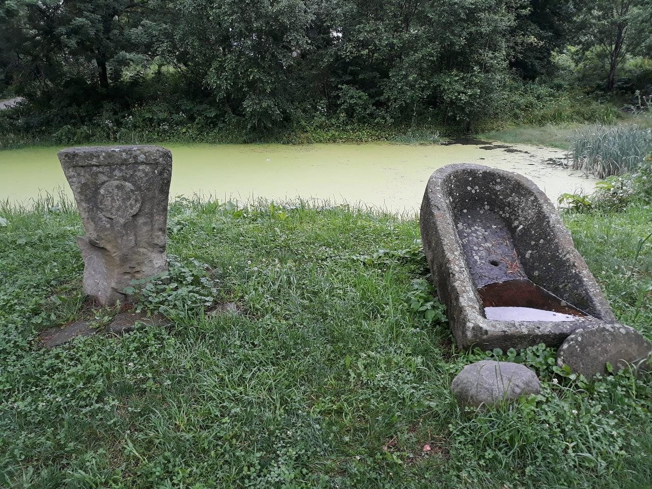
A stone idol formerly stood on the right bank of the river before being moved onto the archaeological site. A Polovtsian statue known as the Bowl Holder was also recorded on the right bank. Polovtsian is a historical name for the Cuman-Kipchak peoples of the Eurasian steppe. Remains of a dam, water conduit, or mill were recorded on a stream in Church Ravine, where the dimensions of the masonry were also documented.