Monkodonja: A Fortified Bronze Age Settlement in Croatia
Site at a Glance
- Popularity
- Medium
- Country
- Croatia
- Primary era
- Bronze Age
- Eras represented
- Bronze Age
- Civilizations
- Unclassified
- Site type
- Military
- Remains
- Fortified Town
On this page23 sections
History
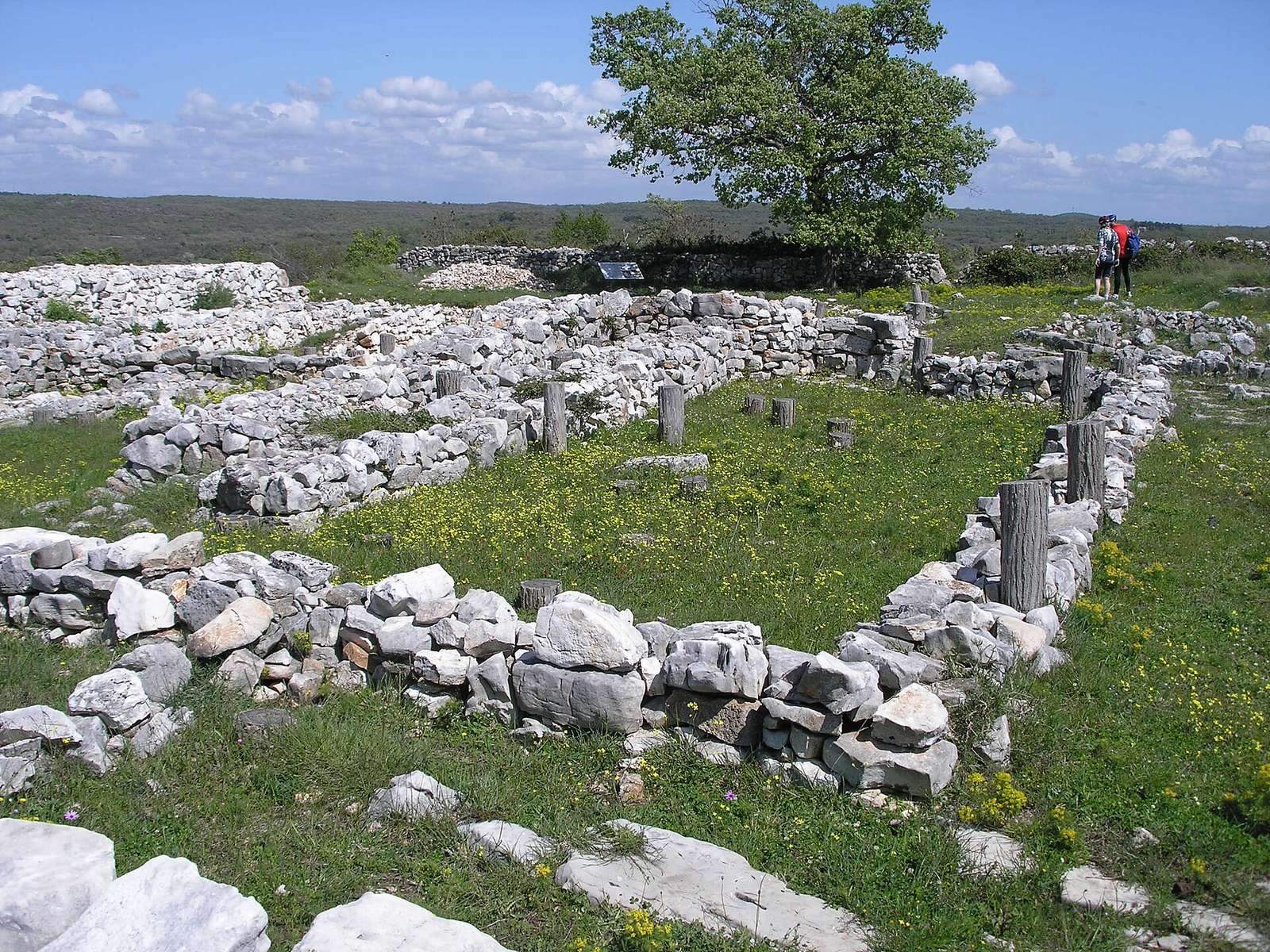
Monkodonja is a fortified settlement of the Early and Middle Bronze Age, on a hill roughly 5 km east of Rovinj in Croatia. The Bronze Age was a prehistoric period associated with bronze tools and objects, with Early and Middle identifying regional subdivisions. Occupation lasted approximately 1850/1750–1500/1450 BC.
A Bronze Age community
About 1,000 people lived at Monkodonja in a socially stratified community. The acropolis, the elevated core of an ancient settlement, was associated with the upper class, while residential and craft areas occupied other parts of the site. Residents cultivated fertile land toward the sea and used the hilltop to observe maritime movement.
Monkodonja was the principal settlement in a wider network of smaller fortified places that could communicate visually with one another. Large quantities of food were brought to the settlement and stored in specialized buildings, although whether the surrounding communities depended on Monkodonja remains uncertain. The settlement also participated in communication and trade networks linking the northern Adriatic with Central Europe and the Aegean.
Animal products made up about 90 percent of the inhabitants’ diet, alongside plant foods. Cattle, smaller livestock and pigs were important; cattle also helped with farming and hauling. Hunting and gathering food from the sea and nearby freshwater sources provided a smaller share. Pottery-making was central to local production, while metalworking was less prominent, though casting and early use of lead are evident.
Abandonment and later traces
Monkodonja was abandoned in the mid-15th century BC after a conflict in which parts of its buildings burned. A silver denarius, a Roman coin, associated with Augustus, Rome’s first emperor, and dated 13 BC indicates that the site was visited sporadically during the Roman Empire.
Archaeological investigations
Museum curators Boris Baćić and Branko Marušić discovered Monkodonja accidentally in 1953. Baćić directed the first excavations, carried out from 1953 to 1955 and covering 160 m². Research in the area resumed in 1982.
From 1997 to 2009, multidisciplinary investigations were led by archaeologists Bernhard Hänsel, Kristina Mihovilić and Biba Teržan, with participation from institutions in Berlin, Pula, Ljubljana and Rovinj. Anja Hellmuth Kramberger studied and published the pottery, contributing to interpretations of the settlement’s regional connections. In 2002, the research received a Europa Nostra Award, recognizing heritage work carried out alongside the excavations.
Remains
The settlement covers about 32,000 m² on a hill roughly 81 m above sea level. Its irregular oval plan extends about 250 m east to west and measures approximately 155–160 m across. The summit held the acropolis, with the upper town below and the lower town farther down the slopes. Two circular terraces beneath the central platform measure about 160–200 m in diameter. The hill consists of limestone and dolomite beneath red soil; stone was quarried there for building, leaving a level plateau.
Defensive walls and entrances
Main wall
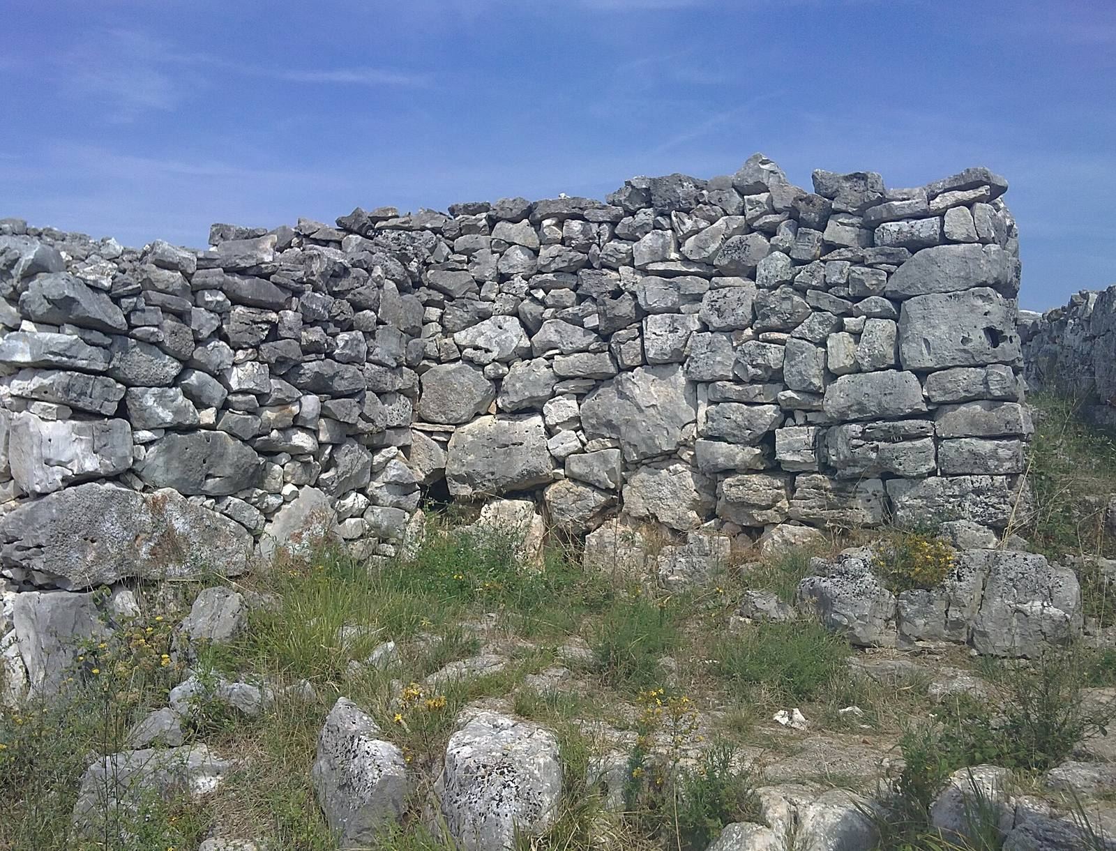
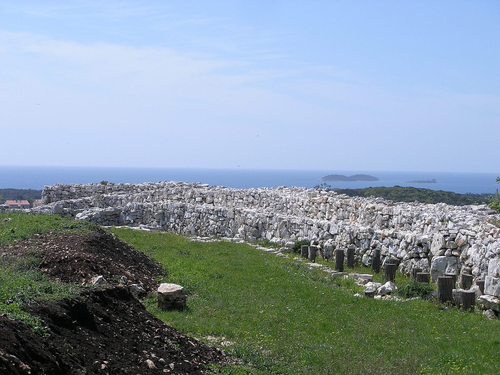
Three concentric defensive lines enclosed the settlement’s central area. The principal wall ran for about 1 km and was roughly 3 m wide and more than 3 m high. Builders fitted large blocks, some weighing several tonnes, using dry-stone construction, in which stones are set without mortar. Sections of the walls were reconstructed in their original positions during the excavations.
Western entrance
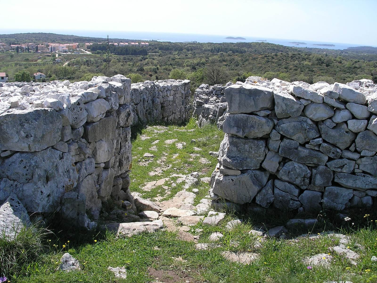
The western gate faced the sea and served as the settlement’s main entrance. Its narrow passage was about 1 m across, enough for a horse to pass, and the entrance was reinforced and enlarged over time. Two stone cist graves, or graves made from stone slabs, lay on opposite sides of the passage.
Northern entrance and nearby cave
The northern gate was also narrow. A zigzag passage led through the defenses toward outer enclosures, a design that could make an attack more difficult. A cave more than 50 m deep lies nearby. Large upright stones at its western side suggest a connection with the settlement. Bronze Age pottery and a burial from the Neolithic, the farming period before the Bronze Age associated with polished stone tools, were found inside.
Burial places
Gate-side graves
The two graves beside the western entrance were stone-built cists. The earliest burials in cist A predated the settlement, while others continued into the 17th century BC. The grave contained bones from numerous people, along with jewelry made from bronze wire and sheet metal and reddish-orange beads that may have imitated amber. Cist B was built into a wall corner on the opposite side of the passage. Bones from its burials indicate use between the 21st and 17th centuries BC.
Mušego cemetery
About 1 km southeast of Monkodonja, a cemetery at Mušego consists of stone burial mounds containing one or more cists. Human remains, bronze jewelry and several amber beads were found there. The cemetery is thought to have served Monkodonja, but it held only some of the population.
Acropolis and town areas
Acropolis
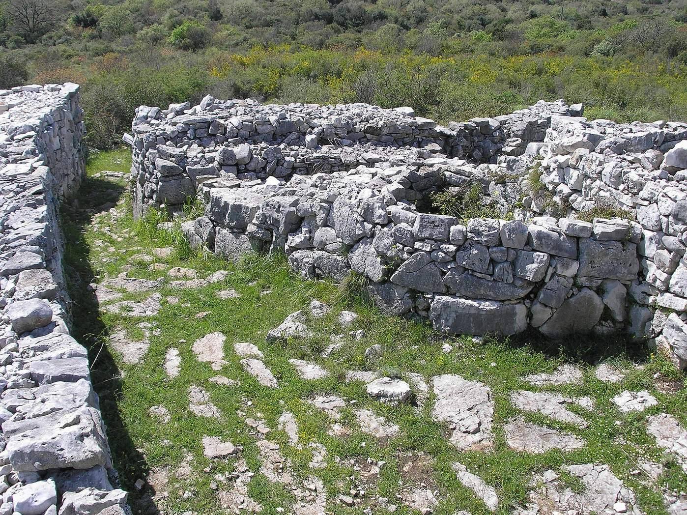
The acropolis had an almost rectangular outline and contained complex buildings made with stone and wood. Their broad rooms, narrow corridors and open or enclosed forecourts were linked by winding, narrow streets. Buildings were repeatedly extended or divided over time.
Upper and lower town
The areas below the acropolis contained simpler houses and craft buildings, separated by streets and passages. Their position, size and construction varied across the settlement.
Houses and production facilities
House 1
House 1, found in November 1953 and excavated in May 1954, had rectangular foundations around an interior about 7 m long and 3.5 m wide. A partition divided the space, and a narrow area about 70 cm wide ran beside the eastern wall, which was built from four large slabs. Its exterior walls had inner and outer stone faces with filling between them.
House 2
Excavated in 1955, House 2 lay parallel to House 1 and measured about 7 m by 4 m. Its northern wall included a projection at the western end. A southern wall, about 0.5 m wide, consisted of a single course of stones no longer than 25 cm. Four hearths were found inside: three in the central area and one near a wall. Sponge and shell remains lay between and beside them.
Pottery kiln
A well-preserved kiln was found in 1954 in a small semicircular space associated with House 1 and a terrace wall. Its perforated ceramic plate was about 5 cm thick, with five or six holes in each of eight rows. Rough walls bordered the house-facing side, with filling about 80 cm wide between them; access was from the south. Kilns of this type used a perforated plate to separate the firing chamber from the fire and help control firing. The kiln was reburied for protection and taken to a museum in 1955.
Crafts and archaeological finds
Pottery and ceramic objects
Potters shaped vessels by hand without a wheel, either by removing clay from the inside or by building up strips of clay. After drying at ambient temperature, vessels lost about 25–30 percent of their weight before firing. Forty-six ceramic tripod legs were found among the house remains. The legs were triangular, broad where they joined a circular top and narrower toward the base; examples include plain pieces, larger upper sections with holes, and smaller decorated forms. Several loaf-shaped Bronze Age objects were also found on the acropolis. They are conventionally called “loaf-of-bread idols,” though the name does not establish that they served as idols.
Metalworking
A bronze axe from the area of House 2 dates to the Early Bronze Age. It is 15 cm long, with a blade about 5 cm wide and a butt about 1.2 cm across. Most of the settlement’s metal-casting moulds came from the acropolis, and evidence also points to early use of lead. A possible bronze foundry in the southern upper town may have formed part of a craft quarter.
Animal remains
About 50,000 animal-bone remains have been recovered, including cattle, sheep, goats, pigs and dogs, as well as wild rabbits. Shells, sponges and crabs represent foods from the sea and nearby freshwater. Sheep stood about 50 cm tall and had hair rather than wool; cattle and pigs were large. Bones were also fashioned into ornaments. Horse bones point to connections with northern Italy or the Carpathian Basin, while fallow-deer remains and antlers indicate links with the Aegean. Fallow deer were uncommon in Istria and valued for their fur or as trophies.