Miran: A Southern Silk Road Trading and Buddhist Center
Site at a Glance
- Popularity
- High
- Country
- China
- Primary era
- Classical
- Eras represented
- Classical, Medieval
- Civilizations
- Tibetan
- Site type
- Settlement
- Remains
- City
On this page13 sections
History
Miran is an ancient oasis settlement and archaeological site on the southern edge of the Taklamakan Desert in China. It was a major trading center on the southern Silk Road, where routes divided into northern and southern branches, and it also became an important Buddhist center.
Yuni and Kröraina
Known as Yuni, Miran served for a time as a capital of Kröraina, also called Loulan, an ancient kingdom in the Tarim Basin. In the third century, the Han dynasty, an imperial Chinese house that ruled from 206 BC to AD 220, brought the kingdom under Chinese control; Miran was then one of its smaller cities. The area was also part of wider Tocharian cultures, associated with ancient peoples of Central Asia.
Trade, Buddhism, and Tibetan rule
Buddhist artistic influence had reached Miran by the first century BC. The settlement developed into a Buddhist center, while its trade declined after the fourth century.
In the mid-eighth century, Miran’s position at the entrance to a pass on a route into Tibet helped turn it into a fortified town. Tibetan forces passed through as Chinese troops withdrew to fight rebels in central China. During the Tibetan occupation, from about the mid-eighth to the mid-ninth century, the area was known as Nop Chungu. The Tibetan Empire, a powerful Tibetan state that expanded into Central Asia, held the area until it lost its Central Asian territories around the mid-ninth century. Tibetan residents continued to use Miran’s old irrigation system.
Water supply and abandonment
A river flowing from nearby mountains supplied the oasis during the first millennium. As the river dried, desertification advanced and Miran was gradually abandoned. The date of abandonment is uncertain.
Rediscovery and archaeological work
In 1876, Russian explorer Nikolay Przhevalsky made the earliest recorded mention of the ancient site. After a later expedition to the region, he described a large ruined city near Lop Nor; the position on his map suggests that he had seen Miran. Count Ōtani Kōzui sent missions from Kyoto to sites in the Taklamakan, including Miran, in 1902 and 1910 to collect Buddhist texts and artworks. In 1905, American geologist Ellsworth Huntington examined the site and recognized its Buddhist character.
Aurel Stein excavated the fort and nearby sites in 1906 and 1907, then returned to investigate further places in 1914. Chinese archaeological and museum teams examined Miran in 1957–1958, 1959, and 1973. Engineer Rao Reifu studied the irrigation remains in 1965. The most extensive investigation described here took place from 1978 to 1980, led by Huang Xiaojing and Zhang Ping of the Xinjiang Museum. A team from the Xinjiang Academy of Social Sciences visited in 1988, and Professor Wang Binghua examined several temple sites in 1989.
Remains
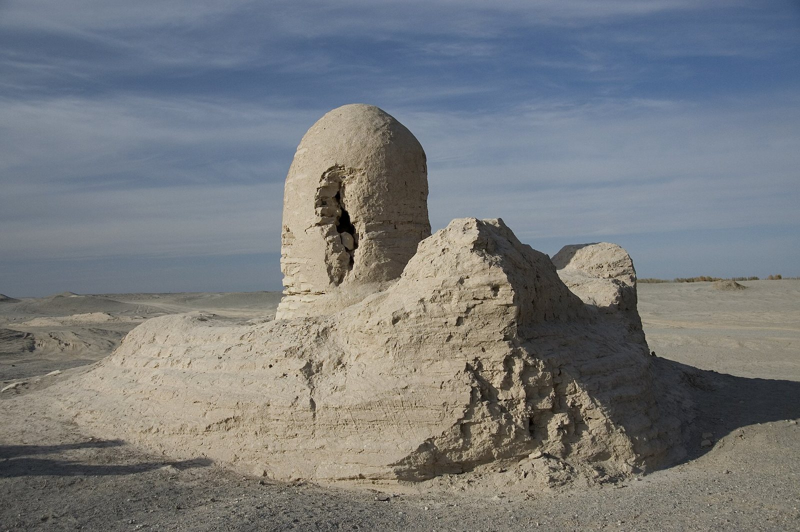
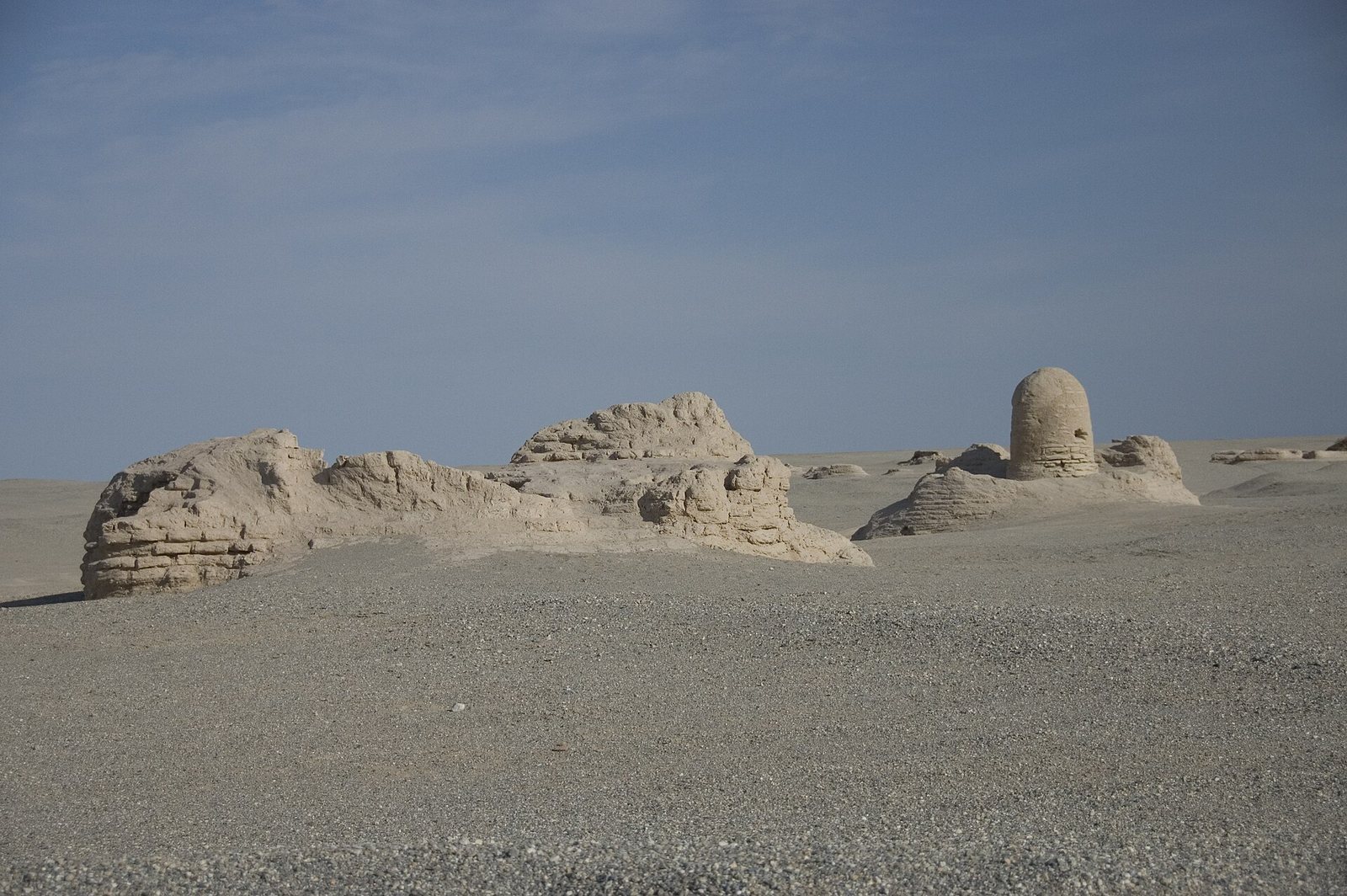
The ruins lie at an oasis where the Lop Nur desert meets the Altun Shan mountains, near an ancient west–east caravan route to Dunhuang. The archaeological remains include a rectangular fort, Buddhist buildings, irrigation works, and residential and industrial traces. Many structures were built of sun-dried brick.
The fort
The large rectangular fort was built of sun-dried brick. Excavation revealed 44 rooms within it, giving a clear sense of the scale of this fortified complex.
Buddhist buildings
Monastery and temples
The Buddhist monastery complex existed between the second and fifth centuries AD. A survey identified three temple sites, while excavated areas mainly north and west of the fort included temples with Buddhist paintings and stucco images.
Stupas
A survey counted eight stupas, Buddhist monuments associated with relics and devotional practice. The described examples were covered, circular structures whose central pillars held Buddha relics. Devotees are thought to have walked around them as part of worship.
Irrigation system
A substantial irrigation system forms part of the surviving remains. It served the oasis supplied by the river flowing from the nearby mountains.
Other archaeological features
Other remains include two beacon structures, dwellings, tombs, a kiln area, and a metal-smelting site.
Art and finds
Sculptures and murals from Miran show affinities with Central Asian traditions and Gandharan art, a Buddhist artistic tradition associated with ancient Gandhara in northwestern South Asia. Some features of the paintings have been interpreted as suggesting direct links with Rome and its provinces. One painting bears a signature in Kharosthi, an ancient script used in parts of South and Central Asia, naming a Buddhist artist known as Titus. The artist may have been Roman and may have travelled east along the Silk Road seeking work. Bows and arrows were also found at Miran, and archaeological finds indicate trade connections reaching as far as the Mediterranean.