Mannar Fort: A Portuguese and Dutch Bastion Fort in Sri Lanka
Site at a Glance
- Rating
- 4.3
- Popularity
- Low
- Country
- Sri Lanka
- Primary era
- Early Modern
- Eras represented
- Early Modern
- Civilizations
- Dutch, Portuguese
- Site type
- Military
- Remains
- Fort
On this page10 sections
History
Mannar Fort is a Portuguese-founded and Dutch-rebuilt fort in Sri Lanka, on Mannar Island, whose principal reconstruction took place in the late seventeenth century according to Dutch military principles. Portuguese forces established the fort around 1560 and named it São Jorge, using it as a base for attempts to conquer the Kingdom of Jaffna. Its position at the northern maritime approaches to Ceylon later gave it military and commercial importance.
Portuguese Foundation and Dutch Capture
The Dutch East India Company, known as the VOC, captured the Portuguese fort on 22 February 1658 after a naval and amphibious assault. The operation formed part of the Dutch campaign to expel Portugal from Ceylon. The Dutch left a small garrison at Mannar, partly to support and promote the pearl fishery.
After the capture, the Portuguese defenses were replaced or substantially strengthened. The Dutch reconstruction continued through the late seventeenth century. In 1671 the fort was reported to be in good condition and held by 250 men, while additional work continued afterward. The VOC was a chartered Dutch trading and colonial company that maintained forts, garrisons, and commercial monopolies across parts of Asia.
Trade, Fisheries, and Regional Control
The VOC used Mannar Fort to control shipping between Ceylon and the Coromandel Coast, the southeastern coast of India. The fort supported the company’s monopoly on cinnamon exports and, at different times, trade in betel nuts from Ceylon and cotton textiles from India. Mannar was also linked to commerce in elephants and marine resources. Elephant sales to merchants from India and Bengal were later transferred to Jaffna because the animals often died in Mannar’s dry climate.
The nearby fort at Aripo, about 15 kilometres south on the mainland, supported chank-shell and pearl fisheries in the bay. Chank-shell fisheries collected large marine shells used in South Asian ornament, ritual, and trade. The VOC later leased the fisheries to private parties, taxed the stones used by divers, and restricted participation by senior company personnel. Overfishing meant that pearl banks needed years to recover, while the development of cultured pearls in Japan during the late nineteenth century brought the Gulf of Mannar pearl fishery to an end.
From Dutch Rule to Modern Damage
In 1679, Robert Knox reached Aripo while escaping from Kandy after twenty years of imprisonment. Laurens Pijl, the commander of Jaffna, took Knox through Mannar Fort to Colombo. Knox then continued to Batavia and England; his later account of captivity became an important early European description of Sri Lanka.
The Dutch surrendered Mannar Fort to the British on 5 October 1795, when Britain assumed control of Ceylon under the Letters of Kew issued by William V, the last stadholder of the Dutch Republic. In the 1980s, W. A. Nelson found the fort in good condition, with its buildings still roofed and its gate intact. By 2004, the gate had vanished, the walls had suffered heavy mortar damage during the war with the LTTE, and the roofs had been lost. The Liberation Tigers of Tamil Eelam, or LTTE, were a Tamil separatist militant organization involved in Sri Lanka’s civil war. Sri Lanka’s Department of Archaeology now occupies the fort and is responsible for archaeological research and heritage conservation.
Remains
Fort Plan and Defenses
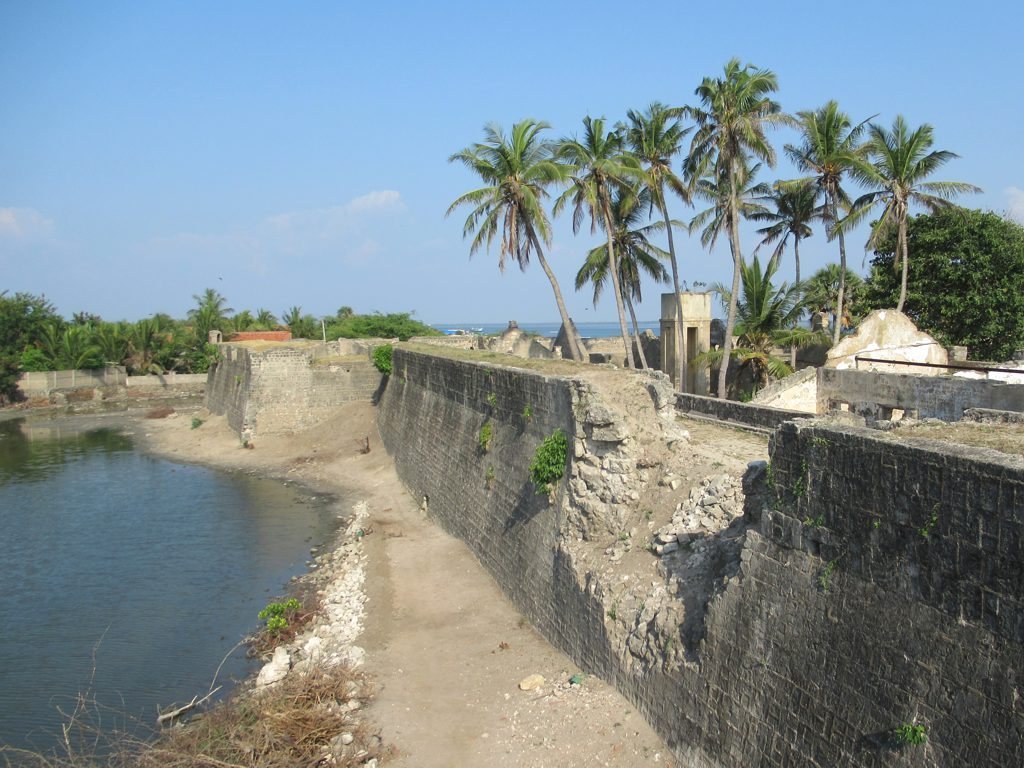
Mannar Fort occupies the southern tip of Mannar Island, opposite the mainland of Sri Lanka, within the chain of islands and shoals known as Adam’s Bridge. Adam’s Bridge extends between northwestern Sri Lanka and southeastern India. The fort is a square bastion enclosure built or rebuilt with granite stone and brick. Its four projecting bastions allowed defenders to cover the walls and approaches with intersecting gunfire.
A moat once surrounded the entire fort, with its eastern side connected to the sea. A causeway linked the enclosure to the western side of Mannar Island, and a road crossing the causeway passed the southwestern bastion before reaching the entrance. The walls rise approximately 6 to 7 metres, and the gun ports indicate that about 24 cannons were once mounted there. In scale, Mannar Fort is comparable to the forts at Kalpitiya and Batticaloa, while it is considerably smaller than Galle and Colombo, which functioned more like fortified towns.
Buildings and Surviving Features
Church
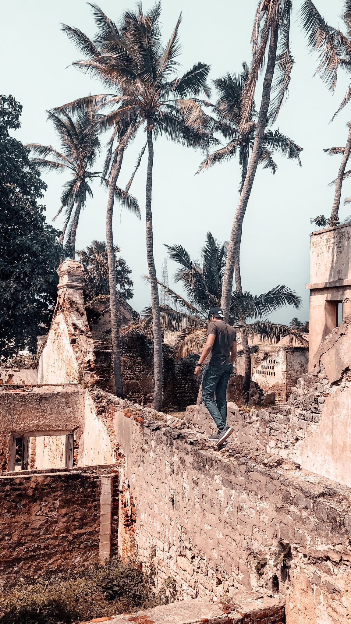
The church survives in fragmentary form on the western side of the fort. Its front and rear façades remain, together with an altar, and several gravestones lie beside it. The church formed part of the fort’s internal group of buildings, which also included warehouses, a smithy, barracks, and reservoirs for drinking water.
Bell Tower
A small bell tower stands on the southeastern bastion. It remains in place but is in a dilapidated condition, preserving a religious feature within the defensive structure.
Entrance Gate
The entrance gate had disappeared by 2004, but its recorded inscriptions preserve details of the Dutch rebuilding. The exterior carried the date 1686, while the inner side bore 1681. A new bridge now connects Mannar Island with the mainland beside the fort.