Longovicium: A Roman Auxiliary Fort in County Durham
Site at a Glance
- Country
- United Kingdom
- Primary era
- Classical
- Eras represented
- Classical
- Civilizations
- Roman
- Site type
- Military
- Remains
- Fort
On this page11 sections
History
Longovicium, also known as Lanchester Roman Fort, was a Roman auxiliary fort serving troops outside the legions, just southwest of Lanchester in County Durham, England. It is thought to have been built around AD 150 on Dere Street, the principal Roman road linking York and Hadrian’s Wall. The fort lay about 20 miles (32 km) south of the Wall, between Vindomora (modern Ebchester) and Vinovia (modern Binchester). By the early third century, it was in Britannia Inferior, the northern of the two Roman provinces into which Britain was divided. A separate road to Concangis, modern Chester-le-Street, has been proposed, but its existence is unconfirmed.
Foundation and early garrison
Two stones attest to the presence at Longovicium during the first century AD of the Cohors I Fida Vardulorum, the First Cohort of the Faithful Varduli. This auxiliary unit of Roman citizens was nominally 1,000 strong, partly mounted, and raised in Gipuzkoa in northern Spain. The evidence points to an earlier presence at the site, but does not date the fort itself. A construction slab names Legio XX Valeria Victrix, Rome’s Twentieth Legion, as the builder without specifying when it worked there. In AD 88, Emperor Domitian ordered the legion to leave its unfinished fort at Inchtuthil in Scotland and redeploy to Deva Victrix at Chester.
Rebuilding and later garrisons
The fort was rebuilt around AD 230 to 240 and again in the early fourth century. Inscriptions dated AD 238 and 244 name Cohors I Lingonum and Cohors I Lingonum Gordiana equitata, a partly mounted unit associated with the Lingones, a people of Gaul. A detachment of Suebians, also known as Suevi, was present at this time. They were a Germanic people from Lusitania, a Roman province in western Iberia.
In the fourth century, the garrison included a native force of Longovicians. This irregular, partly mounted auxiliary unit was commanded by Roman equestrians, members of the empire’s non-senatorial elite. The fort was abandoned around the fifth century.
Industry and later interpretations
The unusually large water supply suggests industrial activity beyond the needs of baths and latrines. An arms store serving Longovicium and nearby forts has been proposed, as has large-scale iron smelting, perhaps assisted by watermills.
The fort’s name is Brittonic, from a Celtic language family historically spoken in Britain, but its origin is uncertain. The first element, longo-, means ship. The second may come from wīg, broadly meaning settlement, or uic-, meaning warrior or fighter. The name may instead adapt the tribal name Longovices.
Longovicium appears in the Notitia Dignitatum, a late Roman list of administrative and military offices, and the Ravenna Cosmography, a geographical work recording places in the Roman world. Lanchester has also been proposed as the work’s Lincovigla, interpreted as hillside watcher. The identification of the inland fort with the Longovicium in the Notitia Dignitatum has been questioned. Professor Andrew Breeze has argued that the tenth-century Battle of Brunanburh, a major conflict in Britain, took place at the fort; he interprets Brunanburh as stronghold of Browney. Systematic excavation has not taken place, and a cemetery southwest of the fort was discovered in the twentieth century.
Remains
The remains center on a rectangular fort with rounded corners, bounded by a ditch and marked by four gates. It occupied high ground beside the River Browney. Nearby evidence includes the associated settlement, waterworks, and a cemetery.
Fort and associated settlement
Fort buildings
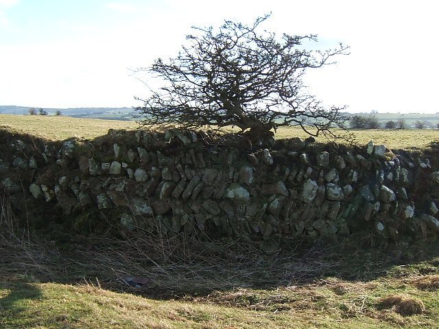
Geophysical surveys have identified the headquarters buildings, bathhouse, and barracks. The fort lies in fields that have not been ploughed, though stone robbing has damaged the remains.
Associated settlement
Traces of a settlement linked to the fort lie nearby and can be traced in aerial photographs.
Waterworks
Two aqueducts supplied the fort. One drew water from an impounded source to the west, where a dam harnessed water from 21 springs. About 6 metres high and 100 metres long, the dam had a stone facing and an inner clay lining. A receiving reservoir stood near the fort. The aqueduct system is among the best-preserved in Britain.
Cemetery
The cemetery southwest of the fort contained stone-lined burials and cremation sites.
Industrial traces and inscriptions
Large quantities of slag and cinders from metalworking have been found within the fort or its associated settlement. Altars and dedicatory slabs recovered near the fort name Jupiter, associated with the sky and sovereignty; Mars, linked with war; Mercury, associated with commerce and travel; Silvanus, connected with woodland and rural life; and Garmangabis, a goddess associated with Celtic and Germanic religious traditions. A milestone dedicated to Emperor Gordian III, who ruled from AD 238 to 244, was found about 800 metres away on Dere Street. A column, probably from the colonnade of the Commandant’s House, and an altar to Garmangabis are now in nearby All Saints’ Parish Church.