Lehigh Canal: A Coal-Transport Waterway in Pennsylvania
Site at a Glance
- Popularity
- High
- Country
- United States
- Primary era
- Modern
- Eras represented
- Modern
- Civilizations
- Unclassified
- Site type
- Infrastructure
- Remains
- Canal
On this page13 sections
History
The Lehigh Canal is a historic waterway in Pennsylvania, United States, built to carry anthracite, a hard coal that burns with relatively little smoke, from the Lehigh Coal Region toward eastern markets. Developed in stages during the 19th century, it connected the southern coal district with the Delaware River basin and helped support industrial growth in the Lehigh Valley.
Coal transport and the lower canal
The Lehigh Coal Mine Company was founded in 1792, a few months after anthracite was discovered at Sharp Mountain near present-day Summit Hill. Although the company obtained rights to more than 10,000 acres, moving coal to market proved difficult. It had to be carried at least nine miles to the Lehigh River, where disposable wooden boats called arks could travel downstream. Early attempts to supply Philadelphia were irregular and often unprofitable.
During the War of 1812, firewood and charcoal became scarce and costly in the eastern United States, increasing interest in shipping anthracite. An expedition launched in 1813 built five boats over the following year, but only two reached the market. The poor result discouraged some of the mine company’s investors.
The Lehigh River had been designated a public highway in 1761, with further legislation in 1771. Laws granting privileges to the Lehigh Navigation Company followed in 1798, 1810, 1814, 1816, and 1817, but major expenditure had brought little improvement by 1818. Josiah White, the company’s managing partner, and his business associate Erskine Hazard proposed improving navigation downstream. In March 1818, the Lehigh Navigation and Coal Company received expanded rights over the river and canal, with the possibility that the state might later require navigation in both directions.
The lower canal was built from 1818 to 1820 as a one-way, toll-paying route for sending coal toward eastern markets. The Lehigh Coal & Navigation Company rebuilt it for two-way traffic from 1827 to 1829. The lower canal remained in operation until 1931.
Two-way navigation and the upper extension
In 1822, White consulted canal engineer Canvass White and tested a two-way navigation system on four dams in the upper river. Two years later, the Pennsylvania legislature rejected a proposal for wider locks that could accommodate coastal vessels and steam tugs. Lumber and timber interests were among those concerned that dams would impede the rafting of logs. A 1827 revision of the Main Line of Public Works, Pennsylvania’s state network of canals, railroads, and related facilities, provided funding for the Delaware Canal and cleared the way for the Lehigh company’s two-way improvements. From 1831, the company built durable barges for return journeys via the Pennsylvania Canal at Easton, replacing the one-way arks.
The canal linked the southern Coal Region to markets including Philadelphia, Trenton, and Wilmington. At Easton it connected with the Delaware Division of the Pennsylvania Canal; a cable ferry across the Delaware River linked it to the Morris Canal, offering a route toward New York. Canal transport also served industry in Bristol, Allentown, and Bethlehem. Shipments of anthracite and pig iron, an intermediate iron product used in manufacturing, contributed to the Lehigh Valley’s development as an industrial center.
In the mid-1830s, business interests and the Pennsylvania legislature pursued an extension to White Haven, influenced by freight carried across the Allegheny Front on the Allegheny Portage Railroad. The 1837 revision of the Main Line authorized the upper canal, which was built from 1837 to 1843 to a design by Canvass White. The Lehigh Coal & Navigation Company established the Lehigh and Susquehanna Railroad as a subsidiary to provide rail connections serving the extension.
Peak traffic, flood, and later history
Canal traffic reached its high point in 1855, when more than one million tons of freight passed along the waterway. Competition subsequently increased, and coal shipped through the Schuylkill Valley displaced Lehigh Canal coal.
On June 4, 1862, a dam above White Haven failed after a wet spring repeatedly overfilled reservoir embankments. The flood caused additional dams to collapse, killing between 100 and 200 people in downstream villages and canal works. The Pennsylvania legislature prohibited rebuilding the upper canal.
Transportation continued on the canal into the 1940s, making it the last functioning towpath canal in North America. In 1962, most of the waterway was sold to public and private organizations for recreational use. The Chain Bridge was listed separately in 1974, and canal sections entered the National Register of Historic Places in 1978 and 1979. The Register is the United States’ federal list of properties recognized for their historical or architectural importance.
Remains
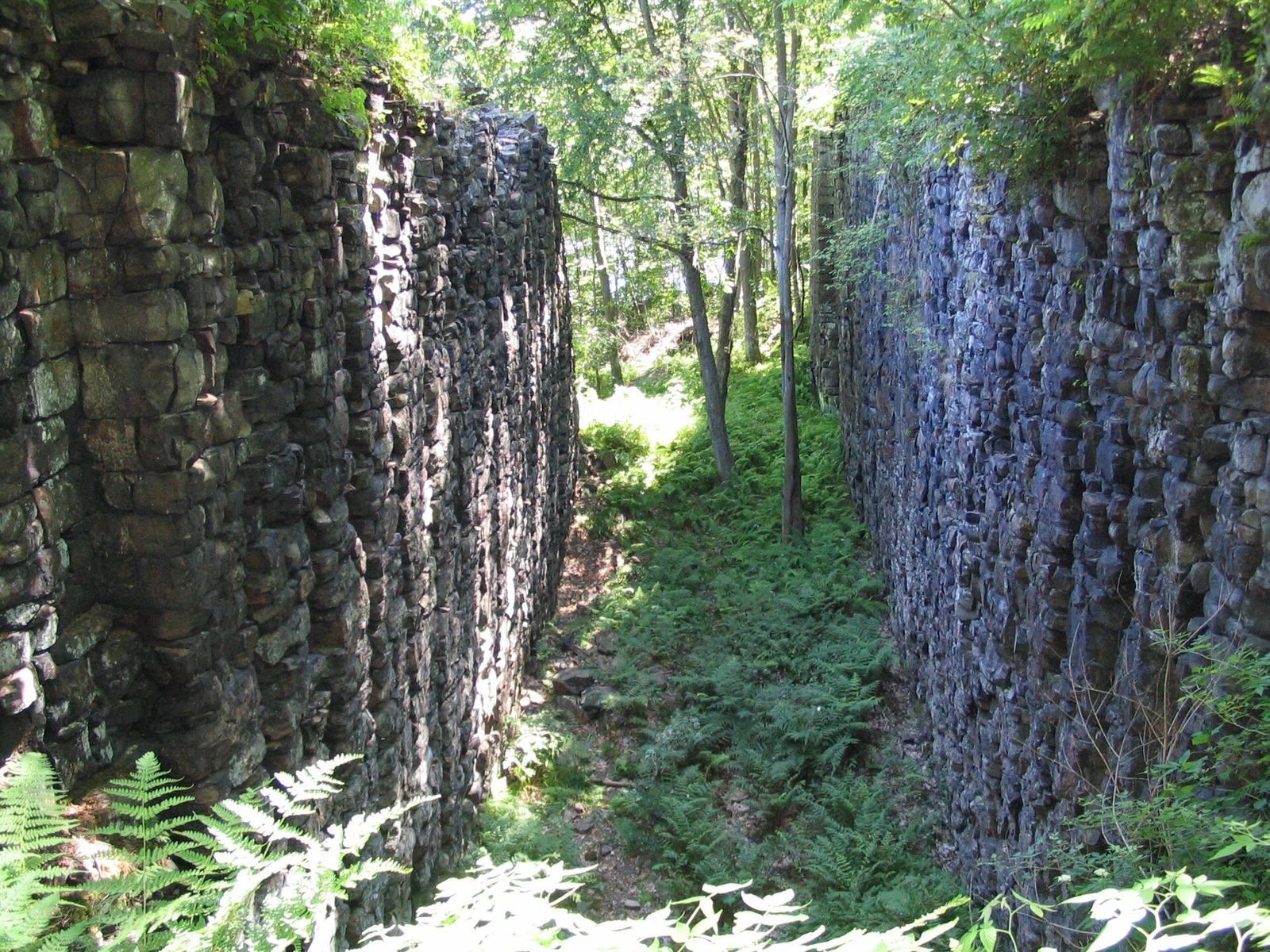
At its greatest extent, the waterway ran for 72 miles. It began at the mouth of Nesquehoning Creek on the Lehigh River, with the lower canal running from Mauch Chunk, now Jim Thorpe, to Easton and the upper extension continuing to White Haven. The route alternated between canal reaches and sections of the Lehigh River made navigable by dams. Its construction used fitted stone, iron, and wood.
River route and water control
Canal boats periodically passed between constructed channels and river stretches held in impounded pools, using locks to move from one to the other. This arrangement allowed navigation to begin before construction across the full route was complete. White’s initial plan also used low stone walls to narrow river channels, with ponds and periodic artificial releases of water to maintain a navigable depth of 15 to 18 inches.
Lower canal
The lower canal extended about 46 miles. Near its beginning, below Packers Dam, a wing wall projected into the upper pool to form slack water beside the loading docks. Dam 1 stood downstream of Broadway, opposite Flagstaff Hill and Bear Mountain. The lower descent included 44 lift locks, chambers that raise or lower boats between water levels, beginning with Lock 1 at Dam 1. Lock 1 had a platform that lifted a barge for weighing; tolls on non-company boats depended on cargo weight and distance traveled. Most lower locks used a bear-trap design, in which a movable gate released water to change the level of a canal reach. The expanded system included 52 locks, among them eight guard locks that controlled water at canal entrances or junctions, as well as eight dams and six aqueducts, structures that carry a waterway over an obstacle. Together, these works overcame an elevation difference of more than 350 feet.
Upper canal and rail connections
The upper canal crossed steep, ravine-like terrain in the Lehigh Gorge and climbed more than 600 feet to the Mauch Chunk slack-water pool, a relatively calm stretch of river held by an impoundment. Its 20 dams, 29 locks, and reservoirs maintained working water flow even in dry summers. Some locks could raise boats by as much as 58 feet. The Lehigh and Susquehanna Railroad linked the Pennsylvania Canal landing at Pittston with a rail yard at Ashley, then used the Ashley Planes incline railway, which moved rail vehicles up or down steep ground, and a deep cutting to reach Mountain Top. The cutting was one mile long and more than 100 feet deep. From Mountain Top, a railway descended a ridge to White Haven, where the upper-canal docks had a turnaround staging yard.
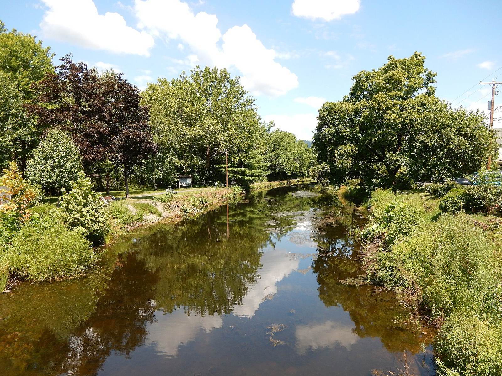
Surviving sections and towpath
Carbon County stretch
The Carbon County stretch runs from Upper Canal Lock No. 1 to Lower Canal Dam No. 3 and includes 30 structures counted as part of the historic canal complex.
Allentown to Hopeville
The Allentown-to-Hopeville area covers 53.9 acres. It includes a building in the Greek Revival and Federal styles, alongside 13 contributing structures.
Eastern reach
The eastern section follows the Lehigh River from Hopeville to its confluence with the Delaware River at Easton. Covering 260 acres, it includes three buildings, seven sites, and 11 structures. The Chain Bridge is part of this stretch.
Towpath and recreational reaches
An eight-mile towpath, the path beside a canal once used for towing boats, now forms a multi-use trail from Freemansburg through Bethlehem to Allentown, beside the river and an active railroad. Recreational boating is possible on sections near Jim Thorpe and in Easton.