Kraków Fortress: Austria’s Multiring Defensive Complex in Poland


Site at a Glance
- Rating
- 4.5
- Popularity
- Low
- Country
- Poland
- Primary era
- Modern
- External website
- Open
- Eras represented
- Medieval, Early Modern, Modern
- Civilizations
- Austria-Hungary, Austrian Empire, Habsburg, Kingdom of Poland, Polish–Lithuanian Commonwealth
- Site type
- Military
- Remains
- Fort
On this page19 sections
History
Kraków Fortress was an Austrian and Austro-Hungarian defensive complex in Kraków, Poland, built and repeatedly modernized from 1849 to 1916. It controlled a crossing of the Vistula and an important communication route between Warsaw and Vienna, making the city a strategically important military centre within the Habsburg monarchy, the Central European imperial state ruled by the Habsburg dynasty.
Origins and the Inner Fortress
Kraków had long served defensive purposes because of its geographical position, topography, and political importance. Earlier elements later associated with the fortress included the medieval fortifications of Wawel and the city walls, together with the eighteenth-century earthworks of the Kościuszko Insurrection, the 1794 uprising led by the Polish-Lithuanian military engineer and national leader Tadeusz Kościuszko.
After the Third Partition of Poland, Austrian military authorities considered establishing a modern fortress in Kraków, but these plans were not carried out before the city became part of the Duchy of Warsaw. Following the failure of the 1846 uprising, the former Free City of Kraków was incorporated into Austria. The Austrian Central Fortification Commission selected Kraków as a fortress site in 1850. Preparatory work had already begun, and fortification of Wawel and construction of the first fort near the Krakus Mound started in 1849.
Emperor Franz Joseph I announced the decision to build the fortress on 12 April 1850. Max Singer, an Austrian lieutenant colonel, became its first commander that year. Kraków was formally declared a fortress on 26 May 1856 and retained that status until 1917. In the broad historical sense, the system incorporated earlier Kraków fortifications, Wawel, the fortifications of Podgórze, and the newer works that eventually surrounded the city.
The first construction phase, from 1849 to 1854, used the existing Kraków fortifications and the separate city of Podgórze as the inner defensive line, or nucleus. Four outlying forts were added: Warsaw Lunette, later numbered 12; Grzegórzecka Lunette, later numbered 17; citadel fort 2, Kościuszko; and citadel fort 33, Krakus. New fortifications enclosed Wawel, which became the citadel of the fortress.
The threat of war between Austria and Russia during the Crimean War led to the construction of 29 FS-type field redoubts between 1854 and 1856. These smaller enclosed defensive positions filled spaces between the inner forts. A system for numbering the defensive works was introduced after this phase.
Expansion into Defensive Rings
Between 1854 and 1866, Count August von Caboga’s project transformed the inner line into a high rampart preceded by a broad moat. Several projecting positions were called bastions, although at Kraków many of them were structurally masonry or timber-and-earth reduit forts. A reduit was a fortified interior position intended to provide strong shelter or a final refuge within a larger work.
Masonry bastions III, Kleparz, and V, Lubicz, were built on the northern and northeastern fronts. Bastions I, I 1/2, II, IV, and VI were semi-permanent timber-and-earth works. Around 1866, a continuous rampart with demi-bastions was constructed on the Podgórze side. The artillery improvements of the 1860s then led to the construction of forts 7, Za Rzeką; 9, Krowodrza; and 15, Pszorna, between 1863 and 1869. These strengthened the second defensive ring, which had previously consisted mainly of field redoubts.
Existing buildings were adapted for barracks during the 1850s and 1860s, while new military complexes were also erected. The Emperor Franz Joseph Barracks was among them. The fortress therefore influenced not only military planning but also the city’s wider development, since its authorities controlled construction outside the defensive works and their restrictions became an important subject of debate.
From 1872, a third defensive ring developed in response to longer-range artillery and the spread of the artillery fort, a fort designed primarily to accommodate heavy guns. The experience of the Franco-Prussian War of 1870 to 1871 and the use of infantry firearms during the Russo-Turkish War of 1877 to 1878 also influenced the new designs. Early works in this outer ring were timber-and-earth positions that were later rebuilt in masonry.
During the 1870s and 1880s, artillery forts 43, Pasternik; 44, Tonie; 45, Zielonki; 47, Łysa Góra; 48, Batowice; 49, Krzesławice; 50, Prokocim; 51, Rajsko; 52, Borek; and 53, Bodzów were added. Artillery batteries, infantry redoubts, and infantry forts 39, Olszanica, and 41, Bronowice, supplemented them. Fort 38, Skała, became the fortress’s first armoured fort, with its defensive works placed in a Grusson armoured turret.
The inner and second rings were modernized, generally through the addition of traverses. In the 1880s, part of the inner rampart was moved forward because Rakowicki Cemetery was expanding and an artillery workshop and storage complex occupied nearby ground. Bastion IV was levelled. Warsaw Lunette was incorporated into the rampart as bastion IVa, while bastion IVb was built on the site of FS-13. Four close-defence forts strengthened the Podgórze section of the inner rampart.
In 1888, the fortress was reorganized into eight defensive sectors. Sectors I and II comprised the northern and southern sections of the inner ring with adjoining parts of the second ring. Sectors III and VI formed the northern part of the third ring, while sectors VII and VIII formed its southern part. Further barracks and logistical buildings were constructed alongside the forts. The Archduke Rudolf Barracks was built between 1873 and 1878, and an airfield with associated facilities was later established at Rakowice.
Armoured Modernization
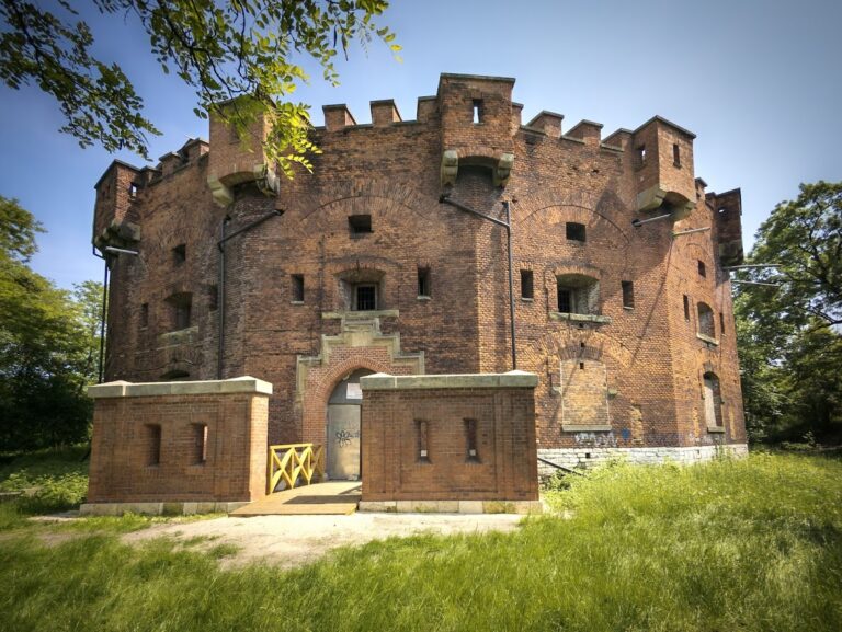
More powerful explosive shells prompted another modernization phase from 1892 to 1914. In the northern fortified area V, the large armoured Einheitsforts 47a, Węgrzce, and 49a, Dłubnia, were built between 1892 and 1896, probably to designs by Ernest von Leithner. An armoured fort used protective steel turrets or other armour for its weapons. Other late nineteenth-century armoured forts were designed for close defence, while heavy artillery was placed in separate batteries behind them.
By 1899, the system included armoured close-defence forts 43a, Podchruście; 44a, Pękowice; 45a, Bibice; 47 1/2, Sudół; 48a, Mistrzejowice; 49 1/4, Grębałów; 50 1/2 West and 50 1/2 East; 51 1/2, Swoszowice; 52a, Łapianka; and 53a, Winnica. Infantry forts 41a, Mydlniki; 49 1/2a, Mogiła; and 50a, Lasówka, were also constructed. Some of the armoured forts were designed by Emil Gołogórski.
From 1902 to 1914, artillery forts were strengthened while their heaviest guns were moved to FB batteries or paired batteries positioned close enough to receive infantry protection from the forts. Lighter anti-assault guns and infantry then took a larger role within the artillery forts. Fort 44, Tonie, was comprehensively rebuilt between 1902 and 1908 as an armoured fort with four retractable revolving armoured turrets.
Fort 53, Bodzów, and infantry fort 39, Olszanica, were converted into permanent works. The dispersed Bielany Fort became the last new fort constructed in the fortress. Meanwhile, the original inner ring was progressively dismantled. By 1909, its rampart curtains and bastions I to VI had been demolished, except for III, IVa, and V, which remained as reduit forts. The second ring assumed the inner ring’s role and was modernized with small infantry forts known as N works, built on the sites of older FS redoubts.
Wartime Service and Demobilization
By the summer of 1914, Kraków Fortress had acquired effective combat strength. Continuous trenches and field infantry positions were established between the forts and in front of the third ring. The Dziekanowice to Bosutów position protected the hills near forts 47 1/2, Sudół; 48, Batowice; and 48a, Mistrzejowice. Where the ground was rocky, underground shelter systems, or caverns, were built from mobilization until 1916.
The fortress was placed under martial law on 14 September 1914, and visitors were ordered to leave. Residents who remained had to assemble at least three months of food supplies. Evacuation from Kraków and nearby settlements within the fortress began on 15 September, followed by compulsory evacuation from 7 to 13 November. Residents were permitted to return in November and December 1915.
Under General Karl Kuk, Kraków Fortress helped Austrian forces transfer troops between the southern and northern banks of the Vistula. It played an important logistical role on the Eastern Front in late 1914, although Russian forces did not besiege it directly. After the Russian withdrawal from Galicia following the Battle of Gorlice, its military importance declined and its principal wartime function became logistical.
Demobilization began in August 1917. Restrictions on construction near most forts were lifted, and some defensive works were converted to storage uses. During the interwar period, the former fortress operated as the Kraków Fortified Camp but received no major modernization. Most artillery armament was removed, and the forts generally received only social and basic-service repairs. Many outlying works were stripped by local inhabitants, while some were sporadically demolished.
War, Destruction, and Conservation
During the September 1939 campaign, the fortress played a limited role in covering the withdrawal of the Kraków Army. On the morning of 5 September, Colonel Wacław Klaczyński’s units occupied the Skała, Mydlniki, Pasternik, Tonie, Zielonki, and Węgrzce forts. They resisted German forces briefly and withdrew during the night of 5 to 6 September.
During the German occupation, some forts served as barracks, warehouses, military quarters, or detention sites for French and Soviet prisoners of war. Fort Krzesławice was used for executions of Polish prisoners. In 1944, German forces incorporated only a few northeastern forts into defensive positions because most of the former fortress was considered obsolete. Fort Liste, or Kościuszko, served as a communications and telephone centre.
After the Second World War, many fortress structures were demolished, especially during the 1950s. Opposition to remnants of Austrian rule and the desire to free land for urban development were used to justify the destruction. Demolition of most of Fort Kościuszko began in 1948, and forts Lubicz, Krakus, Krowodrza, and Bodzów were also destroyed.
Karol Estreicher, a Polish historian and art historian, and Janusz Bogdanowski, an architect, urban planner, and scholar of historic fortifications and landscapes, helped oppose further demolition. Their arguments emphasized the forts’ historical and urban value, as well as the importance of the green areas around many of them. Large-scale demolition subsequently ceased, although later users, housing estates, and road infrastructure contributed to the deterioration of several sites.
Interest in Kraków Fortress increased during the 1970s, particularly through Bogdanowski’s pioneering research. Adaptation and conservation work began in the 1980s and has continued at different rates and with varying results. Fort Kościuszko was partly adapted as a hotel and Fort Grębałów as an equestrian centre. Later work also involved smaller structures such as ammunition shelters and gate spurs. Conservation authorities and civic organizations participated in these efforts, while theft, vandalism, and difficult management continued to affect some forts. Thirty-four forts survive, together with approximately 120 to 140 smaller defensive works and associated structures. The surviving complex and its green areas are regarded as unique on a European scale.
Remains
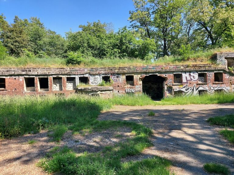
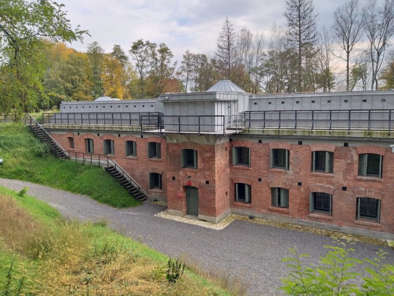
Kraków Fortress survives as a dispersed landscape of three defensive rings rather than as a single enclosed monument. The system included forts, artillery and infantry redoubts, batteries, trenches, caverns, roads, barracks, hospitals, magazines, workshops, and other logistical buildings. The works extend through Kraków’s city centre and outer districts and across parts of Węgrzce, Zielonki, and Bibice. Some are preserved or adapted to new uses, while others are ruined or heavily deteriorated.
Central and Inner Defences
Wawel and the Earlier Fortifications
Wawel occupied the central position in the broader fortress configuration. Its hill and citadel were enclosed by new nineteenth-century fortifications, linking the Austrian system with Kraków’s medieval city walls and earlier defensive works. The Kościuszko Insurrection earthworks also formed part of this wider historical arrangement.
Kościuszko Fort
Citadel fort 2, Kościuszko, enclosed the Kościuszko Mound. It was designed by Franz von Pidoll Quintenbock, Felix Księżarski, and Bernard von Caboga and built between 1850 and 1856. The fort now contains a museum devoted to Tadeusz Kościuszko, a radio station, a hotel, and cafes.
Krakus Fort and the Podgórze Towers
Citadel fort 33, Krakus, enclosed the Krakus Mound. Behind it stood artillery towers 32, Krzemionki, and 31, St. Benedict. Fort 31 is the only surviving one of three mid-nineteenth-century forts built in Podgórze to protect the Vistula and the road to Lviv. It stands on the Krzemionki cliffs of Lasota Hill and takes its name from the adjacent St. Benedict’s Church.
Fort 31 was later used as an Austrian barracks and converted into apartments in the 1950s. It is now generally derelict, with abandoned furniture and building materials. Fort 32, Krzemionki, was the other tower fort built in addition to Fort 31. It was adapted as barracks in the eighteenth and nineteenth centuries, then demolished around 1954 for the construction of a television building.
Inner Rampart and Reduits
The inner ring was based on existing earthworks and fortifications and later took the form of a high rampart with a broad moat. Its surviving or documented reduit forts included bastion III, Kleparz; bastion IVa, formerly Warsaw Lunette; and bastion V, Lubicz. Bastions I, I 1/2, II, IV, and VI were timber-and-earth works. Bastion IV was later levelled, while bastion IVb replaced FS-13.
Warsaw Lunette began as an independent detached fort numbered 12 and was later incorporated into the inner rampart as bastion IVa. Grzegórzecka Lunette was numbered 17. On the Podgórze side, the rampart included demi-bastions, or smaller projecting sections, and four close-defence forts.
Second-Ring Works
The second ring initially consisted mainly of FS field redoubts, later supplemented by forts 7, Za Rzeką; 9, Krowodrza; and 15, Pszorna. These works occupied the defensive belt between the inner and outer systems. Their later strengthening formed part of the broader reorganization that allowed the second ring to assume the inner ring’s role after the older rampart was dismantled.
Outer Forts and Armoured Works
Artillery and Infantry Forts
The third ring contained artillery forts, infantry forts, armoured forts, artillery batteries, and infantry redoubts positioned farther from the nineteenth-century city. Its artillery forts included 43, Pasternik; 44, Tonie; 45, Zielonki; 47, Łysa Góra; 48, Batowice; 49, Krzesławice; 50, Prokocim; 51, Rajsko; 52, Borek; and 53, Bodzów. Fort 45, Zielonki, is now used as a hotel.
Fort 38, Skała, was the first armoured fort in the system and contained defensive works in a Grusson armoured turret. The Wolski Forest contained artillery batteries 35, 36, 37, 40a, and 40b. Infantry forts included 39, Olszanica, and 41, Bronowice. Fort 41 remained a timber-and-earth work and was never rebuilt in masonry.
Late Armoured Forts
Armoured Einheitsforts 47a, Węgrzce, and 49a, Dłubnia, were built in northern fortified area V between 1892 and 1896. Other armoured close-defence works included 43a, Podchruście; 44a, Pękowice; 45a, Bibice; 47 1/2, Sudół; 48a, Mistrzejowice; 49 1/4, Grębałów; 50 1/2 West and 50 1/2 East; 51 1/2, Swoszowice; 52a, Łapianka; and 53a, Winnica.
Additional infantry forts were 41a, Mydlniki; 49 1/2a, Mogiła; and 50a, Lasówka. Fort 44, Tonie, was rebuilt between 1902 and 1908 with four retractable revolving armoured turrets. Fort 53, Bodzów, became a small, partly dispersed fortified group, while Fort 39, Olszanica, became a permanent work. The dispersed Bielany Fort was the last new fort built in the system.
Batteries and Fortified Groups
Late fortifications included FB artillery batteries, N infantry redoubts, and fortified groups that combined older and newer works into autonomous defensive complexes. Heavy artillery was increasingly placed in batteries behind the forts, while the forts themselves received lighter anti-assault guns and infantry. The network also included military roads, magazines, workshops, storage buildings, hospitals, and barracks.
Wartime Field Defences and Military Infrastructure
During the First World War, continuous trenches and field infantry positions filled the intervals between the forts. The Dziekanowice to Bosutów position lay near forts Sudół, Batowice, and Mistrzejowice. Rocky ground was penetrated by underground shelter systems. Some served as passive shelters, while others were directly connected with trenches and field defensive positions.
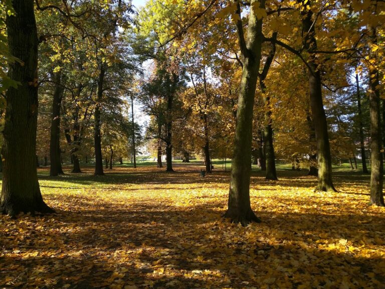
The Emperor Franz Joseph Barracks is now occupied by the Regional Public Library, and the Archduke Rudolf Barracks is the principal seat of Kraków University of Technology. Rakowice contained an airfield with supporting facilities. The fortress also included about 1,083 hectares of green areas, more than 380 hectares of which consisted of mature woodland.
Surviving Distribution and Condition
The surviving remains comprise 34 forts and approximately 120 to 140 defensive works and associated structures distributed through Kraków and the nearby villages of Węgrzce, Zielonki, and Bibice. Their present condition varies widely. Some forts have been conserved or adapted for new functions, while others remain ruined or heavily deteriorated. Together with the surrounding green areas, they preserve the physical outline of a large defensive landscape shaped by repeated changes in artillery, fort design, and urban growth.