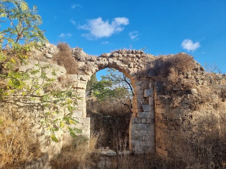
Khirbet Rushmiya: A Crusader Road Fortress in Haifa


Site at a Glance
- Rating
- 4.2
- Popularity
- Low
- Country
- Israel
- Primary era
- Medieval
- Eras represented
- Classical, Medieval, Early Modern
- Civilizations
- Crusader, Kingdom of Jerusalem, Ottoman, Roman
- Site type
- Military
- Remains
- Fort
On this page8 sections
History
Khirbet Rushmiya is an archaeological site in Haifa, Israel, centered on a Crusader road fortress dating broadly to the twelfth and thirteenth centuries. The site stands on a hill in the Old Romema neighborhood and formed part of the Crusader Kingdom of Jerusalem, a Latin Christian state in the Levant during the Crusades.
Earlier Settlement
The hill was already in use during the Bronze Age. Khirbet Rushmiya also appears in writings associated with the Second Temple period, the era when the Temple in Jerusalem stood from the late sixth century BC until its destruction by Rome in AD 70. During the Great Revolt, the Jewish uprising against Roman rule that ended with the Temple’s destruction, the site was described as a fortified settlement.
Excavations in 1973 and 1974, directed by Dr. Moshe Prausnitz, uncovered remains from the Roman and Hasmonean periods. The Hasmoneans were a Jewish ruling dynasty that governed Judea from the second century BC until Roman takeover in the first century BC.
Crusader and Later History
A road fortress, a fortified site intended to secure a route, stood at Khirbet Rushmiya under Crusader rule between the twelfth and thirteenth centuries. Its precise dating remains estimated because only part of the site has been excavated.
Daher al-Omar, an eighteenth-century Arab ruler in northern Palestine associated with the development of new Haifa, later strengthened the fortress. Tradition attributes to him the claim that even a fly could not pass through the lower city and port without being seen from the fortress.
A memorial grove known as the Sons’ Grove and a monument commemorate people from Romema who fell.
Remains
The site covers approximately 20 dunams at an elevation of about 248 metres above sea level. Part of the fortress remains buried, while other sections are exposed. The visible remains belong to the Crusader fortress and include several structures, water cisterns, and evidence that the complex may have been enclosed by a wall.
Fortress Structures
Main Fortress Structure
The most prominent structure measures 20.8 metres from east to west and 13.2 metres from north to south. Its walls are 2.5 metres thick. These exposed masonry remains form part of the Crusader fortress and represent the principal surviving structure at the site.
Water Storage and Enclosure
Several water cisterns survive among the fortress structures. A cistern is a constructed reservoir used to collect and store water. The site may also have been surrounded by a wall, adding an enclosing element to the fortress complex.
Archaeological Layers
Excavated areas contain remains from the Roman and Hasmonean periods, providing physical evidence for the earlier phases of occupation beneath and around the later fortress.