Kastell Neckarburken: Two Roman Frontier Forts in Germany
Site at a Glance
- Popularity
- Low
- Country
- Germany
- Primary era
- Classical
- Eras represented
- Classical
- Civilizations
- Roman
- Site type
- Military
- Remains
- Fort
On this page13 sections
History
Kastell Neckarburken comprises two Roman forts, the West Fort and East Fort, near Elztal in Germany. Built during the reign of Emperor Trajan, AD 98–117, they belonged to the Odenwald section of the Neckar-Odenwald Limes, the Roman frontier system. Their construction is conventionally placed around AD 100, with an uncertainty of about five years. A later chronology dates the beginning of the Odenwald frontier to AD 107 or 110, based on a statistical reassessment of coins from forts along the frontier. Both forts were occupied during the Trajanic period and remained in military use until about AD 159 or earlier, although the East Fort may have continued somewhat longer.
Garrisons and frontier service
The West Fort’s first garrison is unknown. A later unit there was the Cohors III Aquitanorum equitata civium Romanorum, an auxiliary cohort of about 480 men that included mounted troops and held Roman citizenship. It was stationed at Stockstadt during the West Fort’s earliest phase, so it did not serve there from the outset. The East Fort’s garrison, the smaller auxiliary unit Numerus Brittonum Elantiensium, is identified by an inscription; its name associates the soldiers with Britain and the Elz.
The combination of a larger cohort fort and a smaller unit fort was used elsewhere, too. During campaigns, a cohort could leave to join the Roman field army, while a smaller unit remained at the frontier to maintain surveillance. Around AD 159, the frontier shifted away from the Odenwald line. The East Fort may have stayed occupied for a time after this change. Once its military use ended, a civilian building, probably part of a rural estate, was established inside its grounds. The Elz Britons were most likely next stationed at the annex of the cohort fort at Osterburken, built between AD 185 and 192 to support frontier operations in the hinterland.
Rediscovery and investigation
Roman finds drew antiquarian attention to Neckarburken in the early nineteenth century. In 1808, a dedication to Minerva, the Roman goddess associated with wisdom and crafts, and the emperor, made by cohort scribes, came to light with silver coins. Extensive Roman masonry was uncovered in 1810, then broken up and discarded in the Elz.
The Mannheim Antiquarian Association began excavating the East Fort in 1881. From 1892 to 1894, the Reich Limes Commission, established to investigate and document the Roman frontier, systematically examined both forts. Further archaeological work, often connected with building and road projects, took place during the second half of the twentieth century.
Remains
The site consists of two separately enclosed forts, built in timber-and-earth and stone phases, together with baths and a civilian settlement beyond the fort walls. Both forts stand at about 175 m above sea level. The surviving evidence also includes a preserved gate, excavated building plans, inscriptions, and features of the frontier landscape.
Fortifications
West Fort
The rectangular West Fort covered about 20,800 square metres, or 2.1 hectares, and measured approximately 131.5 by 158 m. A ditch around 5 m wide and more than 1.6 m deep enclosed its timber-and-earth and later stone construction. Four gates pierced the defenses. The main gate faced east toward the frontier, about 300 m away, and was more than twice as wide as the other entrances.
Within the enclosure, excavators identified the headquarters building and its shrine for military standards. Another structure has been interpreted as an artillery platform. A small bath may have belonged to the commandant’s residence, although the platform and bath could instead have been built for civilian use after the fort’s abandonment. The area is now largely built over. Sulzbacher Straße and Schillerstraße roughly follow the former western and southern walls, while Bürgstraße crosses the site just south of its centre.
East Fort
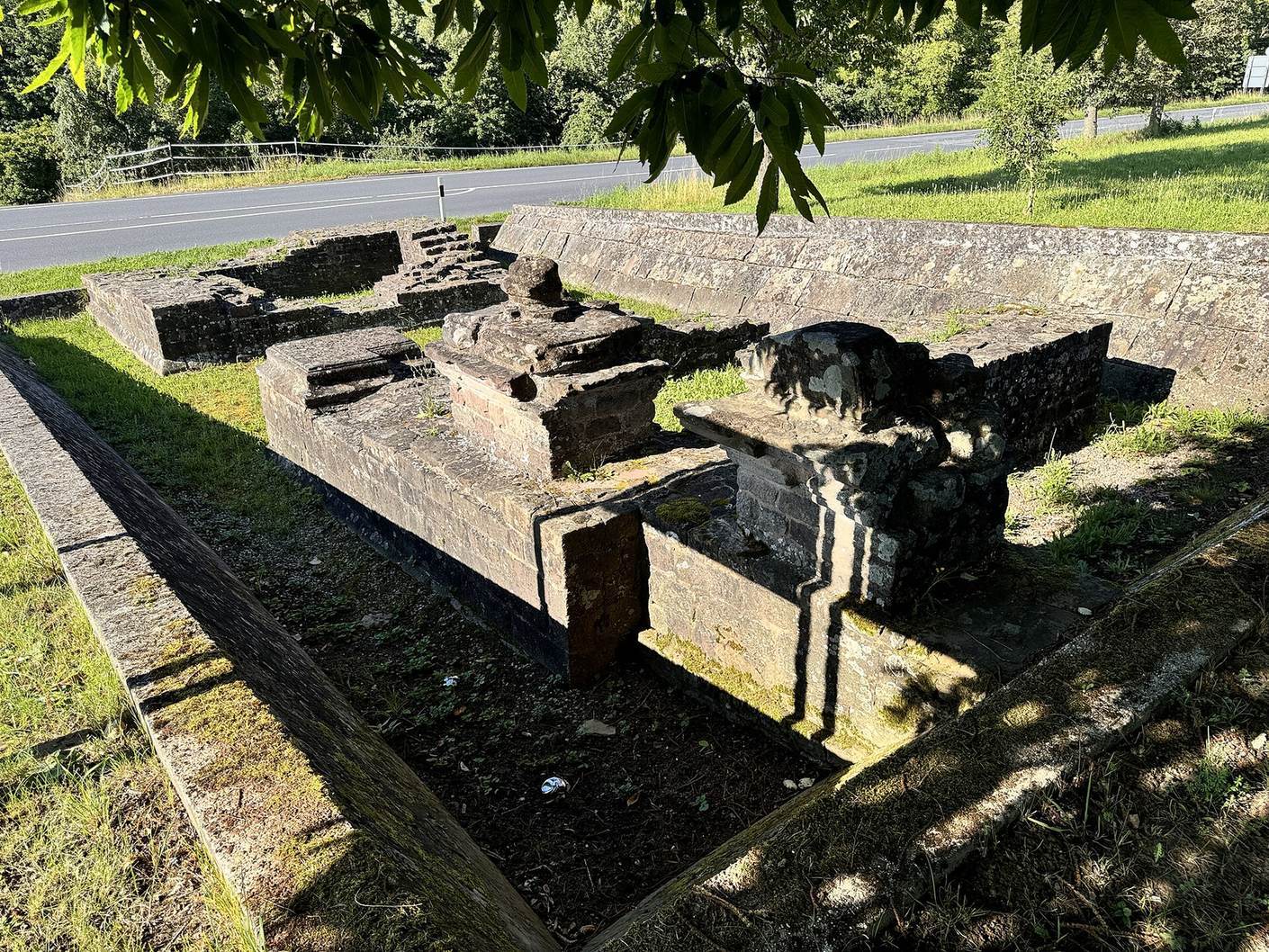
The East Fort was an irregular quadrilateral with an area of about 6,400 square metres and listed dimensions of roughly 80 by 80 m. It had timber and stone construction phases and three gates. Its main entrance faced north toward the Elz. The west gate has been conserved.
An inscription from the east gate dates to AD 145–161. It names the Numerus Brittonum Elantiensium and dedicates the gate to Emperor Antoninus Pius, who ruled from AD 138 to 161.
Baths
West Fort bath
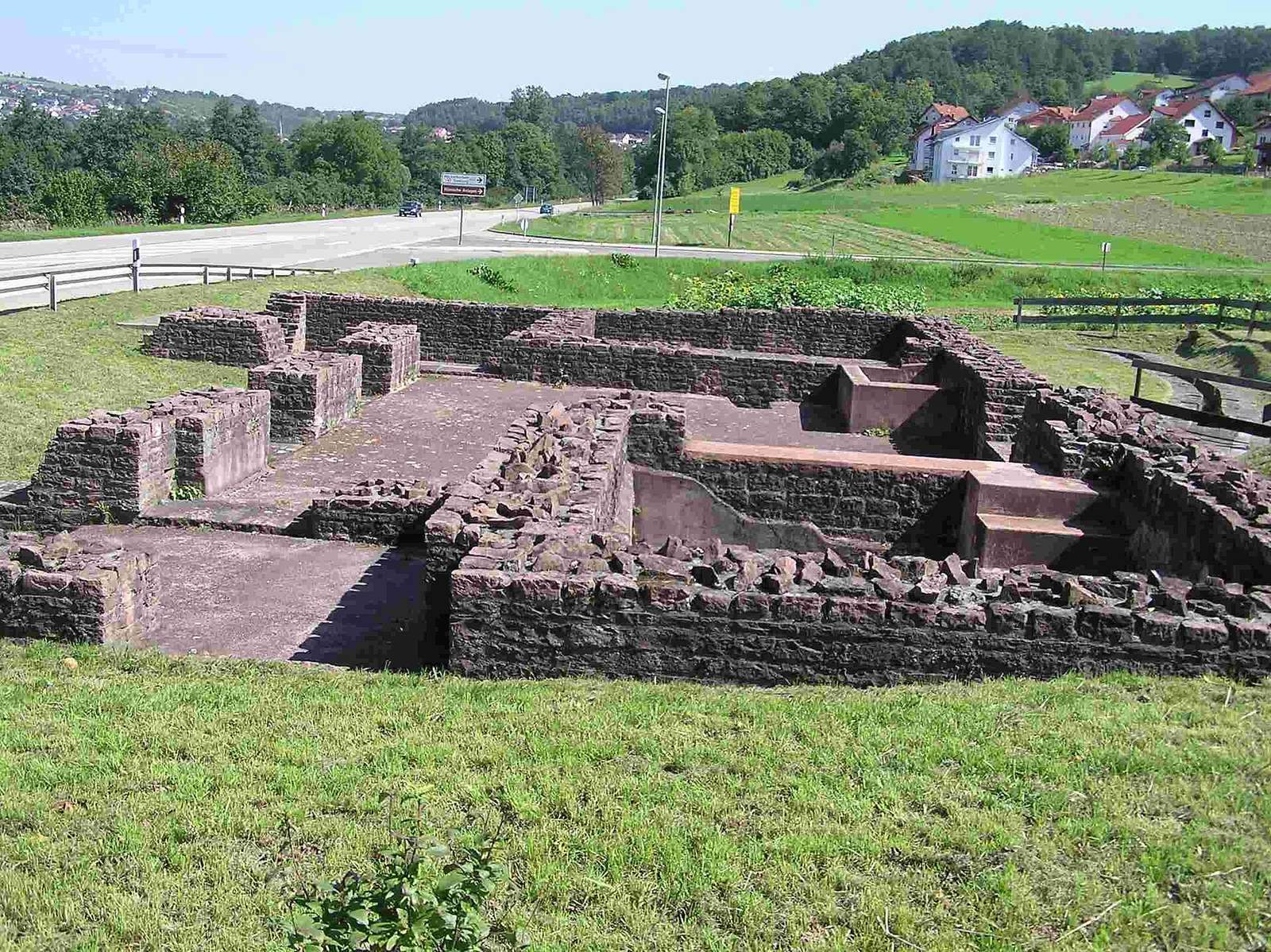
The West Fort bath stood beside federal highway B 27, about 40 m east of the fort’s northeast corner. Excavation revealed the principal parts of a Roman bath, along with lead water pipes and a system for draining wastewater. The highway has disturbed the northern part of the building, while its southern portion has been restored. Baden-Württemberg’s state monument-preservation authority investigated the bath in detail in 1974 and 1975.
East Fort bath
The East Fort bath was about 70 m northwest of the fort’s northwest corner and came to light during sewer construction in 1982. It was greatly enlarged in AD 158 under the supervision of Veranius Saturninus, a centurion, or Roman army officer, serving with the Elz Britons. The enlargement may indicate that the fort remained in military use beyond AD 159.
Civilian settlement and frontier landscape
Civilian settlement
A civilian settlement occupied ground between the forts and west of the West Fort, with further settlement finds southwest of that fort. The military road probably served as its main route, with smaller streets running parallel to it and crossing it. Beside one of the parallel streets, excavators uncovered a long building measuring 18.6 by 6.6 m.
A relief found just in front of the East Fort’s north gate in 1850 may have been a tombstone showing Cupid, the Roman god of love. Its discovery prompted the suggestion that a cemetery lay nearby, but the cemetery locations remain uncertain.
Frontier landscape
South of Neckarburken, the frontier runs in a straight line toward Bad Wimpfen and the small fort at Duttenberg, rather than following the local terrain. A watchtower position was chosen to overlook the Elz valley and the northern frontier line. A rise still visible in the ground may mark another tower site, from which a view north may have reached a further watchtower.
A tower at an elevation of 346.2 m commanded views north over Sattelbach and Robern, east across land beyond the frontier, south toward the northern edge of woodland, and west to where the Elz joins the Neckar.