Jankent: An Oghuz Yabgu State Capital in Kazakhstan
Site at a Glance
- Rating
- 4.8
- Popularity
- Very Low
- Country
- Kazakhstan
- Primary era
- Medieval
- Eras represented
- Medieval
- Civilizations
- Khwarazmian
- Site type
- City
On this page15 sections
History
Jankent, also known as Yangikent, is a fortified town in Kazakhstan associated with the Oghuz Turks and the medieval Oghuz Yabgu State. Founded as an early settlement in the seventh century and enclosed in the ninth or tenth century, it became a principal seat of the Oghuz rulers and a commercial and craft centre on the lower Syr Darya.
Early settlement and Oghuz rule
The earliest settlement at Jankent was founded in the seventh century by communities associated with the Dzhetyasar culture, an archaeological culture of settled and semi-settled people in the lower Syr Darya region. These settlers had moved from farther upriver. Their arrival coincided with the development of an early medieval branch of the Northern Silk Road, a network of routes linking Central Asia with the Volga region, the Iranian world, and lands farther west.
The fortified town was probably laid out in the ninth or tenth century, after the Oghuz Turks had reached the steppes north of the Syr Darya. During the tenth and eleventh centuries, Jankent served as the capital or principal seat of the Oghuz Yabgu State. This was a medieval Turkic polity whose ruler held the title yabgu, a rank traditionally understood as below that of a supreme khan or imperial ruler.
Jankent occupied a position where the Northern Silk Road met a north-south caravan route between the Volga region and Khorezm, the ancient and medieval civilization centred on the lower Amu Darya. Trade also connected the town with the Kimak lands along the Irtysh. Grain travelled down the Syr Darya from Transoxiana, the region broadly between the Amu Darya and Syr Darya, while salt from the Aral Sea region was associated with the town’s exports.
A mixed cultural and political centre
The population of Jankent may have included communities shaped by Oghuz nomadic culture, the settled Dzhetyasar tradition, and Khorezmian civilization. Medieval Arabic geographers referred to an Oghuz town called Jengi-Kent. Ibn Rustah and Ibn Hawqal identified it as the seat of the Oghuz yabgu, while Al-Masudi and Al-Idrisi also mentioned the town. Other writings used names translated or rendered as Dihi Naw, al-Karyat al-Haditha, and Shehrkent.
In the early twentieth century, V. V. Bartold identified the archaeological site with historical Jengi-Kent and regarded it as a winter residence of the Oghuz rulers during the tenth and eleventh centuries. The town flourished especially from the tenth to the twelfth century, before the Mongol conquest. Its political setting changed as the Oghuz polity came under pressure from the Kipchaks and Kimeks, contributing to wider upheaval in the region.
Destruction, recovery, and abandonment
Local tradition holds that the ruler Sanjar Khan and his people died in 1153 after provoking the anger of the holy figure Karabura. In autumn 1219, the Mongols reportedly attacked Jankent, massacred its inhabitants, and burned the town. A separate historical tradition says that trade and handicraft production resumed after the destruction and that Jankent recovered during the fourteenth century, when it became a centre of Arab-Islamic culture.
The final history of the settlement remains uncertain. Interpretations place its abandonment sometime between the twelfth and fourteenth centuries, with changing channels in the Syr Darya delta, altered trade routes, and political developments among the possible causes. The decline of overland caravan routes, including the main crossing of the Syr Darya near Jankent, also weakened the town’s connections. Communities from Jankent and neighbouring settlements gradually moved toward Tashkent, Bukhara, Samarkand, and Khorezm. From the fifteenth century, Jankent was known only through its ruins, and written information about it ceased.
Rediscovery and continuing investigation
Russian military topographers recorded the site in the early nineteenth century. P. I. Lerkh and M. K. Priorov conducted limited excavations and prepared a plan in 1867, followed by further investigation by V. V. Vereshchagin in 1868. In 1946, the Chorasmian Archaeological and Ethnographic Expedition, directed by S. P. Tolstov, carried out a major survey, produced a more precise plan, and photographed the settlement from the air. N. I. Igonin and B. V. Andrianov prepared an improved plan in 1963.
Systematic excavations began in 2005 and have involved institutions from Kazakhstan, Russia, and Germany. Work has continued without fully investigating the site. A 2007 international conference in Kazaly considered comprehensive research at Jankent and proposals for its development as an open-air museum, while the exact date of the town’s construction and the definitive cause of its destruction or abandonment remain unresolved. Kazakhstan protects Jankent as an archaeological monument of republican significance.
Jankent is traditionally identified as the home of Korkyt Ata, a celebrated Turkic cultural figure associated with epic tradition, music, and the kobyz, a two-stringed bowed instrument. An interpretation associated with Alkey Margulan also places the birth of Abu Nasr al-Farabi, the tenth-century philosopher, music theorist, and scholar, at Jankent. These identifications belong to historical and cultural tradition rather than securely established archaeological evidence.
Remains
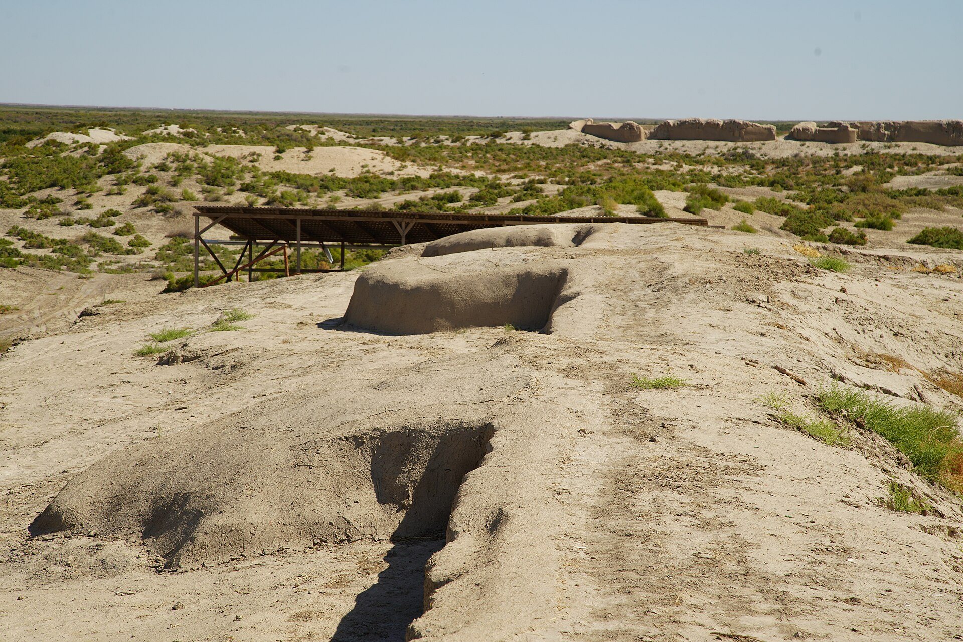
Jankent occupies a fortified, broadly rectangular enclosure oriented from east to west. The town covered about 16 hectares, with one plan recording dimensions of approximately 375 by 225 metres. Its walls, towers, gates, citadel, streets, residential areas, palace complex, and production quarters reveal a settlement built and altered through several occupation phases.
Fortifications and defensive areas
Town walls and gates
The town wall formed a rectangular circuit with an eastern cross-bar that gave the enclosure a T-shaped plan. Gates opened through the eastern and western walls. Several defensive towers stood along the circuit, including towers with openings interpreted as arrow or gun loopholes. The walls survive in places to approximately 7 or 8 metres high, and measured sections are about 6 metres thick. The southern wall is the best-preserved stretch, while the highest tower was reportedly positioned at the south-western corner.
Citadel
A separately fortified citadel occupied the north-western corner of the town. It measured about 100 by 100 metres and rose 7 or 8 metres above its surroundings. Geophysical evidence places its interior on a natural elevation. Excavation at the junction of the citadel and the northern town wall exposed occupation deposits extending more than 8 metres below the present top of the citadel wall. Radiocarbon determinations from the trench produced calibrated ranges between AD 786 and 923 and between AD 961 and 1095.
Work from 2012 onward uncovered semi-circular towers along the top of the citadel wall. Inside the citadel, two occupation layers have been associated with the ninth or tenth century. The lower layer contained building remains and a street. In 2019, excavators found a ninth- or tenth-century pottery vessel outside the northern base of the citadel wall. The vessel held three eggs bearing Arabic writing.
Northern enclosure features
A semicircular annexe was attached to the northern town wall. Geophysical investigation identified its interior as completely empty. Another large, regular feature inside the northern wall was first interpreted as an estate and later identified as a massive clay platform. Outside the eastern gate, a low mound once hypothesized as a caravanserai was instead identified through geomorphological investigation as a natural island in an ancient, now-dry river channel that predates the settlement.
Town interior and production areas
Residential quarters
The western half of the town contained a regular and dense arrangement of buildings, while larger complexes were more loosely arranged in the eastern half. Excavation in the central lower town, especially in Trench P1, revealed a built-up residential area arranged along a street in a Central Asian style. A possible metalworking workshop was found in the same area. Coins associated with these remains date them to the ninth or tenth century, and deeper excavation since 2011 has exposed several earlier building phases.
Palace and administrative complex
A central palace or palace complex stood within Jankent. Its remains were associated with the rulers or administrators of the settlement. The palace formed part of the town’s internal organization alongside the residential quarters and craft areas.
Craft production
Jankent’s production areas contain evidence for brick firing, pottery manufacture, and glazed ceramic production. Finds include a kiln used to melt glaze, a cast-iron cauldron with hardened glaze traces, and other industrial waste. The town was also associated with the manufacture of carpets, wall hangings, horse equipment, bows and arrows, pottery, and ceramic ware.
Materials and chronological evidence
Excavated architectural and artistic material includes fired bricks, blue and pink glazed ceramic tiles, terracotta, plaster ornament, wall paintings, pottery fragments, and ceramic vessels decorated with Arabic script. One brick carried Arabic lettering. Copper and silver coins from the thirteenth and fourteenth centuries have been found at Jankent, including objects reflecting the culture of the Golden Horde during the Dasht-i Kipchak period.
Coring and other investigations have identified deeply stratified cultural deposits extending several metres below the present surface in most sampled areas. These layers reflect repeated occupation and construction. Together with the fortified layout, industrial remains, written references, and later coin finds, they preserve evidence of Jankent’s development from an early medieval settlement into an Oghuz political and commercial centre and its subsequent transformation.