Gettysburg Battlefield: A Civil War Battlefield and National Military Park
Site at a Glance
- Rating
- 4.8
- Popularity
- Low
- Country
- United States
- Primary era
- Modern
- External website
- Open
- Eras represented
- Modern
- Civilizations
- Unclassified
- Site type
- Military
On this page18 sections
History
Gettysburg Battlefield is the Pennsylvania, United States, landscape of the Battle of Gettysburg, a major Union victory in the American Civil War, fought from July 1 to 3, 1863. The battlefield developed around the borough of Gettysburg, whose population was about 2,400 and whose roads connected communities in Pennsylvania and Maryland, including Chambersburg, York, and Baltimore. The battle area later became the setting for Soldiers’ National Cemetery, Abraham Lincoln’s Gettysburg Address, and one of the most extensively commemorated military landscapes in the United States.
The battle and its immediate aftermath
The fighting extended across the ridges, hills, fields, roads, and buildings surrounding Gettysburg. A preliminary military encounter took place on June 27, 1863, when the Gettysburg Railroad trestle over Rock Creek was burned. During the main battle, Confederate and Union forces contested positions west, north, south, and east of the borough, with the fighting eventually reaching East Cavalry Field.
After the battle, about 22,000 wounded soldiers remained in the area. They received treatment at Camp Letterman, temporary field hospitals, private houses, churches, and other buildings. Approximately 8,900 dead soldiers, together with many animals, required burial. Contractors carried out most of the burials near the places where the dead had fallen under the supervision of Samuel Weaver.
Pennsylvania Governor Andrew Curtin visited Gettysburg on July 10, 1863, and supported the creation of a permanent cemetery for the fallen. David Wills arranged the purchase of 17 acres on Cemetery Hill for the Soldiers’ National Cemetery. The cemetery was dedicated on November 19, 1863, when President Abraham Lincoln delivered the Gettysburg Address, a short speech dedicating the burial ground and interpreting the war as a test of the nation’s founding principles. By March 1864, 3,512 Union bodies had been reburied there.
The cemetery passed to the federal government in May 1872. Between 1870 and 1873, memorial associations from Richmond, Raleigh, Savannah, and Charleston arranged for the removal of 3,320 Confederate bodies. Of these, 2,935 were reburied in Richmond’s Hollywood Cemetery and 73 in family or local cemeteries.
Private preservation and federal park creation
David McConaughy began acquiring battlefield land in 1863, including Cemetery Hill, Little Round Top, and parts of Culp’s Hill. His holdings eventually covered about 600 acres. In 1864, the Gettysburg Battlefield Memorial Association was formed as a private organization to acquire and protect locations associated with the battle. It expanded McConaughy’s work and helped establish the pattern of preserving specific positions, roads, and landmarks.
John B. Bachelder played an important role in identifying and interpreting the battlefield. Beginning in 1863, he recorded troop positions, consulted convalescent officers, and interviewed Union officers during the winter of 1863–1864. He later brought more than 1,000 officers, including 49 generals, back to the field. With federal funds secured through the support of Wade Hampton III, Bachelder surveyed the battlefield and prepared maps of troop positions in 1880. Emmor Cope had also surveyed and annotated the field in 1863, and his map was displayed at the 1904 Louisiana Purchase Exposition.
The federal Gettysburg National Park Commission was established in 1893. Legislation promoted by Daniel Sickles, a Union general and later a member of the United States House of Representatives, authorized the War Department to acquire battlefield land. The 1895 park legislation transferred about 800 acres and approximately 300 monuments from the memorial association to the federal government. In 1896, the War Department acquired another 522 acres and 320 monuments while assuming the association’s debts. The era of the private memorial association ended as federal administration expanded.
Administration of Gettysburg National Military Park passed from the War Department to the National Park Service in 1933. The National Park Service, the federal agency responsible for national parks and related historical areas, continues to administer the park. The battlefield is also represented by Gettysburg National Cemetery and the Gettysburg National Military Park. The park is listed as a National Historic Landmark, while the broader Gettysburg Historic District, which includes both public and private property, was added to the National Register of Historic Places in 1975.
Commemoration, military use, and interpretation
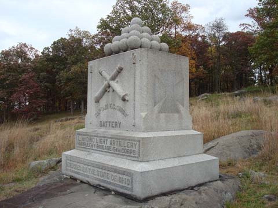
Commemoration expanded rapidly in the late nineteenth century. The first battlefield monument was a marble urn for the 1st Minnesota Infantry, placed in the National Cemetery in 1867. The first monument outside the cemetery was the 1878 Strong Vincent tablet on Little Round Top. By May 1887, the field contained 90 regimental and battery monuments, and National Park Service inventories later counted more than 1,300 monuments.
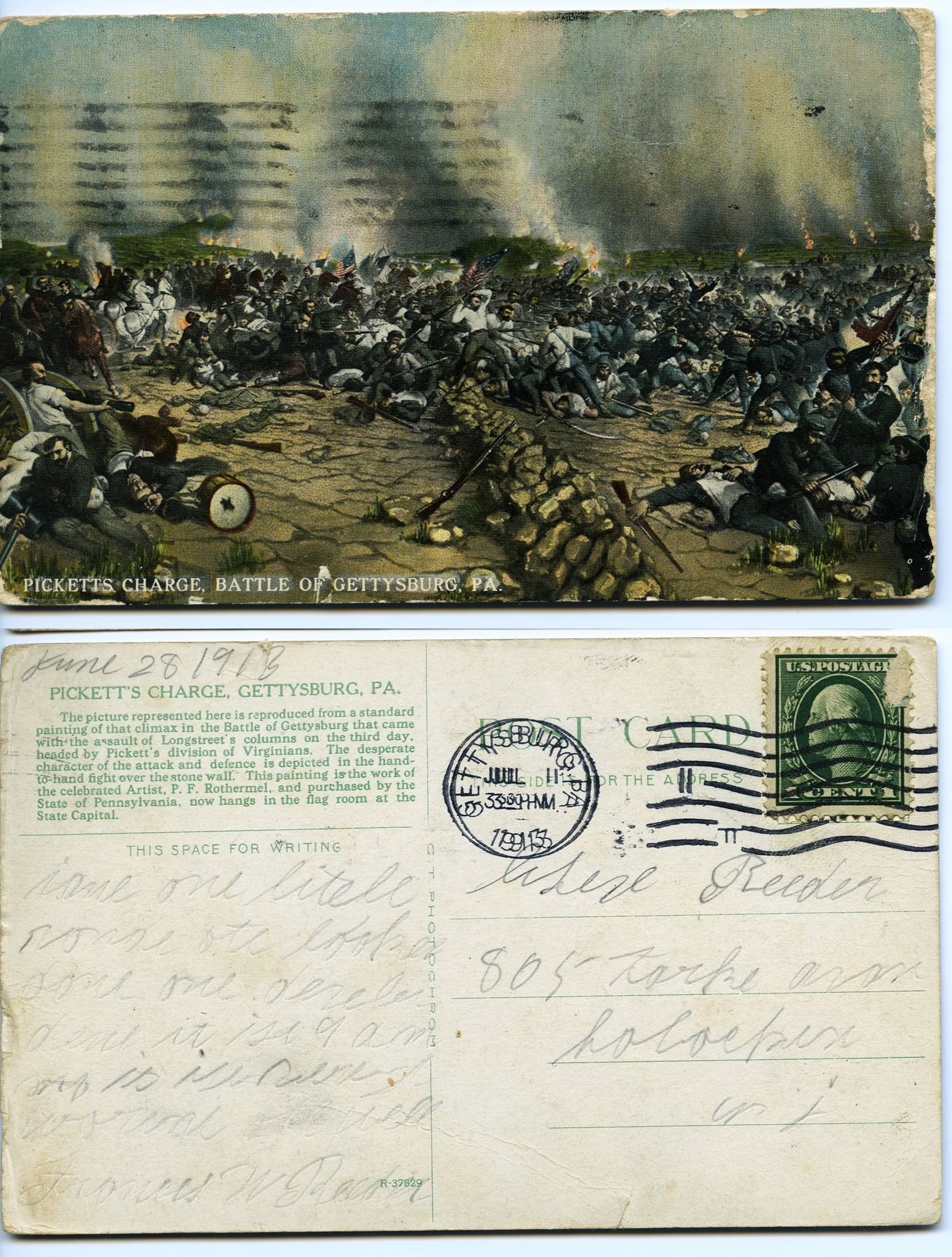
Pennsylvania National Guard encampments began at Gettysburg in 1884. The field later hosted Camp Colt in 1918, Camp Sharpe during the Second World War, and a German prisoner-of-war camp at McMillan Woods. Reenactments and military demonstrations also shaped public interpretation, including a Marine Corps reenactment of Pickett’s Charge in 1922 and a modern-weapons simulation the following day.
Veterans returned in large numbers for major anniversaries. More than 50,000 attended the fiftieth-anniversary reunion in 1913. At the seventy-fifth anniversary in 1938, 1,845 veterans attended, and the Eternal Light Peace Memorial was unveiled. These gatherings reinforced Gettysburg’s place as both a battlefield and a national commemorative site.
Depression-era and later federal programs changed the physical presentation of the park. The National Park Service and the Civilian Conservation Corps constructed and maintained roads, restored battlefield houses, resurfaced about 31 miles of avenues, replaced the railroad-cut bridge, and restored the Gettysburg Cyclorama. The Mission 66 program, begun in 1956, organized many improvements intended for the National Park Service’s fiftieth anniversary in 1966.
A 393-foot Gettysburg National Tower was built on private land in 1974. The National Park Service acquired it through eminent domain, and the tower was demolished in 2000. The modernist Cyclorama Building, designed by Richard Neutra, was demolished in 2013 after the painting had been removed and restored.
Recent preservation
Since 1997, the American Battlefield Trust and its partners have acquired and preserved 1,231 acres through more than 35 transactions. In 2015, the organization acquired a four-acre parcel containing the stone house used by Robert E. Lee as his headquarters. Later commercial buildings were removed, and the property was restored toward its wartime appearance.
Landscape preservation has included removing trees from areas that were historically open, replanting orchards and woods that had disappeared, and conserving or restoring battlefield properties. Portions of the wider 1863 battlefield, including Confederate positions and areas around Cemetery Hill, remain outside the federal park or have been affected by modern development. In 2016, Gettysburg National Military Park entered a sister-battlefield agreement with Sekigahara in Gifu Prefecture, Japan. Both sites are associated with civil wars regarded as having brought major internal conflicts to an end and contributed to peace.
Remains
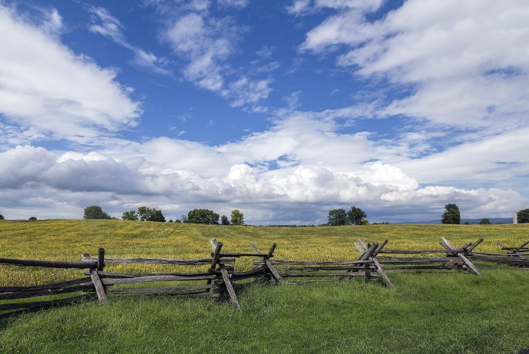
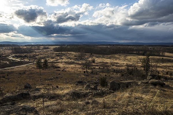
Gettysburg Battlefield occupies the Gettysburg-Newark Basin of the Pennsylvania Piedmont, near the meeting area of Marsh and Rock creeks and close to the boundary between the Potomac and Susquehanna watersheds. The principal battlefield area measures approximately 3.33 by 5.33 miles, or 5.4 by 8.6 kilometers. Its surviving landscape combines ridges, wooded hills, open fields, roads, buildings, monuments, artillery pieces, observation structures, and archaeological features.
Ridges, hills, and battle positions
The western approach includes Lohr’s, Whistler’s, School-House, and Knoxlyn ridges between Cashtown and Gettysburg. McPherson’s Ridge, Herr’s Ridge, and Seminary Ridge continue toward the borough. Seminary Ridge takes its name from the Lutheran theological seminary on its crest. Oak Ridge extends northward from McPherson Ridge and Seminary Ridge and includes Oak Hill, an artillery position with wide views over the ground north of Gettysburg. Before Pickett’s Charge, 159 guns formed a line from the Peach Orchard to Oak Hill for a coordinated bombardment.
Cemetery Hill and Culp’s Hill
Cemetery Hill rises immediately south of Gettysburg, about 80 feet above the borough, to an elevation of approximately 503 feet. Evergreen Cemetery occupies its summit, while Soldiers’ National Cemetery occupies part of the hill. Culp’s Hill lies east of Cemetery Hill across a shallow saddle. Its wooded and rocky ground formed part of the eastern battle position, where Confederate artillery fired toward the Union line extending from Culp’s Hill to Cemetery Hill.
Cemetery Ridge and The Angle
Cemetery Ridge extends south from Cemetery Hill for about 1 mile. It rises only about 40 feet above the surrounding ground. At The Angle, a stone wall turns through two right angles near a copse of trees associated with the farthest Confederate advance during Pickett’s Charge, the large Confederate infantry assault against the Union position on July 3. The nearby Codori farm and Emmitsburg Road were involved in Pickett’s Charge and in attacks by Richard H. Anderson’s division on July 2.
The Round Tops and Plum Run Valley
Weikert Hill forms the southern end of Cemetery Ridge north of Little Round Top. The Round Tops are the highest ground on the battlefield. Big Round Top, called Sugar Loaf locally during the nineteenth century, rises 116 feet above Little Round Top. It is steep, heavily wooded, and covered with large rocks. Little Round Top is lower, oval, steep, and rocky, with a largely open historical form. It rises about 130 feet above Plum Run and reaches an elevation of approximately 550 feet.
Devil’s Den is a large rocky area southwest of Little Round Top, with boulders that are in places approximately the size of rooms. Between Houck’s Ridge and the Round Tops, Plum Run Valley became known as the Valley of Death during the fighting on July 2. Northwest of the Round Tops, the Wheatfield, Rose Woods, and Peach Orchard occupy ground about 40 feet higher than the low ground at the southern end of Cemetery Ridge. These areas were scenes of attacks by Lafayette McLaws’s division.
Eastern and urban engagement areas
The eastern and northern portions of the battlefield include East Cemetery Hill, Steven’s Knoll, Coster Avenue, the railway cut, East Cavalry Field, and parts of Gettysburg itself. Union artillery on Cemetery Hill fired toward the railway cut, while Confederate artillery from Oak Hill fired toward the Union positions around Culp’s Hill and Cemetery Hill.
During the battle, the borough contained Confederate provost positions, snipers, and skirmish lines. Important urban positions included the brickyard behind the McCreary House, the John Rupp Tannery on Baltimore Street, a church belfry, and the area around Breckenridge Street and East and West Middle Streets. The battlefield landscape therefore includes streets and buildings as well as rural military positions.
Monuments and battlefield structures
A National Park Service inventory counted approximately 1,320 monuments, 410 cannon, 148 historic buildings, two and a half observation towers, and 41 miles of avenues, roads, and lanes, including unpaved routes. The monuments and markers commemorate units, commanders, states, veterans, and particular actions. Their locations often reflect veterans’ recollections of unit positions, which did not always correspond to the most decisive military events.
Commemorative monuments
The 1867 marble urn for the 1st Minnesota Infantry stands in the National Cemetery. The 1878 marble tablet to Strong Vincent marks Little Round Top, while the 1872 statue of John F. Reynolds in the cemetery was the first bronze monument on the battlefield. Other features include an 1887 plaque near The Angle marking Lewis Armistead’s farthest advance and the 1884 monument to the 2nd Maryland Infantry on Culp’s Hill. Bronze guide tablets installed by the War Department identify units, commanders, and their actions. Artists and sculptors associated with the monuments include Caspar Buberl, James E. Kelly, Lee Lawrie, Randolph Rogers, Cyrus Dallin, Edward Potter, John Quincy Adams Ward, and Gutzon Borglum.
Observation towers
The Gettysburg Battlefield Memorial Association operated a wooden observation tower on East Cemetery Hill from 1878 to 1895. The War Department built replacement towers in 1895, including one on Big Round Top. The Zeigler’s Grove tower was removed in 1962, and the Big Round Top tower was removed in 1968. These structures formed part of the changing system used to observe and interpret the battlefield.
Eternal Light Peace Memorial
The Eternal Light Peace Memorial stands on Oak Hill. Unveiled during the seventy-fifth-anniversary reunion in 1938, it forms part of the battlefield’s later commemorative landscape alongside the Strong Vincent tablet, the Armistead plaque, the 2nd Maryland monument, the Reynolds statue, and numerous unit, state, and national memorials.
Railways, parks, and battlefield interpretation
The Gettysburg Railroad’s Round Top Branch, completed in 1884, crossed the battlefield toward the Round Tops. Round Top Park occupied 13 acres at the line’s terminus and included an exhibition building, two wells with pumps, a kitchen, a photography studio, and other structures. The railway line was removed in 1939.
From 1894 to 1916, the Gettysburg Electric Railway crossed private land near the battlefield. Its route followed the Emmitsburg Road and passed through the Pickett’s Charge area, the Peach Orchard, the Wheatfield, and the Plum Run area known as the Slaughter Pen before ending south of Little Round Top. Tipton Park operated near the Slaughter Pen from 1892 and included facilities for battlefield visitors.
The Gettysburg Cyclorama
The Gettysburg Cyclorama is a large circular painting of the battle completed in 1884 by the French artist Paul Philippoteaux. It was removed from its former building for restoration, relocated to the Gettysburg Museum and Visitor Center away from the battlefield, and reinstalled there in 2008. The painting remains part of the site’s interpretive history rather than a feature of the original 1863 landscape.
Historic landscape preservation
Preservation work has sought to restore parts of the battlefield toward their 1863 appearance. Projects have included clearing trees from historically open areas, replanting orchards and woods, and conserving battlefield properties. The resulting landscape brings together surviving wartime terrain, nineteenth-century memorials, historic buildings, roads, artillery, and later structures that reflect changing methods of commemoration and interpretation.