Gagron Fort: A Hill-and-Water Fortress in Rajasthan, India
Site at a Glance
- Rating
- 4.3
- Popularity
- Medium
- Country
- India
- Primary era
- Medieval
- Eras represented
- Medieval, Early Modern, Modern
- Civilizations
- Rajput
- Site type
- Military
- Remains
- Fort
On this page10 sections
History
Gagron Fort is a hill-and-water fortress in India, founded by Raja Madho Bhil and developed through successive medieval Rajput phases. Its precise construction date is uncertain, with parts of the fort dated broadly between the seventh and fourteenth centuries, while Bijaldev Singh Dod, a Parmar Rajput king, is associated with its control during the twelfth century. Its position at the meeting of the Ahu and Kali Sindh rivers made it an important defensive stronghold in Rajasthan’s Hadoti region.
The Khinchi Kingdom
The fort remained under the Khinchi kingdom for about 300 years. The Khichis were a Rajput lineage associated with Gagron, and Achal Das Khinchi was its last reported ruler. During this period, the fort’s elevated position, surrounding water, and fortified approaches supported the control of a strategically placed stronghold.
The Malwa Attacks
In 1423, Sultan Hoshang Shah of Malwa, the first sultan of the Malwa Sultanate, attacked Gagron with an army of about 30,000 horsemen and 84 elephant riders. Achal Das Khinchi refused to surrender and continued fighting until his death. Many women reportedly carried out jauhar, a wartime practice of collective self-immolation to avoid capture after a fortress fell. Gagron is also associated with 14 battles and two such events involving queens.
The fort was captured again in 1444, when Mahmud Khalji defeated the Khichi Rajputs and the Rajputs of Mewar. In 1519, Rana Sanga, the Rajput ruler of Mewar, defeated Mahmud Khilji II of Malwa at Gagron. These conflicts placed the fort within the wider struggle between the Malwa sultans and the Rajput powers of the region.
Later Mughal and Regional Control
Gagron was captured at other times by Sher Shah, founder of the Sur Empire, and by the Mughal emperor Akbar. Akbar reportedly used the fort as a headquarters before granting it to Prathviraj of Bikaner as part of his estate. Later buildings within the complex, including the palace structures associated with the eighteenth and nineteenth centuries, reflect the fort’s continued use after its major medieval battles.
Heritage Status and Religious Associations
In 2013, Gagron became one of six fortified sites in the UNESCO serial World Heritage property called the Hill Forts of Rajasthan. The group includes Amer, Chittor, Kumbhalgarh, Ranthambore, and Jaisalmer. The inscription, made during the World Heritage Committee’s 37th session in Phnom Penh, recognized the forts under criteria ii and iii as examples of Rajput military hill architecture. The property covers approximately 230,000 square metres and has a buffer zone of about 7.2 square kilometres. Gagron is also a state-protected monument.
Religious traditions remain connected with the fort’s surroundings. The Sufi mausoleum of Mitthe Shah stands outside the fort and hosts an annual fair during Muharram, the Islamic month associated especially with the martyrdom of Husayn ibn Ali. Across the river confluence is a monastery associated with Saint Pipaji, a medieval Indian saint linked with devotional religious traditions.
Remains
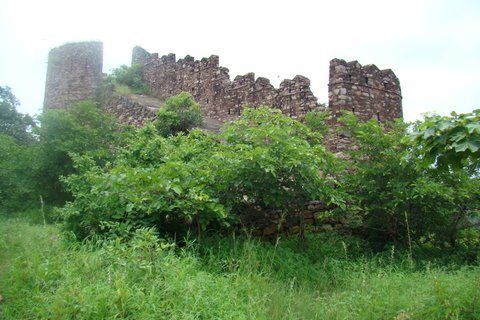
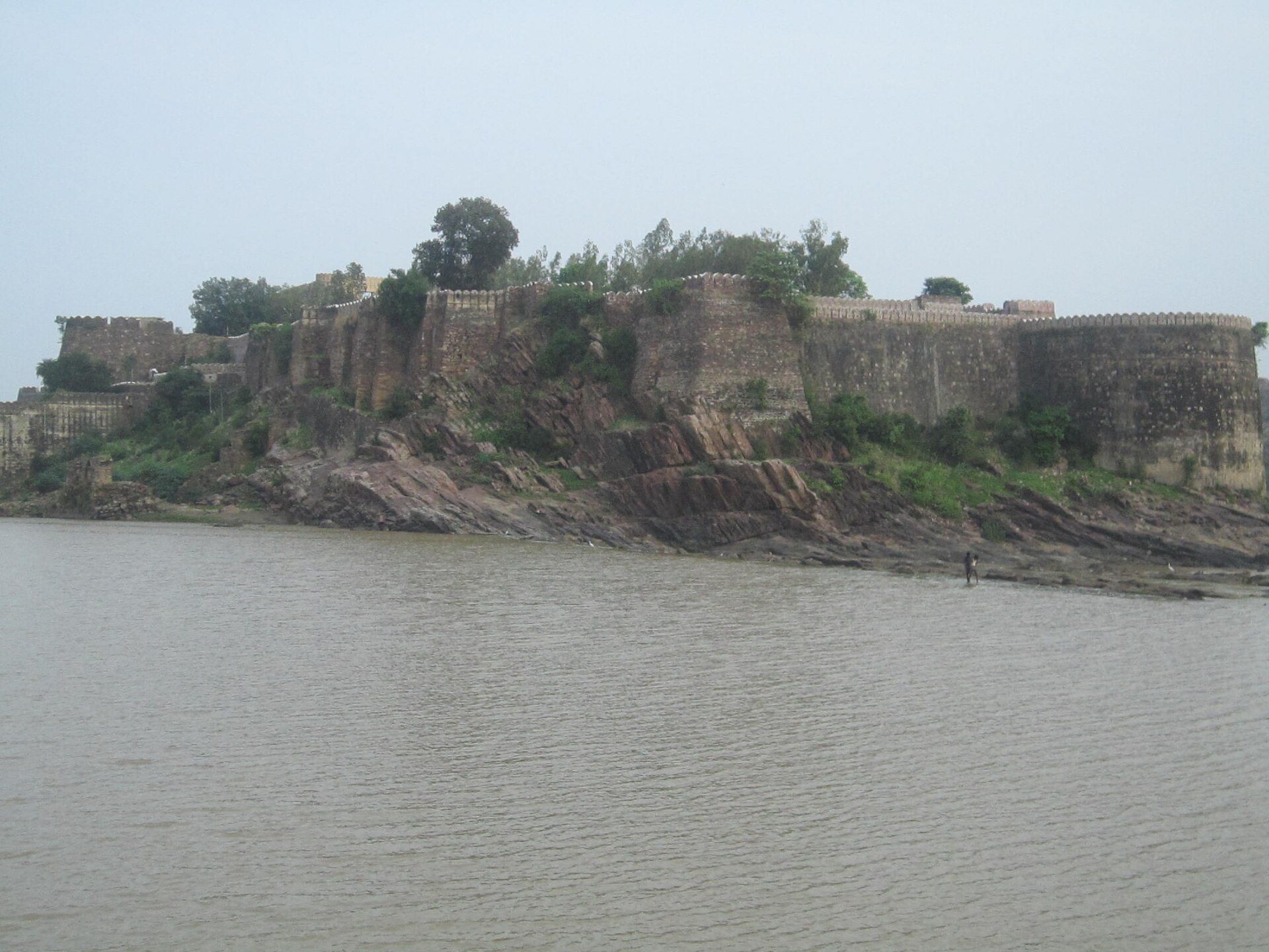
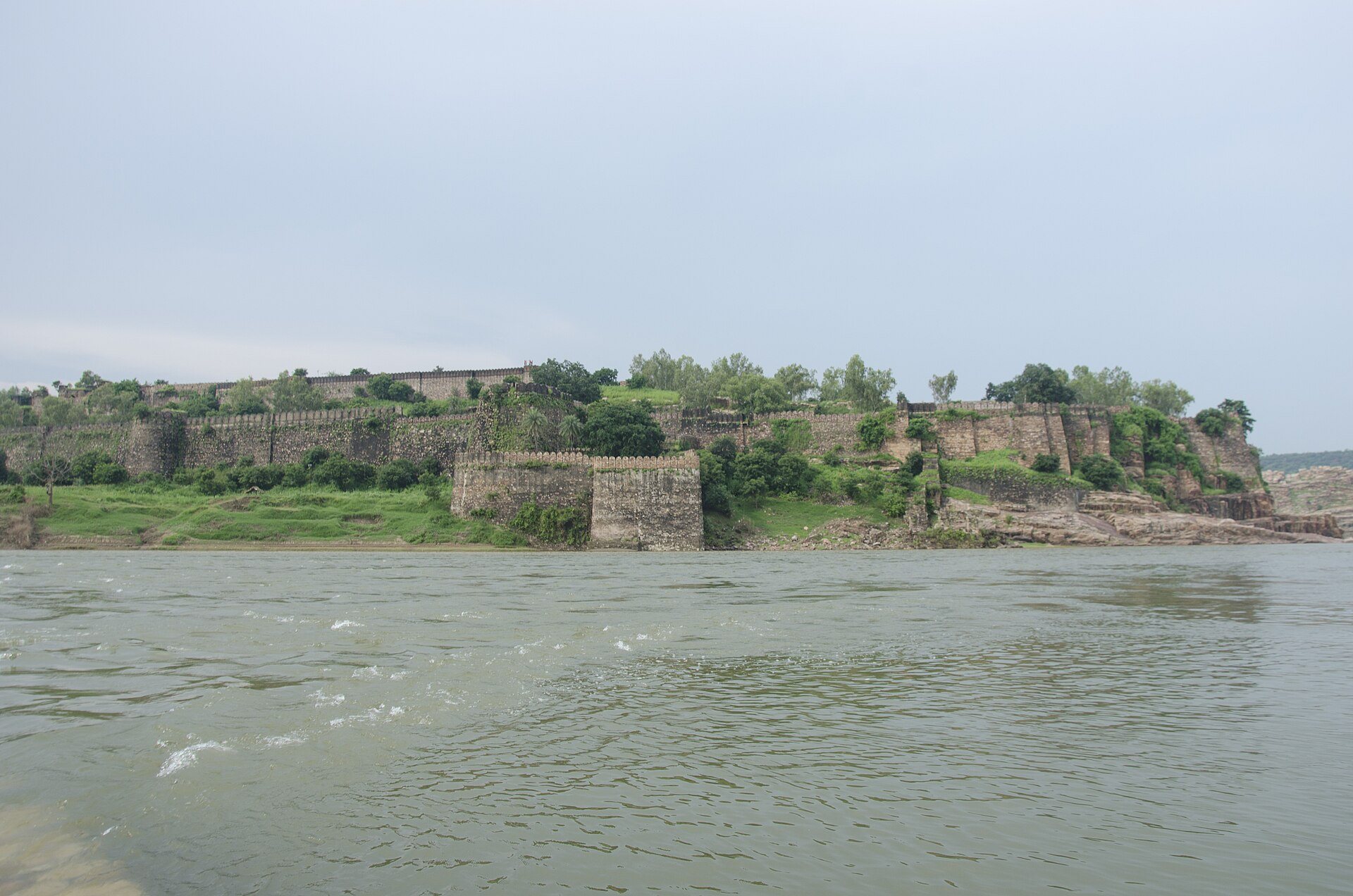
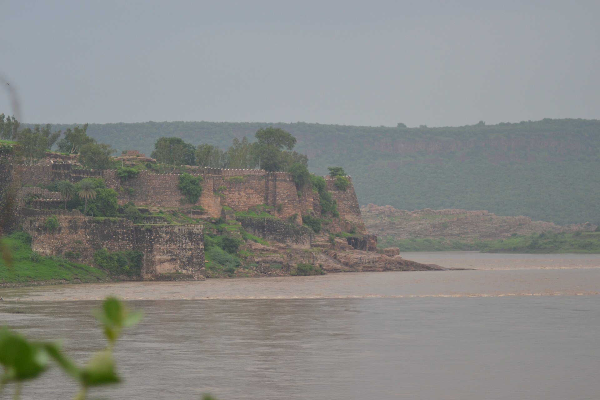
Gagron occupies a plateau and hill in the Vindhya Range at the confluence of the Ahu and Kali Sindh rivers. Water encloses three sides of the site, while a water-filled moat protects the fourth. This arrangement gave the fort the name Jaladurg, meaning “Water Fort.” The mountain itself forms part of the defensive foundation, and the fort’s towers merge visually with the Mukundara Hills.
Ramparts, Towers, and Entrances
The fort has three ramparts, with defensive walls approximately 10 to 15 metres high and circular towers about 25 metres high. On the river side, a vertical cliff roughly 93.6 metres high blocks approach. The cliff was also used for executions. Two principal entrances serve the complex, with one directed toward the river and the other toward the mountain road.
Palace Complex
The palace area occupies the northwestern part of the inner complex. Its principal surviving buildings date mainly from the eighteenth and nineteenth centuries and include Shish Mahal, identified as the harem, and Mardana Mahal. Their leaf decoration and arched openings are associated with the period of Zalim Singh Jhala, a nineteenth-century statesman of the Jhala Rajput house.
Temples, Shrine, and Monastic Remains
The fort complex includes the Hindu Madan Mohan Temple, dated to the eighteenth or nineteenth century, as well as a Hindu temple dedicated to Hanuman and a Muslim dargah, a shrine or mausoleum associated with a Sufi saint, dating from the sixteenth century. The mausoleum of Mitthe Shah stands immediately outside the fort, while the monastery associated with Pipaji lies across the confluence of the two rivers.
Supporting Structures
Other surviving elements include monuments, water reservoirs, wells, storage buildings, and residences. Together with the ramparts, towers, palace buildings, and religious structures, these features form the physical remains of a fortified settlement whose defenses were integrated with the surrounding hill and waterways.