Franzensfeste Fortress: An Austrian Stronghold on the Brenner Route
Site at a Glance
- Popularity
- Very High
- Country
- Italy
- Primary era
- Modern
- Eras represented
- Modern
- Civilizations
- Austria-Hungary, Austrian Empire, German, Habsburg
- Site type
- Military
- Remains
- Fort
On this page20 sections
History
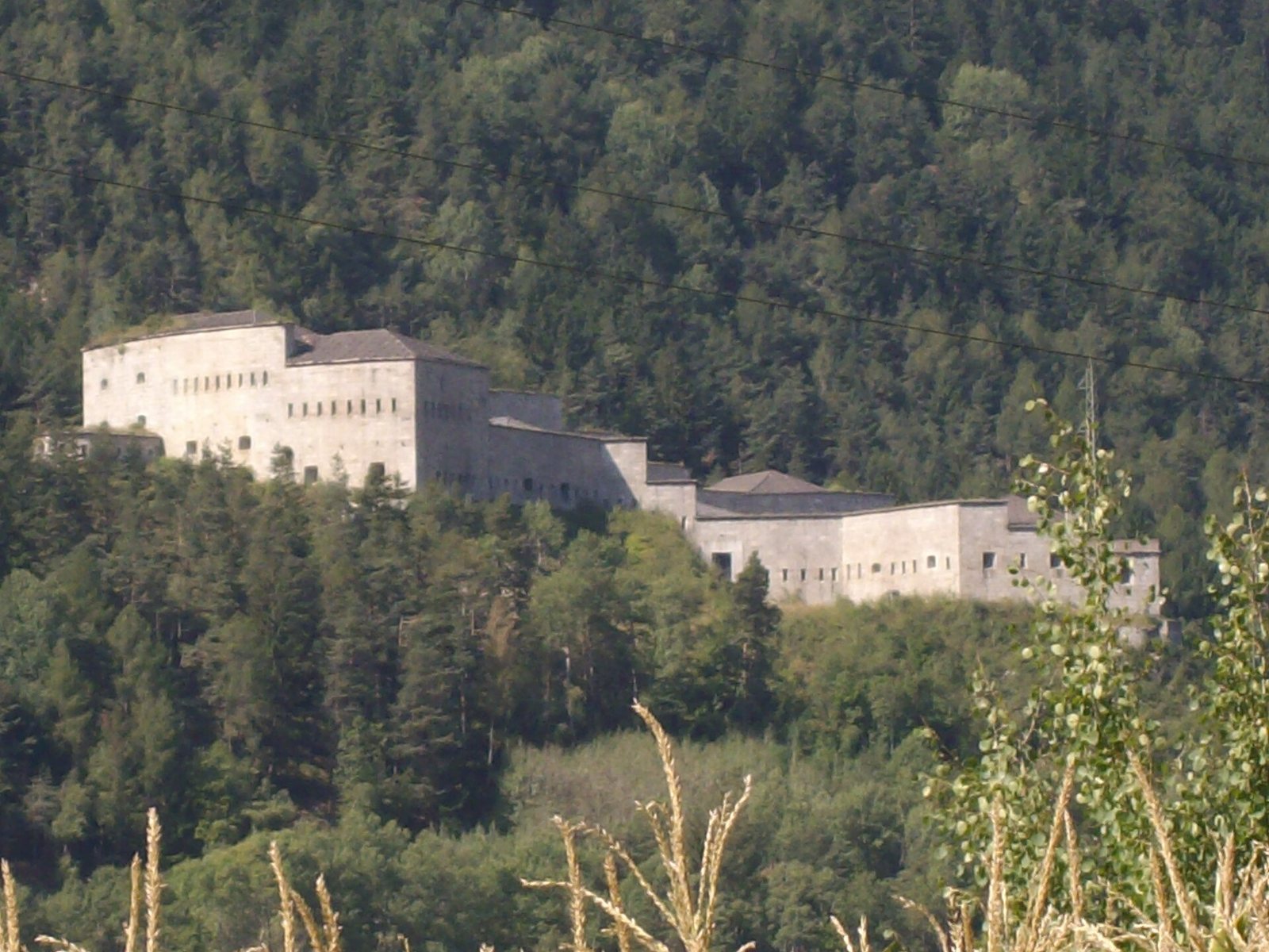
Franzensfeste Fortress is a nineteenth-century Austrian stronghold at Fortezza in Italy. The Austrian Empire designed it in a neoclassical style, with neo-Prussian fortification principles, a nineteenth-century system influenced by Prussian defensive works. It was intended to control routes through the Eisack and Puster valleys and protect the Brenner corridor, an important passage through the Alps.
Planning and construction
Archduke John of Austria selected the location in response to concerns about Napoleon’s expansion and the vulnerability of imperial communications. The nearby site of a 1809 battle also influenced the choice. During a Tyrolean rebellion against Napoleonic rule, about 500 peasant militiamen associated with Andreas Hofer and led by Peter Mayr repelled French and Saxon troops commanded by General Lefebvre near Oberau. The fortress site was close to the former Ladritsch Bridge, which was probably Roman in origin. A later bridge stood about 100 metres downstream.
Austrian military engineer Franz von Scholl was commissioned to design the fortress in 1832. Lieutenant Colonel Karl von Martony and Captains Magdlich von Magddenau and Lazarus von Manula were assigned to supervise construction. The construction decree was signed on 17 June 1833, and Emperor Ferdinand I attended the inauguration on 18 August 1838. The fortress was named for Franz I, who was emperor during the planning period; Ferdinand I was his successor.
The project cost about 2.6 million gulden, a currency used in the Austrian Empire. Depending on the season, between 3,200 and 4,600 workers were employed, including 1,700 specialists. Workers’ barracks extended as far as Sterzing. Dysentery and cholera outbreaks struck the workforce, and many workers died. They were buried in a mass grave near the former sanatorium at Brixen.
Military use and changing strategy
A peacetime garrison arrived in 1846, but the fortress never fought an enemy in battle. Its military usefulness was questioned in part because the guns of the period could fire only about one kilometre. Blocking the Eisack route would not prevent an invading force from using the Puster Valley to advance toward Vienna. A second fort farther east was considered but never built. When Archduke John gave up his post directing fortifications in 1848 and returned to civilian life by 1849, the fortress lost its principal advocate.
Although the plan called for 90 guns, Franzensfeste was reduced to depot status in 1882 as the frontier moved farther away. During the First World War it served as a storehouse, not an active defensive position. Bavarian troops occupied it briefly from 7 to 11 November 1918. After the war, the territory became part of Italy and the fortress lost its former strategic role.
From after 1930, the Italian army built five small bunkers around the complex as part of the Alpine Wall, a system of Italian frontier defences. The position was intended to protect the border from Germany, then Italy’s ally. In 1940, work began on a large underground fortification at nearby Ochsenbühel to replace Franzensfeste, but the project was abandoned in 1942 as political circumstances changed. Some of the surrounding bunkers were reactivated during the Cold War. NATO, the military alliance formed after the Second World War, later reused parts of the Alpine Wall as a defence against a possible Soviet invasion.
Construction of the dam that formed the Franzensfeste reservoir took place during the 1930s, and the lake appeared around 1940. The rising water transformed the valley: the settlement of Prà di Sotto disappeared and the road was relocated. Some fortress entrances came to face the lake, and storage spaces are periodically partly submerged.
Wartime storage and the gold
During the Second World War the fortress was used for military storage. An explosion near the chapel brought down part of the middle fort; otherwise, the complex escaped war damage. German SS forces may also have stored looted property there. The SS was Nazi Germany’s paramilitary and security organization.
The fortress became a temporary vault for gold belonging to the Bank of Italy. Bank governor Vincenzo Azzolini feared that Germany would seize the reserves. In September 1943, SS officer Herbert Kappler and Major Karl Hass took the gold and moved it to Milan. On 16 December, 12 railcars arrived at Franzensfeste carrying 127.5 tonnes of gold bars and coins, as well as a small quantity of platinum. Russian prisoners unloaded the cargo into a bunker. The fortress commander, a Bank of Italy official and local mayor Josef Wild each held one of the three keys. German anti-aircraft batteries were positioned around the fortress.
Further shipments left for Berlin and Switzerland in 1944. On 29 February, 55 tonnes went to Berlin; on 19 April, 23.5 tonnes went to Swiss banks in Bern; and on 21 October, another 24 tonnes went to Berlin. On 17 May 1945, the US Fifth Army took the fortress without firing a shot and found about 25 tonnes of gold in 153 barrels and 55 boxes. The Allies returned the recovered gold to Italy three years later. Records for the 79 tonnes sent to Berlin were lost in the final days of the war, and some dispatch documents were suspected of being forged. Wild was arrested and his land searched, but later searches, including one by the Bank of Italy, found no further gold. The whereabouts of additional gold remain uncertain.
The gold also prompted later searches and inquiries. Engineer Luigi Cavalloni began searching in 1977 and claimed in the 1980s that gold remained at the fortress. An inquiry opened in 1983 by Trento investigating judge Carlo Palermo into a suspected link between Cavalloni and Kappler’s escape from hospital produced no result. A mould for casting bars was found in the gold bunker on 15 November 2005, along with coal and lead deposits indicating that material had been melted there. Allegations about Yugoslav gold shipments and visits by Licio Gelli also became part of the story.
Postwar use and restoration
The Italian army continued to use Franzensfeste for storage after the war, including as a powder magazine, a secure store for gunpowder and ammunition. It ceased to be a military base in 1991, although storage use continued until 2003. Restoration, safety work and adaptation began in 2007, making the lower and middle forts accessible for public use; the main works were completed by 2009. Clearance of the former powder-magazine area recovered thousands of grenades and other munitions, including about 18,000 bullets.
The Italian state transferred ownership to the Province of Bolzano in 2013, and the Brenner Base Tunnel observatory took on management the following year. Since 2017, the complex has housed the South Tyrol Museum of the Franzensfeste Fortress. Its permanent exhibition Eingebunkert examines the Alpine Wall, including its construction under Benito Mussolini amid distrust of Adolf Hitler over the South Tyrol question, and its later reuse during the Cold War.
Remains
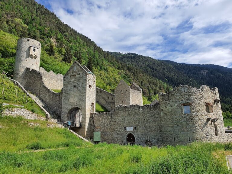
The fortress stands at about 750 metres above sea level, where the Eisack and Puster valleys meet. Its three principal sections are the lower fort, the middle fort and the upper fort. The lower and middle works sit beside one another in the valley and together form the Talwerk, or valley fortification. The middle fort occupies slightly higher ground, while the upper fort lies on the slope to the southwest, about 75 metres above the valley sections. Each section was designed to function independently for defence and supply. The complex has multiple storeys, in places reaching three levels, and its earth-covered roofs provided concealment and protection while collecting rainwater in large cisterns.
Lower fort
Defences and garrison facilities
Smooth outer walls, firing slits at several levels and internal walls behind protected entrances formed the defensive plan. The artillery chambers had narrow openings at the guns’ firing points, chimneys to carry away smoke and two windows opposite each gun opening for light. The planned armament totalled 90 pieces, including defensive and field guns, howitzers and mortars. These guns were loaded through the muzzle and had no spiral grooves inside their barrels. The lower fort contained command offices and two groups of fighting chambers. Its original entrance had two gates; the inner one was demolished during the Second World War to allow heavy vehicles through.
Chapel and parade ground
The garrison chapel stands on the lower fort’s parade ground. Designed by Captain Gedeon von Radò, it was built in 1845 and consecrated to Saint John the Baptist on 22 October that year. It was later also dedicated to Saint Barbara and reconsecrated to both saints in December 2009. The exterior follows a medieval German style, while the interior uses a basilican arrangement, with a long central space and side areas. Its cylindrical vault has recessed panels and was intended to carry the celebrant’s voice. The chapel could hold about 30 people and had a roof designed to resist bombs.
Ovens, stores and survey marker
The lower fort’s bread ovens could bake up to 500 rolls each at a time. A central chimney heated a boiler, and steam passed into two side ovens; the oven room also had firing slits. Near the storeroom is a fountain carved from one block of granite. The officers’ mess stood on the parade ground, with frescoes and small rooms on its upper floor. A separate storehouse had several doors to ease the movement of equipment and provisions. A small obelisk installed in 1889 marks a surveyed reference point for measuring elevation and location. A brass plate lies beneath it, and the benchmark gives an elevation of 736.4520 metres above the Adriatic.
Middle fort
Eastern defences and guard post
The middle fort faces east toward the Puster Valley and was arranged to control the approach and the high bridge. Its eastern defensive works are extensively ruined. A cistern collected rainwater from the roofs. On the ascent, a guard post could shelter more than 20 soldiers and cover both the lower parade ground and the approach to the steps.
Kaiservilla
The building known as the Kaiservilla, or Imperial Villa, stands within the middle fort. The name does not reflect a royal residence: emperors did not stay there. Its protected position, inner courtyard, raised floor and cavities in the walls could have suited a powder magazine. Another proposed use is as a special detention building, since its entrance could be locked from outside.
Gold bunker
A bunker beneath the middle fort was reached from the lower fort. Its entrance and exit galleries survive. The access corridor ended at a reinforced-concrete wall and a double armoured door 40 centimetres thick, fitted with three separate locks.
Upper fort
Courtyard and connecting stairway
The upper fort has an internal courtyard served by ramps and stairs. Its eastern entrance was reached by the underground stairway, while a carriage road approached from the west; heavy gates closed both entrances. A kitchen, fountain and barracks supported the garrison. The covered gallery linking the upper fort with the lower complex was built above ground rather than cut into rock. Granite blocks reinforced it, and two metres of earth covered the structure. It is 2.53 metres wide and contains 451 steps, each with a rise of 18.4 centimetres and a tread of 31.6 centimetres. The original plan showed 433 steps and a landing after the first third, but the landing was not built.
Artillery positions
The upper fort’s artillery occupied three levels, with eight guns directed toward the Brenner route. A semicircular caponier, a projecting position used to defend a ditch, extended north from the wall to cover the northern ditch. Smooth squared walls and firing slits strengthened the defences, including positions overlooking the western side of the Eisack Valley. A gate at the upper fort retains a narrow passage for one person at a time and a portcullis, a heavy barrier lowered across an entrance.
Bridges, railways and altered setting
Bridge and railway works
A separate blockhouse stood beyond the main complex at the base of the road bridge on the fortress’s eastern edge, where the bridge crossed the Eisack. Before the reservoir altered the valley, the river and a deep ravine formed a natural obstacle on this side. The Brenner railway passed beside the fortress and required only a small change to the lower fort’s perimeter wall. The Puster railway ran through the lower and middle forts along a route that screened their interiors from passengers. Beyond the fortress, a bridge about 80 metres high crossed the Eisack ravine; a 20-metre stretch of track could be drawn back inside the fort for strategic reasons.
Reservoir and road changes
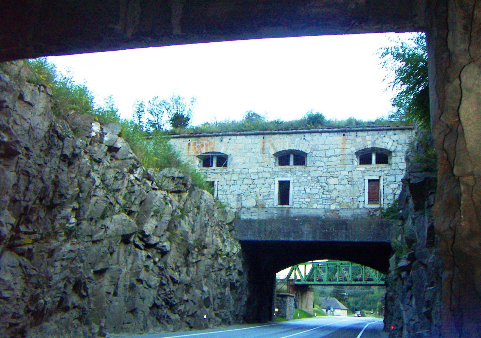
The reservoir now meets some access points to the lower fort, and water periodically covers parts of its storage areas. Later transport construction also changed the surviving complex. Between 1965 and 1970, construction of the A22 motorway led to the demolition of parts of the lower and middle forts and another relocation of the main road. The A22, State Road 12, the Brenner and Puster railways, and a cycle path now pass through or across the fortress area.