Fortress of Ključ: A Medieval Stronghold and Strategic Town-Fortress in Bosnia and Herzegovina
Site at a Glance
- Rating
- 4.8
- Popularity
- Low
- Country
- Bosnia and Herzegovina
- Primary era
- Medieval
- External website
- Open
- Eras represented
- Classical, Medieval, Early Modern
- Civilizations
- Kingdom of Bosnia, Ottoman, Roman
- Site type
- Military
- Remains
- Fortified Town
On this page11 sections
History
Medieval origins and political importance
The Fortress of Ključ is a medieval town-fortress above the modern town of Ključ in Bosnia and Herzegovina, associated with the twelfth century and built over earlier Roman fortifications and possibly older masonry. The fortress occupied a strategic position above the Sana valley, where the river enters a narrow gorge, and controlled an important route between the Pounje region and the valleys of the Pliva and Vrbas. Its name probably referred to this role, presenting Ključ as a “key of Bosnia.”
The area first belonged to the župa of Mrena, a medieval territorial district usually governed by a local noble or župan, and later to the župa of Brnjice-Banica. During the Late Middle Ages, Ključ became the seat of the territorial-political unit called the župa of Sanica. By the thirteenth century, it was already regarded as one of the oldest towns in the region.
Ključ entered the written record explicitly in 1322, when Ban Stjepan II Kotromanić granted the župas of Banica and Vrbanja, along with the towns of Ključ and Kotor, to Vukoslav Hrvatinić. The fortress then passed to Vukoslav’s son, Vlatko Vukoslavić. In 1364, Vlatko ceded Ključ to Louis I, king of Hungary and Croatia, receiving possessions in Hungary, including the Slavonian town of Bršljanovac.
Recovery by the Hrvatinić family and the end of medieval Bosnia
After Louis I died in 1382, Hrvoje Vukčić Hrvatinić, Grand Duke of Bosnia and head of the Hrvatinić family, recovered Ključ and other family estates. The fortress later passed to the grandchildren of Hrvoje’s brother, the župan Dragiša Vukčić. In a charter issued at Vranduk in 1446, King Stjepan Tomaš confirmed Ključ to Ivaniš Dragišić and his sons. The charter also gives the castle-town the name Podključ.
Ključ became the last capital of Stjepan Tomašević, the final king of medieval Bosnia, who ruled from 1461 until the Ottoman conquest in 1463. He withdrew there from Jajce while confronting the Ottoman advance. The final confrontation between the Bosnian and Ottoman armies took place below the fortress in 1463, bringing the independence of the medieval Bosnian state to an end.
Ottoman and Austro-Hungarian periods
Following the conquest, Ključ became part of the Ottoman Empire’s Bosnian Sanjak, an administrative district later incorporated into the larger Bosnian Eyalet, or province. In the early Ottoman period, the fortress served as a gathering place for forces preparing campaigns toward Bihać and the Croatian and Habsburg territories. Ključ later became the seat of a nahija, an Ottoman administrative subdivision, a kadiluk, a district administered by a Muslim judge, and a captaincy, an Ottoman military-administrative unit.
The fortress remained in use until the nineteenth century. During the Austro-Hungarian occupation of Bosnia and Herzegovina in 1878, the surrounding area became a center of strong Bosnian resistance. The fortress’s appearance in the early sixteenth century is preserved in an engraving included in Benedikt Kuripešić’s 1530 travelogue, providing a visual record from the Ottoman period.
Protection and interpretation
On 12 May 2003, the Commission to Preserve National Monuments of Bosnia and Herzegovina declared the architectural ensemble of the Old Town of Ključ a National Monument of Bosnia and Herzegovina. The protected ensemble is classified as a Category I monument.
Remains
Layout and construction
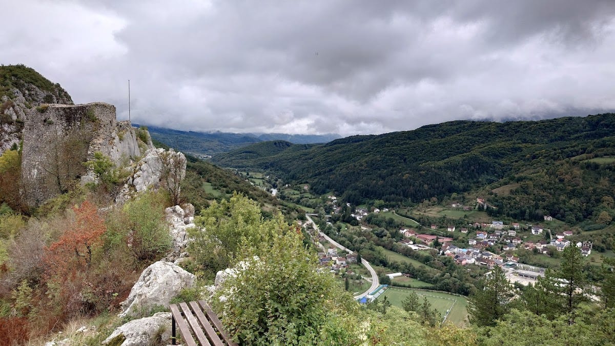
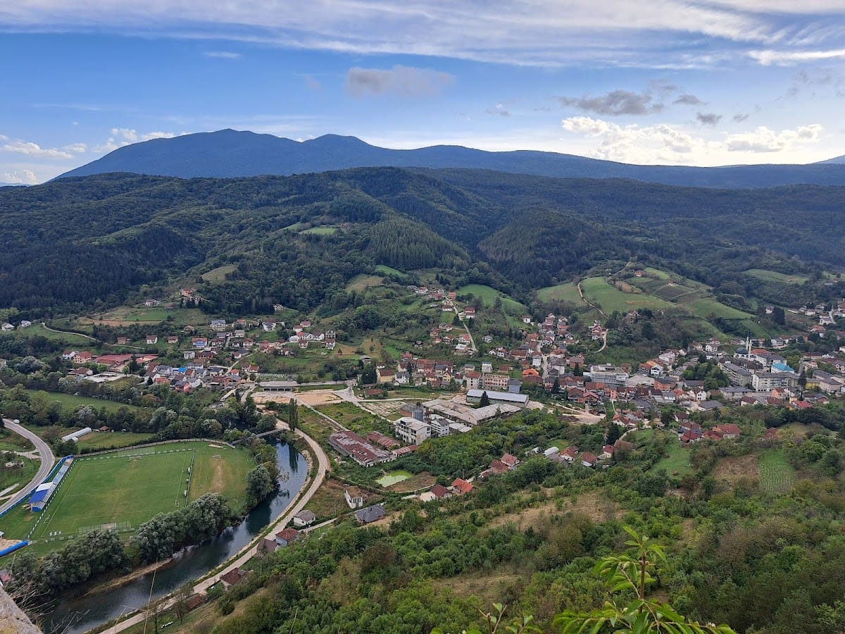
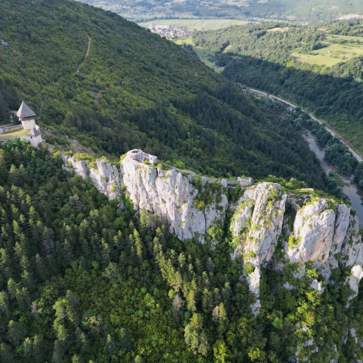
The fortress occupies an elongated slope on high rocks above the Sana valley at an altitude of 521 metres. It stands where the Sana enters a narrow gorge between Breščica, approximately 528 metres high, and Ljubinska, approximately 656 metres high. The complex rises above the river’s left bank in a naturally defended position. Its walls connect three principal sections, the town with its castle-town or lower settlement, Tabor, and the Ljubica Tower, also rendered Lubica. The surviving walls were built chiefly from limestone laid in dry-stone construction, and the fortress now survives as a ruin.
The town and castle-town
The oldest core consists of the town and its castle-town. Its northern approach was protected by a high rampart. Together, these elements formed the central medieval part of the complex and occupied the main fortified area on the elongated rocky slope.
Tabor
Tabor forms one of the three wall-connected sections of the fortress. It was enlarged during the Ottoman period, when the complex continued to serve military and administrative purposes.
Ljubica Tower
Ljubica Tower projects from the fortress and was built to provide lateral protection for the central core. Roman-period remains are located on the main plateau near the tower. The tower and the Tabor section were enlarged during the Ottoman period.
Ancient fortifications
Traces of ancient fortification buildings survive within the medieval fortress area. Roman remains lie on the main plateau near Ljubica Tower, while still older masonry is located on a narrow terrace immediately below the fortress. These earlier layers form part of the physical remains incorporated into the broader fortified setting.