Forte Grande de São Mateus da Calheta: A Maritime Fort in the Azores


Site at a Glance
- Rating
- 4.4
- Popularity
- Very Low
- Country
- Portugal
- Primary era
- Early Modern
- Eras represented
- Early Modern, Modern
- Civilizations
- Portuguese
- Site type
- Military
- Remains
- Fort
On this page8 sections
History
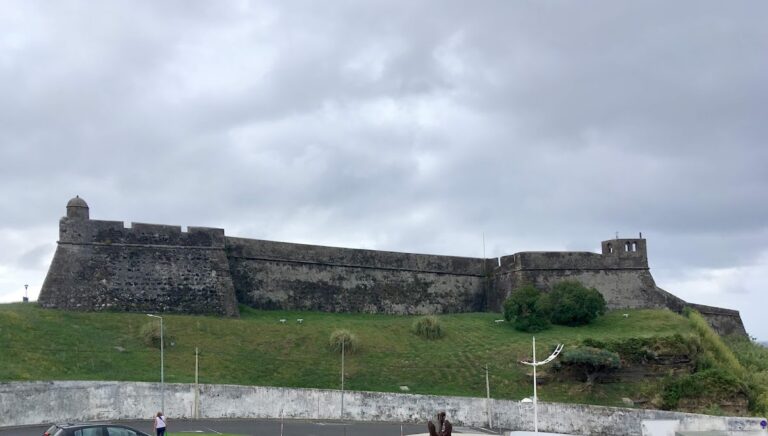
Forte Grande de São Mateus da Calheta is a maritime fort in Portugal, near Angra do Heroísmo on Terceira Island in the Azores. Built from 1581 after the Portuguese succession crisis of 1580, it formed part of the island’s coastal defenses and was initiated by Ciprião de Figueiredo e Vasconcelos, the Azores’ corregidor, a royal administrative and judicial official.
Sixteenth-century defenses
The fort belonged to a wider defensive plan for Terceira prepared in 1567 by the military engineer Tommaso Benedetto de Pesaro. The plan followed Pierre Bertrand de Montluc’s attack on Funchal in October 1566 and an unsuccessful attempt by pirates to seize Angra in the same year. The fort’s position beside the landing place of carracks, large Portuguese ocean-going ships serving long-distance trade, gave it a role in protecting the first landfall of vessels arriving from the Indian trade routes.
Expansion and military importance
In 1767, João António Júdice, an engineer and sergeant-major, inspected the fort and expanded it under orders from the Captain-General of the Azores, the archipelago’s senior military and civil authority. He called it the largest fort west of Angra and recommended two additional cannons with their equipment. At the time, the fort had between six and eight artillery pieces and 32 auxiliaries, including six steel cannons in good condition.
A report of 1776 referred to it as Forte da Praya de S. Matheus and described it as the best fort on the coast. It also stated that the fort had already been rebuilt and needed no further reconstruction. At the beginning of the nineteenth century, José Rodrigo de Almeida prepared a plan for six cannons, three of them directed toward the sea.
During the Civil War of 1828–1834, the conflict between supporters of competing Portuguese political claims, the fort helped defend Terceira. The island served as the headquarters of the Regency supporting Queen Maria II. José Rodrigo de Almeida reinforced the fort’s plan in 1830. The Baron of Basto later described it as being in good condition, probably reflecting its reputation as the coast’s most important fort. He recorded five cannon emplacements, an area of five square fathoms, accommodation for 20 personnel, a magazine for ammunition or weapons, and a storehouse.
Changing uses
By 1871, the fort was under the Ministry of War and had been assigned to a veteran for use as a family residence. It was later used to house needy people. By 1881, about 483 square metres had been added, probably by the Ministry of War.
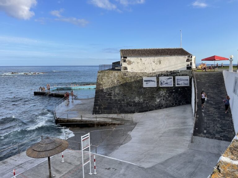
During the twentieth century, as its military purpose declined, the fort passed to the São Mateus parish council for open-air concerts and cinema. The municipal council of Angra do Heroísmo attempted an initial remodeling, and the landward area was remodeled in 2010. The Portuguese Republic owns the fort. Its associated modern uses include operation by the São Mateus parish council, the Centro de Estudos do Mar and Núcleo Museológico do Mar, and service as the headquarters of the folklore group Modas da Nossa Terra.
Remains
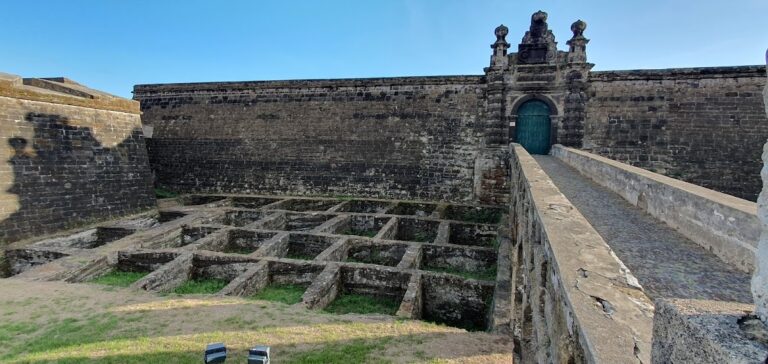
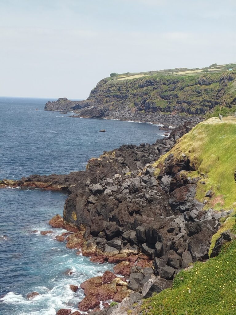
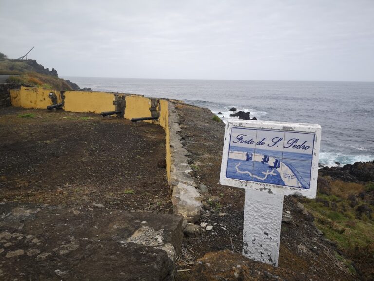
The fort stands beside Prainha de São Mateus, approximately 4 kilometres west of Angra do Heroísmo. The beach is the most important southern port on Terceira and the island’s principal commercial fishing port. The fort occupies a cliff formation almost at sea level, where its layout was adapted to the pronounced relief. The principal roadway lies to the north. Constructed from basalt, wood, and tile, the surviving fortification includes several artillery emplacements and deteriorated walls.
Sea-facing fortification
Principal fort
The main fortification has a triangular plan pointing toward the sea. Two half-bastions, projecting defensive works with limited or asymmetrical forms, face the uneven ground. One is sharply pointed, while the other is almost rectangular, and the internal battery occupies the space between them. A bastion is a projecting part of a fortification that enabled defenders to fire along the faces of the surrounding walls. The fort formed part of a defensive system along Terceira’s southern coast and was positioned to create a crossfire zone with the Fort of Biscoitinho and the Fort of Má Ferramenta.
Western defensive curtain
A small defensive curtain, a wall linking stronger projecting elements, is joined to the fort on its western side. Some interpretations identify this surviving work as the remains of the Reduto do Poço, a structure still mentioned at the end of the eighteenth century.
Nearby sites