Fort Rüstersiel: A Prussian Naval-Port Fortification in Germany
Site at a Glance
- Rating
- 4.4
- Popularity
- Very Low
- Country
- Germany
- Primary era
- Modern
- Eras represented
- Modern
- Civilizations
- German
- Site type
- Military
- Remains
- Fort
On this page6 sections
History
Fort Rüstersiel is a former Prussian fort in Wilhelmshaven, Germany, built between 1876 and 1880 as part of the fortification system protecting the naval port. Also designated Fort I, it formed one of three Maade forts and is now the best-preserved fort in Wilhelmshaven’s fortification system.
Construction and military purpose
Fort Rüstersiel, together with the Maade forts at Mariensiel and Schaar, was put out to tender on 4 August 1876. Construction began soon afterward and was completed on 4 November 1880. General von Voigt-Rhetz, who headed the responsible department in the War Ministry, inspected the progress on 24 June 1878.
The fort was designed as part of a defensive system that could use the surrounding landscape against an attacking force. Wooden sluices were rebuilt in stone so that the area around the Maade forts could be flooded when necessary. The III Stamm-Seebataillon, a German naval infantry formation, was stationed at Rüstersiel. Before the First World War, it supplied replacement personnel for Kiautschou, a German-controlled territory and naval base in China.
Restrictions and changing use
The Treaty of Versailles, the 1919 peace agreement that imposed military restrictions on Germany after the First World War, allowed the Maade forts to remain but prohibited their enlargement or modernization to contemporary military standards. From 1918, Fort Rüstersiel served as an ammunition store.
Outside the moat, the bathing association established a spa park between the Rüstersieler Straße, then called Amtsverbandsstraße, and the perimeter road. Known as Delepark, it was named after the innkeeper Adele Tiesler. After the Second World War, trees in the park and within the fort were felled for fuel. British forces demolished the fort’s casemates by blasting in 1948, after which proposals included turning the demilitarized grounds into a recreation area or zoological park.
From 1966 onward, the grounds were largely remodeled and became the seat of the Institute for Avian Research “Vogelwarte Helgoland.” The site has been protected as a landscape conservation area since 1968.
Remains
Fort Rüstersiel lies in the Rüstersiel district near the Maade. Its defensive layout extends 420 metres from southwest to northeast and measures 265 metres across. A moat up to 70 metres wide surrounds the fort, while the rampart, an elevated defensive earthwork, rises as high as 6 metres.
Fortifications and surviving structures
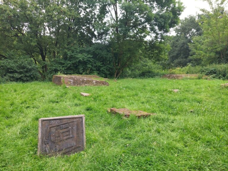
Along the north-northwestern long side, remains of brick casemates and bunkers survive. Casemates are fortified, usually vaulted chambers intended to shelter troops, ammunition, or artillery. The fort was initially armed with two 15-centimetre L/22 guns, ten 15-centimetre ring guns, and eleven guns of 12-centimetre and 9-centimetre calibre. It was later equipped with flat-trajectory guns ranging from 6 to 15 centimetres in calibre.
Roads, sluices, and wider defenses
A northern connection to the outer fort of Altona formerly crossed Möwenstraße. The fortification road to Fort Heppens followed the Neuer Groder Weg and included an ammunition railway. A further perimeter road leading toward Forts Schaar and Mariensiel used field-railway tracks and followed routes now represented by An der Vogelwarte, Dodoweg, and Kurt-Schumacher-Straße. The stone sluice works formed part of the defensive water system that enabled the surrounding area to be flooded.
Nearby sites