Fort Ronduit: A Dutch Water-Line Fortification at Naarden


Site at a Glance
- Rating
- 4.3
- Popularity
- Very Low
- Country
- Netherlands
- Primary era
- Modern
- External website
- Open
- Eras represented
- Modern
- Civilizations
- Dutch
- Site type
- Military
- Remains
- Fort
On this page9 sections
History
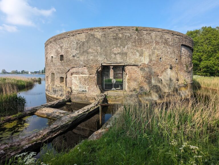
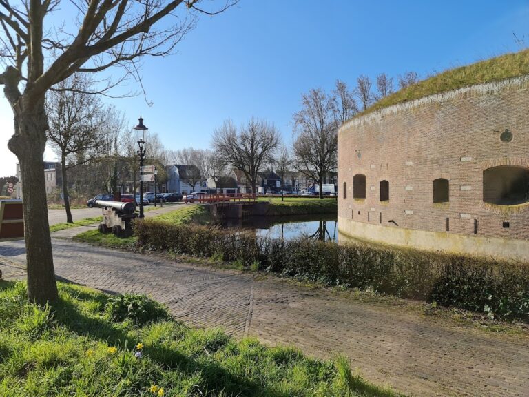
Fort Ronduit is a polygonal fort in the Netherlands, at Naarden, built between 1873 and 1875 as part of the Nieuwe Hollandse Waterlinie, a Dutch defensive system using controlled flooding, forts, earthworks, and waterways to protect the country’s central region. It occupied the outer-dike lands north of Naarden Fortress and served as a reduit, a fortified inner position intended for final resistance after an outer line had been breached.
Earlier Defence and Nineteenth-Century Construction
A defensive earthwork protecting Naarden’s harbour stood on the site in the seventeenth century. The present fort was constructed over this earlier position in 1873–1875. Its position north of Naarden Fortress, near the former Zuiderzee, made it part of the wider defensive arrangement around the fortress. A connecting rampart between Fort Ronduit and Naarden Fortress enabled troops to move unseen by the enemy.
Decommissioning and Preservation
Fort Ronduit and Naarden Fortress were decommissioned as fortifications in 1926. Fort Ronduit nevertheless continued in military use as an ammunition store. Its buildings were restored in 1986. The fort is protected as a Rijksmonument, a nationally designated monument, under monument number 531378.
Remains
Fort Ronduit lies north of Naarden Fortress and south of the former Zuiderzee. Its grounds are enclosed by a wet moat approximately 25–35 metres wide. A high earthen rampart surrounds the buildings and includes positions for artillery, while the front rampart also contains a shelter. Access across the moat is provided by a crane bridge connected to the mainland, with a windlass mechanism incorporating a drum.
Entrance and Defensive Works
Guardhouse
The entrance passes through a bombproof guardhouse, designated Building T. A bombproof building was intended to protect occupants and stores from artillery fire. The guardhouse’s original loopholes have been replaced by windows, while the surrounding earthwork remains part of the fort’s defensive structure.
Central Barracks and Gun Storage
Bombproof Barracks
The centrally placed, brick-built bombproof barracks, designated Building S, contained rooms for enlisted men, accommodation for the commander and officers, and a kitchen. Ammunition magazines occupied the middle of the building, and rooms at its extreme left and right housed the artillery. Sand covers the front side of the barracks.
Artillery Access and Remise
Two passageways with doors run through the front wall and its sand covering, allowing troops to reach the guns in the front rampart quickly. Large doors on the right-hand side of the barracks lead to the bombproof remise, designated Building U. A remise is a fortified storage space for guns or other military equipment. Together with the earthwork, guardhouse, barracks, remise, and crane bridge, these components form the surviving built layout of the fort.
Nearby sites