Fort Pitt: A British Frontier Fort in Pittsburgh
Site at a Glance
- Country
- United States
- Primary era
- Early Modern
- Eras represented
- Early Modern
- Civilizations
- British
- Site type
- Military
- Remains
- Fort
On this page15 sections
History
Fort Pitt was a British fortification built by British forces from 1759 to 1761 at the confluence of the Monongahela and Allegheny rivers, where the Ohio River begins, in present-day Pittsburgh, Pennsylvania, United States. Its position made the river junction a contested center of military activity and diplomacy over the Ohio Country.
French and British forts at the confluence
British forces began Fort Prince George at the confluence in 1754, but French troops captured it before it was finished and completed Fort Duquesne there that year. During the French and Indian War, the North American theater of the wider Seven Years’ War, a British expedition led by General Braddock failed to take Fort Duquesne at the Battle of the Monongahela in 1755. In September 1758, a British regiment under Major James Grant was defeated near the fort.
As General John Forbes’s expedition approached, the French abandoned and destroyed Fort Duquesne in November 1758. The British capture of Fort Frontenac, a French post at the eastern end of Lake Ontario, had disrupted French supply lines. The Treaty of Easton also weakened French alliances in the region. Fort Duquesne’s garrison was short of supplies and personnel, possibly numbering about 200 regular soldiers, while the flood-prone fort was vulnerable to attack. Before leaving, the French destroyed stores and many structures.
The Treaty of Easton involved leaders from 13 Native nations, including the Six Nations of the Iroquois, the Lenape, also called the Delaware, and the Shawnee. They agreed to pursue peace with Pennsylvania and New Jersey and to end their alliances with France. In return, they sought respect for their hunting rights and territory in the Ohio Country, a halt to new settlements west of the Appalachians, and the withdrawal of British and colonial troops after the war. Native leaders wanted a trading post at the former Fort Duquesne site, not a British garrison or settlement.
Fort Pitt and Pontiac’s War
After a temporary British post called Mercer’s Fort, the British built Fort Pitt beside, but not directly on, the former Fort Duquesne site. Captain Harry Gordon, a British engineer serving with the 60th Royal American Regiment, built the fort. It was named in honor of William Pitt the Elder, a British statesman. Virginia’s colonial protection of the area contributed to the later development of Pittsburgh and Allegheny County. The permanent British military presence, however, ran counter to Native expectations that troops would leave after the war.
During Pontiac’s War, a 1763 uprising by Native peoples against British rule and colonial expansion in the Great Lakes and Ohio regions, Lenape and Shawnee forces began besieging Fort Pitt on June 22. They sought to drive settlers from Native territory amid broken treaties and continued colonial encroachment. The fort withstood their assaults. During negotiations, its commander, Captain Simeon Ecuyer, gave two Lenape emissaries blankets that had been exposed to smallpox. The potential use of the blankets to spread disease was understood: trader William Trent expressed hope that the act would have its intended effect, and British officers Henry Bouquet and Jeffery Amherst later discussed similar tactics. The effect of the blanket incident is unknown. Smallpox also spread naturally, and epidemics devastated Native communities in the Ohio Valley and Great Lakes regions.
On August 1, most of the besieging force left to intercept Bouquet’s approaching relief column. Bouquet defeated a Native force at the Battle of Bushy Run, then relieved Fort Pitt on August 10.
Virginia control and the Revolution
In 1772, the British commander sold the fort building to colonists William Thompson and Alexander Ross. As Virginia and Pennsylvania disputed control of the region, Virginians took possession and renamed it Fort Dunmore for Virginia’s governor, Lord Dunmore. The post served as a staging point during Dunmore’s War, a 1774 conflict between Virginia and Native peoples that included the Shawnee and Mingo.
During the American Revolutionary War, Fort Pitt served as the American headquarters for the western theater. In 1777, the Continental Congress sent commissioners to assess the threat posed by British commander Henry Hamilton at Fort Detroit and to address relations with Native nations. Their instructions called for building friendly ties with the Shawnee and Delaware, preventing abuses against them, and considering the recruitment of Native warriors. The commissioners reported that the western frontier faced serious danger and recommended sending 3,000 militia. General Edward Hand commanded the Continental Army’s Western Department at Fort Pitt.
In 1778, George Rogers Clark’s force gathered supplies at Fort Pitt before traveling from the Monongahela River toward the Falls of the Ohio for a campaign in the Illinois country. Clark captured Kaskaskia, Cahokia, and Vincennes, but did not march on Detroit. He captured Hamilton in 1779.
Later military use and archaeology
During the Northwest Indian War, a conflict between the United States and an Indigenous confederacy in the Old Northwest, General Anthony Wayne built a separate fort beside Fort Pitt’s site. First called Fort Lafayette, it later became known as Fort Fayette. In 1797, the U.S. Army auctioned Fort Pitt’s property as part of demilitarizing the site. Fort Fayette was later regarrisoned as a staging point and supply depot for expeditions against British forts during the War of 1812.
Twentieth-century excavations commissioned by Pittsburgh examined Fort Pitt’s foundations. The work led to a partial reconstruction intended to convey the fort’s scale. Later investigations included archaeologist James Swauger’s work and a 2007 project by A.D. Marble and Company, which identified features associated with Fort Pitt’s construction and occupation from 1758 into the 1760s.
Remains
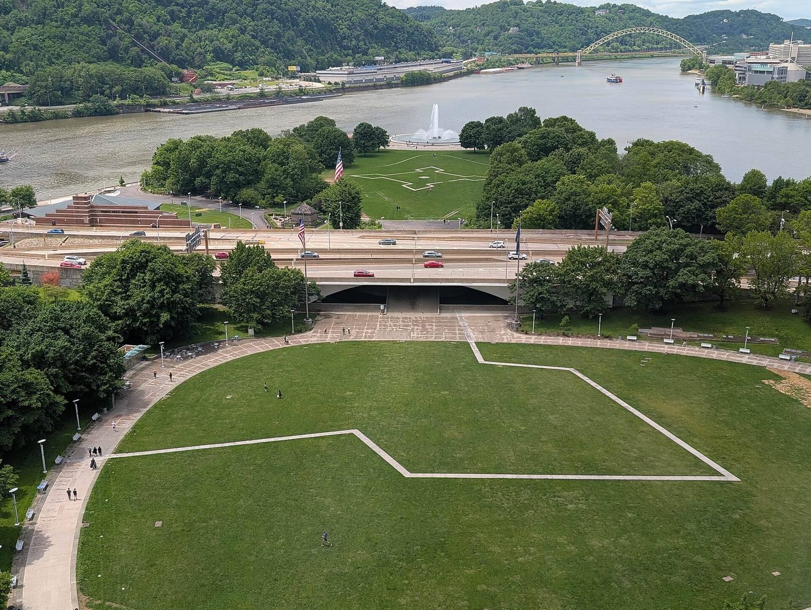
At Point State Park, Fort Pitt occupied a higher, geologically older river terrace and a lower terrace formed by flooding after the Pleistocene, an epoch marked by repeated ice ages. Its masonry enclosure followed a five-pointed star plan, with a bastion, a projecting section that allowed defenders to cover adjoining walls, at each point.
Defensive layout and archaeological features
Bastions and terraces
The Monongahela Bastion and the Music Bastion, also known as the northeast bastion, formed parts of the fort’s defenses. The Music Bastion extended from the upper terrace onto the lower one. Builders raised the lower ground behind its north wall with fill.
Western palisade
A palisade, a defensive barrier of upright stakes, probably enclosed the unfinished fort’s open western side for the winter of 1759-60. Archaeological traces lay in a trench running northeast to southwest west of the Blockhouse. The trench crossed the lower terrace and reached the western end of the upper terrace. Seven separate rectangular postholes formed a line extending from north of the Blockhouse toward the south.
The postholes contained redeposited prehistoric or early historic artifacts. A fragment of English white salt-glazed stoneware and a lead musket ball are consistent with construction around 1760. Three features also contained later pottery, including creamware dating to 1762-70 or a pearlware sherd dating to no earlier than 1785. These later pieces probably entered the holes when posts were replaced or removed.
One hole preserved the lower part of a hand-hewn white-oak post. Its base was about two feet long, with a rounded face and original bark on one side. The other faces showed extensive shaping with a broadax, including a cut through the bark. Its flat base indicates that it was set upright in a prepared hole rather than driven into the ground. Milner+Carr Conservation treated the surviving post base.
Timbers and underground stores
Music Bastion timber
An irrigation trench crossing the Music Bastion exposed a spruce trunk 18 feet long and four feet in diameter at its base. It lay in gray-clay fill behind the bastion’s north wall, probably deposited in autumn 1759 or winter 1760 to raise the lower terrace. Milner+Carr Conservation treated the trunk.
Underground stores
Fort Pitt had several underground magazines, secure stores for ammunition or other supplies, and storerooms beneath its ramparts and within the eastern bastion. An electrical trench east of the modern portal bridge crossed the mapped location of a flour storehouse shown on Bernard Ratzer’s 1761 map. It dislodged a sharpened, round post about four feet long and a partly shaped timber nearly eight feet long. Richard Lang identified the post, which may have stood upright along the storeroom wall. James Swauger found similar posts in the 1950s. Brian Howard Conservation treated both recovered pieces.
Surviving buildings and reconstruction
The Blockhouse
The Blockhouse is a small brick redoubt, or defensive fortification, erected in 1764. It is the sole surviving remnant of Fort Pitt and is believed to be the oldest building still standing in Pittsburgh. After serving for many years as a private residence, it was acquired and preserved by the local chapter of the Daughters of the American Revolution.
Reconstructed fort
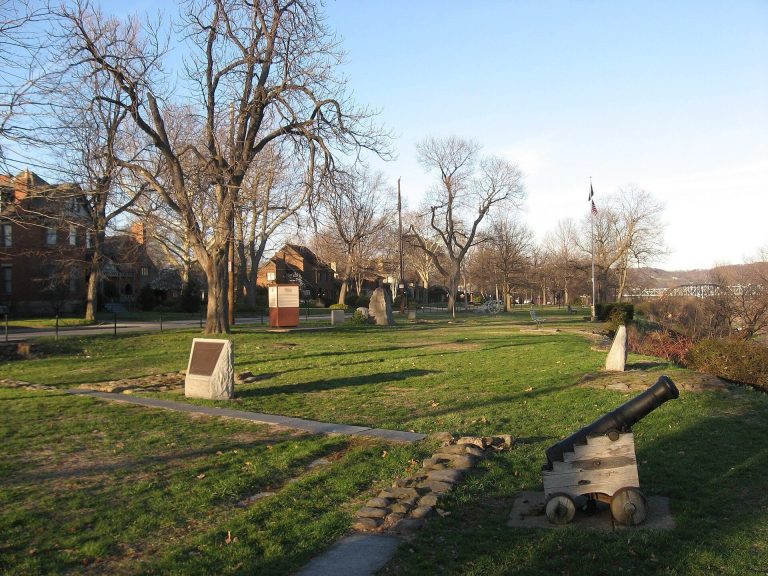
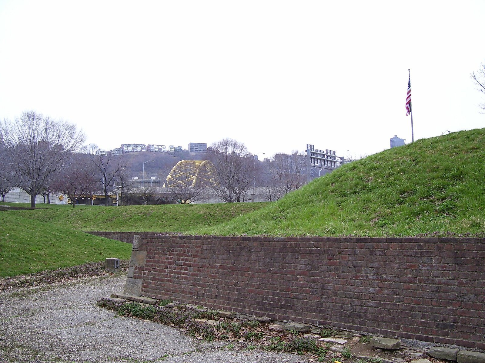
A portion of Fort Pitt has been reconstructed at Point State Park. The Fort Pitt Museum occupies the reconstructed Monongahela Bastion. Excavated portions of the fort were subsequently filled in.