Fort of the Holy Cross (São Roque do Paraguaçu): A Coastal Defense of the Paraguaçu River
Site at a Glance
- Rating
- 4.9
- Popularity
- Very Low
- Country
- Brazil
- Primary era
- Early Modern
- Eras represented
- Early Modern
- Civilizations
- Portuguese
- Site type
- Military
- Remains
- Fort
On this page6 sections
History
The Fort of the Holy Cross, also known as Fort Santa Cruz do Paraguaçu, stands in São Roque do Paraguaçu, Brazil, at the mouth of the Paraguaçu River. Its present form probably dates from the beginning of the eighteenth century and developed over an earlier structure built during the first half of the seventeenth century. The fort was one of three recorded in the region in 1659, although its original builders remain uncertain. It guarded access to the Recôncavo Baiano, the historically important region surrounding the Bay of All Saints and the lower Paraguaçu River.
Seventeenth-Century Defense
During the Dutch invasion of Brazil, the fort exchanged fire with the Fort of Forca on the opposite bank of the Paraguaçu River. Its purpose was to prevent hostile forces from reaching the Iguape hinterland, its sugar mills, and the towns of Maragogipe and Cachoeira. The site is associated with the Dutch-Portuguese War, the conflict between Dutch and Portuguese forces in Brazil, and later with the Brazilian War of Independence, the struggle that ended Portuguese rule in Brazil.
Eighteenth-Century Repairs
In 1759, the military engineer José António Caldas recorded seven dismounted artillery pieces and barracks in ruins. A captain commanded the fort at the time. The government of Bahia restored it in 1762, probably under the direction of João Abreu de Carvalho Contreiras, a colonial military engineer. After a further inspection by Caldas, the barracks were also restored.
Decommissioning and Preservation
Maintenance work followed the arrival of the Portuguese royal family in Brazil during the Peninsular War. After 1816, the fort was considered to have no further military use, was decommissioned, and subsequently fell into decay. Emperor Pedro II, who ruled Brazil from 1840 to 1889, noted the fort during his journey through Bahia in 1859. In 1938, Brazil’s Service of National Historical and Artistic Heritage classified the ruins as property of the Union. A stabilization and restoration project prepared in 1959 was not implemented.
Remains
Coastal Fortifications
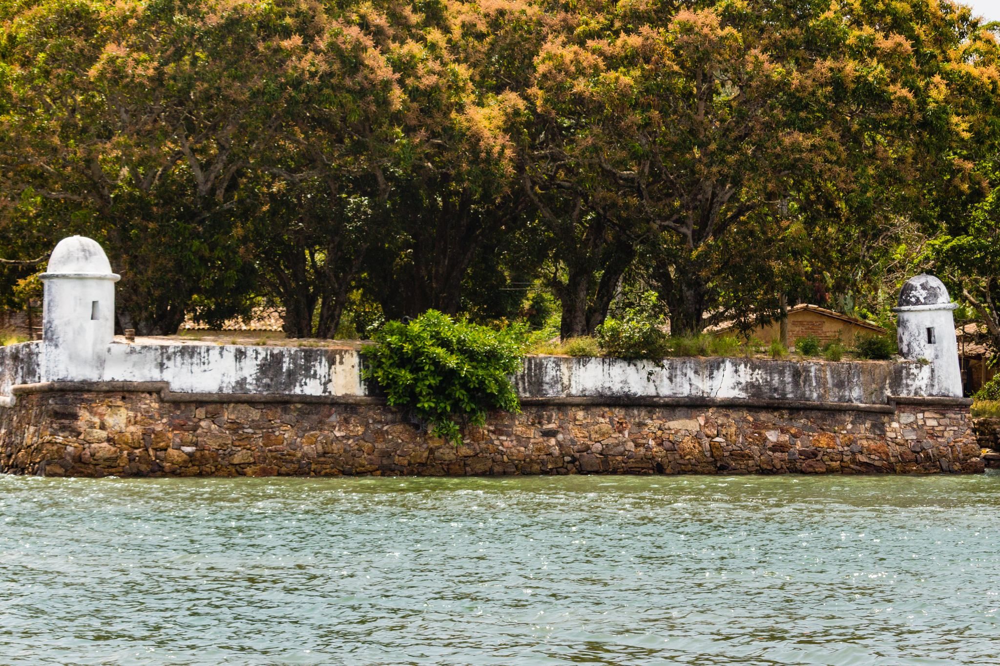
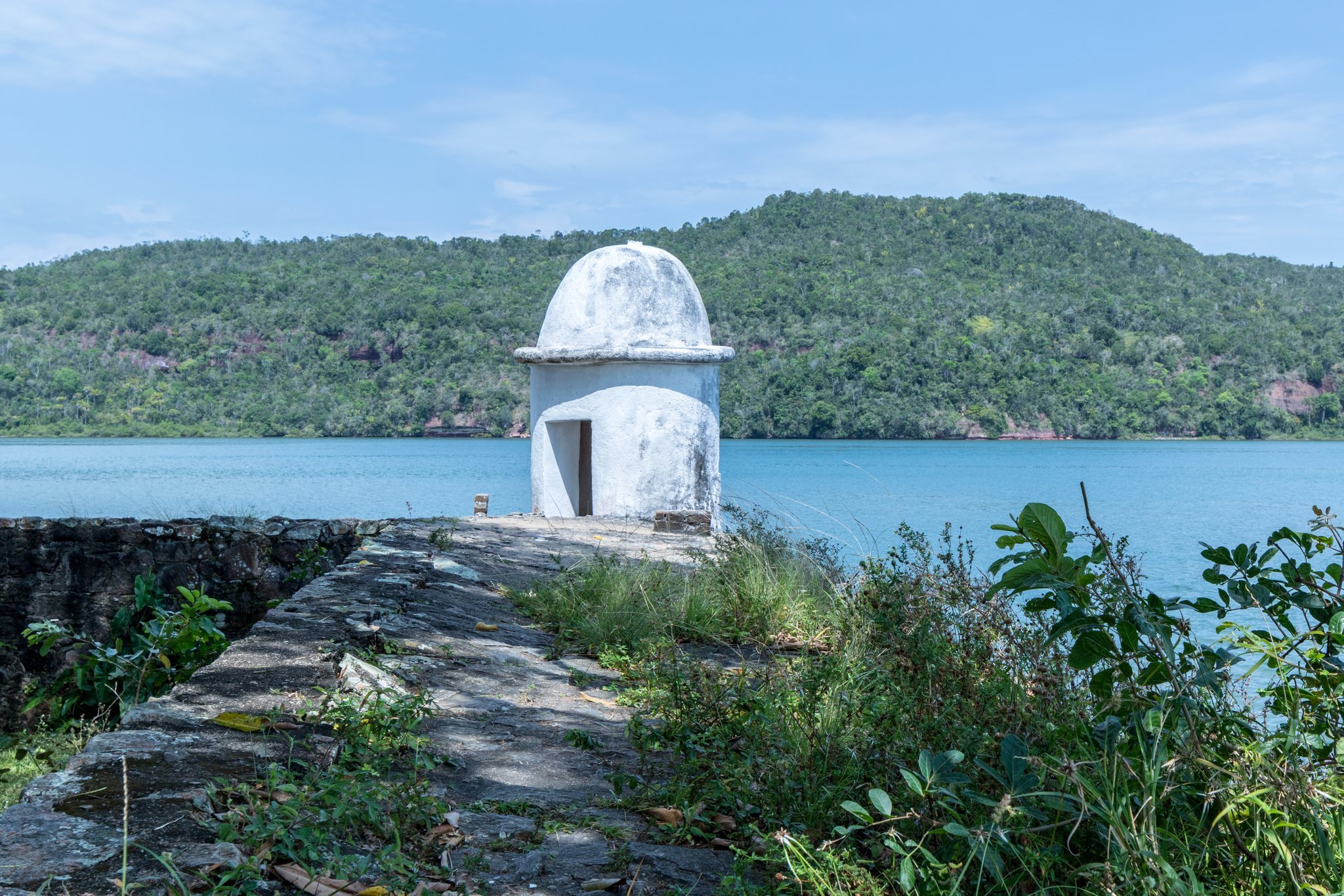
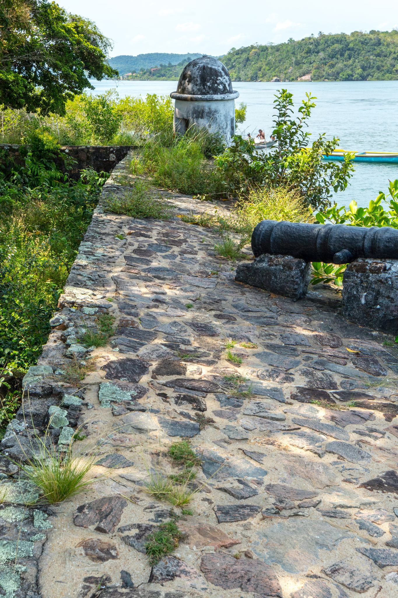
The fort occupies the right bank of the Paraguaçu River’s mouth in present-day Maragogipe, Bahia, where it commands access to the Recôncavo Baiano. It is a stone coastal fort with brick sentry boxes, small fortified guard structures, and water along three of its six sides. A 1759 sketch by José António Caldas shows an irregular hexagonal plan with battlements, raised defensive sections along the edge of the walls. On the courtyard’s entry side, a single-storey building contained the command house, troop quarters, mess, and other service rooms. The fort now survives in ruins, including the courtyard’s stone walls, a circular sentry turret with a dome, and a cannon.