Fort Lennox: A British Bastioned Fortification in Canada
Site at a Glance
- Rating
- 4.2
- Popularity
- Low
- Country
- Canada
- Primary era
- Modern
- External website
- Open
- Eras represented
- Modern
- Civilizations
- British
- Site type
- Military
- Remains
- Fort
On this page11 sections
History
Fort Lennox is a British fortification on Île aux Noix in Canada, built between 1819 and 1829 in the classical bastioned style. It guarded a strategic position in the Richelieu River near the Canada–United States border, protecting British North America against a possible invasion from the south. The present fort formed part of a defensive system created after the War of 1812 and the Napoleonic Wars.
Île aux Noix before the present fort
Indigenous groups used the island intermittently as a seasonal camp before European fortifications were established there. Samuel de Champlain observed it in 1609 while travelling along the Richelieu toward the lake later named after him. The island was already officially known as Île aux Noix by the middle of the eighteenth century, although its name was variously linked to Indigenous inhabitants or to Champlain. The island was covered by many butternut trees when he saw it.
Pierre Jourdanet, a soldier in the De Lorimier company, became the island’s first permanent inhabitant in 1753. He agreed to cultivate it for eight years without cutting down its walnut trees and to make an annual payment of walnuts to the seigneurial residence, or local lord’s manor, in Montreal.
French and British military occupation
Île aux Noix was first fortified by the French in 1759 during the French and Indian War, the North American phase of the wider Seven Years’ War between France and Britain. Its position made it a defensive point against invasions from the south. Later English fortifications and redoubts occupied the island before being demolished for the construction of the present fort.
During the War of 1812, the conflict between the United States and Britain that also affected British North America, Île aux Noix became the principal naval base on the Richelieu River–Lake Champlain route. The military altered the fortifications and established a naval complex with service buildings and a shipyard in 1814. The shipyard produced the Confiance, the largest vessel to have navigated the Richelieu River and Lake Champlain.
After the War of 1812 and the Napoleonic Wars, Britain reorganized its defences in British North America. The construction of an American fort at Rouses Point in 1816 and recommendations associated with Charles Lennox, Duke of Richmond, encouraged the authorities to establish a new fortification on the island. Construction began in spring 1819 according to plans by the military engineer Gustavus Nicolls and was completed in 1829. The fort was named after Charles Lennox, 4th Duke of Richmond, who was Governor General of British North America and died in 1819.
Garrison life and later military use
Fort Lennox could accommodate more than 400 soldiers and 10 officers, although an average of about 150 soldiers occupied it between 1829 and 1854. A British garrison remained on the island until 1870. From May 1833 to May 1835, a company of the 24th Regiment of Foot, a British infantry regiment, occupied Île aux Noix. A detachment commanded by Captain James Beveridge Harris travelled from Montreal aboard the steamship Canadian Patriot to replace a company commanded by Captain Thomas Colman of the 15th Regiment.
In 1833–1835, the garrison probably included about 60 soldiers, 30 women, and 60 children. Families had no specially designed quarters and divided their living spaces with curtains made from blankets or sheets. Soldiers followed a strict routine of inspection, drill, parade, guard duty, cleaning, maintenance, transport, construction, and repairs. Sentinels controlled access to buildings such as the powder magazine and monitored movement around the fortification.
Recognized soldiers’ wives could live in the barracks and receive daily rations. Women carried out cleaning, laundry, sewing, cooking, childcare, and hospital work, while children also took part in tasks connected with garrison life.
After the garrison
After the military left, the site was used seasonally by the Canadian militia until the First World War. Local farmers also used the island as pasture, while around the turn of the twentieth century it became a tourist and vacation site and later a summer camp for adolescents.
During the Second World War, Fort Lennox operated as a refugee camp from 1940 to 1943. Camp I housed nearly 400 Jewish men from Germany and Austria. From 1950 to 1970, the island and fort were used chiefly for recreation. Parks Canada began a major conservation and restoration program in 1970, preserving the fort’s defensive works and buildings.
On 30 January 1920, the Historic Sites and Monuments Board of Canada designated Fort Lennox a National Historic Site of Canada and the island a national historic park. Parks Canada owns and administers the site.
Remains
Fortification and layout
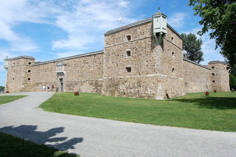
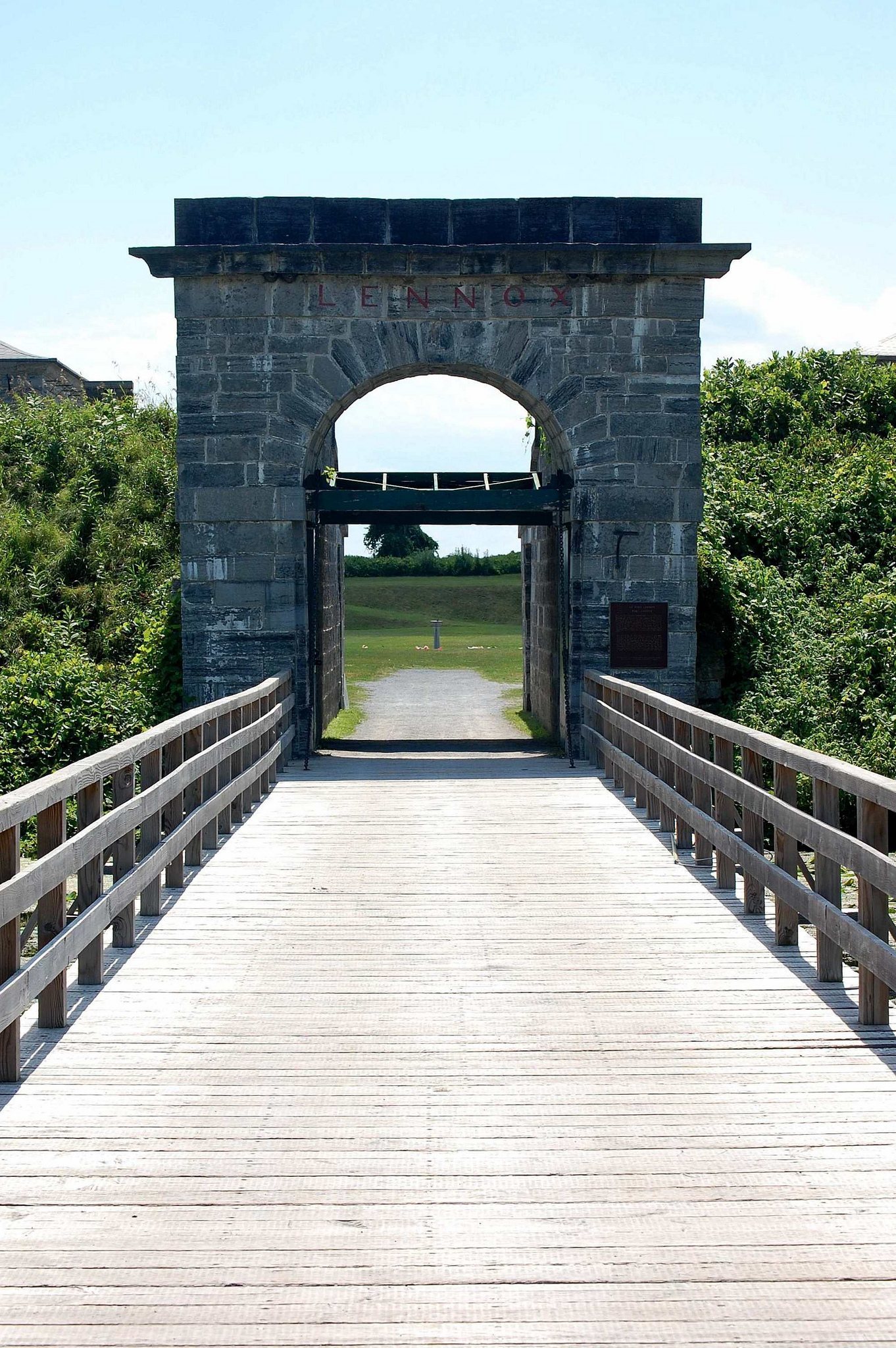
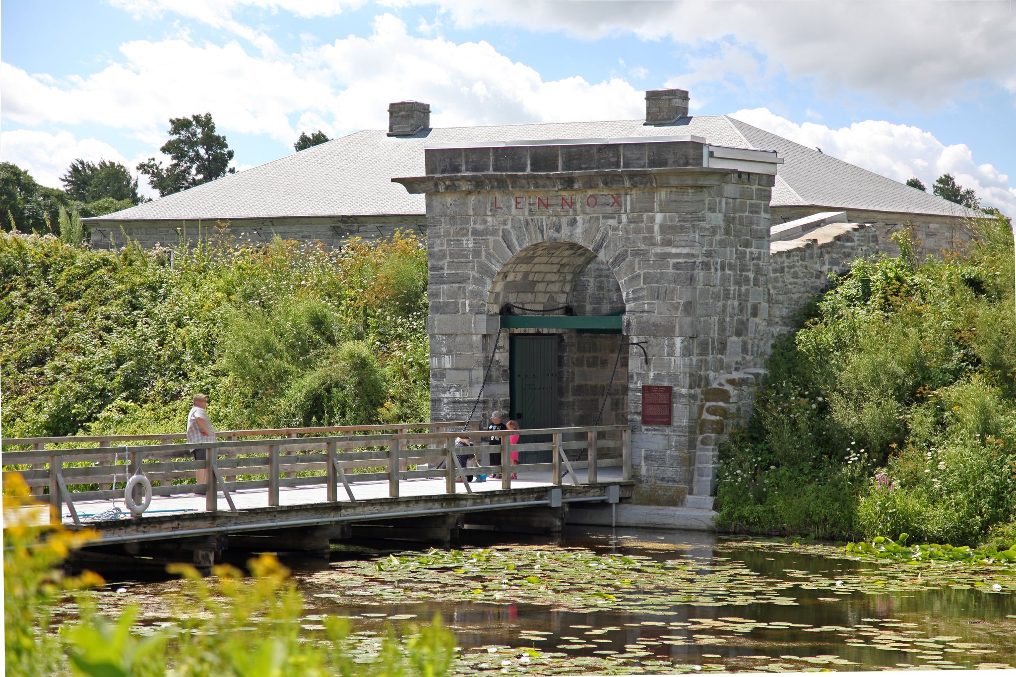
Fort Lennox occupies most of Île aux Noix, an island in the Richelieu River covering approximately 850,000 square metres. The fort itself has a rectangular plan and is a classical bastioned fortification. Its projecting angular bastions allowed defenders to cover the walls and surrounding ground with fire. Earthen works, walls, a ditch, and other defensive structures form a system enclosed by a star-shaped moat, or defensive ditch. An entrance complex with a portal leads into internal routes and spaces arranged around the parade ground.
The fortification works were concentrated mainly in the southern part of the island. The surviving defensive system includes restored earthworks and stone structures, with ditches and internal circulation spaces connecting the principal buildings. Fort Lennox is described as the only fortification in Quebec to have retained its original structure. Its defensive works and buildings were conserved and restored during the program begun in 1970.
Principal buildings
Guardhouse and stores
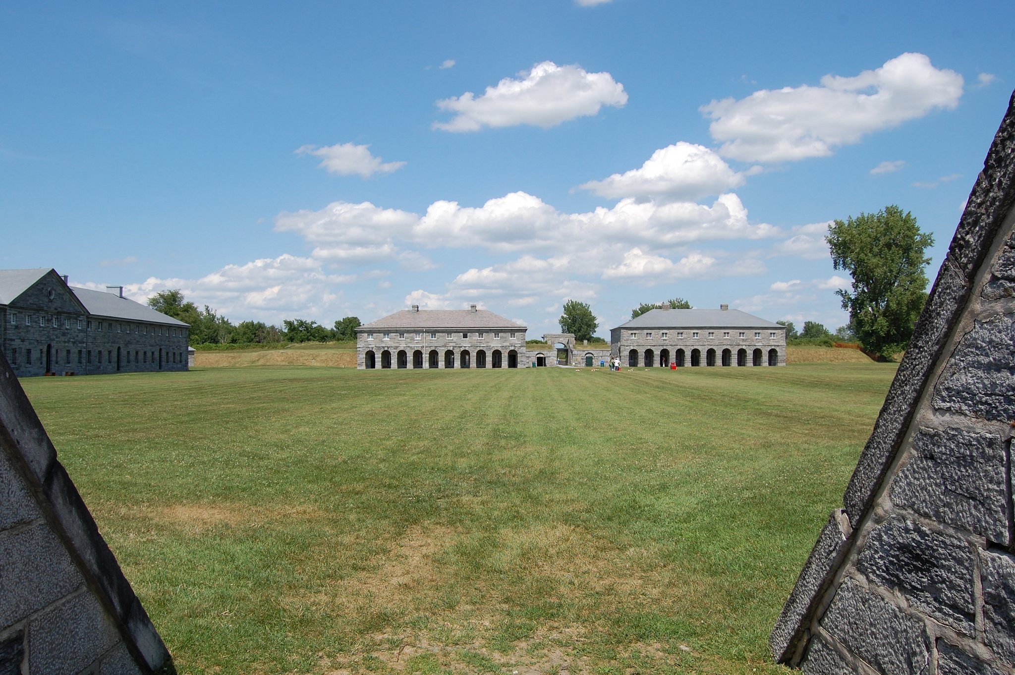
The principal buildings were erected in stages inside the fortified enclosure. The powder magazine was built in 1820, followed by the guardhouse and two storehouses between 1821 and 1823. The fort also contains a commissariat storehouse, service buildings, latrines, living quarters, and arcaded spaces associated with the barracks and officers’ quarters. The north and south magazines are closed to the public.
Officers’ quarters and barracks
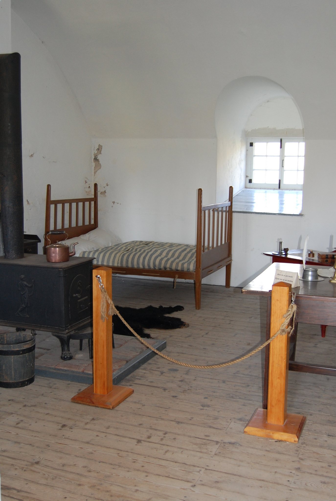
The officers’ quarters were built between 1821 and 1828 and retain the character of an 1820s military building. The soldiers’ barracks were constructed between 1827 and 1829. They contain dormitory spaces and an exhibition concerning the island’s successive historical passages. Historic interiors include officers’ living spaces, kitchens, latrines, magazines, and storehouses, while some rooms are arranged to represent mid-nineteenth-century military life with the uniforms and equipment of soldiers of the 24th Regiment.
Naval complex
The naval complex established during the War of 1812 included numerous service buildings and a shipyard. In 1814, the shipyard built the Confiance, the largest vessel to navigate the Richelieu River and Lake Champlain. This naval installation formed an earlier military layer on the island before the present Fort Lennox was completed.