Fort des Dunes: A Séré de Rivières Coastal and Territorial Fort in France


Site at a Glance
- Rating
- 4.3
- Popularity
- Medium
- Country
- France
- Primary era
- Modern
- External website
- Open
- Eras represented
- Modern
- Civilizations
- French, German
- Site type
- Military
- Remains
- Fort
On this page12 sections
History
Fort des Dunes is a French military fort at Leffrinckoucke, near Dunkirk in northern France, built between 1878 and 1880 as part of the Séré de Rivières system. This late-nineteenth-century network of forts, batteries, and defensive positions was created after France’s defeat in the Franco-Prussian War of 1870–1871 under General Raymond Adolphe Séré de Rivières. The fort protected Dunkirk’s port, coastline, coastal railway, canal, roads, and approaches from Belgium. It was the only land-based Séré de Rivières fort built on the French coast, while the system’s other coastal works were directed toward the sea and harbor entrances.
Construction and coastal defense
Construction formed part of France’s effort to protect strategically important ports, cities, railway junctions, transport routes, mountain passes, and frontier approaches. Fort des Dunes was designed to support the wider defenses around Dunkirk and to control a corridor containing a canal, two roads, and a railway running from the Belgian frontier. Its listed garrison was 451 men, including 13 officers, 22 non-commissioned officers, and 416 soldiers. The fort initially carried about 25 artillery pieces, comprising 15 rampart guns and 10 flanking guns.
The fort’s defensive role continued into the First World War. Dunkirk remained behind the Western Front and Fort des Dunes did not see direct frontline fighting, although German long-range artillery bombarded the city. Its main wartime importance was the protection of Dunkirk’s port, which received troops and matériel for the front. The fort also functioned largely as a munitions depot. Its principal armament included two or three 90 mm guns on the ramparts, while several 120 mm anti-aircraft guns were installed in the surrounding area.
From the Maginot Line to the Battle of Dunkirk
After the First World War, Fort des Dunes was incorporated into the Maginot Line, France’s interwar system of fortified defenses. Its importance around Dunkirk remained largely unchanged because the border in the area had not moved. Despite its inclusion in the line, the fort was not given the special concrete modernization or substantial restructuring applied to many newer installations farther east.
During the Battle of Dunkirk in 1940, the fort’s purpose changed. Instead of preparing to resist an attack from the west, it became a headquarters and defensive position protecting Allied forces concentrated on the beaches and threatened by German troops advancing from the east. The French 12th Motorized Infantry Division established its headquarters there on 1 June. The fort also served as the Camp des Dunes, where French soldiers separated from their units were processed and assigned new duties.
German aircraft and artillery heavily attacked the fort on 2 June. General Gaston Janssen, commander of the 12th Motorized Infantry Division, was killed with members of his staff. A further bombardment on 3 June killed approximately 100 more soldiers and caused severe structural damage. Estimates of the total deaths inside the fort over the two days have ranged from 150 to 200, while the number of soldiers later recovered from the site suggests that a figure near 100 may be more realistic. The divisional headquarters left the fort on 3 June and moved to the Jules Ferry school in Leffrinckoucke. With the drawbridge destroyed, troops escaped through the moat by way of a collapse in the northern escarp wall and masonry debris at the entrance.
Operation Dynamo, the Allied evacuation from Dunkirk between 26 May and 4 June 1940, ended after German forces reached the coast and took possession of the fort. Many Allied soldiers were not evacuated and became prisoners of war.
German occupation and the Resistance executions
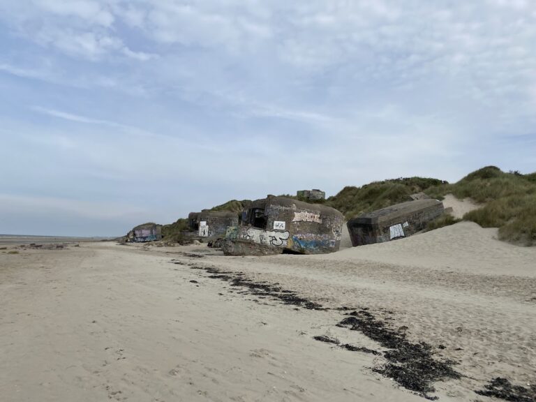
During the German occupation, Fort des Dunes was repaired and incorporated into the Atlantic Wall, Germany’s coastal defense system for resisting a possible Allied invasion of western Europe. It served as a ration depot and supported a radar-equipped anti-aircraft installation. German forces added concrete structures, including a small blockhouse on the western side and another bunker covering the approach road. In 1944 these positions were reinforced with temporary revetments and a heavy-machine-gun emplacement. German troops also left murals and other decorative work in the magazines and barracks.
In September 1944, German authorities used the fort as a prison for members of the local French Resistance arrested after an attempted attack on a German soldier in Rosendaël. On 6 September, six prisoners were executed by firing squad in the northern ditch. A seventh prisoner, seriously wounded during his arrest, was euthanized by the Germans. The victims were Georges Claeyman, Vincent Dewaele, Henri Gadeyne, Roger Reynaert, Marcel Reynaert, Robert Vangheluwe, and Élysée Willaert.
The executed prisoners were buried beside the ramparts. The wall against which they had been shot later collapsed over the grave, removing visible traces of the execution. After Dunkirk’s liberation, local Resistance members and French military authorities investigated German prisoners of war and organized excavations. The seven bodies were recovered in July 1945, although lime made identification difficult, and were reburied during a solemn ceremony in August 1945.
Post-war use and preservation
German forces held the Dunkirk pocket until the end of the Second World War. After the Second Dunkirk battle and the German surrender in May 1945, more than 10,000 German soldiers were taken prisoner, with many held at the fort. They were used for war-damage clearance and mine removal before their release under the terms of Germany’s surrender.
After the war, the customs service used the fort as a storage center for seized goods and provided accommodation there for customs officials and their families. The army regained control in 1955 and excavated collapsed sections to recover soldiers killed and buried beneath the ruins and sand from the 1940 bombardments. Their remains were reinterred in a nearby cemetery in August 1955 at a ceremony attended by General Janssen’s widow.
The army later abandoned the fort, which remained neglected for about two decades. A local preservation organization was founded in 1978 to conserve the site and adapt it for military-reserve use. By 1990, its rooms had been made habitable. Responsibility passed to the commune of Leffrinckoucke in 1998, and the Association Fort des Dunes maintains and interprets the site as a military museum with exhibitions and guided visits.
Remains
Embedded fort and defensive works
Fort des Dunes occupies a sandy ridge in the Bray-Dunes coastal dune corridor, about 1 kilometre west of the shoreline near the English Channel. The ridge runs north to south and rises to approximately 27 metres. Built into the dune, the rectangular fort measures about 300 metres from north to south and 150 metres from east to west. It has two levels, a stated height of 8 metres, and an area of about 45 dunams. Its buildings were recessed into the sand and covered with up to about 6 metres of soil, helping the fort blend into the landscape and withstand artillery fire.
Approximately 40 million red bricks, produced on site, were used in the construction. Brick and stone masonry form the principal walls, while later German structures are partly concrete. A dry moat surrounds the fort. Its defenses included a simple caponier, a covered position projecting into the moat so defenders could fire along the ditch, a double caponier, and a double gorge caponier. A drawbridge provided entry, but the 1940 bombardment severely damaged both the bridge and the entrance structure, while debris obstructed the moat.
Interior accommodation and armament
The internal spaces combined military accommodation, storage, and services. They included troop barracks, a pavilion for officers and other cadres, a dining room, kitchen, bakery, abattoir, stores, a powder magazine, ammunition storage, a well, a cistern, an infirmary, and a prison. Two sunken internal courtyards still show how the buildings were embedded in the dune and later covered by sand.
An artillery powder magazine was added several hundred metres south-west of the fort in 1898. It stored and assembled newer types of artillery projectiles. West of the fort, directly on the coast, the Zuydcoote battery held emplacements for ten coastal guns. These weapons could fire toward the sea and eastward toward the fort, forming part of the wider defensive network around Dunkirk. The fort itself was positioned to control the nearby canal, roads, and railway leading from the Belgian frontier.
Bombardment damage and later military additions
Damage from June 1940
The attacks of 2 and 3 June 1940 damaged or destroyed the officers’ courtyard, vehicles, part of the guardhouse, the drawbridge, the entrance vault, and the exterior stairway in the central courtyard. Bombs also affected a troop-building room above the infirmary, the gallery leading to the officers’ pavilion, adjoining rooms, the vault of the northern caponier’s flanking casemates, and a traverse shelter used by the military provost. Collapsing masonry destabilized the sand above the fort and buried soldiers beneath the rubble. The damage remains visible, and the entrance tunnel is now largely exposed.
German occupation structures
Concrete German additions remain associated with the fort’s later wartime use. They include radar structures, the western blockhouse, the bunker covering the approach road, temporary revetments, and a position for a heavy machine gun. These works belong to the fort’s incorporation into the Atlantic Wall and its connection with the Zuydcoote battery.
Memorial landscape
A nearby military cemetery contains soldiers killed in and around Fort des Dunes as well as the seven French Resistance members executed there. Their recovery and reburial connect the surviving fortifications with the human cost of the bombardments, occupation, and liberation of the Dunkirk area.
Nearby sites