Fort des Ayvelles: A Séré de Rivières Fortification in France


Site at a Glance
- Rating
- 4.4
- Popularity
- Very Low
- Country
- France
- Primary era
- Modern
- External website
- Open
- Eras represented
- Modern
- Civilizations
- French
- Site type
- Military
- Remains
- Fort
On this page21 sections
History
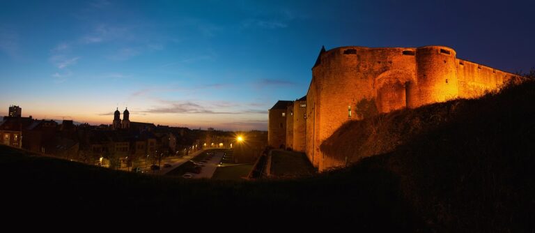
Fort des Ayvelles is a French Séré de Rivières fortification near Villers-Semeuse in the Ardennes, built between 1877 and the mid-1880s on a ridge overlooking Mézières. It formed part of France’s post-1870–1871 defensive system, created after Germany annexed Alsace-Lorraine, and was designed to protect the railway network converging at Mohon and Charleville.
Construction and strategic purpose
The Séré de Rivières system was a network of forts, batteries, and defensive positions built mainly after the Franco-Prussian War under General Raymond Adolphe Séré de Rivières. Its dispersed works were intended to control strategic routes and replace older city-centered defenses. Fort des Ayvelles was built to help replace the outdated fortifications of Mézières, while the Ardennes were expected to provide an additional natural barrier.
The site was selected about three kilometres south of Mézières, on a promontory approximately 210 metres above sea level. Mézières and Charleville stood at about 150 metres in the Meuse valley below. From this higher position, the fort could observe the railway installations and guard the routes leading toward Reims and Paris, Montmédy and Metz, Hirson and Lille, and Givet and Belgium. Mohon also contained major railway workshops and engine sheds, making the junction important for the movement of troops and military supplies.
Work on the main Fort and the smaller detached Battery began in 1877 under Captain Léon Boulenger, with construction carried out by the contractor Adrien Hallier. Some summaries place completion around 1880, while archival evidence places the building work between 1877 and 1886, with the complex finished around the middle of the 1880s. Construction was difficult. Earthworks collapsed, and some local contractors withdrew. About 500 workers, including approximately 300 Italians, took part, and nearly three million gold francs were spent on the two works. The planned garrison comprised 880 men for the Fort and 150 for the Battery.
Renaming and military obsolescence
In 1887, War Minister Georges Boulanger ordered the fort to be renamed Fort Dubois-Crancé after Edmond-Louis-Alexis Dubois-Crancé, a French Revolutionary general and politician from the Ardennes. The decree of 21 January was repealed on 13 October by Boulanger’s successor, Théophile Ferron, and the fort officially resumed the name Fort des Ayvelles. The later name nevertheless remained carved on the entrance pediment.
The work had been conceived as a powerful fort of arrest, meaning a position intended to stop an advancing enemy. Advances in artillery and the introduction of high-explosive shells after 1883 quickly made its masonry defenses vulnerable. This period became known as the crisis of the torpedo shell, when shells capable of penetrating earth-covered masonry before exploding challenged the older fort design. Fort des Ayvelles and its Battery were retained without major modernization but were downgraded in 1899, and their armament was reduced to smaller calibers. Planned concrete improvements in 1900 and a supplementary program in 1908 were never carried out.
The First World War
At the outbreak of the First World War, the fort was assigned to support French field forces defending the left bank of the Meuse south of Mézières. Its designated governor was Commandant George-Joël Lévi Alvarès, who had been stationed at Mézières since 1910.
Mobilization began on 2 August 1914. Chimney protection was reinforced and splinter protection was installed, while territorial infantry and artillery reinforcements continued to arrive for about three weeks. By the fifth day, the garrison numbered nearly 1,200 men. The obsolete armament consisted of twelve 95 mm guns, twelve 90 mm guns, and two 155 mm guns.
On 25 August, French forces withdrew from Mézières and the fort became exposed on the front line. Lévi Alvarès ordered the guns’ breeches removed and destroyed and instructed that the food reserves be burned, despite General Fernand de Langle de Cary’s order not to evacuate. The garrison left at 22:30 and marched about 15 kilometres to Poix-Terron. It was later ordered to return, but when the troops approached on 26 August, German forces on the heights of Saint-Laurent opened a bombardment that lasted three days. Unable to re-enter, the French troops withdrew toward La Francheville and Boulzicourt.
Lévi Alvarès returned to the fort and took his own life there on 27 August. The reasons remain uncertain. They have been associated with fear of accusations of cowardice or treason, and with a desire to spare his men dishonor. German troops buried him nearby with military honors. Later treatment of his grave has been understood both as a genuine tribute and as propaganda.
German forces entered the complex between 29 and 31 August 1914, after the bombardments of 25–27 August. They found a position whose masonry and weapons were already obsolete, including mortars dating from 1842. The remaining guns were removed for melting, while usable metal, cauldrons, woodwork, and other materials were stripped. During the occupation, the fort served as a prison and munitions depot. Three French civilians were executed in the ravelin before the entrance between October 1915 and January 1916.
Before withdrawing in 1918, German forces destroyed most of the central barracks. This prevented the French Army from readily returning the position to active use. French forces reoccupied the complex at the end of the war in November 1918.
Between the wars and the Second World War
The fort remained in military ownership during the interwar period, but received little maintenance and was not fully restored to defensive service. The Army used the grounds for training, and anti-aircraft batteries were installed around the Fort and Battery during the 1920s.
During the Second World War, the French Army made little use of the complex. German forces bombarded it on 14 May 1940, adding to the earlier damage, and French troops abandoned it during the night of 15 May. During the German occupation, thirteen members of the French Resistance were executed at the fort. They included René Arnould, Georges Boillot, Robert Stadler, and Lucien Maisonneuve, four railway workers from Amagne who were executed on 26 June 1944 for sabotage at the Amagne-Lucquy depot.
Military training and preservation
After 1945, the site became a training area for the 3rd Engineer Regiment based at Charleville-Mézières. A tank track was created in the forest, and training equipment, including a zip line and rappel systems, was installed in the ditches. Explosive tests damaged the northern caponiere and the southern place of arms, while several major artillery pieces were removed during the 1960s.
Military training gradually declined, but the fort remained overgrown and largely inaccessible. The Association of the Fort and Battery of Ayvelles was founded in 1989 to restore the complex. Work included clearing collapsed earth and stone from two vaulted passages, rebuilding damaged casemates and chimneys, and securing internal routes. More than 25 years of restoration eventually made a visitor circuit possible.
In 2004, the General Council became owner of the 37-hectare Ayvelles domain and arranged the removal of pollutants from the grounds and both fortifications while continuing to support the preservation association. In 2011, the association became the social-economy group Ardenne Patrimoine Insertion, combining conservation with employment and training. The Fort and Battery are maintained by a preservation organization and managed on behalf of the Ardennes department.
Remains
The complex consists of a square principal Fort and a smaller detached Battery about 600 metres to its east. A protected covered way approximately 600 metres long connects them. The Fort occupies a ridge and has four faces, each approximately 250 metres long, enclosed by a ditch about 10 metres wide and between 8 and 10 metres deep. Earth, masonry, underground passages, artillery positions, and surviving casemates together preserve the organization of a late nineteenth-century French fortified position.
Fort layout and ditch defenses
Caponiers
The southern and northern salients contain two large double caponiers, fortified structures projecting into the ditch to provide flanking fire along its faces. Vaulted passages from the places of arms lead to them. Each caponiere has three large masonry firing embrasures for 12 cm breech-loading guns and 40 mm Hotchkiss revolving cannon, with the projecting orillons also allowing infantry fire. The northern caponiere has two projecting échauguettes, or observation posts, at the ends of its orillons. These posts are described as unique in France, although their primary purpose was decorative. Bombardment and later explosive testing damaged the caponiers, especially the northern structure.
Entrance and places of arms
The Fort has one entrance, protected by a counterscarp guardhouse flanked by firing chambers. A fixed bridge on two wooden piers crossed the ditch and ended at a bascule drawbridge that could close the access. Two casemates beside the second entrance contained musketry loopholes. The entrance was given a carefully finished pastiche of the Louis XIII style, with the words “1878 Fort des Ayvelles” carved on its pediment. A vaulted passage beyond it contains multiple firing openings on both sides.
Four infantry places of arms occupy the southern, eastern, northern, and western salients. Their parapets provided cover and firing positions, and mortars could be installed to fire across the glacis. The southern place of arms is the largest and has a blue-stone staircase leading to its firing area. Tunnels connect the southern and northern places with the two caponiers. Three casemates at the southern place included a forge and a stable for six horses.
Ramparts and artillery positions
A vaulted passage links the southern place of arms with the rampart street. At its center, the enveloping gallery forms a roughly circular protected route about 530 metres long around the Fort. It gives access to artillery positions beneath two to three metres of earth. Twenty open-air positions, each approximately six metres wide and 9.5 metres long, were arranged around the Fort so that guns could fire through 360 degrees. Two staircases served the positions, which were separated by traverses containing shelters for artillerymen.
Armored artillery
The Fort’s Mougin casemate
The Fort contains a Mougin casemate, an armored artillery chamber named after its designer Henri-Philippe Mougin. It was delivered on 23 November 1882 and faced southwest toward Boulzicourt and the railway between Reims and Mézières. Its 4.2-metre-long gun fired a 155 mm shell approximately once per minute to a maximum range of 9,200 metres. Mounted on a carriage running on two concentric rails, it could traverse through 60 degrees.
The armor consists of four hardened cast-iron voussoirs weighing ten tonnes each and a 23-tonne shield. The shield opening served as the gun embrasure but also formed a vulnerable point. A seven-tonne hardened cast-iron shutter could cover it. Four men operated the shutter with winches in two lateral casemates, while a counterweight balanced its movement. A saline-cell safety system was intended to prevent accidental firing when the opening was covered. Two further lateral casemates sheltered the gunners from dust and noise, and a large ceiling ventilation shaft removed dust. The gun was removed around the 1960s, but the casemate survives.
Artillery stores and armament
The original armament plan called for seventeen 120 mm long de Bange guns and three 155 mm long de Bange guns. A de Bange gun was a French rifled artillery weapon designed by Charles de Bange. After the 1899 downgrading, the artillery was reduced to smaller 90 or 95 mm calibers. Guns were kept in artillery magazines when not deployed and were moved into position by men and horses.
Central quarters and underground systems
Barracks and service rooms
The central living quarters lay beneath the earth mass around a courtyard approximately 50 metres long and eight metres wide. Casemates on two levels flanked the courtyard, whose arrangement was intended to bring morning or afternoon sunlight into the dormitories. The complex contained wells, lavatories, artillery stores, a bakery, powder magazines, kitchens, and an infirmary.
The original barracks plan provided 28 casemates with windows opening onto the courtyard and accommodation for 880 soldiers. An ordinary dormitory held thirteen four-place bunk beds, allowing up to 52 soldiers to occupy a room. The beds used plank frames with simple straw mattresses. Shelves stored equipment, racks held four rifles, and a single wood- or coal-fired heater supplied warmth. Most of the central barracks were destroyed in 1918 and are now represented by a thick layer of earth. The officers’ corridor leading to the dispatch room and commandant’s quarters remains accessible, although damaged.
Powder magazines
Two identical powder magazines each held 80 tonnes of black powder. The powder was stored in watertight brass cases weighing 50 kilograms and used to load shells in nearby loading rooms. Each magazine measures approximately 19.6 metres long, six metres wide, and five metres high beneath an earth covering about eight metres thick.
A vestibule allowed workers to change into clothing without metal parts that might create sparks, and two heavy locked armored doors controlled entry. Colza-oil or petroleum lanterns stood in wall niches behind two-centimetre-thick glass. One opening lit the vestibule and three served the magazine, keeping illumination limited. Crawl spaces beneath the magazines, mineral-pitch-coated floors, raised ventilated floors, and eight floor openings helped control humidity. The outer vaults were coated with mineral pitch, while the inner surfaces were whitewashed with lime to waterproof them and reflect light. Shuttered openings connected with the ventilation shafts, galleries ventilated the sides, and a metal cable led from ceiling hooks through the shaft to a lightning conductor.
Water supply
Two wells, approximately 26 and 29 metres deep, supplied the Fort. Each produced an average flow of about four cubic metres. Suction pumps fed lead pipes leading to an underground storage cistern with a capacity of 473 cubic metres and to a smaller cistern serving the lavatories. The stored water was intended to sustain the Fort for six months during a siege, with reduced rations for soldiers and horses.
Detached Battery and nearby defenses
Detached Battery
The detached Battery has a pentagonal plan and lies approximately 600 metres east of the Fort. It contained ten artillery positions and was intended for a garrison of 150 men. A second Mougin casemate was installed there, originally holding one 155 mm long de Bange gun. The Battery was less damaged by the wars than the Fort and was partly occupied after 1945, but its Mougin casemate was completely demolished by the French Army after the Second World War.
Blockhouses and commemorative features
Two lightly armed blockhouses stand near the Fort, the southern Fort des Ayvelles blockhouse and the Villers-Semeuse blockhouse. Built during the 1930s, they formed part of the Defensive Sector of the Ardennes, a lightly fortified military sector made mainly of scattered casemates and blockhouses that later became associated with the Maginot Line.
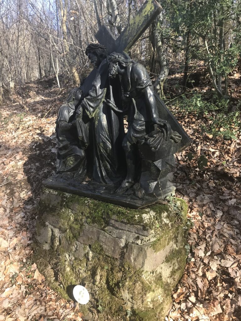
A commemorative plaque at the entrance honors those executed at the site during the two world wars. The grave of Lévi Alvarès stands beside the wooded path linking the Fort and Battery and was later replaced by a more elaborate grave marker. The restored complex includes cleared galleries, progressively reconstructed casemates, rebuilt chimneys, secured passages, and a route through the surviving fortification.