Fort de la Redoute de Saint-Apollinaire: A Séré de Rivières Redoubt in France


Site at a Glance
- Rating
- 4.6
- Popularity
- Very Low
- Country
- France
- Primary era
- Modern
- Eras represented
- Modern
- Civilizations
- French
- Site type
- Military
- Remains
- Fort
On this page7 sections
History
Fort de la Redoute de Saint-Apollinaire is a late-nineteenth-century French military redoubt at Saint-Apollinaire, on the edge of Dijon. Built as part of the Séré de Rivières system, a network of defensive works created for France’s eastern frontier after the Franco-Prussian War of 1870–1871, it helped protect the intermediate sector between the roads to Langres and Gray.
Postwar defensive system
The redoubt formed part of the fortified complex of Dijon and stood behind Fort de Varois. Its position northeast of the urban area allowed it to contribute to the defense of approaches between two important roads. The work was designed for a garrison of 172 men, although that number had fallen to 73 by 1914. Its planned armament consisted of 18 guns on the rampart and nine pieces assigned to flank the defensive ditches and walls.
Uncompleted modernization
Several later plans aimed to update the redoubt, but none was carried through. The 1900 program did not add special concrete protection, a Bourges casemate, an armored turret, or an observatory. The supplementary program of 1908 and the subsequent restructuring were also left unfinished. Four positions for anti-aircraft guns were added during the twentieth century, including one built in 1915.
Municipal preservation
Fort de la Redoute de Saint-Apollinaire has been protected as a French historic monument since 17 March 2006. The municipality of Saint-Apollinaire owns the site and converted it into a recreational and sports park used for walks and various events. This later use preserves the former military work within a civic setting, while its masonry remains in excellent condition.
Remains
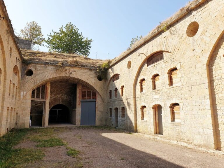
The redoubt lies on the boundary between Saint-Apollinaire and Dijon, about 2,500 metres from Dijon’s city center, at an average elevation of 286 metres. It is arranged around a central massif rather than the layout of a conventional fort. The entrance was intentionally made weaker than the rest of the work, so that an enemy capturing it would have difficulty turning it into a fortified position close to Dijon. The surrounding ditches have since been filled in, but the masonry survives in excellent condition.
Barracks and underground circulation
The barracks contain six casemates, or protected vaulted rooms. Four served as sleeping chambers for between 125 and 150 soldiers. Another held the kitchen and a well 25 metres deep, while the sixth was used for artillery equipment. An ammunition room stood at each end of the façade. Behind these rooms, a maneuver corridor led to a powder magazine, a protected chamber for gunpowder and artillery ammunition, with a capacity of 30 tonnes.
Ramparts and artillery defenses
A rampart road runs beside a lower battery equipped with nine shelter traverses, which were earthen or masonry barriers intended to protect troops and guns from fire. One traverse is built into the earth. Two others form covered galleries for caponiers, fortified positions projecting into the ditch so defenders could fire along it, at salient angles 2 and 3. Together, these arrangements comprised a double caponier and a wing.
The barbette positions could accommodate 18 guns. In these positions, artillery fired over the parapet rather than through an opening in the wall. At the gorge, two pseudo-bastioned positions protected the curtain wall with enfilading fire, sweeping along the length of the defensive line. The summit of the central massif retains the foundations of a building used for optical communications, while four twentieth-century anti-aircraft-gun emplacements add a later layer to the fortification.
Nearby sites