Erguel Castle: A Medieval Fortress in Switzerland

Site at a Glance
- Rating
- 4.5
- Popularity
- Very Low
- Country
- Switzerland
- Primary era
- Medieval
- External website
- Open
- Eras represented
- Medieval
- Civilizations
- Holy Roman Empire
- Site type
- Military
- Remains
- Castle
On this page9 sections
History
Erguel Castle is a ruined medieval fortress in Switzerland, above Sonvilier in the Saint-Imier Valley. Developed under the Lords of Arguel and the Prince-Bishops of Basel, the castle probably took its visible form in the thirteenth century and gave its name to the surrounding lordship, later called Erguel. Its position on a route between Neuchâtel, Saint-Imier, and Basel made it an important frontier stronghold. The municipality of Sonvilier now owns the ruins.
Origins and the Lords of Arguel
During the eleventh century, the Bishop of Basel and the Counts of Fenis controlled the Saint-Imier Valley. They entrusted local administration to the Lords of Arguel, a noble family probably from Franche-Comté whose name later became Erguel. The family settled in the region, held the surrounding lands and lordship, and exercised the office of vogt, an administrative or protective role, over the church at Saint-Imier.
The foundation date of Erguel Castle remains uncertain. Some interpretations place its beginnings as early as the late eleventh century, while another tradition connects its construction or enlargement with the Lords of Arguel in the late twelfth or thirteenth century. The family may have expanded an earlier installation. One proposal links an early foundation with Burkhard von Fenis, Bishop of Basel from 1072 to 1107, during a territorial dispute between the dioceses of Basel and Lausanne. In that interpretation, the fortress protected the population, helped control agricultural resources in the valley, and watched a toll route leading between Saint-Imier and Neuchâtel.
Henricus de Arguel, named in 1178, is the first documented member of the family. Heinrich von Erguël was also recorded as ruling the region in 1178 and 1184. The family retained the castle, its lands, and the lordship until 1264. In that year, Otto von Erguel, then living in Basel, transferred his share of the castle, its estates, and the lordship to Heinrich von Neuenburg, Prince-Bishop of Basel, in exchange for rights and possessions at Raedersdorf in Alsace.
Episcopal rule and military conflict
After 1264, the Prince-Bishop of Basel appointed a bailiff or castellan to represent his authority at the castle. The enlarged territory was administered through Biel. The episcopal mayor of Biel also received the vogt office and the right of banner in Lower Erguel. This right allowed the authorities to summon troops and, in some circumstances, negotiate with foreign powers and request military assistance.
Erguel marked the southernmost point of the Basel episcopal territory. In 1284, Bishop Heinrich of Isny ordered the fortress strengthened and enlarged, and much of the visible masonry probably belongs to this phase. In 1335, a treaty of combourgeoisie, an agreement placing a territory under the mutual protection of another political community, placed the castle under the tutelage of Saint-Imier.
Biel obtained the right of banner in Upper Erguel in 1395 and gained the authority to raise troops in the region during the fifteenth century. By 1493 it administered Erguel through the mayors of its villages and hamlets. During the war between Bern and Biel and the Bishop of Basel in 1368, troops from Bern and Biel captured the castle and partly burned it. The fortress was rebuilt afterward, since a castellan is recorded there in 1417. Its military value later declined, and for several decades it served mainly as a prison.
Religious and political change
The combourgeoisie treaty involving the chapter of Saint-Imier was renewed in 1479. The chapter moved to Solothurn in 1530. In 1553, the Bishopric of Basel pledged Erguel to Biel for 7,000 crowns, but opposition from the people of Erguel, supported by Solothurn, led to the revocation of the agreement. In 1556, the bishop granted Erguel its franchises.
The Counter-Reformation, the Catholic reform movement that followed the rise of Protestantism, reached the region in 1575 as part of the Bishop of Basel’s attempt to restore religious authority. In 1594, the bishop sought to recover his rights over Erguel, but federal arbitration largely upheld the existing arrangement. Biel surrendered most of its remaining rights to the bishop in 1599 in return for a guarantee of freedom of worship, while retaining the right to raise troops.
The Biel exchange of 1604 ended the lordship’s main political ambitions and left it more isolated on the Swiss frontier, although customary law gave the region additional autonomy. In 1605, the bishop installed his direct representative, a castellan, at Courtelary. The appellate court was transferred to Porrentruy in 1606. After the episcopal bailiff Petermann de Gléresse moved from the castle to the administrative house at Courtelary shortly after 1606, only a watchman and his family remained at Erguel.
Abandonment and preservation
Bishop Wilhelm Rinck von Baldenstein planned in 1617 to repair the fortress and station a garrison there against Biel. The plan was only partly carried out, although the roofs were repaired in the summer of 1618. During the Thirty Years’ War, the major European conflict of 1618 to 1648, Swedish troops under Bernhard of Saxe-Weimar occupied Erguel in 1636 for quarters and storage. Repairs were thereafter limited largely to essential work, and the roofs were repaired again in 1680.
Inventories from 1704 and 1724 describe the castle as being in poor condition. An attempt to lease it in 1752 failed because the proposed tenant would have had to maintain the deteriorating buildings. The diocese decided to abandon Erguel permanently in 1754, after which the southern part of the keep collapsed.
Following the abandonment, the castle estates were assigned to La Ferrière and later sold to François Finot of Undervelier in 1828. Sonvilier acquired the property in 1845, and local residents used the ruins as a quarry for a long period. Excavations began in 1884 under the architect Antoine Biétix. A restoration led by Paul Flotron between 1929 and 1931 was followed by repointing of parts of the masonry in 1964 and 1965.
Further collapses began in 1993. A major renovation in 1997 and 1998, carried out with the participation of the Bernese cantonal archaeology service, stabilized and conserved the surviving structures. It also removed the ground-level entrance cut into the keep during the earlier restoration. Erguel Castle has been protected as a cultural property of regional importance since 15 July 1929. It is regarded as the best-preserved castle ruin in the Bernese Jura and as the region’s only medieval fortification that was neither extensively rebuilt nor almost entirely lost.
The castle’s influence gave the Saint-Imier Valley its former name, Erguel Valley. Earlier, the valley was known as Suzingau, a Germanic name reflected in that of the Suze River. Writings once described the tower as the farthest point of the civilized world and the last defense against “barbarians.” A local legend tells of a subterranean passage near the castle that connected it with La Neuveville on the northern shore of Lake Biel. The supposed connection remains legendary.
Remains
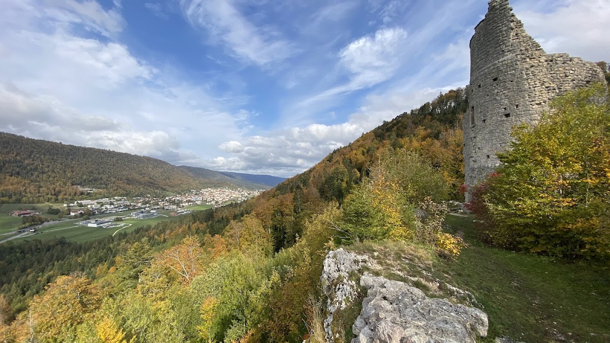
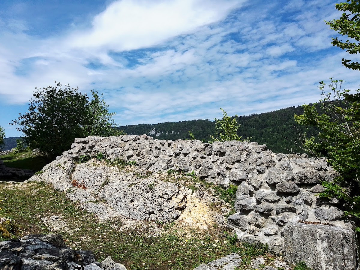
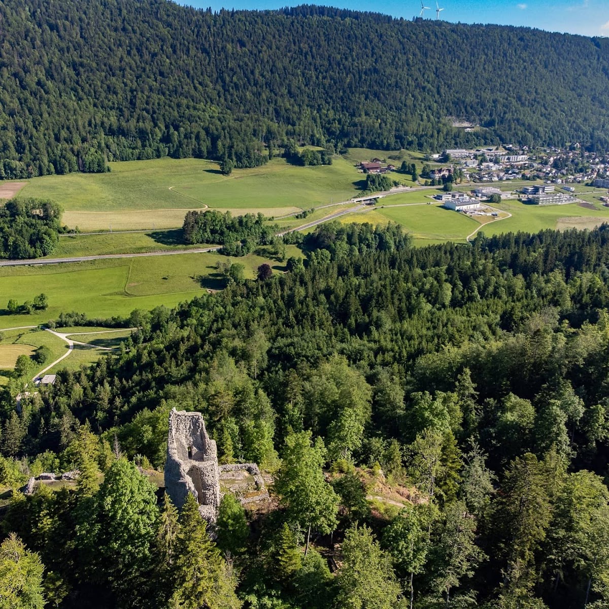
Erguel is an elongated ruin on an exposed rocky ridge about 935 metres above sea level, southeast of Sonvilier on the northern flank of Chasseral. The castle extends from east to west, with a ditch protecting its higher southern side. Its surviving walls are built mainly of limestone rubble masonry and probably belong to the thirteenth-century rebuilding and enlargement. The buildings formed a sequence along the ridge, linking the entrance, courtyard, residential structures, and towers.
Entrance and courtyard
The eastern entrance gatehouse was preceded by a zwinger, an outer defensive enclosure placed in front of the main fortifications. The gate led into the castle courtyard. A plan prepared by the master mason Bortlin before the proposed repairs of 1617 preserves the arrangement of the fortress at the beginning of the seventeenth century. Farther west, a semicircular tower was still shown on that plan, while a further building adjoined the western end of the residential complex.
Keep
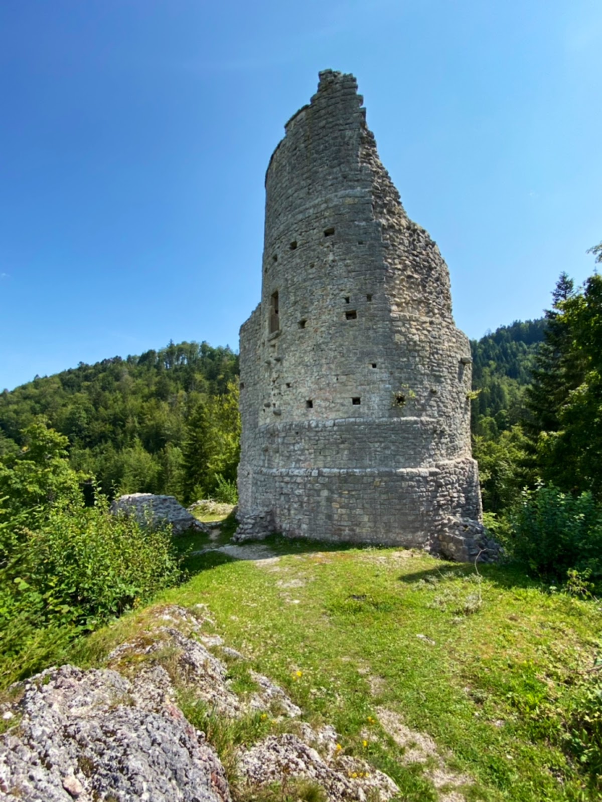
A large circular keep stood south and west of the gatehouse on the southern side of the courtyard. It probably rose about 30 metres and had foundation walls more than 3.5 metres thick, with another measurement giving approximately 3 metres at the base. Its exterior was faced with dressed limestone blocks. The keep functioned as the castle’s principal fortified tower and refuge.
Entry was originally possible only through a high doorway about 7 metres above ground level. A ground-floor entrance inserted during the 1929 to 1931 restoration was removed in 1997 and 1998. The circular tower is the most substantial surviving part of Erguel. Putlog holes, openings that supported temporary construction or floor timbers, remain visible at the levels of the former floors. The southern section collapsed after the 1754 abandonment, and later quarrying and further collapses reduced the structure.
Residential complex
A stairway from the courtyard led to the first floor of the palas, the principal residential and representational building of a medieval castle. The palas extended westward from the keep. Its lower level contained a cellar, stable, and kitchen, while a chapel formed part of the residential complex.
The upper floor was a single hall measuring about 18 by 7 metres, making the building a hall-type residence. A drawing attached to an inventory dated 5 August 1707 shows two paired windows on this level. Their arrangement indicates that the Basel episcopate maintained a representative hall at the castle, comparable in design with the knights’ hall at Laupen Castle.