Acrocorinth: The Fortified Acropolis of Ancient Corinth


Site at a Glance
- Rating
- 4.7
- Popularity
- Medium
- Country
- Greece
- Primary era
- Early Modern
- Eras represented
- Iron Age, Classical, Medieval, Early Modern
- Civilizations
- Ancient Greek, Byzantine, Crusader, Kingdom of Macedon, Ottoman, Principality of Achaea, Roman, Venetian
- Site type
- Military
- Remains
- Citadel
On this page16 sections
History
Acrocorinth is the fortified acropolis of ancient Corinth in Greece, rising on a naturally defensible plateau 575 metres above sea level. Its first identifiable fortifications date to the seventh century BC, and the site remained occupied and militarily important through successive Greek, Macedonian, Roman, Byzantine, Frankish, Venetian, Ottoman, and modern Greek phases. From its heights, the fortress controlled the Corinthian Isthmus, its fertile plains, and routes from central Greece and the sea.
Early Corinthian and Macedonian Acrocorinth
The hill was probably visited intermittently during the Neolithic period and shows activity from the Late Helladic period, the Late Bronze Age culture of the Mycenaean world. Occupation continued from at least the eleventh century BC. Mythological tradition named Bellerophon, the legendary king of Corinth, as the first owner of the area. He was said to have dedicated the rock to Helios and given its summit, described as 240 stremmata, to Aphrodite. A stremma was a traditional Greek land measure of approximately one thousand square metres. Medea was credited with building a temple to the goddess, while Sisyphus was said to have brought water to the hill and created the Peirene spring.
The earliest identifiable defensive works belong to the seventh century BC and are associated with Cypselus and Periander, rulers of the Cypselid family. The family was established by the Corinthian tyrant Cypselus, whose son Periander became one of archaic Corinth’s prominent rulers. The fortress was expanded and strengthened under Macedonian rule in the fourth century BC. A Macedonian garrison was established during the later fourth century BC, turning Acrocorinth into a major base for controlling the Isthmus and nearby Greek states.
Acrocorinth changed hands repeatedly during the Wars of the Diadochi, the conflicts among the successors of Alexander the Great for control of his empire. Cassander occupied the acropolis in 315 BC, Ptolemy I captured it in 308 BC, and Demetrius I Poliorcetes took it in 303 BC. It then remained under Antigonid control for about sixty years. The Antigonids were the Macedonian dynasty descended from Antigonus I Monophthalmus. After the Macedonian governor Alexandros of Corinth defected, the fortress returned to Macedonian control after his death in 245 BC and the marriage of his widow, Nikaia, to Demetrius II.
In 243 BC, Aratus of Sicyon captured Acrocorinth in a night assault with 400 men. Aratus was the strategos, or elected military commander, of the Achaean League, a federation of Greek cities in the northern Peloponnese. He handed the fortress to Antigonus III Doson in 224 BC, and a Macedonian garrison was installed again. After Macedon’s defeat in 197 BC, Rome briefly occupied the fortress before it was returned to the Achaean League.
Roman and Byzantine Transformations
In 146 BC, the Roman general Lucius Mummius Achaicus destroyed Corinth and its acropolis after the city refused to leave the Achaean League. Julius Caesar refounded Corinth in 44 BC, and Acrocorinth was subsequently repaired or reconstructed. Its strategic importance was reduced for a time, although the hill continued to be occupied.
The settlement and fortress suffered during attacks by the Heruli in 267, the Goths in 375 and 395, Slavic incursions in the sixth century, and Saracen attacks in the eighth century. Earthquakes, especially those of 357 and 521, also damaged the defenses. The hill was probably inhabited between the seventh and ninth centuries, while its fortifications were renewed during the middle Byzantine period.
Under the Byzantine military provincial system, Acrocorinth belonged to the province of the Peloponnese. It escaped capture in 995, when the Bulgarian ruler Samuel withdrew from the Isthmus after learning that Emperor Basil II was approaching. In 1147, the Norman ruler Roger II of Sicily attacked Corinth, and the Byzantine commander surrendered Acrocorinth without a fight.
Frankish, Venetian, and Ottoman Rule
Leon Sgouros, the archon of Nauplia, captured Corinth and Acrocorinth in 1203. Crusader forces besieged the fortress from 1204 or 1205 until 1209. Medieval tradition held that Sgouros died in 1208 by riding his horse over the walls rather than surrendering. The fortress eventually passed to the Principality of Achaea, one of the Frankish states established in Greece after the Fourth Crusade. Here, “Frankish” refers to the Latin crusader states of the period.
In 1358, Robert of Taranto granted the castellany of Corinth, a territorial jurisdiction administered from a castle, to the Florentine Niccolò Acciaiuoli as an hereditary barony. After the death of Niccolò’s son, Nerio I Acciaiuoli, in 1394, the fortress passed through his heirs to Carlo I Tocco and Theodore I Palaiologos, despot of the Morea. The latter title belonged to the Byzantine ruler of the Despotate of the Morea, a late Byzantine state in the Peloponnese. Theodore sold Acrocorinth to the Knights of Saint John around 1400 for financial and defensive reasons, but recovered it in 1404.
Sultan Mehmed II conquered Acrocorinth in 1458. A Venetian attempt led by Bartoldo II d’Este failed in 1463. In 1612, Vaqueras, commander of the Knights of Malta, temporarily seized the fortress but relinquished it after receiving a ransom. The Venetians captured Acrocorinth without resistance on 9 August 1687 during the Morean War and repaired the defenses, giving the fortress much of its present form. Two Ottoman attempts to recover it, in 1689 and 1692, failed.
The Ottoman grand vizier Silahdar Damat Ali Pasha captured Acrocorinth in 1715 after a thirteen-day bombardment. The capture involved burning, massacres, and the enslavement of 200 local Roman inhabitants. Ottoman control continued until the Greek War of Independence, when the fortress again became a principal military objective.
Greek War of Independence and Later Study
Christian Arvanites from Megara, an Albanian-speaking Christian community established in parts of Greece, occupied Acrocorinth in 1821, but Ottoman forces soon recovered it. After negotiations, the Ottoman garrison surrendered to Greek forces on 26 January 1822 in the Gregorian calendar, corresponding to 14 January in the Julian calendar. Ottoman troops briefly recaptured the fortress in July.
A renewed Greek siege began in 1823. Ioannis Notaras was appointed to command it by the National Assembly of Astros. Staikos Staikopoulos, associated with the capture of Palamidi, joined the operation in June, while Georgios “Gennaios” Kolokotronis was appointed by the Executive in October. Theodore Kolokotronis took part in the surrender negotiations. The garrison regarded him as a commander who would keep his word and protect the prisoners.
A surrender agreement was signed on 19 October, and the garrison departed in late October or early November after a nine-month blockade. The negotiated evacuation included about 300 Albanian or Turco-Albanian soldiers and between 40 and 60 women. In 1824, rebels commanded by A. Londos and Ioannis Notaras briefly besieged the fortress during the Second Civil War. In 1826, conflict between Panayotis and Ioannis Notaras affected the region, and Ioannis occupied Acrocorinth with Roumeliot mercenaries, people from central Greece. After his death in 1827, Kitsos Tzavelas acquired the garrison he had left there.
Acrocorinth remained one of the last Greek-held fortresses during the later stages of the war and was provisioned in anticipation of a siege. Kütaşi Bey did not attack it, and the Greek position was ultimately preserved by the Ottoman-Egyptian defeat at the Battle of Navarino in October 1827. After Greek independence, the fortress lost its strategic function, was abandoned, and suffered further earthquake damage.
The American School of Classical Studies at Athens began an extensive archaeological investigation of Acrocorinth in 1896. The mountain is also protected as the Acrocorinthos Natura 2000 site, a protected area within the European network for conserving habitats and species of ecological importance, covering 6.02 square kilometres.
Remains
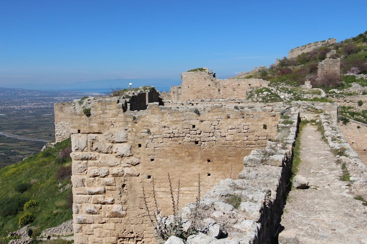
Acrocorinth occupies two summits of a 575-metre rocky massif, with small springs rising between them. The plateau and slopes form a defensive system extending for nearly two kilometres. Steep scree slopes and rocky escarpments protect the fortress on the north, east, and south, while the fortified route approaches from the western, southern-facing side, concealed from the ancient city. The hill’s vegetation includes shrubland, rocky scrub, and phrygana, a low, open Mediterranean shrubland dominated by drought-resistant plants.
Gates and Defensive Circuit
Entrance and Lower Gates
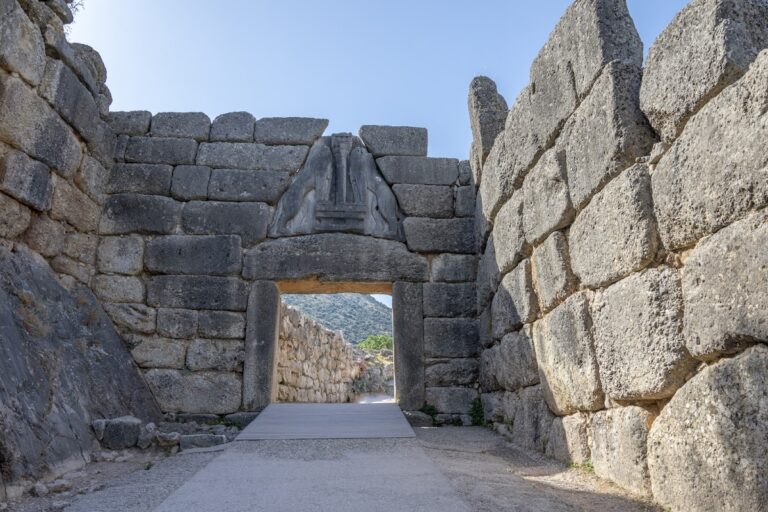
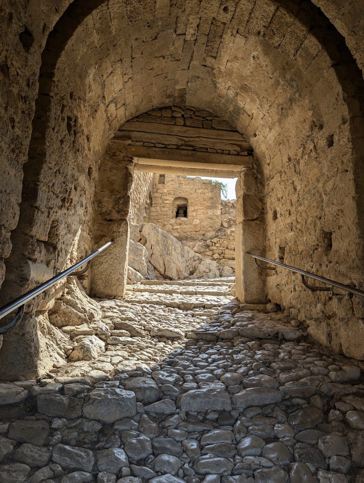
The principal entrance is reached by a single uphill road that is partly paved and partly cut into the rock. The route rises in a large spiral toward the upper fortress. On the lower level, a large vaulted first gate stands with adjoining walls. During the medieval period, a substantial defensive ditch and drawbridge lay in front of it, although much of the surrounding structure has collapsed. The bridge over the ditch and the guardhouse at the first gate were reconstructed in 1965 and 1966. Conservation during the 1970s focused on the first two gates and their adjoining walls, while further work in 1993 to 1995 included replacement of the wooden entrance bridge.
Second and Upper Gates
About 100 metres northeast and uphill from the first gate is a second vaulted gate with a larger adjoining enclosure. A third vaulted gate leads into the principal upper fortress. Its continuous perimeter wall, interrupted by intermediate towers, encloses the western and eastern sections of the plateau. Three smaller vaulted gates in the northern wall probably served mainly for sorties or escape rather than ordinary passage.
Summits and Religious Buildings
Aphrodite Sanctuary and Byzantine Chapel
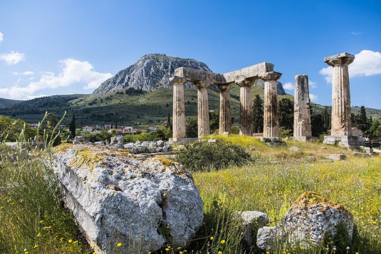
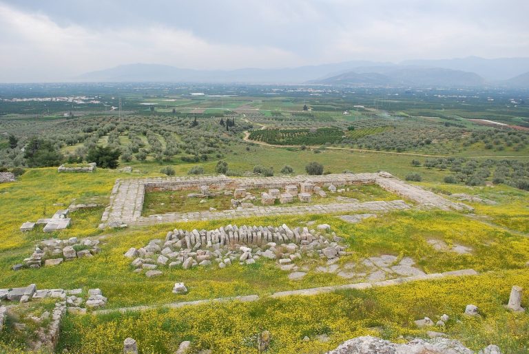
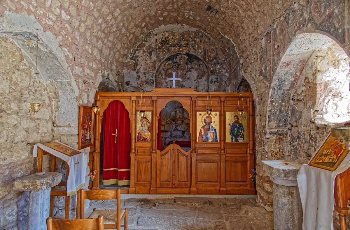
The eastern summit contains the oldest visible building remains. A temple of Aphrodite once stood there, but the visible structure is a Byzantine chapel built over the temple’s foundations. The sanctuary was traditionally associated with numerous temple prostitutes, although the surviving elements belong to the later chapel rather than to the temple itself.
Finds from the sanctuary area include two fragments of a Late Helladic Psi figurine from the fourteenth century BC, two fragments of Protogeometric kylikes, or shallow drinking cups, dating to about 1000 BC, and a handmade Early Iron Age terracotta bull figurine from the tenth century BC. These objects provide evidence for activity at the summit across several early periods.
Western Summit Tower
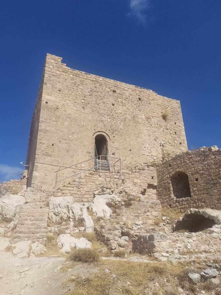
The western summit contains the ruins of a Frankish tower. The Venetians enlarged it, and the Ottomans strengthened it further. The tower forms part of the later defensive history of the summit, where buildings from several periods survive among the fortifications.
Later Buildings and Water Supply
Venetian and Ottoman Structures
Especially at the foot of the western summit, the fortress contains buildings from several historical periods. These include a Venetian chapel or church, Ottoman dwellings, fountains, wells, small mosques, underground passages, storage buildings, and a Byzantine cistern. Many walls and buildings use ancient stone taken from earlier ruins, which makes the date and identification of some elements difficult.
The mosque of Ahmed III stood in the northern part of the fortress. Farther south was the mosque associated with Mehmed II. Only the latter mosque’s cylindrical minaret survives, including its spiral staircase. Cannons associated with the final Venetian occupation under Francesco Morosini also remain at the fortress, including one marked with the manufacture date 1670.
Dragonera and the Peirene Spring
The structure now known as the Dragonera is a water cistern identified with the upper Peirene spring. Tradition connects it with the lower Peirene spring in the ancient city, and its description has been associated with the account of Pausanias. The upper spring was restored in 1930.
Conservation and Landscape
Modern conservation campaigns restored or reconstructed numerous sections of the classical, Byzantine, Frankish, and Ottoman fortifications, together with several buildings. The surviving remains occupy a rocky landscape with views across the Gulf of Patras and the Gulf of Corinth, toward the southern coast of central Greece, and across the western Saronic Gulf toward Salamis and Aegina.
The protected landscape supports narrow-leaved stachys and Greek fritillary, as well as Peloponnese rock lizards, green toads, skinks, house snakes, legless lizards, golden jackals, bent-toed geckos, large lizards, slow-worms, sacred snakes, blind snakes, bats, horseshoe bats, butterflies of Rhodes, and marginated tortoises.