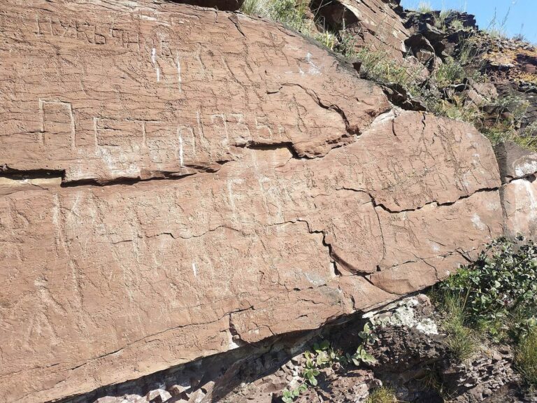
Chebaki Fortress: A Bronze Age Mountain Sanctuary in Khakassia
Site at a Glance
- Popularity
- Medium
- Country
- Russia
- Primary era
- Bronze Age
- Eras represented
- Bronze Age
- Civilizations
- Unclassified
- Site type
- Military
- Remains
- Fort
On this page15 sections
History
Bronze Age setting and development
Chebaki Fortress is a Bronze Age mountain fortress-sanctuary on Mount Takh in Shirinsky District, Khakassia, Russia. The site is broadly dated to the second millennium BC, during the Bronze Age, a prehistoric period when bronze was used for tools and other objects. It belongs to a group of about 45 related sve, a Khakas term for a fortress or fortification, concentrated in northern Khakassia and spread across southern Siberia.
The Black Iyus and White Iyus valleys meet a forest-steppe corridor described as the only accessible passage into the mountain-enclosed Minusinsk Basin. Fortresses in the wider group, along with short stone walls across valleys, passes, terraces, and mountain paths, were understood as positions for watching river valleys and relaying messages between sites.
Archaeological interpretation places the citadel’s overall form in a period of close contact between the Okunev culture, a Bronze Age culture of the Minusinsk Basin, and the Kamenno-Lozh culture. This development is dated to around the end of the second millennium and the beginning of the first millennium BC.
Traditional associations and interpretations
Tradition connected Chebaki with the legendary Chud people and also with the Yenisei Kyrgyz, a historical people associated with the Yenisei region. Archaeologist D. A. Klements regarded Chebaki, Ustanakh, and the Syrsky structure as similar in form and believed they were made by the same people. Ustanakh, Taptan Turazy, and Shishka are also recognized as comparable sve monuments.
The site’s purpose remains uncertain. Its design resembles a fortress, but its defensive capacity was considered weak. Charcoal, bones, pottery, and stone tools indicate human activity, though the evidence does not establish the site as a fortified residential estate. Archaeologist D. G. Savinov proposed several possible roles, including a fortress, a refuge settlement, a ritual center conceived as “closer to Heaven,” or a seasonal hunting settlement. He also suggested that such fortresses might have marked boundaries between the Okunev and Kamenno-Lozh cultures and displayed the influence of tribal leaders able to organize substantial labor.
Archaeologist A. I. Gotlib viewed Chebaki and related sites as places that continued to draw Okunev people even when the Kamenno-Lozh culture predominated in the valleys. He described this as the persistence of Okunev culture and compared the fortresses’ role with fortified mountain villages in the Caucasus and tower houses associated with Scottish clans.
Archaeological investigation
D. A. Klements brought the sve structures into scholarly study in 1888. Excavations at Chebaki began in 1990, with further work in the citadel from 1995 to 1997. Chebaki is among the most extensively explored sve fortresses and is one of Khakassia’s better-studied monuments.
Remains
Summit enclosure
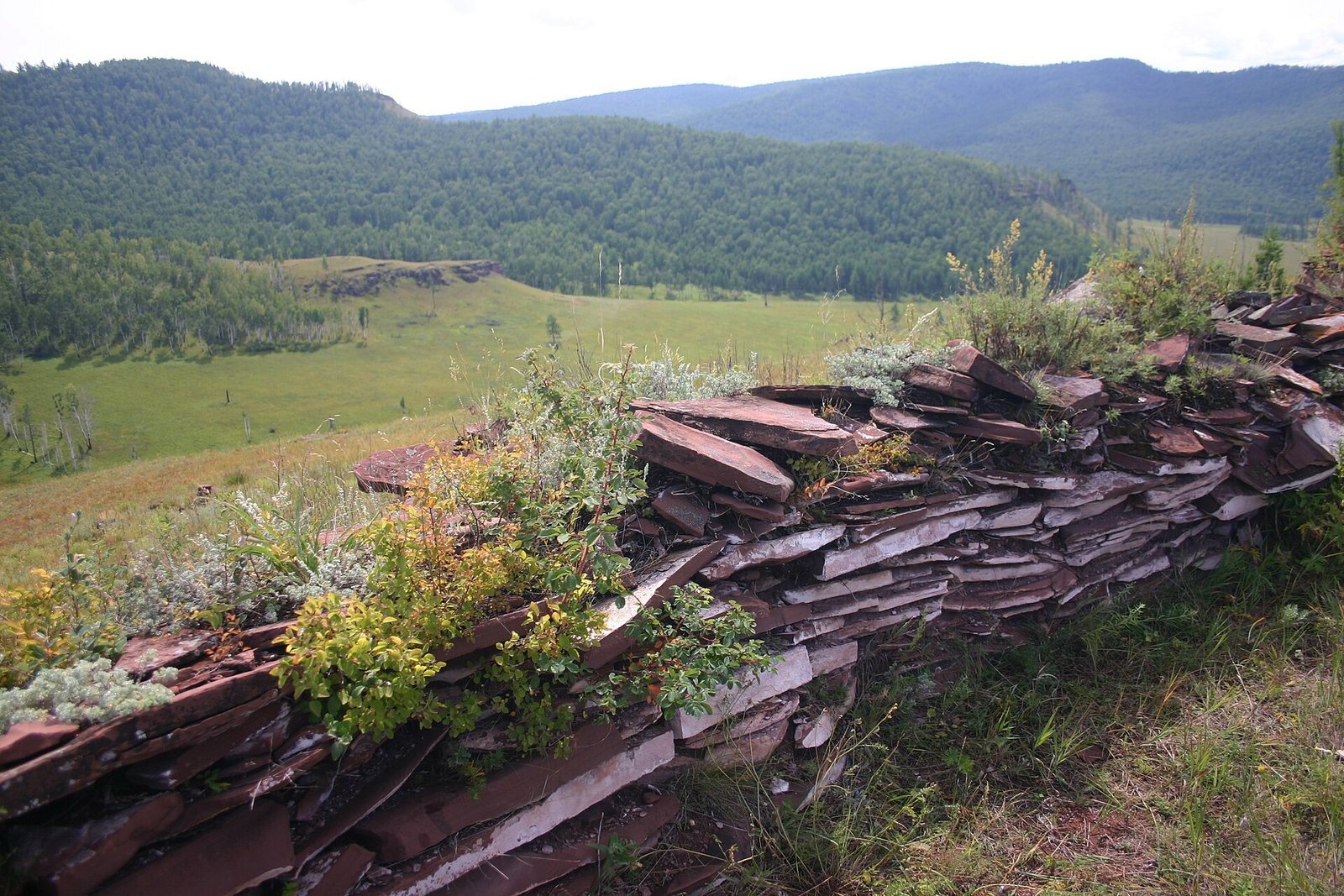
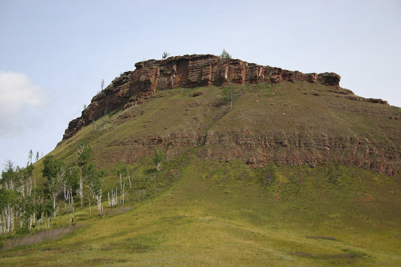
The fortress occupies the summit of Mount Takh on the right bank of the Black Iyus River, about 4.5 km northeast of Chebaki village. The mountain is not the range’s highest point; steep rock faces form part of the site’s setting, and the summit can be seen from different directions. Two lines of sandstone slabs laid without mortar enclose the summit, using dry-stone construction. Steep ground lies between the outer enclosure and the smaller inner enclosure.
Outer wall
The outer wall crosses a saddle to block the approach from a neighboring peak and encloses a summit area measuring 160 by 170 m. It is 210 m long. Its height reached 1.8 m during the period of research and is now up to 1.5 m; the masonry is described as well preserved.
Inner wall and citadel
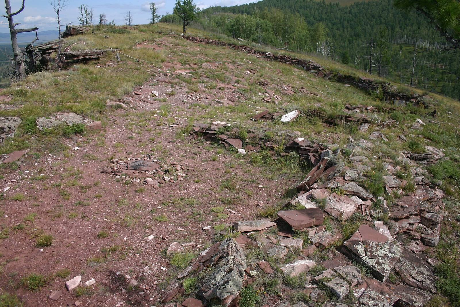
The inner wall surrounds the smaller summit area known as the citadel, the enclosed central part of the site. The outer and inner walls are thought to have been built together as one complex, rather than in separate phases.
Structures within the citadel
Semi-subterranean structure
Excavations close to the citadel wall uncovered a structure measuring about 4 by 15 m and partly set below ground.
Western stone enclosures
Two smaller stone structures stood close to the wall in the western part of the citadel. One was oval and measured 4 by 5 m; the other was subrectangular and measured 4 by 6 m.
Excavated materials
Excavation area and stone tools
Excavations covered 330 m² of the citadel. Its archaeological cultural layer, the accumulated material evidence of human activity, was 0.5–0.9 m thick. The layers had been redeposited, complicating the sequence of finds. Much of the excavated area contained collapsed slabs from the citadel wall and attached structures, with many finds recovered within or beneath them. The objects included charcoal, animal bones, stone axes and adzes, arrowheads, scrapers, and unused pieces from toolmaking.
Pottery
Pottery was the largest category of finds, with 1,304 fragments representing about 69 vessels and 95 percent of the Bronze Age pottery recovered. Much of it belonged to the Okunev culture and came from lower excavation layers; some pieces lay among or beneath the stone slabs. Its forms and decoration have parallels in Okunev burial sites in the Minusinsk Basin. Pottery of the Kamenno-Lozh culture was also found.
Animal bones
About 32,000 fragments of animal bone were recovered. Most came from wild species, with 16 represented, including roe deer, deer, elk, musk deer, wild boar, bear, lynx, fox, beaver, and birds. Isolated remains of domestic cattle, horses, and sheep were also present.