Château de Princé: A Succession of Feudal and Renaissance Estates in France
Site at a Glance
- Rating
- 4.4
- Popularity
- Very Low
- Country
- France
- Primary era
- Early Modern
- Eras represented
- Medieval, Early Modern, Modern
- Civilizations
- Duchy of Brittany, French
- Site type
- Domestic
- Remains
- Castle
On this page11 sections
History
Château de Princé is a succession of castles in France, at Chaumes-en-Retz, whose earliest feudal stronghold was mentioned in 1382 and whose later estate included a seventeenth-century Renaissance complex. Built in the forest of Princé, the site developed through several phases, of which only fragments of the principal château survive.
The medieval lordship
The first known castle was a moated feudal stronghold associated with the lordship of Retz. Jeanne Chabot, Lady of Retz, who was known as Jeanne the Mad, lived there. In 1400, she transferred the lordship of Princé to her grandson, Guy de Laval.
Gilles de Rais, a fifteenth-century French nobleman and military figure who accompanied Joan of Arc during campaigns against the English, later gave his name to the castle’s five-storey Bluebeard’s Tower. His association with the Bluebeard legend explains the traditional name, although the tower itself disappeared in the early twentieth century.
Henri de Gondi and the seventeenth-century estate
The estate was reshaped under Henri de Gondi, Duke of Retz. After relinquishing the ducal title to his son-in-law and cousin Pierre in 1634, Henri retired to Château de Princé, where he died on 12 August 1659. In 1641, the domain was reduced by 1,000 journaux, a traditional French land measure based approximately on a day’s ploughing, to help meet the owners’ expenses.
Henri de Gondi also commissioned a Renaissance pavilion and developed the Îles enchantées gardens. A plan from 1678 by François de La Pointe shows both the older castle and the new castle, as well as the ordered arrangement of the gardens and waterways. The château neuf became a recreational estate for the local aristocracy, associated with hunting, fêtes, and fairs.
Division, rebuilding, and destruction
In 1774, the estate was divided into two lots. The old château, ponds, and northwestern grounds formed one, while the pavilion, eastern lands, and woodland formed the other. In 1778, Jean Guillon, an écuyer and secretary to the king, purchased Princé vieux. He built a modern château and added a quadrangular belvedere to the surviving tower.
The name Princé appears on the Cassini map. During the War in the Vendée, a counter-revolutionary conflict in western France during the French Revolution, Republican troops under Adjutant-General Jordy burned the château on 2 December 1793. The building was reportedly partly rebuilt afterward, but it was eventually abandoned.
Another property known as Princé Neuf appears in the land register and was probably built as a country house during the nineteenth century. The nearby château neuf, also called the Palace of Pleasure, remained associated with the Îles enchantées and their aristocratic recreational landscape. Its local reputation for fêtes and fairs continued through the surviving remains of a podium.
Remains
The medieval château
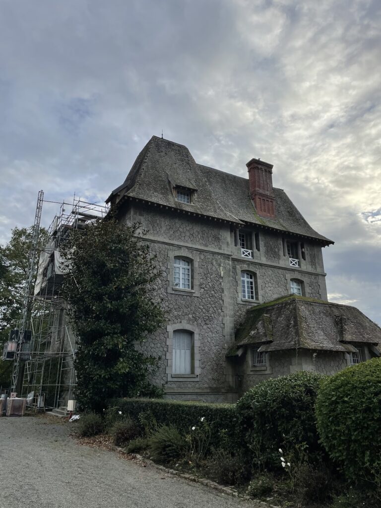
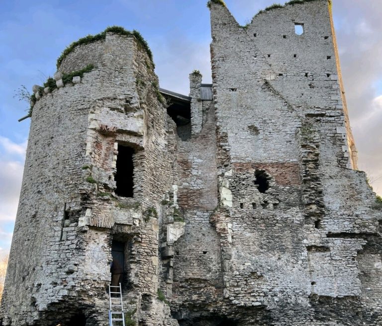
The principal château stands in ruins beside a pond. Its surviving elements include the entrance porch, windows, interior masonry, walls, moats, a landscaped water feature, and parts of productive gardens. The feudal castle occupied a mound within an enclosure and was surrounded by water-filled ditches, bridges, ponds, and wooded estate grounds.
The five-storey Bluebeard’s Tower has disappeared, but a small corner tower called the Chapel remains visible. A quadrangular belvedere was later built on the tower, linking the surviving fragment to the estate’s eighteenth-century rebuilding.
The château neuf and its islands
Canals and central buildings
The château neuf was arranged around a central building and other constructions set on islands within a canal network. Five islands were enclosed by almost 1 kilometre of canals. Two intersecting rectangles shaped the system, including an east-west rectangle 130 metres long and 78 metres wide. Their overlap created a central square surrounded by four canals.
Small monuments occupied the islands. Gloriettes, which were ornamental garden pavilions, stood on the four arms of the cross, while a pavilion occupied the central island. A proposed reconstruction places eight further small pavilions around the central château, although their elevations and exact window arrangements remain uncertain. Footbridges probably connected the château neuf to the islands, and small boats may have circulated through the canals. These elements belong to a proposed reconstruction rather than clearly surviving structures.
Gardens and surviving landscape features
The gardens combined kitchen gardens and orchards for food production with ornamental flower gardens and functional areas such as a kennel. Walls divided these areas. Some walls were rebuilt in the eighteenth century without following the earlier plan, and the entrance avenue was widened.
The central salon of the château neuf was dedicated to Apollo, Neptune, Pan, and Diana. Four other rooms were associated with tutelary deities. The building served as a hunting residence and formed part of a formally ordered Renaissance garden.
The present Îles enchantées retain fragments of the garden walls, water-management works, a dry hollow path that may represent a former canal, overgrown structures, wooden footbridges, and the remains of the podium associated with the former fairs.
The Baignoir and water system
The Baignoir was a landscaped outdoor bathing feature integrated into the estate’s water system. Its remains form a triangular arrangement of walls measuring approximately 15 metres on each side. The structure is interpreted as the former inlet supplying a rural swimming pool. Its original water came from the large pond, which was fed by two streams, one descending from the forest ridge and another rising at the Lande de la Noé-Bertet. The exact remains were identified in 1992 after guided visits organized by V. Mathot.
A later Baignoir drew water from a stream near the Parc farm rather than from the pond reservoir. Its supply channel included a double barrage. A later embankment, approximately 50 metres long and 8.5 metres wide, connected the eastern edge of the Bois de la Taille with the Bois de la Hernerie. This alteration probably postdates the 1678 plan.
Tivoli enclosure and estate boundaries
The Tivoli enclosure occupied a wooded area between Château de Princé and the Îles enchantées. It lay beside the large kennel and within the estate walls, following the route of the Petit Canal, whose conduits supplying the château’s moats were buried.
Tivoli had a flattened rectangular plan aligned with the cardinal directions. A small solidly built structure stood at its southern corner. It was approximately 2 metres high and 3 metres in diameter, with a circular domed form possibly intended as shelter for hibernating tortoises.
A monumental gate closed the southern end of the embankment path at the edge of the Bois de la Hernerie. Broad walls flanked the gate, whose circular openings are known as oculi. The entrance was comparable to the northern gate of the château.
Nearby sites