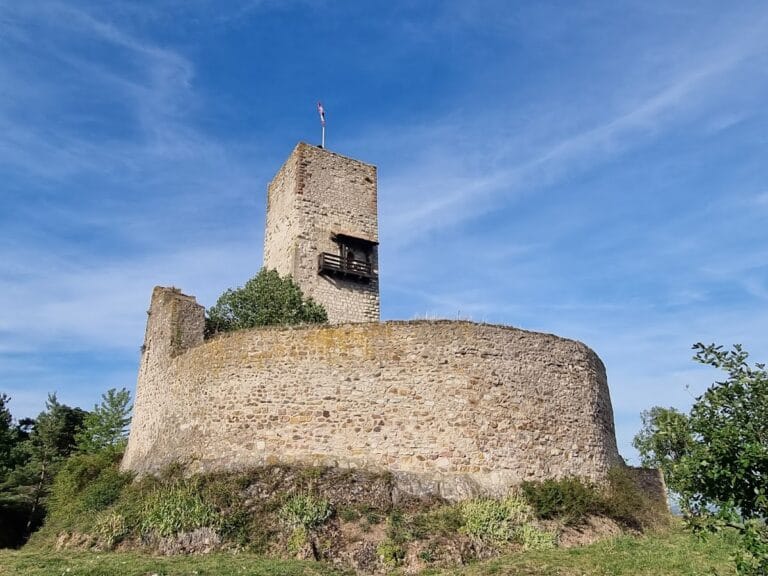
Château de Pflixbourg: A Medieval Imperial Garrison Fortress in France



Site at a Glance
- Rating
- 4.1
- Popularity
- Low
- Country
- France
- Primary era
- Medieval
- External website
- Open
- Eras represented
- Medieval, Modern
- Civilizations
- German, Holy Roman Empire
- Site type
- Military
- Remains
- Castle
On this page20 sections
History
Château de Pflixbourg is a medieval imperial garrison fortress in France, above Wintzenheim, built very probably between 1212 and 1219 on the initiative of Frederick II, the Hohenstaufen emperor of the Holy Roman Empire. Its early thirteenth-century construction strengthened imperial authority in Alsace and created a base for watching the entrance to the Munster valley, protecting Colmar, and controlling the Saint-Gilles priory.
Imperial foundation
The date before 1212 is considered unlikely because the surrounding territory remained in the hands of opponents of the Hohenstaufen until the dynasty seized the advocacy of Munster and supported Colmar’s emancipation in that year. An advocacy was a lay protective office over a religious institution and its lands. At the end of the twelfth century, the territory was divided among the abbeys of Munster, Payerne, and Constance and their dependent priories, including Saint-Gilles. The future castle site belonged to the lands assigned to Saint-Gilles.
The Hohenstaufen expanded their influence in the region through support for Colmar, the acquisition of advocacy rights over abbeys, and the construction of castles. Pflixbourg formed part of this policy. Its military role extended beyond the immediate stronghold. It monitored access to the upper Munster valley, helped protect Colmar, controlled the Saint-Gilles priory, and served as a base for the imperial army.
The fortress first appears in a charter of 1220 under the name Blickisberc. In that document, Frederick II granted it to Frederick of Schauenburg, who held it as imperial procurator, an official acting for the emperor or the empire. The name later took forms including Plixiberg in 1276 and Blixperch in 1298. Pflixburg and Plixburg are also used for the castle.
Officers, pledges, and changing jurisdiction
After the Habsburgs came to the imperial throne, Pflixbourg remained associated with imperial officers. It appears to have been the official residence of Conrad Werner of Hattstatt, the Landvogt of Upper Alsace. A Landvogt was an imperial territorial governor or bailiff. His wife died at the castle in 1276.
The construction of Hohlandsbourg in 1279 reduced Pflixbourg’s strategic value. Hohlandsbourg offered more effective control of the area around Colmar, and rights formerly linked to Pflixbourg gradually shifted elsewhere. Jurisdiction over the Saint-Gilles priory and the village of Hausen passed progressively to Hohlandsbourg and Kaysersberg.
From 1298 and through the fourteenth century, the castle was repeatedly pledged. King Adolf of Nassau pledged it to the Üsenberg family in 1298, Otto IV of Ochsenstein held it from 1316, and King John of Bohemia received it in 1330. In 1375 it was pledged to the lords of Hus. At an undetermined date, Pflixbourg became a fief of the House of Issenheim, possibly through that family’s marital connections with the Hattstatt.
The castle’s changing ownership reflected the transfer of the rights attached to it. The settlement of Hausen, also called Husen, is known by 1269 and was under the jurisdiction of Pflixbourg’s lord during the fourteenth century. It may have possessed its own church, but its exact location remains unknown. Archaeological investigations have shown that it did not stand immediately north of the castle, and the function and date of a terrace near the mountain pass remain uncertain.
Decline and abandonment
The House of Issenheim became extinct in 1430. Emperor Sigismund then granted Pflixbourg to his vice-chancellor, Caspar Schlick. Schlick sold the castle in 1434 to Maximin I Smassmann of Rappoltstein, together with the remaining rights associated with it, a mill, and the villages of Gunsbach and Griesbach.
The Hattstatt family continued to claim the castle during the fifteenth century. Their dispute with the Rappoltstein family contributed to a feud. Pflixbourg is not mentioned after 1434, and no occupation later than the fifteenth century has been identified. The castle was probably abandoned around the middle of that century, when the Rappoltstein family already held numerous nearby castles and had little practical use for a large and costly fortress.
Older tradition attributes the castle’s end to a siege and destruction around 1450, but neither documentary nor archaeological evidence supports that event. Pflixbourg was not located on the principal north-south routes and probably did not protect long-distance roads or block an invasion from Lorraine, as earlier interpretations proposed. Its known local communications included a path to Hohlandsbourg and a route joining the Munster-Colmar road near Saint-Gilles. Lidar surveys have also indicated another route between the castle and the priory, possibly connected with settlement terraces and the site of Husen.
Investigation and modern military use
Initial consolidation began in 1864, when the keep and cistern were cleared and part of the wall near the entrance was rebuilt. Soundings carried out during restoration work in the 1970s and 1980s were followed by investigations in 2010, focused mainly on the outer fortifications, ditches, and area around the sump. Research by Thomas Biller and Bernhard Metz, together with the 2010 investigations, rejected claims of prehistoric or earlier occupation, a castle village immediately north of Pflixbourg, construction before 1212, and attribution of the building to Wölfelin.
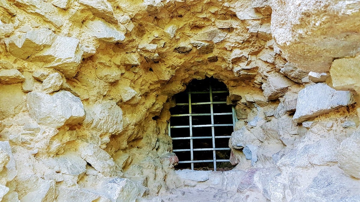
The masonry underwent major restoration in the 1980s and again in 2006 and 2007. Work included the north-eastern curtain wall, while the cistern was restored and protected with a grating. During the First World War, the German army occupied and fortified the summit from 1915 because its position could help control the Munster valley during the attempted French advance in spring that year. The castle played only a marginal part in the fighting, since French forces were repulsed and then held farther up the valley during the Battle of Linge.
Château de Pflixbourg has been protected as a French monument historique since 17 December 1968. The commune of Wintzenheim owns the site, which survives as a ruin.
Remains
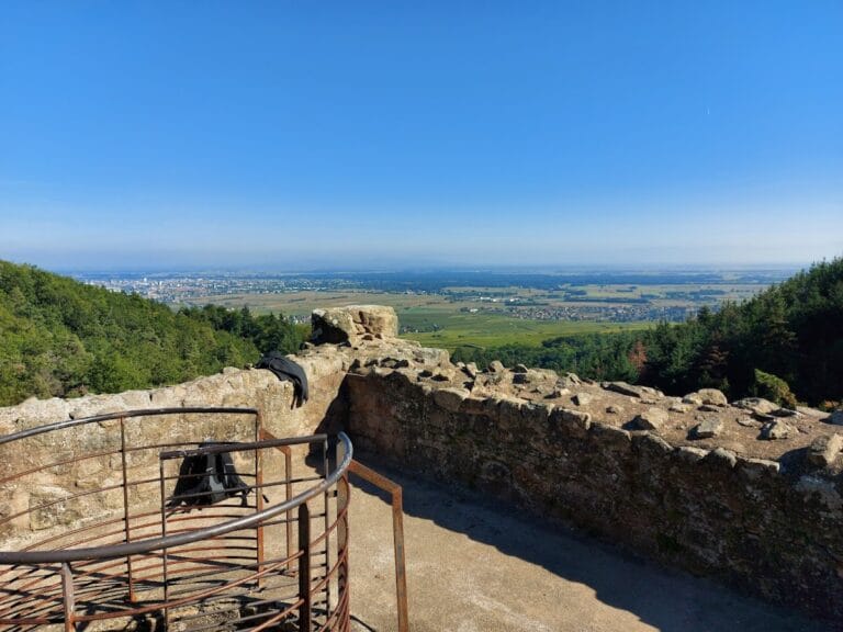
The fortress occupies a north-western projection of the Ehrberg at an elevation of 454 metres, roughly 200 metres above the valley floor and opposite Zimmerbach. It stands on a steep-sided, sugarloaf-shaped granite summit of the Turckheim granite formation. The Wilsbachgraben ravine borders the site to the south-west, the Saint-Gilles ravine lies to the east, and a mountain pass on the eastern approach rises about forty metres toward the castle. The position overlooks the upper Munster valley, while a higher projection of the Ehrberg restricts the view toward the Alsatian plain.
Fortress plan and stonework
The castle follows the form of the rock in an elongated polygonal plan. Measurements give approximately 81 metres in length and 40 metres in width, although another architectural description gives about 70 by 40 metres. Ditches surround the enclosure, and buildings were attached to most of its inner perimeter.
Granite forms almost the entire fortress. Much of the stone was quarried on the summit while the rock was levelled and the ditches and building basements were cut. Two small quarries a few dozen metres north-west of the castle probably supplied additional stone late in the construction process. Quarry workers extracted blocks in benches with a lever along natural fissures.
The granite blocks vary from about 12 to 30 centimetres in height. The keep’s outer facing uses larger blocks than its inner facing and the curtain wall. The wall cores contain rubble and quarry waste bound with lime mortar, whose limestone was brought from Florimont hill north-west of Ingersheim. Fine-grained pink sandstone of uncertain origin was used for window surrounds and other openings.
Keep and entrance
Entrance corridor
At the entrance, the curtain wall turns inward at right angles to create a 13-metre access corridor. The gateway itself, positioned almost directly beneath the keep and controlled from it, has largely disappeared. A small opening in each side of the corridor may have served as an arrow slit or simply as a lighting opening. This form of entrance corridor is the only surviving example of its type in Alsace.
Cylindrical keep
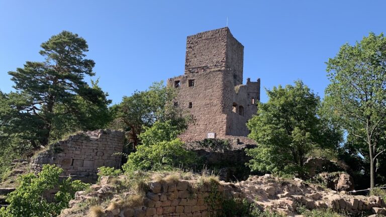
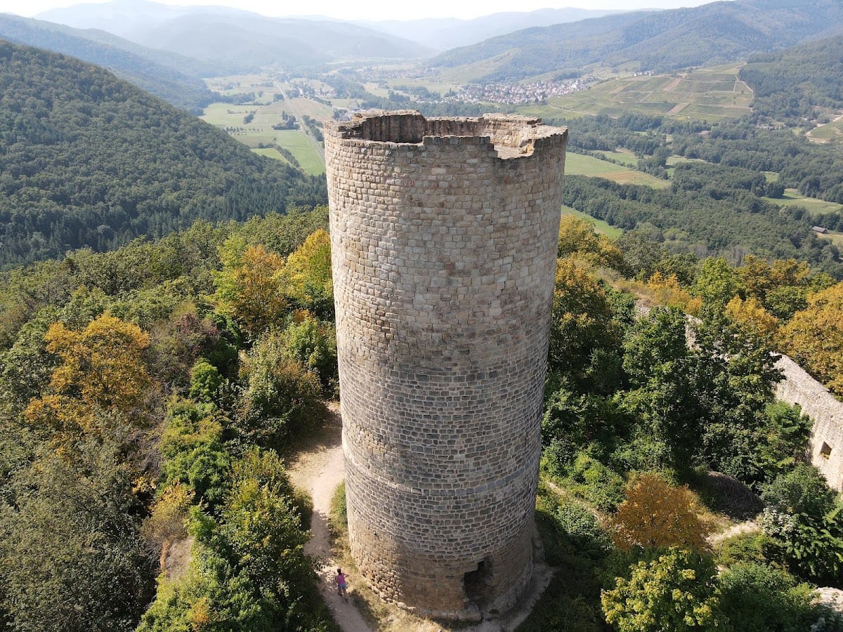
The cylindrical keep stands at the highest point, just beyond the gateway and independent of the curtain wall. It lies about six metres from the wall at its closest point, rises 23 metres, and measures approximately 9.50 metres across at the base. Its walls average three metres in thickness, leaving an interior only about 3.25 metres in diameter.
The tower is a bergfried, a fortified keep intended for combat rather than permanent residence. It is almost entirely blind, with only its entrance and a small opening opposite it. The entrance has a pointed arch, among the earliest known examples of this form in Alsatian castle architecture. Its sandstone jambs carry two nearly identical masons’ marks.
Set 9.50 metres above ground level, the entrance opens onto the second level and was reached by a removable wooden structure. Below it is the lowest level, sometimes called an oubliette level, while two further floors survive above the entrance level. Their floors rested on roughly carved stone corbels. The battlement walk at the top was covered with brick during the fifteenth century. Much of the parapet remains, although most of its merlons, the solid raised sections between openings, have disappeared. Foundation traces on the west side may indicate a former circular enclosure around the keep, but the surviving evidence cannot determine whether it was a low wall or a complete enclosing wall.
Buildings within the enclosure
Western buildings
The western range is the best-preserved group of buildings. Between the gateway and the western corner, four cross-walls create five spaces, each about 6.5 to 7 metres wide at its base. Because the ground slopes, these rooms form a basement level. Each received light through three to five openings in the curtain wall, whose narrowness and height exclude their use as arrow slits.
A later rebuilding doubled the thickness of the second cross-wall from the gateway. This is the only alteration identified after the castle’s initial construction, although its date is unknown. Above the basement was a residential level whose internal arrangement cannot be reconstructed because its partitions have disappeared. The curtain wall at this height contains two latrines, a broad window with stone seats, two paired windows, and three other windows in the northern half. The southern half is blind as far as the western corner, where two additional windows occur.
Parts of the sandstone frames of the paired windows remain. They are decorated with a medallion bearing a fleur-de-lis and a ball-shaped motif that was common in Upper Alsace during the early thirteenth century.
Eastern buildings
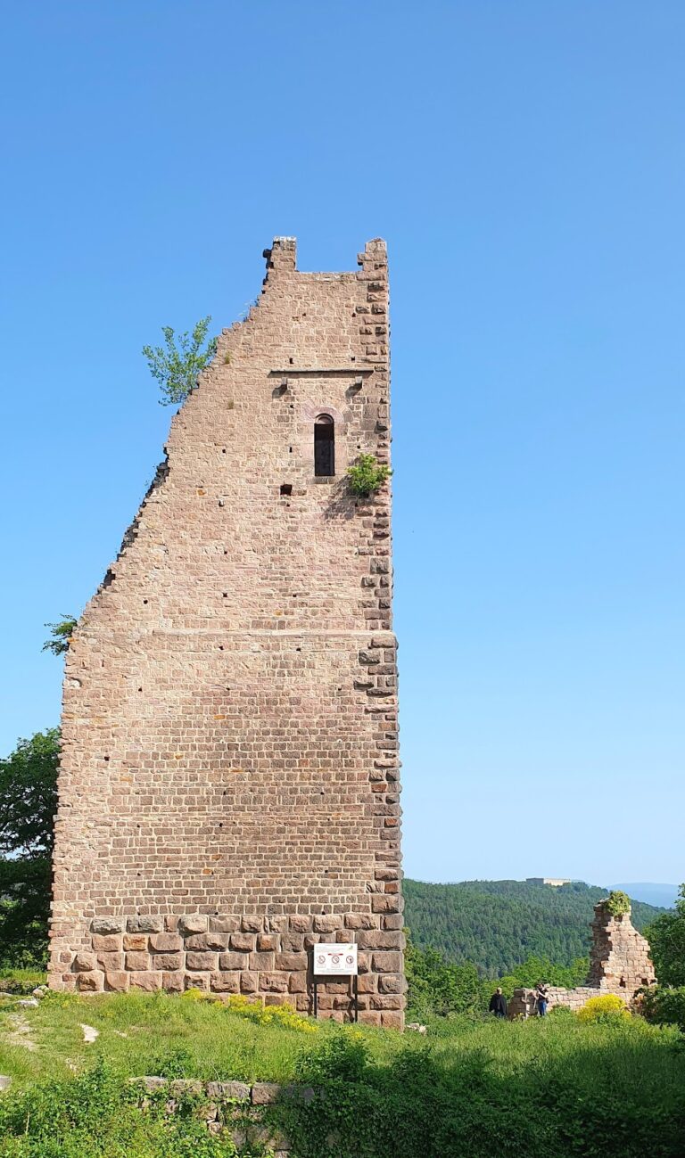
The eastern buildings are more damaged. Five basement spaces can still be identified, but the upper floor has deteriorated too far for its arrangement to be reconstructed. Five lighting slits pierce the northern curtain wall. The north-eastern wall and eastern corner, facing the approach, are almost blind, while seven further lighting slits in the south-eastern curtain wall indicate a building whose above-ground elevations have disappeared.
Ditches and outer defenses
Peripheral ditch
A ditch cut directly into the rock runs below the curtain wall. Its depth and width change with the terrain, and parts of the southern and south-eastern stretches are reinforced with rough dry-stone masonry. Near the southern point, a depression contains traces of a foundation. Its purpose and date are uncertain, although entrances to concrete galleries nearby suggest a connection with the First World War.
Eastern defensive ditch
A second ditch lies about forty metres east of the peripheral ditch, cutting across the mountain spur where the gentler slope created a more vulnerable approach. It extends for approximately 120 metres and is 1.90 metres deep relative to the original ground level. Its outer bank is about 3.50 metres wide and 1.35 metres high. A thorn hedge may have stood on the bank, while a palisade has been excluded.
The ditch does not continue north or south, where the slopes are steeper. Investigations in 2010 showed that an apparent continuation of the western defensive line was instead part of a water-collection system linked to the lower sump.
Western ditch
Another ditch lies about fifty metres west of the peripheral ditch. Its shallow profile and low bank, only about 0.80 metres high, reflect more rudimentary construction. Its medieval date remains uncertain because German military maps place machine-gun positions there during the First World War.
Water storage and supply
Cistern
South-west of the keep, a small rectangular building shelters a barrel-vaulted cistern with a pointed vault. The reservoir measures 4.75 by 7.25 metres and is five metres from its floor to the crown of the vault, giving it an approximate capacity of 140 cubic metres. It is partly cut into the rock and partly built in masonry. Its surfaces are coated with waterproof lime mortar mixed with crushed tile.
A circular sump, a shaft or basin into which collected water drains, is cut into the floor for maintenance. It is 0.60 metres high and 1.20 metres across. The vault has a central square opening for drawing water and another opening at its eastern end for filling the reservoir.
Lower sump and hollow way
The cistern had no separate catchment system and was probably supplied largely from a sump outside the fortifications. That lower sump lies about 100 metres north-west of the castle and forty metres below it. Its granite walls form a conduit about 1.10 metres in diameter and were built without mortar. Water filtered through granitic sand from the surrounding drainage basin collects there. The sump holds at least 17 cubic metres, and its original curb has disappeared.
Pack animals carried water from the lower sump to the cistern along a hollow way, a recessed route formed by use or deliberate cutting into the ground. The path runs straight from the eastern defensive ditch before turning almost at a right angle around the sump and then climbing gently toward the castle. Its east-west stretch has a central rubble bed to limit erosion and steady the route for loaded animals. Ceramics from the hollow way date to the early thirteenth century, indicating that the sump was established first, partly to supply the construction work.