Catequilla: An Equatorial Ceremonial and Astronomical Landscape in Ecuador
Site at a Glance
- Rating
- 4.4
- Popularity
- Very Low
- Country
- Ecuador
- Primary era
- Medieval
- Eras represented
- Medieval
- Civilizations
- Unclassified
- Site type
- Religious
- Remains
- Sanctuary
On this page14 sections
History
Catequilla is a group of seven places associated with Catequil worship in Quito, Ecuador, with the principal archaeological site at Monte Catequilla in the San Antonio Parish. Attributed to the pre-Columbian Quitu-Cara culture and generally dated to around AD 800, Monte Catequilla probably served as a viewpoint, ceremonial bohío, and astronomical observatory before the Inca arrival. The name has been interpreted as referring to an aquatic rush or, in Barbacoan languages, to jatiquilla, meaning “following the moon.”
Monte Catequilla and the Equator
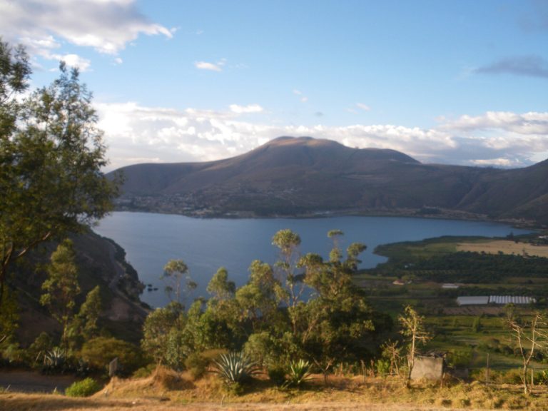
Monte Catequilla rises in the Pomasqui Valley on the terrestrial Equator, opposite the modern Mitad del Mundo monument. The French Geodesic Mission, an eighteenth-century expedition that measured the shape of the Earth and surveyed the Equatorial region, worked in the area between 1735 and 1745. Current GPS measurements place the modern monument about 240 metres south of the actual Equator.
Excavations, including investigations by the archaeologist Oswaldo Tovar, recovered Quitu-Cara, Inca, and colonial ceramics. These finds indicate that the site remained important and occupied through several cultural periods. Its stone disks have been examined for relationships with stars, solar cycles, astronomical alignments, and geodetic alignments. Their purpose remains disputed. A local interpretation identifies them as threshing surfaces, while 27 detected alignments strongly challenge that explanation.
Monte Catequilla, the stone circles of Jarata, and those of Pacpo form a straight alignment associated with the shadow cast by the mountain relief at the June solstice. The remains have also been interpreted as part of a pre-Inca lunisolar calendar system. Colonial evangelization reportedly destroyed pillars that once stood on the disks because they were considered idolatrous. Later interpretations proposed that the pillars had served as solar clocks, or gnomons, vertical markers whose shadows indicate the Sun’s position.
The site is now virtually abandoned. Nearby mining activity threatens its physical integrity, and effective official action had not been taken by 2011. The archaeological landscape also includes the Inca stone fortress of Rumicucho, approximately 1,550 metres north of Monte Catequilla.
Catequil worship and the seven places
The wider Catequilla tradition is linked to Catequil, an Andean deity associated in Ecuador with water, weather, animals, initiation, and supernatural strength. Sacred places called pilu, or pools of Catequil, could be lakes, rivers, springs, or other water sources. The initiation rite traditionally took place at a spring or pool, often at midnight during the waning moon. It involved cold, solitude, and ritual bathing associated with sacred animals, especially frogs at the beginning and snakes at the end of the ceremony.
The seven places called Catequilla were identified through chronicles or place names referring to springs, hills, or both. Four are associated with Puruhá territory, two with Panzaleo territory, and one with Caranqui territory. The Ecuadorian cult differed from the cult of Catequil in Cajamarca. Archaeological evidence places the worship of the deity in Ecuador before the Inca conquest, while the proposed Cajamarca origin and later expansion under Huayna Capac remain contested. In Cajamarca, Catequil was associated with thunder, whereas Puruhá tradition associated thunder with Huactahuay and Pillallau.
Colonial descriptions of Quito used Catequilla for a water-growing rush. This meaning has been connected with the former lagoons of Añaquito and Turubamba, where such plants reportedly had ceremonial uses, and with a hill near the ruins of Rumicucho and the Monjas River. The word therefore carried both a botanical meaning and a wider religious association with water places.
Temples, springs, and colonial transformation
At Cerro Zumbi near the Chimbo River, a temple dedicated to Catequil is attributed to the Puruhá culture’s Guano or San Sebastián period. Its position connected routes between the highlands and the coast through the Chimbo, Yaguachi, and Guayas river systems, as well as routes between Milagro-Quevedo and Puruhá territories. Ritual sacrifices were traditionally performed there. After evangelization, related practices were transformed into the Gallo Compadre, an Ecuadorian festival associated with the reshaping of earlier Indigenous ceremonies. The site retained religious importance into the eighteenth century, when a miraculous cure was recorded for the corregidor, or colonial magistrate, of the Corregimiento of San José de Chimbo.
Other Catequilla places acquired Catholic identities while retaining associations with springs and hills. At Chambo, a spring became linked to the sanctuary of Our Lady of the Fountain of Carmel. Oral tradition tells of Feliciana Pilatuña seeing the Virgin Mary and the Christ Child beside the water, followed later by the discovery of an image of Our Lady of Carmel with the Child Jesus in a rock. After an attempt to damage the image with dynamite injured the local commissioner, he ordered a chapel to be built. The bishop of Riobamba later established July 16 as the feast of the Virgin.
Catequilla de Tisaleo is associated with the Quebrada Catequilla and its springs on the boundary between Puruhá and Panzaleo-Quitu territory. It became connected with Saint Lucy, regarded locally as patroness of sight, after her image was brought to the area on December 13, 1584. The spring also forms part of the Inga Palla festival, which commemorates a traditional account of a 1534 battle between Indigenous forces led by a local Inga and Spanish invaders.
At Catequilla de Quero, the spring became associated with Our Lady of the Rosary of the Mountain. The devotion was first housed in a hermitage on Cerro Mulmul beside a stream called “yellow water.” An ecclesiastical parish was created in 1797, and the image was later transferred to the Sanctuary of Our Lady of the Mountain. Catequilla de Latacunga consists of a mineral spring near the Cutuchi River, on the sacred Catequilla hill. It has served bathing, healing, ceremonial, and irrigation purposes, although pollution, climate change, mining, and contamination associated with some shamanic practices threaten the spring, whose flow has declined.
Catequilla de Guachalá lies on the Equatorial line near the historic Guachalá estate, described as Ecuador’s first hacienda and formerly covering about 12,000 hectares. The estate hosted members of the French Geodesic Mission and stood between Cayambe and Tabacundo, former Indigenous reductions, or Spanish colonial settlements that concentrated Indigenous communities for administration and religious instruction. A church built there in 1580 stood over an earlier Inca temple, which itself had been constructed over Quitu and Caranqui structures. Its deteriorated mural of Heaven and Hell dates to 1757. After the Cangahua Parish was created in 1779, the church’s functions were transferred elsewhere.
At San Catequilla in Pichincha, a summit temple was associated with a clay idol with an open mouth. Franciscan accounts described sacrificial practices continuing after the Spanish conquest and the idol being destroyed during an attempt to save a final intended victim. The idol was said to have been made from sacred quishihuar wood. A later image of Christ carved from the same wood became associated with the Lord of the Tree, while a convent of Poor Clare nuns was established at Pomasqui to consolidate evangelization in the area.
Remains
Monte Catequilla
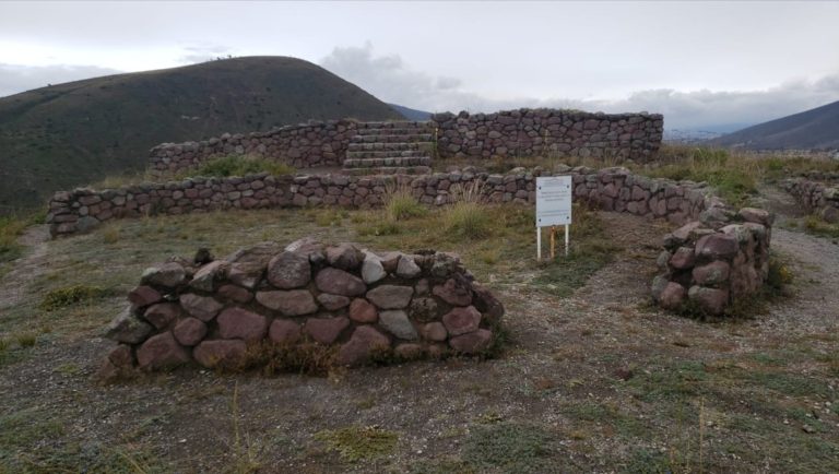
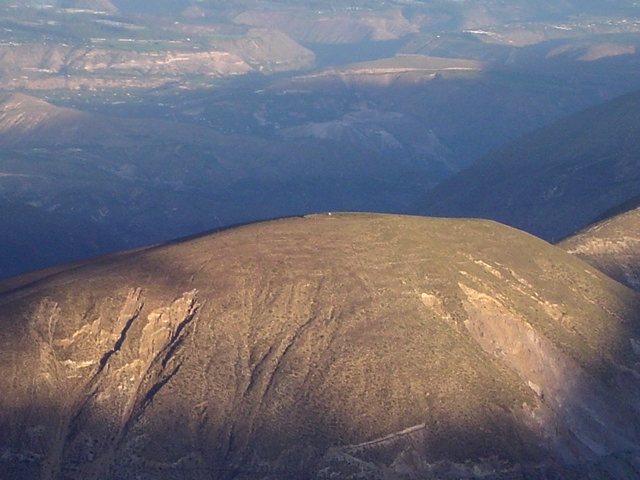
Monte Catequilla stands at 2,638 metres on a mountaintop about 300 metres above the valleys on either side. Its elevated position provides a 360-degree view, from which approximately 25 ancient settlements can reportedly be distinguished. The site was positioned near an ancient spring that has since dried up. Its surviving features consist chiefly of a large semicircular stone wall and a series of lithic disks, or stone-filled platforms, distributed across the summit and surrounding area.
Semicircular wall
The principal wall forms a semicircle approximately 107 metres long and 68 metres in diameter. Its precise ends are uncertain because no clear architectural features define the limits of the arc. The surviving height ranges from about 25 centimetres to 1.2 metres, while adjacent rubble suggests that it may originally have exceeded 2 metres.
The eastern end has an azimuth, or horizontal direction measured from north, of approximately 113 degrees, and the western end has an azimuth of about 293 degrees. The eastern end is described as reaching the actual Equator, while the western end lies slightly farther north. The orientation corresponds closely with the June-solstice sunrise and December-solstice sunset, although the uncertain limits of the wall prevent a completely precise reconstruction.
Stone disks and alignments
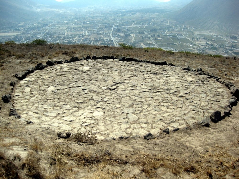
A circular stone disk or filled platform about 8 metres across occupies the northwestern part of Monte Catequilla. It is built mainly from quarry stones and contains three lines of stones, two crossing its diameter and one arranged radially. Thirteen prehistoric disks have been counted in the surrounding area, although local collaboration has revealed some of them and further examples may remain buried.
The disks at Monte Catequilla, Jarata, and Pacpo lie along a straight line associated with the seasonal shadow of the surrounding mountain relief. They have also been interpreted as bases for pillars used to observe solar cycles and the night sky. The proposed astronomical function remains debated, particularly because the disks have also been described locally as threshing surfaces.
Other Catequilla sites
Cerro Zumbi temple
The Catequil temple at Cerro Zumbi near Chimbo had a rectangular plan measuring approximately 35 by 25 metres. It had doors on both lateral sides. The western entrance led into the temple, while the other opened toward a plaza used for Catequil ceremonies. Each doorway was about 11 metres wide.
The present Loma de Catequilla is a thermal-water resort believed locally to have medicinal properties. A viewpoint on the road to the Sanctuary of the Virgin of Guayco was used during evangelization campaigns to promote Catholicism and replace Indigenous religious practices. A monument to Saint Joseph now stands on the hill and gave its name to the settlement of San José de Chimbo. The principal hill is also called Susanga.
Tisaleo and Quero springs
Catequilla de Tisaleo includes a ravine, a public square, springs, and the Saint Lucy Grotto at the spring associated with the Virgin. The spring still produces water, though in smaller quantities than formerly, and worshippers regard it as holy water. At Catequilla de Quero, the spring forms part of the drinking-water system of the San José de Puñachizag community. It lies near Cerro Mulmul and the former hermitage of Our Lady of the Rosary of the Mountain beside the “yellow water” stream.
Latacunga and Guachalá
The Catequilla site at Latacunga consists of a mineral spring on or near Cerro Catequilla. Its water is used for local irrigation, including in the community of Pitigua, while mining activity continues on the hill. At Guachalá, the former church retains the deteriorated 1757 mural of Heaven and Hell. The nearby Catequilla hill was interpreted as an observation point for solar cycles and the full night sky.
San Catequilla in Pichincha
The archaeological remains at San Catequilla include a semicircular wall and lithic disks. A surviving wall segment inclines eastward toward the south and westward toward the north, matching the recorded azimuths. The summit was also associated with a temple containing the idol and an internal channel leading from the idol’s mouth into the ground. Nearby evidence was identified as an acta huasi, a place associated with women selected for sacrifice.
Archaeological reconstruction
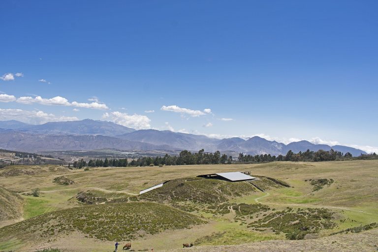
In June 1997, the National Institute of Cultural Heritage in Quito reconstructed a major enclosure at nearby Quitsato. The work combined satellite technology with archaeological observations to investigate whether the Catequilla and Quitsato remains formed part of a lunisolar calendar system. The reconstruction belongs to the modern history of interpreting this wider Equatorial archaeological landscape, whose surviving walls, disks, springs, temples, and later religious structures preserve several overlapping cultural traditions.