Castra Albana: A Roman Legionary Fortress in Italy
Site at a Glance
- Popularity
- Medium
- Country
- Italy
- Primary era
- Classical
- Eras represented
- Classical, Medieval
- Civilizations
- Roman
- Site type
- Military
- Remains
- Fort
On this page27 sections
History
Foundation and Severan rule
Castra Albana was a Roman legionary fortress at present-day Albano Laziale, Italy, founded around AD 198 by Emperor Septimius Severus as a permanent base for Legio II Parthica. It was the only permanent legionary fortress in Italy. Severus brought the legion close to Rome after a civil war, partly to protect himself while the Praetorian Guard, the emperor’s elite guard in Rome, had been temporarily dissolved.
Legio II Parthica had been raised in AD 197 for Severus’s campaign against the Parthians, which ended the following year with the sack of Ctesiphon, a Parthian capital in present-day Iraq. The legion also served elsewhere, including in Mesopotamia, and was not continuously stationed at Castra Albana. Before the fortress was built, earlier walls or fortifications on the site were levelled. The camp’s position near Rome and the imperial estate at Castel Gandolfo formed part of its strategic setting.
The name Albana reflected regional naming traditions associated with the Alban Hills and Lake Albano, which were linked in legend to Alba Longa, a city traditionally connected with Rome’s origins. The legion itself became known as Legio Albana, and its soldiers as Albani.
After Caracalla had his brother and co-emperor Geta killed, Legio II Parthica refused to accept Caracalla as sole emperor. Caracalla went to the camp and persuaded the troops to remain loyal, increasing their pay by half. He also commissioned the Baths of Caracalla, probably for the garrison.
Later imperial period and abandonment
Ancient histories mention the legion under Macrinus, Elagabalus, Alexander Severus, Maximinus Thrax and Philip the Arab. Inscriptions record changing honorific names: Severiana under Septimius Severus or Alexander Severus, Antoniana under Elagabalus, and Philippiana under Philip. After the Battle of Antioch in AD 218, Elagabalus granted the legion additional honors.
The amphitheatre was built in the middle of the third century, after the fortress and baths. Its construction may mark the end of the legion’s most prosperous period, and the troops may already have left Albano. Giuseppe Lugli established the amphitheatre’s third-century date after it had long been associated with Domitian’s villa.
The fortress was abandoned in the late third or early fourth century as civilian settlement spread across it. By the beginning of the fourth century, the legion had moved to Bezabde on the eastern frontier. It was last mentioned in the early fifth century at Cepha, after which it disappears from the historical record.
Medieval settlement and archaeological identification
The Liber Pontificalis, a collection of papal biographies, credits Constantine I with founding the cathedral of San Giovanni Battista during the pontificate of Pope Sylvester I. It also says that Constantine endowed the church with nearby property, including abandoned barracks and houses. Albano Laziale subsequently developed over the former camp.
Inscriptions associated with Legio II Parthica and its cemetery helped identify Castra Albana with Albano Laziale. The first discoveries at the Selvotta cemetery, near the boundary between Albano Laziale and Ariccia, were made in 1866 by Lorenzo Fortunato and examined by Nicola Wendt. Wilhelm Henzen proposed that the inscriptions came from a cemetery belonging to the legion. Henzen, Hermann Dessau and Rodolfo Lanciani surveyed and excavated the site in the late nineteenth century. Giuseppe Lugli worked there in 1908, 1910, 1913, 1945 and 1960–62, while Maria Marchetti Longhi led work in 1916.
Excavations in 1915–16 exposed sections of camp roads and buildings, and work in 1935–38 examined the Rotunda. An Anglo-American air raid on 1 February 1944 destroyed a later building that had incorporated the Porta Praetoria, bringing the Roman gate to light. Bombing also destroyed a building near San Paolo that had contained evidence of a probable circular turret. Work by the Albano Laziale Civic Museum and the Ramacci company in the 1980s uncovered further remains, including a road intersection and a building with a portico.
Remains
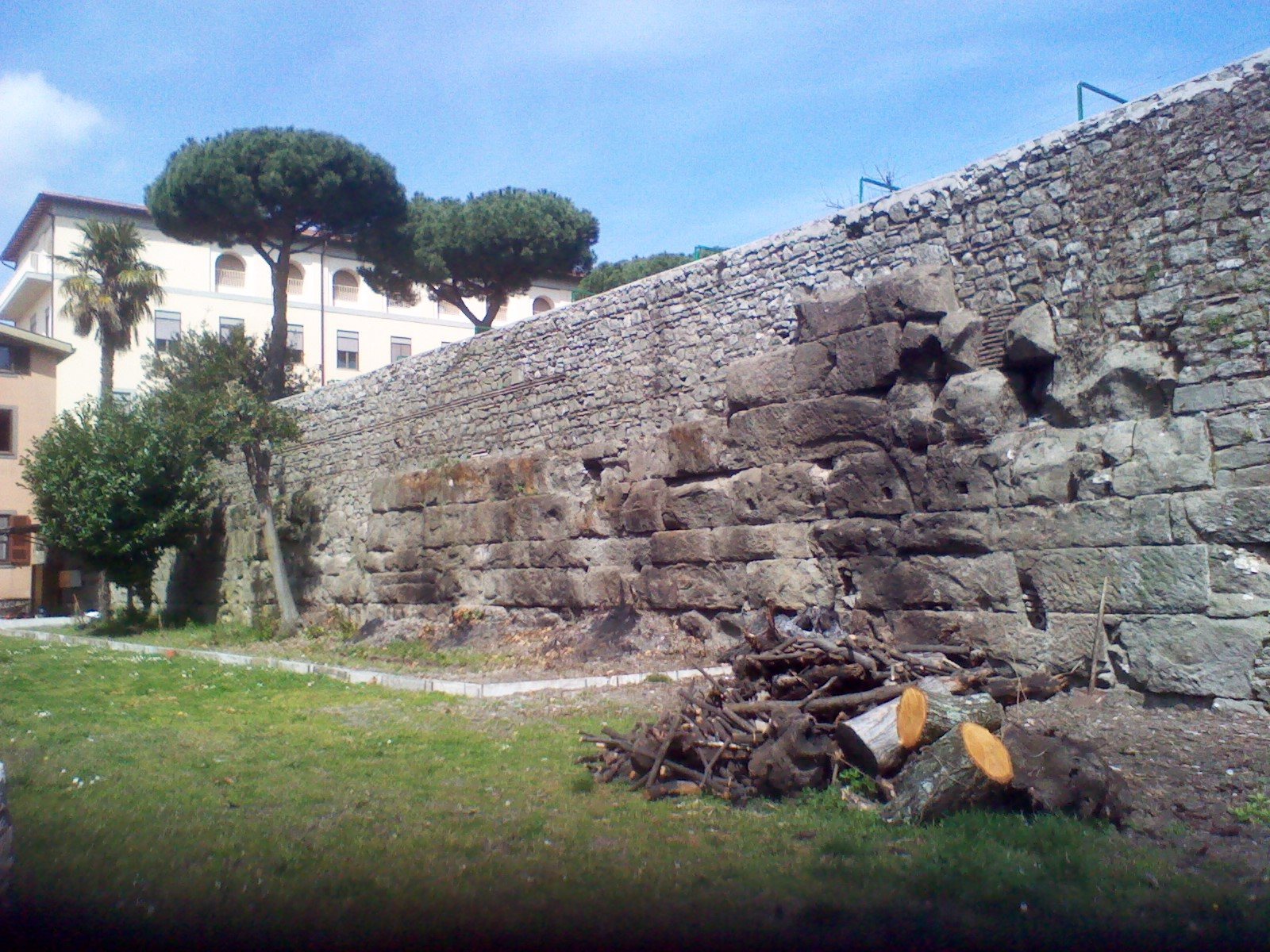
The ancient camp lies beneath modern Albano Laziale, with its remains generally between half a metre and two metres below today’s ground surface. It covered about 95,000 square metres and followed a regular rectangular plan with rounded corners. Its perimeter measured 1,334 metres; the northwest and southeast sides were 434 and 437 metres long, and the northeast and southwest sides 224 and 239 metres. Circular corner turrets formed part of the circuit. The walls were built from squared blocks of peperino, a volcanic stone from the Alban Hills. Since the ground slopes by about 11 percent, the arrangement of the blocks changed along the walls to accommodate the terrain.
Walls and gates
Northeast wall
A well-preserved section of the northeast wall extends for about 50 metres. It also retains an exterior embankment that reaches four metres in height. The Porta Decumana is thought to have stood near the middle of this stretch and may have been reached by steps or a ramp. At the corner by Via Tacito, the rounded ancient wall remains visible. Wall remains uncovered during water-system work at Piazza San Paolo in 1904 were laid in horizontal courses suited to the steep ground.
Southeast wall and gate
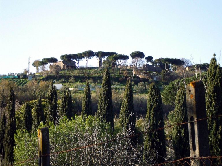
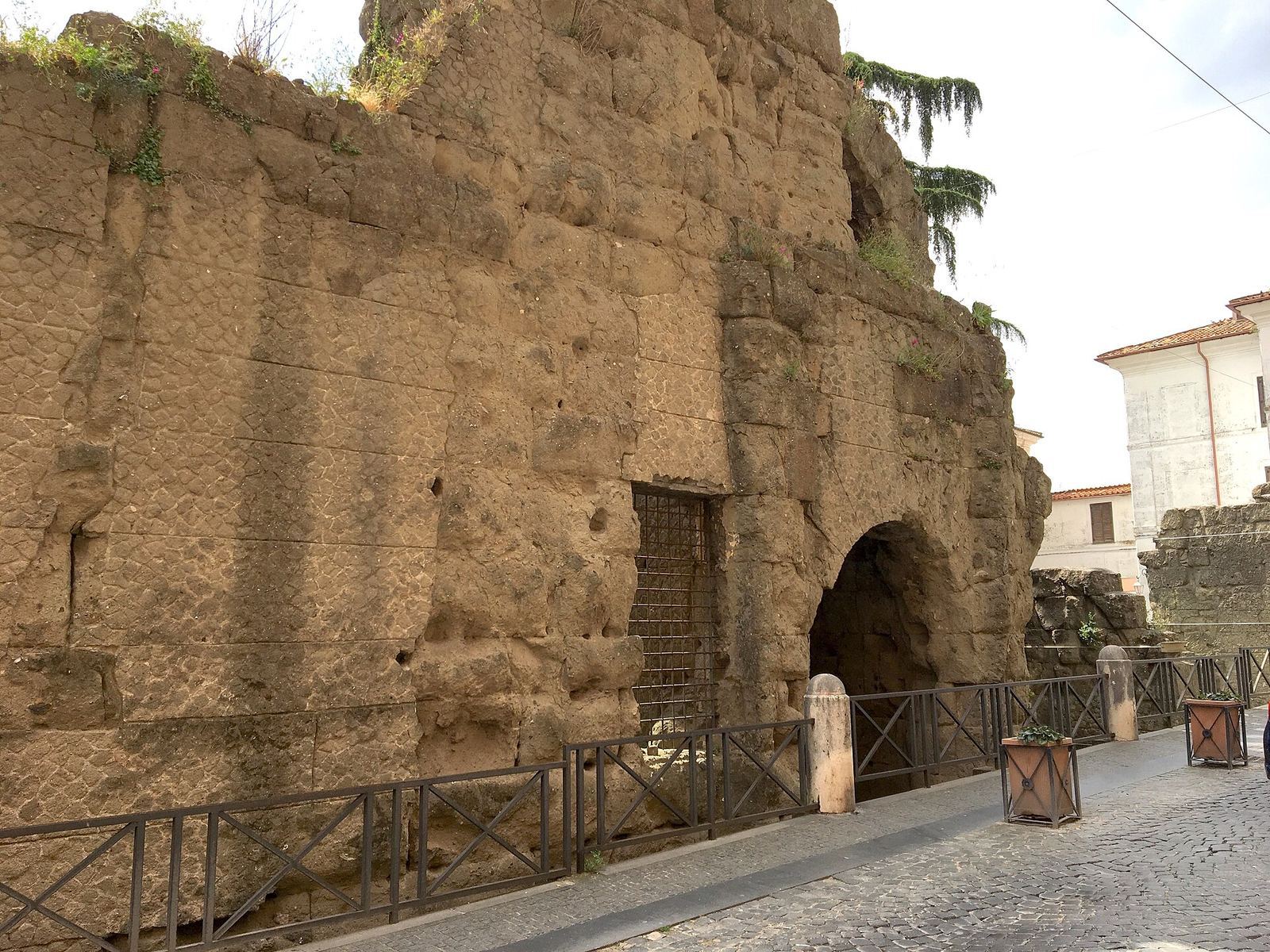
The best-preserved part of the circuit is on the southeast side, where 142 metres of wall include a rectangular guard tower and the Porta Principalis Sinistra. Located about 60 metres from a rounded corner, the tower is now used for agriculture. Its interior measures 5.90 by 3.85 metres. The walls are 0.90 metres thick, except for the outer wall, which is 0.59 metres thick; a 1.78-metre-wide entrance faces into the camp.
The Porta Principalis Sinistra survives as a single-arched opening 3.85 metres wide. The camp’s other principal gate, the Porta Principalis Dextra, is thought to have stood near a courtyard off Via Don Giovanni Minzoni.
Southwest wall and Porta Praetoria
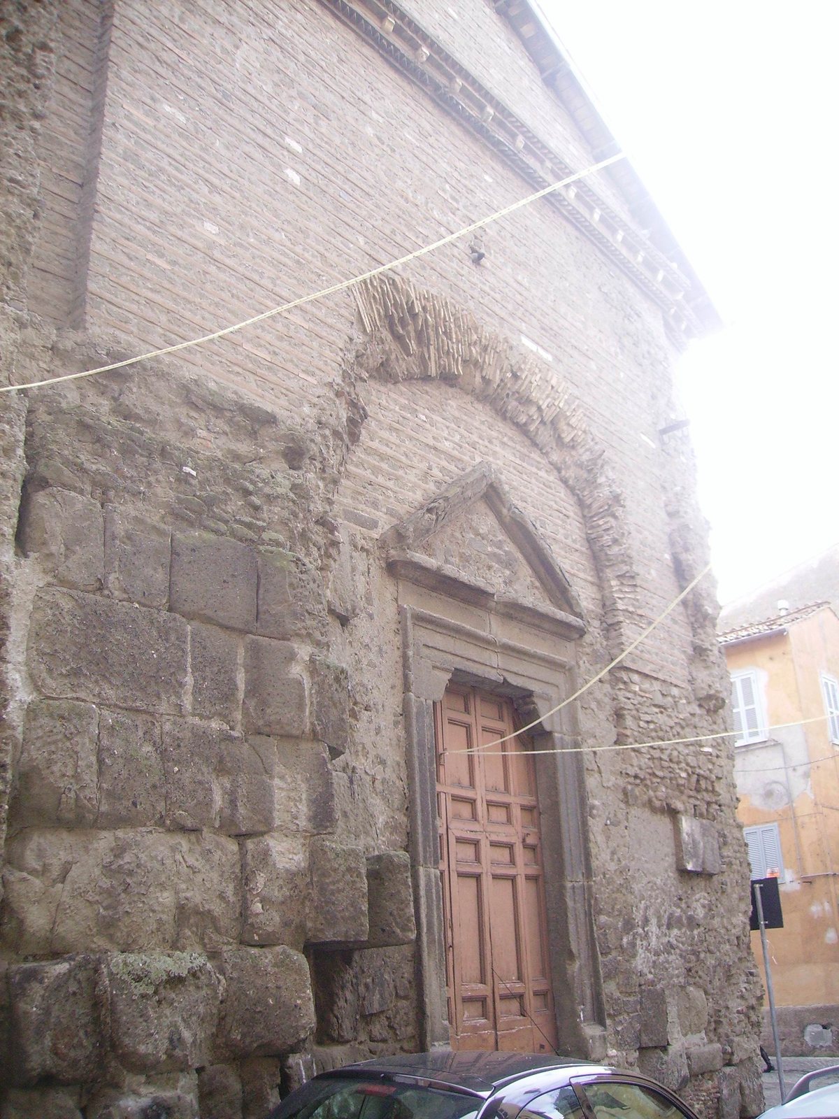
The Porta Praetoria faced the Appian Way, which passed about 20 metres away. The gate was about 36 metres wide, with three archways and two side chambers thought to have served as guard towers. Its central archway measured about three metres wide and five metres high, and stood 14 metres tall. Each side archway was just over one metre wide and five metres high; the chambers measured 5.40 by five metres. Other southwest wall sections were found at Piazza Giosuè Carducci in 1913, and some are incorporated into modern house foundations.
Near Via San Pancrazio, a circular structure lies 3.40 metres below the present ground level at Via Alcide De Gasperi. Its single room is 1.20 metres across and 2.10 metres high, with walls 0.90 metres thick. The vault rises only 1.60 metres above the inner circuit road. Lugli considered whether it had a second storey, but judged it too low to function plausibly as a guard tower. It may instead have served a special purpose, perhaps balanced by a tower at the southeast corner.
Northwest wall
Much of the northwest wall lies beneath modern buildings. A circular room once incorporated into a building near San Paolo measured 3.63 metres across and had a low dome of poor workmanship, thought likely to be a later repair. A building containing this room was destroyed by wartime bombing.
Roads and internal layout
Streets within the camp
Two main streets crossed at right angles. The Via Praetoria, the principal lengthwise street, ran between the Porta Praetoria and Porta Decumana, passing the camp headquarters. The Via Principalis crossed between the two principal gates. Excavations have exposed a short section of the first street near its gate and two stretches of the second. The section on Via San Francesco d’Assisi, found in 1915–16 about 1.10 metres below the modern surface, had raised edges and drainage channels.
Work in the 1980s uncovered the intersection of the Via Principalis with a street running parallel to the Via Praetoria. Peperino pillars had blocked this other street in the medieval period, indicating that the inhabited area had contracted. An additional internal road, the Via Quintana, connected rectangular guard towers. A stretch of a road crossing it was found near Via San Francesco d’Assisi.
Roads around the camp and the Appian Way
Sections of the outer circuit road have been found along all four sides, including beneath Via Tacito and Via San Pancrazio and near the Porta Principalis Sinistra. Parts of the inner road that followed the walls survive on the northeast, southeast and northwest sides, as well as near the Porta Praetoria.
Remains of the Appian Way have been found beneath modern Corso Giacomo Matteotti and in sections near Viale Risorgimento and Viale Europa. The road stood six metres below the Porta Praetoria over a distance of 20 metres. A pedestrian staircase and one or two curving roads for vehicles have been proposed to bridge the difference in level. A north–south road found beneath Palazzo Savelli in the 1980s may relate to this approach.
Buildings and barracks
The Rotunda
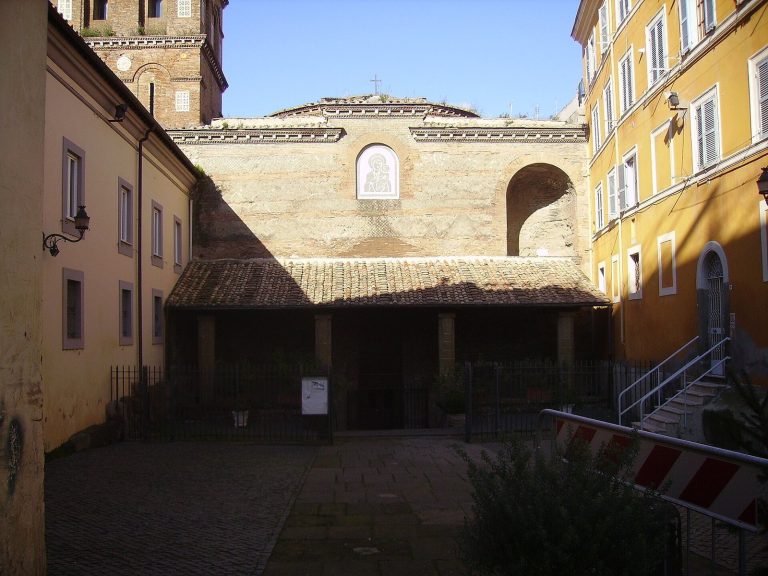
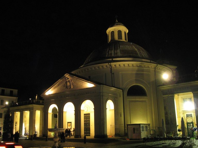
The Rotunda, now the sanctuary of Santa Maria della Rotonda, is Albano’s best-preserved Roman structure. Its circular interior has a maximum circumference of 49.10 metres and imitates Rome’s Pantheon on a smaller scale. Built before the camp, it was probably a water-display building for the villa of Domitian, emperor from AD 81 to 96. The stretch of the Appian Way between Bovillae and Aricia had remained free of buildings until Domitian’s time.
The Rotunda was later restored and incorporated into the Severan complex, but its use there remains uncertain. A black-and-white mosaic floor with mythological figures, now in the sanctuary’s portico, supports the possibility that it served as a bath building. A peperino altar from a pagan religious practice and burials found in 1935–38 instead support its interpretation as a place of worship. After the Severan period it served as a granary or religious building, before becoming a Christian church around the eighth century.
Covered corridors near Piazza della Rotonda
Remains sometimes identified as the Small Baths lie beneath houses on Via Don Giovanni Minzoni and near Piazza della Rotonda. Two covered corridors, about two metres high and 2.70 and 3.29 metres wide, have rows of niches. Built during the Severan period with peperino and small, regularly arranged facing stones, they represent a late use of this construction technique in the territory around Rome. They were probably covered galleries associated with baths and connected with other rooms near the modern bishop’s palace.
Headquarters, substructures and barracks
The camp headquarters, called the praetorium, is thought to have stood beneath houses near the start of Via Aurelio Saffi, where the two main streets would have met. In the rear part of the camp, five supporting walls at different levels have been found on properties along Via San Francesco d’Assisi. Traces of a partition on the second wall indicate rooms about six metres wide.
Excavations in 1915–16 along Via San Francesco d’Assisi uncovered rooms measuring 4.50 metres square, built using several techniques over earlier walls dating to around the first century BC. Parallel walls found at Piazza della Rotonda in 1914 were not aligned with the camp’s layout. A stamp from the Hadrianic period indicates that these buildings predated the fortress and were levelled for its construction. Excavators also found rooms mixed with fallen peperino blocks at Piazza della Rotonda and further rooms at Piazza San Paolo.
Later barracks generally used brick facing interspersed with peperino blocks. Work in the 1980s uncovered further barrack remains and a building with a portico on Via Castro Pretorio.
Water storage and drainage
The Cisternoni
The Cisternoni, beneath the episcopal seminary and accessible from Piazza San Paolo and Via San Francesco d’Assisi, is a five-aisled reservoir. Its long sides measure 45.50 and 47.90 metres, and its short sides 29.62 and 31.90 metres. It covers 1,436.50 square metres and held 10,132 cubic metres of water. Cut three to four metres into peperino bedrock, it has vaulted ceilings about 6.50 metres high, with some variation. Decorative objects found in 1830 and 1884 indicate that at least its front was ornamented.
Water reached the reservoir from the Malafitto and Palazzolo springs near Lake Albano. Two supply tunnels enter on the northeast side; the older one fed the cistern by gravity. The municipality returned the reservoir to use in 1884 and restricted it to irrigation in 1912 for hygiene reasons. Before the 1920s, Lugli found the older water-supply tunnel.
Cistern beneath Via Aurelio Saffi
An elongated cistern beneath Via Aurelio Saffi is about 30 metres long and 4.16 metres wide, with a barrel-shaped vault. It may have formed part of a larger reservoir that has not been identified. A substantial section of its supply tunnel, which runs northeast, survives.
Drainage channel
The camp’s drainage followed the slope toward a main sewer beneath the inner circuit road on Via Alcide De Gasperi. A 0.90-metre-wide section of the sewer was found at the junction with Via San Francesco d’Assisi in 1915–16.
Baths and amphitheatre
Baths of Caracalla
The Baths of Caracalla, also known as the Baths of Cellomaio, were built after the camp and before the amphitheatre, probably for the garrison. A medieval neighbourhood now occupies part of the complex. Its best-preserved room is a rectangular hall measuring 37 by 12 metres, now occupied by the Church of San Pietro. A black-and-white mosaic floor was found beneath the church sacristy and nearby Via Cellomaio. A system that heated rooms through spaces beneath the floor was found in the garden of the Sisters of Jesus and Mary. The building has a concrete core made with peperino fragments, interrupted in places by brickwork and faced with brick.
Amphitheatre
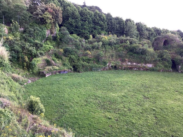
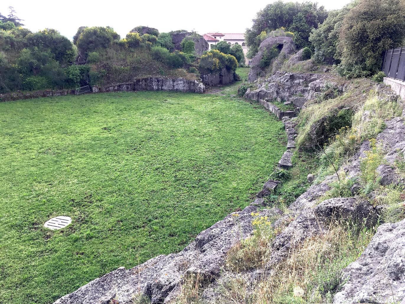
The amphitheatre measures up to 113 metres in length. Its seating capacity has been estimated at 14,850, with a total capacity of up to 16,000. Its southern half is visible; the northern half lies beneath retaining walls along Via San Francesco d’Assisi and Via dell’Anfiteatro Romano. The remains include an imperial viewing place, partly cut into the rock and partly built from squared peperino blocks, as well as unusual supporting arches and corridors leading into the arena. A paved road found nearby probably linked the amphitheatre with the Appian Way in one direction and Domitian’s villa, by the route now followed by Galleria di Sopra, in the other.
Cemetery and inscriptions
Selvotta cemetery
By the 1960s, about fifty graves had been found at the Selvotta cemetery, roughly two-thirds bearing funerary inscriptions. The graves were cut into solid peperino and covered by a single stone shaped either like a roof or a lid. Soldiers were buried alongside wives and children. Although the graves were irregularly arranged, they often formed groups. Finds from the 1960–62 excavations included a broken-column grave marker of a type associated with eastern burials and the cemetery’s only cremation grave.
Religious and military inscriptions
Inscriptions from Selvotta name legionaries and provide evidence about the soldiers buried there. Many men’s inscriptions use the name Aurelius, suggesting that they served during the legion’s prosperous years under Caracalla and Elagabalus; the women’s names are Italic. Other inscriptions refer to a temple dedicated to Minerva, a shrine to Jupiter, and an altar to the Sun and Moon.
Small terracotta plaques or bricks bearing legionaries’ names include one dated to AD 226 and another later reused in the foundations of Albano Cathedral during Constantine’s reign. Together, these inscriptions and objects record the legion’s presence and its religious associations.