Castle of the Porte du Scex: A Fortified Rhône Passage in Switzerland


Site at a Glance
- Rating
- 4.1
- Popularity
- Very Low
- Country
- Switzerland
- Primary era
- Early Modern
- Eras represented
- Medieval, Early Modern, Modern
- Civilizations
- Swiss
- Site type
- Military
- Remains
- Castle
On this page12 sections
History
The Castle of the Porte du Scex is a fortified passage complex at Vouvry in Switzerland, built and enlarged under Valaisan rule between the sixteenth and seventeenth centuries. It stands where the Rhône passes between a rocky spur of the Pre-Alps and the river, on the route linking Vouvry with Le Bouveret and Chessel and connecting Saint-Maurice with Saint-Gingolph. Its position made it a place of toll collection, passage control, administration, and later transport infrastructure.
Medieval passage and feudal control
A toll station at Porte-du-Scex is recorded from the thirteenth century, although its precise location is unknown. Medieval documents also refer to fortifications that came before the present castle. When river conditions allowed, the passage may have functioned as a transshipment harbour for boats travelling upriver from Lake Geneva. The earliest defensive arrangement cannot be securely reconstructed. It may have been a barrier wall with a gate, or a wall associated from the outset with a castle-like structure.
From at least the fourteenth century, the Lords Tavelli of La Tour held the site as feudal lords. In 1358, Count Amadeus VI of Savoy authorized them to establish gallows at Porte-du-Saix. These were later moved to Proz, an island in the Rhône. The name of the passage developed from the gate and the Latin word saxum, meaning rock. Historical forms include Saix, Scé, Sex, and Sé.
Transfer to Valais and early fortifications
In 1536, Bern conquered Savoyard Vaud while Valais annexed the territory south of Lake Geneva. Porte-du-Scex consequently came under Valaisan rule. The new authorities strengthened the passage as part of their control of the acquired territory. The Valaisan Diet, the territorial governing assembly of Valais, ordered fortifications and a ditch in 1591, as well as the reinforcement of a gate downstream from the present castle. The communes of the Monthey district paid 400 florins for this work, while Vouvry and Vionnaz provided the guards who watched the route.
Fortifications at the gate were rebuilt between 1591 and 1609, and construction of a new castle began in 1597. The site sometimes served as the residence of the castellan, an official responsible for administering a lordship or district, in the newly acquired Valaisan territory. An act of 1639 refers to the rampart of Porte-du-Scex. The fortified passage therefore remained part of the region’s administrative and defensive system even as the castle developed.
The seventeenth-century castle
In the seventeenth century, the site became connected with the transport and commercial projects of Gaspard Jodoc Stockalper, a Valaisan merchant and entrepreneur involved in the salt trade. Work on the Stockalper Canal began in 1658. In 1661, Vouvry sold land at Sous-Vanel to Stockalper for 51 ducats and a cartload of wine. By 1671, the Abbey of Saint-Maurice owned the toll station.
In 1672, the Valaisan Diet decided to build the present castle beside the guard post. It was intended as the residence of the castellan of Vionnaz-Bouveret. The construction agreement of 4 August required the communities of the Monthey district to prepare and transport lime, gypsum, wood, stone, and sand. Petermann Barberini, grand castellan of Sion, supervised the work and received annual funds for paying the artisans. His son Barthélemy Barberini, major of Nendaz-Hérémence, assumed this responsibility in 1676, probably after Petermann’s death. The building’s designer is unknown.
Materials were assembled and preparatory work probably began in 1672, while the main construction proceeded in earnest from 1673. Structural work continued until 1675. The roof structure followed, along with limewashing in 1676 and interior and finishing work in 1677. The project probably ended in 1678, when the final payment was made. That year also appeared on a soapstone stove and on several wooden furnishings carrying the arms of the seven Valaisan districts.
Deterioration and nineteenth-century change
The successive castellans of Vionnaz-Bouveret did not use the castle as their residence, preferring their homes at Le Bouveret. Guards were stationed in the building, but it gradually deteriorated. A signal was established on the rock in 1743. In 1791, the Diet recorded the need for major repairs, including the re-excavation of the ditch.
During the nineteenth century, the castle was described as badly damaged. A fire affected the guard’s residence, apparently situated on one of the castle’s floors, and Baptiste Daillodi, a master mason from Vouvry, carried out repairs in 1804. The drawbridge was repaired in 1810, but damage caused by a hurricane led to its removal in 1812 or shortly afterward. A door and a guardhouse replaced it.
A customs post and an inn operated at the site around 1820. In 1838, a substantial covered bridge of larch wood replaced the ferry. The wall between the castle and the Rhône was partly demolished around 1842 and again in the late 1850s. These changes made room for the extension of the Stockalper Canal and the construction of the Tonkin railway, the historical line linking Saint-Gingolph and Saint-Maurice along the Rhône corridor. The Saint-Gingolph-Saint-Maurice railway opened in 1859.
Flood damage, military use, and conservation
A breach in the Rhône embankment at Illarsaz caused severe flooding in 1902. The eastern part of the castle was destroyed while it was being used as a policeman’s residence and office. Joseph Dufour, an architect from Sion, designed the rebuilding. The reconstructed section followed a smaller plan, allowing the Stockalper Canal to be widened.
The gate and the wall that enclosed the passage were demolished around 1935-1937 to facilitate road traffic. During the Second World War, the Swiss Army incorporated the site into the Porte-du-Scex blocking position, part of the Saint-Maurice fortified area. The position included an infantry fort and antitank obstacles. The building continued to house a cantonal gendarmerie post until 1967.
The castle was classified as a monument of cantonal importance around 1907-1910 and entered the inventory of monuments of federal importance in 1958. Its facades were completely renovated that year. From 1974 to 1978, an interior restoration directed by Charles Zimmermann’s architectural office in Monthey removed internal partitions and restored the original interior volumes. Under a 1976 agreement, the municipality of Vouvry assumed responsibility for maintaining and administering the building.
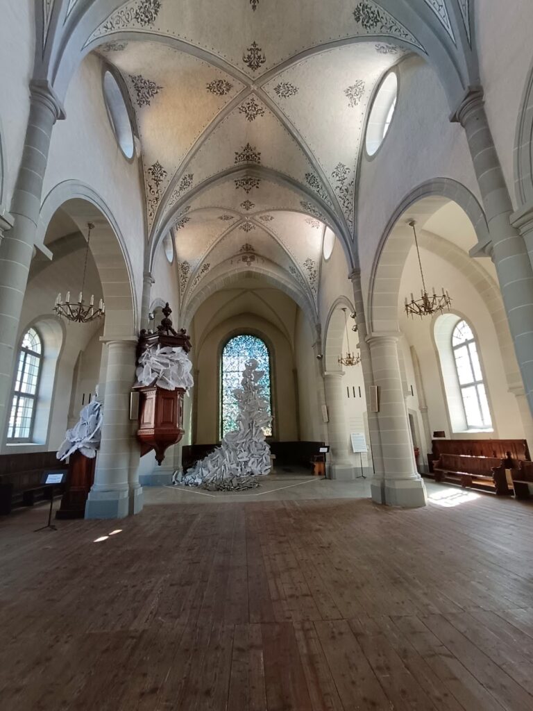
Following that agreement, the castle became a venue for exhibitions and celebrations. The Historical Museum of Chablais moved there from the former post-office building in Bex in 2007 and reopened in 2010 with a temporary exhibition on transport in Chablais and a permanent exhibition on the Rhône. The museum closed permanently in 2018 after visitor numbers remained too low in relation to operating costs.
Remains
Layout and defensive works
The castle occupies the left bank of the Rhône, between the river and a rocky spur extending from the east-southeastern ridge of Grammont. The rock rises about 60 metres above the Rhône plain, leaving only a narrow passage between the rock face and the water. Before twentieth-century road expansion, a defensive barrier known as a Letzi closed the defile. This wall contained a gate on the old road and gave the place its name. The castle now stands between the road and the Stockalper Canal, after the enclosing wall and gate were removed in stages during the nineteenth and early twentieth centuries.
Staircase tower
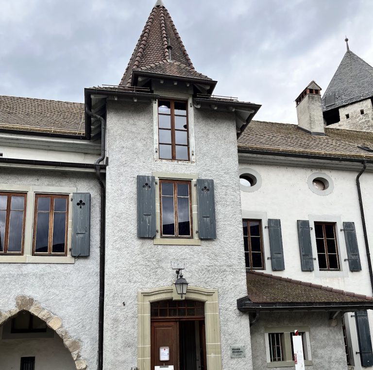
The building’s tall, square staircase tower stands beside the road. It provides access to the defensive walkways of the main building and formerly rose above the road gate. The principal entrance passes through the tower. Its western facade preserves an inscription beneath the lower double window. The inscription names or identifies several artisans and includes the collective designation “LE. M. M. LVMBAR,” apparently referring to Lombard master masons, followed by P. Alexander, A. Melber, I. Melber, and I. Cunto. Some individual identifications remain uncertain.
Main defensive and residential building
East of the tower is a substantial three-storey building that combined defensive and residential functions. Since the rebuilding after the 1902 flood, it has been about one-third smaller than its earlier form. The building has a high gabled roof and small window openings whose forms on the southeastern and northeastern facades reflect its early-modern construction. The southeastern side contained the living quarters. A second entrance leads into the main building through a small annex on the canal side.
On the northern side, facing Lake Geneva, the defensive wall contains several rows of small horizontal loopholes, openings through which weapons could be fired. They are positioned at the level of the walkways, which can be reached from both the staircase tower and the residential section. A ditch formerly lay outside the wall on the northwestern side, where it helped obstruct the approach. Around 1820, a small annex was built in the space between the tower and the main building.
Construction materials and interior evidence
Construction used lime, gypsum, wood, stone, and sand. Claude du Boin was probably responsible for the main structural work. Alexandre Mayer, a cabinetmaker from Swabia, made much of the furniture as well as the doors and windows, while the makers of the woodwork and ceilings are unknown. A soapstone stove dated 1678 and several wooden pieces carry the arms of the seven Valaisan districts.
Archaeological excavations in 1974 exposed fragmentary wall remains that predate the present castle. Their surviving condition does not establish the form of the earliest fortifications. A polished stone axe was found in a fissure in the rock above the present road. Roman coins reportedly discovered in a small fortification near the passage have since disappeared.
Transport corridor
The surviving castle forms part of a corridor shaped by successive transport routes. The main road between Vouvry and Le Bouveret passes through the defile, alongside the Stockalper Canal, which was extended during the nineteenth century. The Saint-Gingolph-Saint-Maurice railway also follows the Rhône corridor. Around 1905, the cantons of Valais and Vaud built a later iron bridge across the Rhône to replace the older wooden bridge destroyed by flooding.
Nearby sites