Castle of Gormaz: A Caliphal Frontier Fortress in Spain


Site at a Glance
- Rating
- 4.7
- Popularity
- Medium
- Country
- Spain
- Primary era
- Medieval
- Eras represented
- Medieval
- Civilizations
- Crown of Castile, Umayyad
- Site type
- Military
- Remains
- Castle
On this page13 sections
History
Castle of Gormaz is a tenth-century Muslim fortress in Spain, built or rebuilt in 965–966 during the Umayyad Caliphate of Cordoba, the Muslim government that ruled much of the Iberian Peninsula. Standing on a contested frontier between al-Andalus to the south and the Christian kingdoms to the north, it controlled routes toward the Duero crossing and the approaches to Medinaceli. The fortress became the largest fortification built by the Caliphate of Cordoba in this region and was probably the largest castle in Europe at the time.
Foundation on a contested frontier
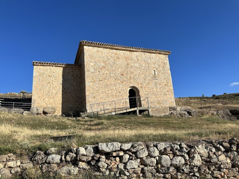
A fortification already stood on or near the ridge before the present castle was built. Christian chronicles record Muslim reconquests in 925 and 940, showing that control of the site changed repeatedly during the frontier struggles. The present fortress was constructed or substantially rebuilt in 965–966 by Ghalib ibn Abd al-Rahman, a leading general of Caliph al-Hakam II. A foundation stone naming the caliph and giving this date was found at the nearby Hermitage of San Miguel de Gormaz. It is now kept in El Burgo de Osma Cathedral and is believed to have come from the fortress.
Castle of Gormaz formed part of a wider defensive network of fortifications and watchtowers along the northern frontier of al-Andalus. Its position above the Duero gave it a role in controlling movement across the river and along the route toward the north. In 974–975, it resisted a major siege by the forces of Sancho of Navarre, Garcia of Castile, and Ramiro III of Leon, who was under the regency of Elvira Ramirez. Ghalib brought a relief force that defeated the besieging army and pursued Garcia’s retreating forces into Castile.
Shifting control in the eleventh century
Christian forces may have captured the fortress between 975 and 983, and Christian chronicles place a successful capture in 978. Muslim forces under Almanzor, the powerful military ruler Muhammad ibn Abi Amir, recaptured it in 983. During the Fitna, the civil war and political upheaval that weakened the Caliphate of Cordoba in the early eleventh century, the caliphs promised to surrender the fortress to Sancho III in 1009 or 1011. Whether that transfer took place remains uncertain.
Fernando I is reported to have captured Castle of Gormaz in 1059, although the occupation may have been brief. Repairs and alterations carried out by Muslims in the 1060s indicate that Muslim control or use continued for some time. By the end of the eleventh century, the Duero region and Toledo had come definitively under Castilian control. After the final Christian conquest, Alfonso VI granted the fortress to Rodrigo Diaz de Vivar, known as El Cid, in 1087. The settlement of Gormaz was established at the foot of the castle during this period.
Fourteenth-century conflict and abandonment
During the War of the Two Peters, a fourteenth-century conflict between Castile and Aragon named for their rulers, Pedro I and Pedro IV, Castle of Gormaz changed hands several times between 1359 and 1369. The fighting brought major restoration, repair, and fortification work. Archaeological evidence shows that the central section was occupied by a small urban settlement during the fourteenth century, adding a period of civilian use to the fortress’s military history.
The fortress was abandoned sometime after these conflicts and subsequently fell into ruins. Modern excavations began in 1922 and have continued since then. Major investigations in the late twentieth century were led by Juan Zozaya, followed by later restoration. Castle of Gormaz has been designated a Spanish National Monument since 1931.
Remains
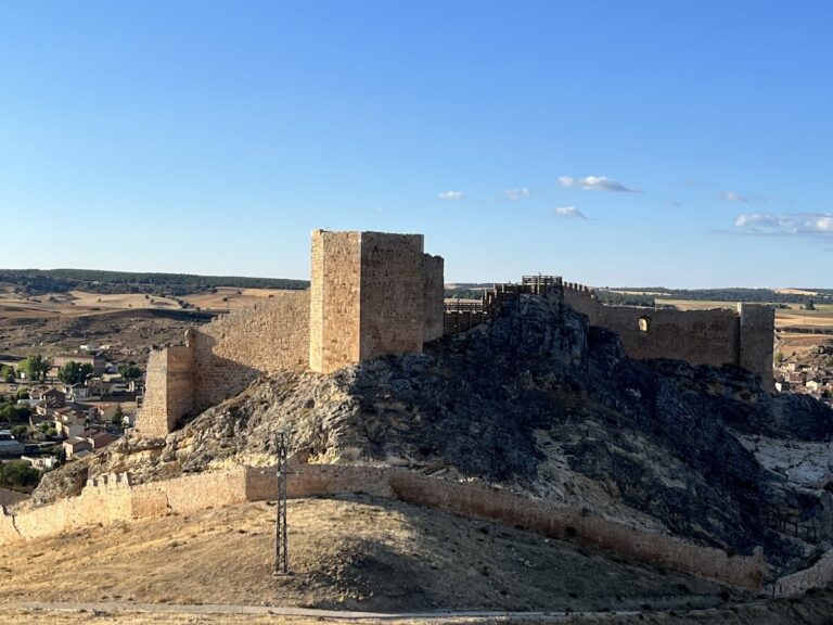
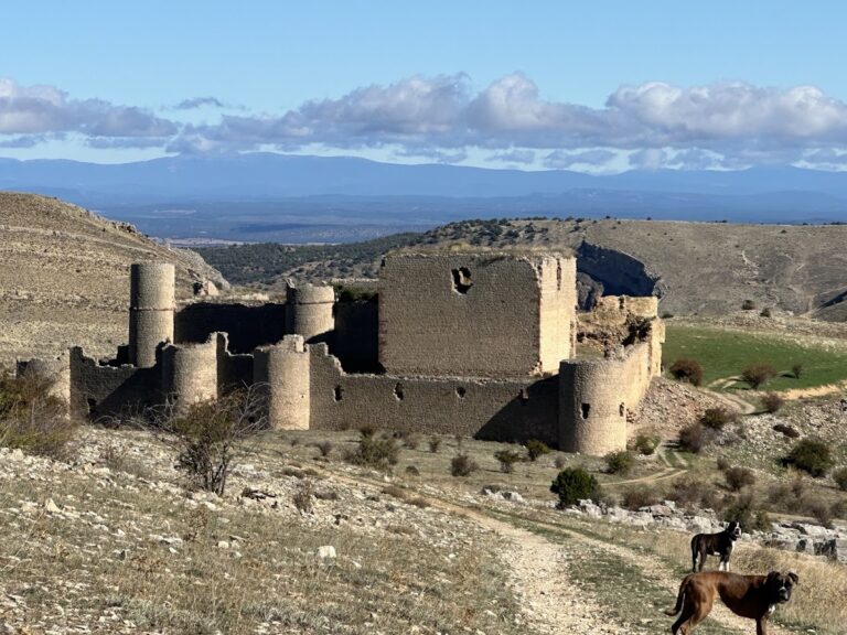
Castle of Gormaz occupies a ridge north of the Duero River, on a hill rising about 100 metres above the water. Its elongated stone-built plan follows the ridge from east to west. The fortress is roughly 400 metres long, with a perimeter of approximately 1 to 1.2 kilometres and a width that varies from about 17 to 63 metres. More than two dozen slightly projecting towers reinforce walls that rise to approximately 10 metres. Earlier masonry was probably reused in the construction.
Walls and entrances
Northern and southern walls
The northern wall follows a comparatively straight line and is built from large, rough stones. About 15 regularly spaced towers reinforce this side. The southern wall is more curved and irregular, and its masonry uses more carefully carved stone. Erosion and landslides have damaged it more severely than the northern wall. Some of the landslides occurred during the medieval period, when damaged sections were repeatedly repaired and reconstructed.
Main gate
At least two entrances survive. The main gate stands on the southwest side, above a rocky outcrop and facing the river and the former Muslim side of the frontier. It contains two monumental horseshoe arches set one behind the other, with 1.26 metres between them. Although the gateway appears to form part of one continuous wall, it occupies the space between two towers. This passage allowed defenders above the gate to throw projectiles at attackers while remaining sheltered from those outside.
The outer arch spans 2.76 metres and rises about 7 metres from the ground to its keystone, although erosion has lowered the ground level. Its surrounding wall was once covered with plaster or stucco within an alfiz, a rectangular frame around an arch in Islamic architecture. Fragments survive, and the decoration probably included painted false wedge-shaped arch stones. The frame may also have carried an Arabic inscription or geometric motifs associated with the caliphal architecture of Cordoba.
Northern postern
A smaller northern postern, or secondary gate, was reached through a vaulted corridor. Its position and construction provided another controlled point of access through the long fortified ridge.
Eastern citadel and western enclosure
Eastern citadel
A separate citadel, or fortified palace and stronghold, occupies the eastern end. A moat divides it from the larger western section, while its walls are higher and more heavily fortified. The citadel may belong to the 965–966 building phase, although some of its work may instead date from later alterations, most probably those of the fourteenth century. Access from the western section passed through a bent entrance in a tower. The arrangement probably allowed the citadel to serve as a keep and final defensive position.
The eastern citadel contains the keep, a structure traditionally identified as the Tower of Almanzor, a cistern, and caliphal chambers. These features belong to the fortified eastern complex and reflect its defensive and residential functions within the larger stronghold.
Western section
The western section contained a second cistern, a large open area where troops could camp, and a pool used to water animals. Its residential area was large enough to accommodate an army. Three upright stone slabs, or stelae, were set into the western wall. One is Roman and another is clearly Islamic. Tradition held that these stones were placed there to ward off evil spirits.
Interior archaeological features
Archaeological investigations identified an area inside the castle covered with white mortar. Some archaeologists interpret it as the remains of a musalla, an open-air prayer area for communal Muslim worship, although that interpretation remains uncertain. The feature provides a possible indication of religious activity within the fortress while leaving its precise function open to debate.