Birg (Hohenschäftlarn): An Ottonian Section Fortification in Germany


Site at a Glance
- Rating
- 4.7
- Popularity
- Very Low
- Country
- Germany
- Primary era
- Medieval
- Eras represented
- Bronze Age, Iron Age, Medieval
- Civilizations
- Carolingian
- Site type
- Military
- Remains
- Fort
On this page14 sections
History
Birg (Hohenschäftlarn) is a large early-medieval section fortification in Germany, situated above the Isar near Hohenschäftlarn in Bavaria. Its final expansion probably took place during the first half of the tenth century, in the Ottonian period, when Magyar mounted raiders campaigned across Central Europe. With about 85,000 square metres of usable ground, Birg is one of the largest presumed Magyar refuge fortifications in the wider area around the Lechfeld.
Earlier settlement and fortification
The broad plateau east of Hohenschäftlarn had already been settled in the Bronze Age. Burial mounds from the Hallstatt period, an early Iron Age phase in Central Europe, survive in the surrounding area. Isolated finds, including a Late Celtic belt-hook, also make Celtic use or visitation of the promontory plausible. Interpretations of Birg as a large Celtic fort or cult site, however, are later misreadings. The double ramparts, slope ditch, and mounted-warrior obstacles belong to the early Middle Ages.
The name Schäftlarn appears in the early form Sceftilari. It may refer to the production of weapons or weapon shafts, while its ending may instead preserve a reference to an old assembly or judicial meeting place. Slag found at a settlement west of Birg may point to the manufacture of spear or arrow shafts, and a smelting site farther west remained in use into the early modern period. A purported row-grave cemetery, opened improperly in the nineteenth century, provides another possible indication of an early-medieval settlement.
Parts of a wall in the southwest and a mostly levelled ditch along the slope point to an earlier fortification of Carolingian date. The Carolingian period was the era of the Frankish rulers descended from Charlemagne. Archaeological evidence has not established whether this earlier defence consisted of a timber-and-earth rampart or a dry-stone wall.
The Ottonian refuge fortification
Probably during the Magyar invasions of the first half of the tenth century, builders enlarged the northern part of the promontory over the older defensive works. The resulting double rampart and rows of obstacles for mounted attackers are characteristic of a large Magyar refuge fortification. A lower rampart south of the obstacles suggests that at least part of the area may already have been defended in early historical times. Tenth-century Magyar fortifications were generally formed by expanding older settlements or fortifications rather than by creating entirely new sites.
The large earthworks may have been associated with King Henry I’s fortification ordinance. Henry I ruled the East Frankish kingdom from 919 to 936 and promoted defensive measures during the Magyar raids. Smaller fortified sites could serve as complements to major territorial strongholds. Comparable fortifications are concentrated around the episcopal city of Augsburg, where German forces decisively defeated the Magyars at the Battle of Lechfeld in 955. That battle helped end the major Magyar raids into the German lands.
Birg is grouped with larger presumed Magyar refuge fortifications such as Haldenburg near Schwabmünchen, Buschelberg near Fischach, and Weiherberg near Nördlingen. Other sites, including Pfarrerschanze near Todtenweis and Wagesenberg near Pöttmes, use outer wards rather than pronounced mounted-warrior obstacles before their double main ramparts. Birg near Kleinhöhenkirchen preserves two obstacle systems, while the Eselsberg near Thierhaupten and the section fortification near Straßberg have smaller defensive arrangements.
Birg’s apparently unfinished state supports its interpretation as a refuge fortification created during the Magyar threat. After the Battle of Lechfeld, such ramparts were generally no longer enlarged because the immediate need had passed. The eastern main rampart is lower than the section on the plateau, but the natural depression and steep eastern slope already made a mounted attack difficult. The unfinished appearance therefore need not indicate that construction simply stopped.
Function and later interpretation
The fortification probably served chiefly as a refuge for the nearby Schäftlarn monastery and the rural population around it. It also provided an assembly area and a place where troops could gather. The careful planning and effective use of the terrain suggest the participation of an experienced master builder, possibly connected with the Bishopric of Augsburg, a diocese governed by a bishop. The site may correspond to the oppidum apud sceftilarii, a phrase meaning a fortified place near Schäftlarn.
Birg was probably never attacked by the Magyars. A tradition or interpretation connects it with the killing of defeated Magyar warriors after Lechfeld, although its distance from the battlefield makes a direct role in the battle unlikely. Some specialists questioned whether a systematic tenth-century fortification programme existed, particularly during discussion surrounding the 2002 Bavarian state exhibition Bavaria-Hungary: A Thousand Years. Birg remains classified by the Bavarian State Office for Monument Protection as an Ottonian-period section fortification, together with Bronze Age and La Tène settlement remains, under monument number D-1-8034-0088.
Remains
Birg occupies the northern spur of a high plateau above the Isar. A gorge-like valley incision protects the site on the north and west, while the plateau stands about 90 metres above the Isar valley. A slope ditch can be followed roughly five to six metres below the edge of the plateau. Across the opening where the gorge meets the high ground, the principal earthworks extend southeast for approximately 350 metres.
Ramparts and ditches
Double rampart system
The main defensive line consists of two ramparts accompanied by ditches four to five metres deep. In the eastern third, the line bends slightly northward and follows the natural descent of the ground. Measured from the ditch bottom, the outer rampart rises four to five metres, while the main rampart reaches eight to ten metres. On the plateau, the main rampart stands about four metres above the interior. Its eastern continuation is lower, rising by up to two metres. The earthworks were probably topped by palisades, defensive barriers made from upright wooden stakes.
Outer defensive line
About 50 metres in front of the double rampart is a separate line between 1.5 and 2.5 metres high. It curves eastward toward the edge of the slope and has no ditch, or one that has been levelled. This lower work probably belongs to an earlier phase of defence. The older outer rampart may have been supplemented by a thorn hedge, while felled trees or additional thorn barriers may have strengthened the foreground.
Mounted-warrior obstacles and entrance
Rows of earthen ridges
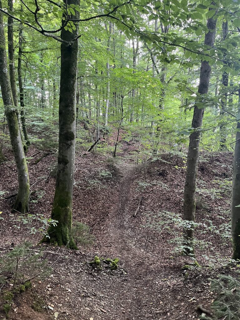
Immediately inside the western rampart line begins the first of four rows of short earthen ridges. These ridges remain up to 1.5 metres high and are separated by hollows formed through excavation. Their arrangement is interpreted as an obstacle system against mounted warriors. Sharpened wooden stakes or thorn hedges probably reinforced the ridges, making a direct cavalry approach more difficult.
Southwestern gate
The principal entrance of both the earlier Carolingian fortification and the later Ottonian works was probably located at the southwestern edge of the slope. A marginal rampart, probably Carolingian, follows the access route for about 40 metres. The later main rampart partly overlies this older work, demonstrating its subsequent construction. The obstacle rows do not continue in front of the presumed gate, where the entrance required a different defensive arrangement.
Plateau and archaeological context
Interior area
The almost level plateau formed the usable interior of the refuge fortification. Its principal role was probably to gather people and troops and to shelter the nearby population. Any structures within it were likely simple timber buildings or clay half-timbered buildings, forms suited to temporary or short-term occupation.
Earlier and later evidence
The site’s physical evidence combines the earlier slope-side defences with the later Ottonian earthworks. Bronze Age and La Tène settlement remains are associated with the monument, while the surviving Hallstatt burial mounds and the Late Celtic belt-hook broaden the archaeological context of the promontory. Slag from the settlement west of Birg also connects the surrounding area with possible metalworking and weapon-shaft production.
Nearby sites