Binchester Roman Fort Vinovia: A Roman Military Fort and Settlement in England



Site at a Glance
- Rating
- 4.5
- Popularity
- Low
- Country
- United Kingdom
- Primary era
- Classical
- External website
- Open
- Eras represented
- Classical
- Civilizations
- Roman
- Site type
- Military
- Remains
- Fort
On this page15 sections
History
Binchester Roman Fort Vinovia is a Roman fort and settlement in the United Kingdom, near Bishop Auckland in England. The Romans probably established it around AD 79 during the campaigns of Agricola, the governor whose advance extended Roman control northward into the territory of the Brigantes. Built beside the River Wear on Dere Street, the principal Roman road linking York, Hadrian’s Wall, and Scotland, Vinovia guarded an important river crossing. It later became the largest Roman fort in County Durham.
Foundation and Roman military occupation
The first fort was probably established between AD 75 and 80 during the Roman advance under Agricola. It may initially have covered about 7 hectares and was built largely from timber. A later stone fort occupied approximately 4 hectares, while a further phase dating to about the 3rd century lay beneath later occupation. Men of Legio VI Victrix, a Roman legion stationed for long periods in Britain, may have built the original fort.
The identity of the garrison remains uncertain. Inscriptions refer to the cuneus Frisorum Vinoviensium, a small Frisian military detachment based at Vinovia, and to the equites catafractarii, heavily armoured cavalry. Other proposed occupants include the ala Vettonum, a Roman auxiliary cavalry unit, Frisian cavalry, part of Legio VI Victrix, and a detachment from the Ninth Legion at York.
The fort and its surrounding settlement
A civilian settlement, or vicus, grew around the fort. Such settlements commonly housed soldiers’ families, traders, craftspeople, and other inhabitants. At Vinovia, the settlement extended around the fort and continued to develop as the military site changed. Although Roman occupation of Britain officially ended around AD 410, people continued to live in and around the settlement. Buildings placed over the fort ditches indicate that local occupation continued after the fort had ceased to function actively.
The commandant’s house and baths were altered several times during the 4th century. The house was eventually divided into several units, and the baths may have changed from an exclusive facility for the commandant to one used by the whole regiment. A coin of the usurper Magnentius, minted between AD 350 and 360, may indicate that these renovations took place after that period.
Decline and post-Roman use
In a later phase, the commandant’s house and baths deteriorated. Rooms in the house were adapted for industrial work, including blacksmithing, lime slaking, and animal butchery. The baths and house eventually fell into ruin during the post-Roman period. The fort was abandoned as a Roman military installation by approximately the 5th century, although occupation in and around Binchester continued into the early medieval period.
By the early 6th century, a small Anglo-Saxon cemetery had been established, and Roman buildings were being dismantled for their stone and other materials. Some of this material was later incorporated into the 7th-century church at nearby Escomb. The fort appears to have served as a cemetery from the mid-6th to the 11th centuries. A medieval manor house later occupied part of the site, and the 17th-century Binchester Hall now stands there.
Rediscovery and archaeological investigation
Antiquarians knew of the ruins by the 16th century. John Leland recorded Roman coins from nearby ploughed fields in 1552, and William Camden described visible wall remains in 1586. In 1815, a farm cart broke through into a hypocaust, a Roman underfloor-heating system in which hot air circulated beneath raised floors, revealing a bath-house. In 1828, altars, urns, and other remains were removed and reused as supports in local coal pits.
The first excavations took place from 1878 to 1880 under John Proud and the Reverend Robert Eli Hooppell. They examined the bath-house, parts of the defences, Dere Street, and sections of the civilian settlement. Modern water-pipe installation in 1891 damaged parts of the fort and settlement but exposed a large Roman altar dedicated by Pomponius Donatus, a governor’s beneficiarius, or military official serving under a governor, to Jupiter and the Matres Ollototae, three Celtic mother goddesses associated with a continental origin.
Kenneth Steer investigated the defences in 1937 and identified an early Agricolan fort beneath a later fort of approximately 3rd-century date. Further work followed in 1955 and from 1964 to 1972. Rescue excavation in 1971 exposed about six successive layers of timber barracks. Excavations directed through the Bowes Museum for Durham County Council continued from 1976 to 1980 and from 1986 to 1988, concentrating on the baths and commandant’s house and tracing their construction, alteration, industrial reuse, and decline.
Geophysical mapping in 2004 covered about 4.7 hectares of the civilian settlement and helped establish its extent beneath surrounding fields. A three-day investigation in April 2007 uncovered further remains of the earlier fort, identified the settlement north of the fort, and revealed a row of three military mausolea, monumental tombs described as the first discovery of their kind in Britain for 150 years. Test excavation followed in 2009, with a full excavation season in 2010 inside the fort and in the settlement. A six-week excavation in 2018, involving archaeologists and volunteers, exposed a Roman road, carved images, and several industrial buildings.
Remains
Fort setting and layout
Vinovia occupied a hill approximately 15 metres above the River Wear. Before construction, trees and brush were cleared from the plateau, which was then raised with a substantial levelling deposit. Two phases of timber buildings, probably barrack blocks, were built on this prepared ground. The first fort was timber-built, while the later stone fort was smaller and covered about 4 hectares. The southern part of the fort lies beneath Binchester Hall.
Roads and defences
The fort’s main internal road was the via principalis, the principal cross-street of a Roman fort. At Vinovia, it incorporated the section of Dere Street that passed through the fort. The road was exposed near the eastern rampart during the excavations of 1878 to 1880. A landslip in the 19th century destroyed parts of the defences, and the installation of water pipes in 1891 damaged the northeast corner, including sections of the rampart, Dere Street, and several houses in the civilian settlement.
River crossing
Part of the stone bridge that carried Dere Street across the River Wear remains visible when the river is low. The bridge formed part of the road infrastructure associated with the fort and its position beside the river crossing.
Civilian settlement
The vicus lay mainly to the north and west of the fort, with further settlement extending eastward beneath the fields of Binchester Hall Farm. Its remains include plain civilian buildings and houses. Geophysical mapping covered approximately 4.7 hectares of the settlement, while later excavations identified additional areas north of the fort. Much of the vicus remains buried beneath pasture and fields.
Military mausolea
North of the civilian settlement, excavations in 2007 revealed a row of three military mausolea. These monumental tombs formed a distinct group outside the fort and settlement. Their discovery added a funerary feature to the known Roman remains at Vinovia.
Commandant’s house and baths
Commandant’s house
The commandant’s house was a courtyard building constructed sometime after the middle of the 4th century over two smaller earlier stone buildings, probably also praetoria, residences or headquarters associated with a Roman commander. The later house was attractively decorated and initially designed for one occupant. It was subsequently divided into several self-contained units. Later rooms were adapted for a smithy, lime slaking, and animal butchery. A channel around much of the building contained a midden with large quantities of animal bones and debris.
Bath suite
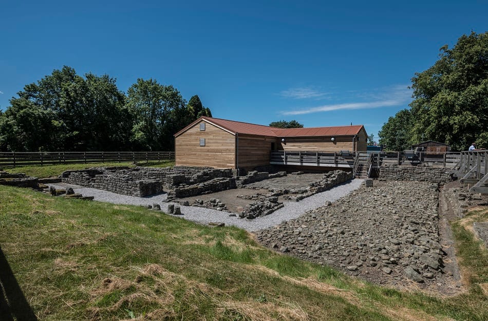
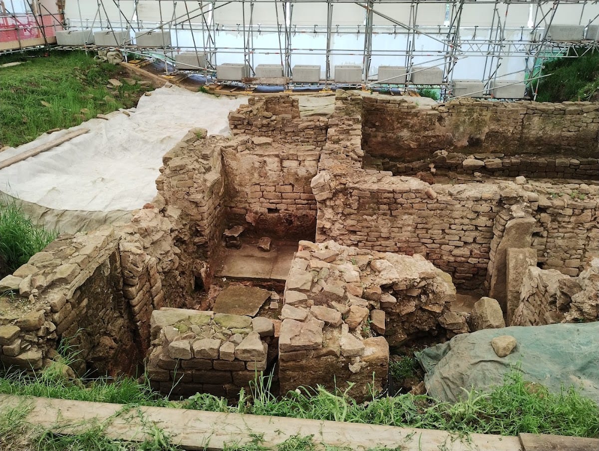
A detached bath suite was built beside the commandant’s house, requiring part of the earlier building to be demolished. It contained a warm room, a hot room, and a second hot room with two plunge baths. The complex included a hypocaust, one of the best-preserved Roman underfloor-heating systems in Britain. Later alterations added a flagstone court, a triple-arched gateway, and a small anteroom.
Several walls and part of the bath-house roof collapsed during the post-Roman period. The rubble included the burial of a Saxon woman. The excavated remains of the bath-house and commandant’s house now form part of the ruined fort, alongside surviving sections of roads, defences, and associated structures.
Later survival
The fort is now ruined, while much of the surrounding civilian settlement remains beneath fields and pasture. The surviving excavated areas preserve the changing relationship between the military fort, its roads, the bath and commandant’s complex, and the settlement that grew beside them.