Aoudaghost: A Medieval Trans-Saharan Trading Town in Mauritania
Site at a Glance
- Popularity
- High
- Country
- Mauritania
- Primary era
- Medieval
- Eras represented
- Medieval
- Civilizations
- Amazigh, Ghana Empire, Mali Empire
- Site type
- Settlement
- Remains
- Town
On this page10 sections
History
Aoudaghost was a medieval town in what is now Mauritania, represented by the archaeological ruins at Tegdaoust. It may have been founded in either the 5th or 7th century by a Lamtuna prince. The Lamtuna were part of the Sanhaja, a Berber confederation. Aoudaghost prospered especially from about the 9th to 11th centuries as a major commercial center on the westernmost trans-Saharan route between the Maghreb and regions south of the Sahara.
Early political and commercial prominence
The earliest known written reference appears in al-Yaqubi’s geographical work, completed in 889–890. He described Aoudaghost as a Sanhaja-controlled town and the seat of a king who raided southern kingdoms. He placed it fifty travel stages south of Sijilmasa across the Sahara. In 962, Aoudaghost conquered Awgham with an army described as 100,000 camel cavalry, and more than twenty rulers from lands south of the Sahara paid tribute to it.
Around 977, Ibn Hawqal described a ten-day journey by lightly loaded caravan between Aoudaghost and Ghana. His account indicates that the town maintained relations with Ghana’s ruler but was not yet part of the Ghana Empire, a medieval West African state distinct from the modern country. Aoudaghost joined the empire sometime in the late 10th or early 11th century and became its northernmost trading post. The caravan route ran from Sijilmasa, a journey described as taking sixty days, through Koumbi Saleh to the Bouré goldfield in the upper Niger region.
Gold was central to commerce. Ibn Hawqal connected the rulers of Ghana and Kugha with Aoudaghost’s role in obtaining salt from the north. Al-Biruni described gold exchanged for northern textiles, while al-Bakri wrote of salt extraction and trade. Salt was probably traded chiefly within the region rather than exchanged for gold over long distances. Al-Bakri described a wealthy town whose Zenata and Arab inhabitants often came into conflict. Many residents came from Ifriqiya, a historical region centered on present-day Tunisia. He also described trade conducted in gold and inhabitants who held very large numbers of enslaved people, perhaps a thousand or more.
Almoravid capture and decline
In 1054–1055, the Almoravids, a North African Muslim movement and dynasty, captured and plundered Aoudaghost under the leadership of Abd Allah ibn Yasin. Al-Bakri described the town as prosperous and said its inhabitants were persecuted because they acknowledged Ghana’s authority. He reported that the attackers seized property as communal booty and violated women.
By the mid-12th century, al-Idrisi characterized Aoudaghost as a small desert settlement with little water, few inhabitants, and limited trade, where people relied on raising camels. The town may never have recovered from the attack. It lost control of the salt trade between the coast and Ghana to Takrur, while Oualata, 360 kilometres to the east, had replaced it by the early 13th century as the southern terminus of the main trans-Saharan caravan routes. Aoudaghost later became part of the Mali Empire, another medieval West African state. Political unrest and drought further weakened its prospects.
Abandonment and archaeological identification
The town was partly abandoned by the end of the 12th century and entirely deserted by the 15th. Some resettlement followed roughly two centuries later, but the settlement was abandoned again in the 17th century. Reduced rainfall is associated with the loss of agricultural production.
In 1927, French Lieutenant Boëry identified the ruins at Tegdaoust as Aoudaghost, an identification later confirmed by the French naturalist and explorer Théodore Monod. Archaeological excavations took place from 1960 to 1976 under Jean Devisse and Denise Robert. In 2001, the site was added to UNESCO’s World Heritage Tentative List, which includes places a country may consider nominating for World Heritage status but does not itself confer that status.
Remains
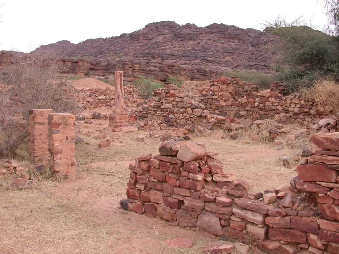
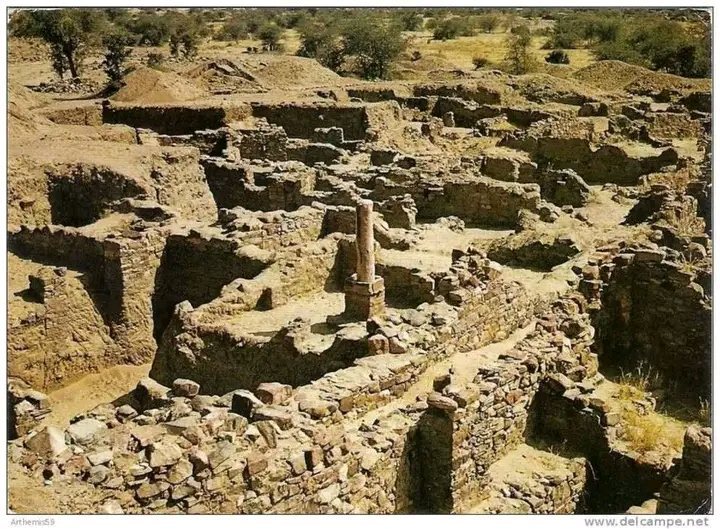
The archaeological site is an artificial mound built up from successive settlement remains, covering about 12 hectares. It lies south of the Hodh depression and 34 kilometres northeast of Tamchakett, roughly midway between Kiffa and Tichitt. The residential area and necropolis together cover about 12 hectares. Archaeological layers date from the 7th to 9th centuries, while excavated occupation phases extend from the late 8th to the 14th century. Remains from the later phase occupy only a small part of the original town. Al-Bakri described the settlement as standing on sandy ground beneath a large, barren mountain, with gardens of date palms and plots growing wheat, cucumbers, small figs, vines, and henna. Residents drew water from wells and watered wheat with buckets.
Houses
The earliest excavated houses built of mud brick date to the late 9th or early 10th century; some stone buildings were erected in the 11th century. House plans remained similar across the identified phases. Each had a central courtyard with a well, reached through an entrance room and corridor, and up to three living rooms opened onto the courtyard. In some houses, columns supported a canopy that shaded part of this open space.
Mosques
Aoudaghost had one main communal mosque and numerous smaller mosques. The remains of a mosque identified as the oldest known in Mauritania include massive square pillars in the prayer hall, bases for smaller columns, and a mihrab, a niche indicating the direction of prayer, in the southeast wall. An adjoining courtyard contained a well for ritual washing and a second mihrab.
Necropolis
The burial ground lies north of the town below a rocky slope and extends about 700 metres from north to south. It includes a pre-Islamic tumulus, a mound raised over a burial, made from stacked stone blocks. Skeletons in two areas lie in different orientations. These patterns have been interpreted as evidence either of successive stages of Islamization or of different religious traditions present at the same time.
Rock shelter
A rock shelter about 400 metres south of the excavation area contains paintings of hunting scenes and horse-drawn chariots from before the Christian era. The images indicate human presence in the area during that earlier period.
Excavated objects
Glazed pottery and semi-precious stones dating to the 9th century are among the earliest excavated finds pointing to trade connections with the Islamic north, including Ifriqiya.