Ammaia: A Roman City in Portugal


Site at a Glance
- Rating
- 4.2
- Popularity
- Medium
- Country
- Portugal
- Primary era
- Classical
- External website
- Open
- Eras represented
- Classical
- Civilizations
- Roman
- Site type
- City
On this page19 sections
History
Ammaia is a Roman city in Portugal, near São Salvador da Aramenha in the municipality of Marvão, whose principal development began during the first century AD under Roman rule. It probably took shape during the reign of Claudius, although intensive settlement was already present during the reign of Augustus, from the late first century BC into the early first century AD. The city became a civitas, a Roman civic community, around AD 44–45 and later acquired municipium status, meaning a formally organized town whose inhabitants held recognized civic rights under Roman rule.
Foundation and Roman development
The date of Ammaia’s elevation to municipal status remains uncertain. It has been linked to the reigns of Nero, Vespasian, or Lucius Verus, but evidence confirms the municipal organization during the reign of Lucius Verus in AD 166. Ammaia belonged to Lusitania, the Roman province covering much of present-day Portugal and parts of western Spain. Its position in the valley of the Sever River gave it access to fertile land, while surrounding forests, mineral resources, quartz or rock crystal, and gold supported its prosperity.
Road connections further strengthened the city’s position. Routes linked Ammaia with Emerita Augusta, now Mérida and the provincial capital of Lusitania, as well as with the road between Norba Caesarina and Scallabis. These connections supported communication with other Roman centers and helped integrate the city into the wider provincial network. The forum became Ammaia’s principal center of administrative, judicial, and religious authority, serving both the urban population and people from the surrounding region. Worship there included deities from Roman and indigenous religious traditions.
Late Roman transformation and decline
During the fourth century, Ammaia’s urban spaces underwent systematic reconstruction, restoration, and reorganization. The changes affected the arrangement and use of the city as its Roman institutions and buildings continued to develop. Between the fifth and ninth centuries, Ammaia gradually declined and lost population. Under Arab rule, the settlement appears to have been abandoned in favor of the nearby fortified settlement of Marvão.
In the ninth century, Ibn Marwan, a prominent muladi leader of local Iberian Muslim origin or descent, used the title of lord of Ammaia and its ruins. The title preserves the city’s name in a period when its urban occupation had already declined and the neighboring hilltop settlement had become more important.
Later reuse and changing interpretations
Ammaia’s remains continued to shape the surrounding landscape after the city ceased to function as an urban center. A mill on the Sever River, owned by Diogo Gonçalves of Marvão, was recorded in 1398. From the early sixteenth century, stone and other building materials from the ruins were reused in religious buildings in Portalegre and nearby communities.
In 1619, Diogo Pereira de Sotto Maior recorded that the bridge of Portagem could still be seen. He associated its destruction with greed surrounding the collection of royal customs duties on goods travelling toward the Kingdom of Castile. A replacement crossing stood farther downstream, where a tower housed royal guards. One of Ammaia’s gateways was removed in 1710 and transported to Castelo de Vide, where it was later destroyed. In 1852, the Spanish investigator José de Viu recorded the sale of 20 statues from Ammaia to England.
The ruins were initially identified as the remains of Medóbriga by André de Resende and other writers. José Leite de Vasconcelos later demonstrated that they belonged to Ammaia, and the site was identified archaeologically and historically as the Roman city in 1935. This clarification established the connection between the surviving remains and the ancient city described by its historical name.
Excavation and preservation
Ammaia’s ruins were designated a National Monument in 1949, but the site remained abandoned until the end of 1994. The establishment of the Ammaia City Foundation brought together Carlos Melancia and other regional figures with the University of Évora, the Polytechnic Institute of Portalegre, and the Municipality of Marvão. Systematic study and preservation then began, with archaeological investigations in 1994 and further projects in 1995 and 1996.
These early projects combined topographic surveying, excavation, cleaning, study, and conservation in four areas: the Porta do Arco, the forum and temple, the Quinta do Deão building, and the Forum Baths. Since 2007, scientific research has been supervised by the University of Évora. Ammaia was also selected as an open laboratory for the European-funded Radio-Past project, which tested non-destructive methods for investigating complex archaeological sites, including surface-artefact collection, geophysical and geoarchaeological survey, remote sensing, and aerial photography. Archaeological work reported in 2019 identified an amphitheater at Ammaia.
Remains
Urban setting and city plan
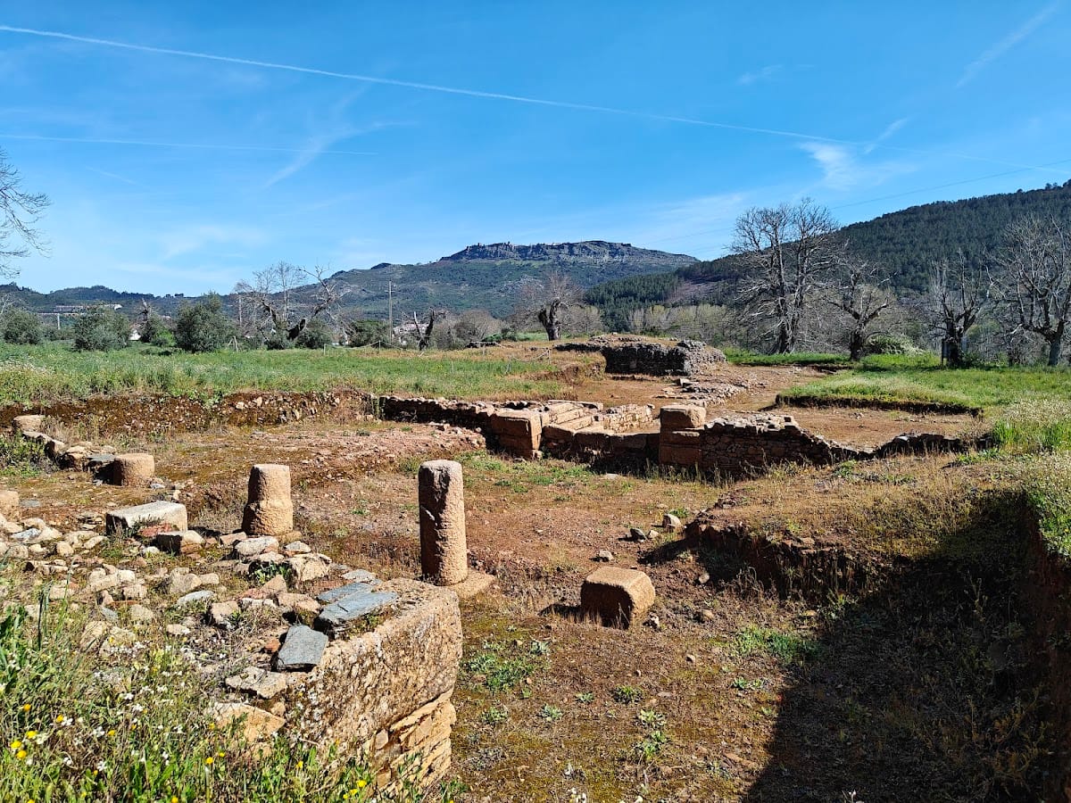
The ruins lie within the Serra de São Mamede Natural Park near São Salvador da Aramenha, along the Sever River. The central archaeological area includes Quinta do Deão and Tapada da Aramenha and covers approximately 25 hectares, while the walled urban area occupied roughly 20 hectares. The remains extend across a valley or plain crossed by the EN359 road and overlooked by the hilltop citadel of Marvão. Dense vegetation and woodland surround parts of the site, while the former suburban zone included buildings outside the walls, cemeteries, and roads.
Ammaia had a roughly rectangular plan enclosed by a Roman wall. Two principal streets crossed at right angles and organized the urban layout around the central forum and the main gates. The surviving remains include numerous column bases, column shafts, scattered stone blocks, and inscribed stones, which belong to the city’s larger architectural fabric.
Southern gate and principal street
Porta do Arco
At the Porta do Arco, two circular structures formed the bases of towers flanking a city gate. Attached to the Roman wall, the towers had external diameters of about 6.30 meters. They were joined by an arch known as the Aramenha Arch. The arch was removed to Castelo de Vide in 1710 and later destroyed, while the circular tower bases remain part of the archaeological evidence for the gateway.
Southern square and Cardo Maximus
Excavation inside the southern gate revealed a public square paved with carefully regular granite blocks. One surviving paved section measures approximately 21.30 by 10.75 meters, and some paving slabs remain in place on the opposite side. The square was oriented east to west. Its paved areas flanked the Cardo Maximus, the principal street traditionally identified in a Roman town by that title. At Ammaia, the street led toward the forum and was about four meters wide, although its original paving has disappeared. Five granite blocks formed the gate threshold, with two still in place.
The monumental southern gate complex was constructed during the second half of the first century AD. Its construction required the partial demolition of older houses dating from the beginning of the Roman imperial period, showing how the city’s public architecture altered an earlier residential area.
Forum and temple complex
Temple podium
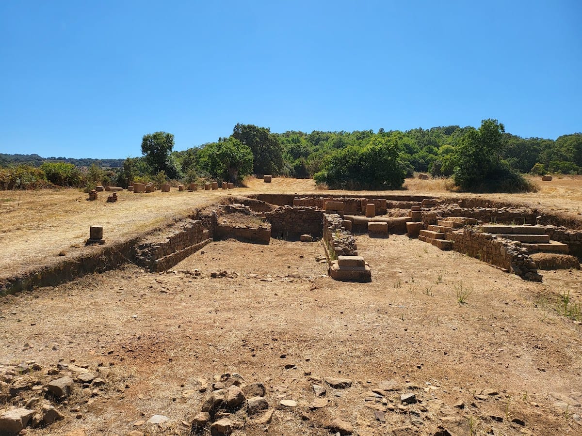
The forum and temple formed Ammaia’s most monumental architectural complex. The temple podium, a raised supporting platform, is a rectangular structure approximately 18 meters long and 9 meters wide, rising to 2.50 meters in height. It has a clay-earth fill and was built using opus incertum, a Roman technique that set irregular stone pieces into concrete or mortar. The podium was intended to receive a facing of granite blocks.
A transverse wall that remains visible divided the podium between the cella, the temple’s principal sacred chamber, and the portico of the atrium, a roofed colonnaded walkway. Excavation around the podium defined the limits of the forum and exposed walls belonging to a portico and a cryptoporticus, a covered or partly underground passage associated with a larger complex.
Forum structures
At the southeastern end of the complex, one structure may have formed the foundation of a staircase. Nearby remains may represent the foundations of another monumental building or monument. The forum’s arrangement reflects its combined civic and religious role, with spaces for public authority and worship concentrated around the temple complex.
Forum Baths
The Forum Baths were a small public bathing complex. Excavation in 1996 identified a small tank lined with marble slabs. It was probably a tepidarium tank for warm water or a frigidarium tank for cold water. Other structures surrounded the tank, and part of a larger natatio, or swimming pool, was later exposed. The pool may have been roofed or open to the air. The EN359 road lies west of the baths and destroyed a substantial part of the building.
Quinta do Deão and museum collections
The Quinta do Deão residence contains an excavated kitchen whose walls were supported by earlier Roman structures. Excavation also revealed a pavement, water conduits, domestic structures dating from the first through fourth centuries AD, associated occupation levels, and hearths. A water conduit formed part of the excavated remains. Roman materials, including inscribed stones, were reused throughout the later building, and epigraphic stones are visible in its courtyard.
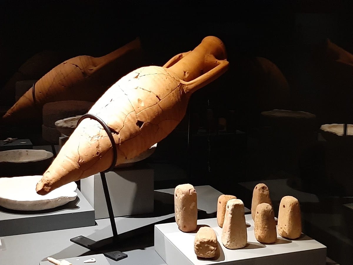
Finds from Ammaia include coins, inscriptions, terra sigillata, ordinary pottery, glass, bracelet fragments, and lamps. Some of the recovered Roman material was transferred to the National Museum of Archaeology in Lisbon. Quinta do Deão houses the Ammaia City Museum, whose permanent exhibition presents excavated material through themes of epigraphy, daily life, economic activities, and architecture.
Theater and amphitheater
Parts of the theater survive, including sections of the seating tiers. A reported amphitheater identified in 2019 is approximately 60 meters wide. Together, these remains add performance buildings to the known civic and domestic areas of the Roman city.
Bridges and river crossings
Ponte Velha
About four kilometers from the principal archaeological area, downstream along the Sever River, stood the Ponte Velha. This single-arched bridge was built with masonry and Roman stonework and formed part of the Roman road system. It collapsed on 26 April 1982.
Portagem complex
Farther downstream, the associated Portagem complex includes the bridge of Portagem and a rectangular tower with an eastern entrance. The crossing and tower belong to the later history of movement through the river corridor connected with Ammaia’s wider landscape.