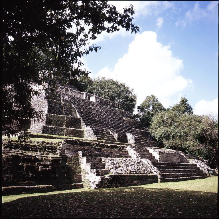
Altun Ha: A Maya City and Trading Center in Belize
Site at a Glance
- Rating
- 4.7
- Popularity
- Medium
- Country
- Belize
- Primary era
- Medieval
- Eras represented
- Iron Age, Classical, Medieval
- Civilizations
- Maya
- Site type
- City
On this page13 sections
History
Altun Ha was a Maya city near Rockstone Pond in the Belize District of Belize, occupied from approximately 900–800 BC until around AD 1000, with limited reoccupation after AD 1225. Its principal period was the Maya Classic Period, the era of major urban and political development from approximately AD 250 to 900. During this time, Altun Ha became a prosperous trading center between the Caribbean coast and routes leading toward the Belize River and the Peten.
Early settlement and urban growth
The earliest settlement belongs to the Middle Preclassic, around 900–800 BC. Population increased during the Late Preclassic, when large public buildings were erected. Altun Ha may initially have been subordinate to the nearby center of Colha, but it developed into an independent major city-state during the Classic Period, approximately AD 280–700.
The city’s original ancient name is unknown. Its modern name is understood as a Yucatec Maya approximation of “Rockstone Water,” referring to the nearby village of Rockstone Pond. An emblem glyph, a sign used to identify a political center or dynasty, is associated with Altun Ha, although its phonetic reading remains unknown.
The earliest evidence for rulers dates to the third century AD. Tomb F8/1 and an uninscribed altar from this period indicate the presence of an elite or ruling authority. Later inscriptions and objects refer to a dynastic sequence, including a ruler described as the seventh in that sequence. A jade plaque refers to the father of Til Man K’inich as an earlier kaloomte, a high-ranking Maya royal title associated with powerful dynastic rulers. These records have been used to suggest that Til Man K’inich’s father founded the dynasty, although complete reign dates are unknown.
The Water Scroll dynasty
Altun Ha was probably the seat of the Water Scroll dynasty during the Late Classic, although this identification remains inferential. The dynasty’s emblem glyph appears between AD 584 and 745 at Altun Ha and at distant sites including Pusilha, Tikal, Naranjo, and Altar de los Reyes. Its rulers used the title kaloomte, indicating a claim to especially high political status.
The dynasty’s activities extended beyond the city. They are associated with a military attack on Pusilha in AD 595, a superior political role at the installation of the ruler of Nim Li Punit in AD 738, and repeated ritual connections with the rulers of Naranjo during the eighth century. The dynasties of Altun Ha and Naranjo may also have been connected through marriage or a shared origin, although this remains an interpretation.
Altun Ha’s wealth is reflected in its architecture, elite burials, jade deposits, and long-distance contacts. Ceramic vessels associated with the city have been found as far away as Teotihuacan, a major ancient city in central Mexico. Objects and materials also indicate connections with central Mexico, the intermediate area of Mesoamerica, and Cocle in central Panama.
Decline and later occupation
Construction activity declined from about AD 800. Structures B5 and A8 were completely abandoned by about AD 850, while Zone E remained especially active between AD 700 and 800. The entire site was abandoned by the beginning of the eleventh century. During the Postclassic, Structures A1 and A5 were used exclusively for burials, and a limited occupation resumed after AD 1225, probably continuing into the fifteenth century.
Altun Ha was brought to archaeological attention in 1963, when quarrying by local villagers exposed a large carved jade pendant. Hamilton Anderson, the archaeological commissioner, informed David M. Pendergast, who carried out reconnaissance and test excavations that year. Stones from ancient structures had already been reused in modern residences at Rockstone Pond. Beginning in 1964, Pendergast led extensive excavations and restorations for the Royal Ontario Museum. The work continued through 1970, followed by a 1971 season devoted to ceramic and laboratory analysis. Later investigations were conducted by Joseph Palacio and Elizabeth Graham. Altun Ha became an archaeological reserve in 1995, with a protected area of 38 hectares.
Food, ritual, and society
Stable-isotope and archaeological evidence indicates that the population relied on maize while also consuming an unusually important marine and reef component. Maize consumption increased sharply between the Preclassic and Early Classic periods and was highest among people of higher status. During the Late Classic, maize was more prominent in the central precinct than in peripheral zones. Postclassic inhabitants consumed a greater proportion of terrestrial animals, possibly deer or dogs.
Ritual caches, deliberately deposited groups of objects, occurred in communal buildings used for public ceremonies and in residential structures associated with individual families. In communal buildings, the principal axis generally determined the position of a cache and served as a route of communication with deities. Late Preclassic caches were often associated with round platforms. Jade became especially important in offerings between 450 and 300 BC, while Classic-period caches commonly accompanied structural alterations and included varied ceremonial objects.
Remains
Altun Ha lies on the north-central coastal plain of Belize in a dry tropical environment. During its occupation, the area was swampy and had few recognizable water sources. Gordon Pond was the principal reservoir, Camp Aguada lay in the site center, and a creek ran beyond the northern edge of the mapped area. The site is divided into thirteen lettered zones containing 516 surviving structures. Groups A and B form the central precinct, together with Zones C, D, and E, while Zones G, J, K, M, and N formed peripheral or suburban areas.
Layout and water management
The central core consists of Group A, approximately 50 by 75 meters, and Group B, approximately 125 by 100 meters, with adjacent zones. Beyond the core, structures become more dispersed. Additional groups lie approximately 2.5 kilometers to the west-southwest, while individual structures extend 3–4 kilometers to the south and east. Settlement density has been used to estimate a population of approximately 2,733 people.
Two causeways have been identified. One lies in Zone C and does not connect directly to another structure; it was probably associated with Structure C13 for ceremonial purposes. The other links Zones E and F across swampy terrain, where water sources were located. Its construction may have required raised walkways to remain passable. Two possible chultuns, subterranean or partly underground reservoirs or storage chambers, are also known, although their original positions are uncertain because they were reused in modern times.
Early and public buildings
Structures C13 and C17
Structures C13 and C17 are the earliest known buildings at Altun Ha. Both consisted of round platforms dating to approximately 900–800 BC. C13 contained postholes and several burials and was probably an early religious building. C17 contained traces of burning or fire.
Structure F8 and Tomb F8/1
Structure F8 was the first major public building of the Late Preclassic and was constructed around AD 200. It passed through three developmental stages and included a two-element staircase made of small steps with side projections that may represent an architectural innovation. Most of the archaeological evidence from F8 belongs to the Early Classic.
Tomb F8/1 was inserted into the building approximately fifty years after its construction. It contained an adult male wearing a jade and shell necklace, jade earflares, shell disks, and pearls. Five pottery vessels and 59 Spondylus shell valves accompanied the burial. More than 8,000 pieces of chert debris and 163 formal chert tools covered the burial, while the cache also contained jade beads, shell valves, puma and dog teeth, slate pieces, and other shell artifacts.
The deposit included 248 objects made from Pachuca green obsidian, volcanic glass from the Pachuca region of Mexico, as well as 23 ceramic jars, bowls, and dishes. The obsidian belongs to the Miccaotli or early Tlamimilolpa phase and provides evidence of contact with Teotihuacan. The roof of the tomb also showed architectural or constructional associations with that central Mexican city.
Central ceremonial precinct
Structure B-4
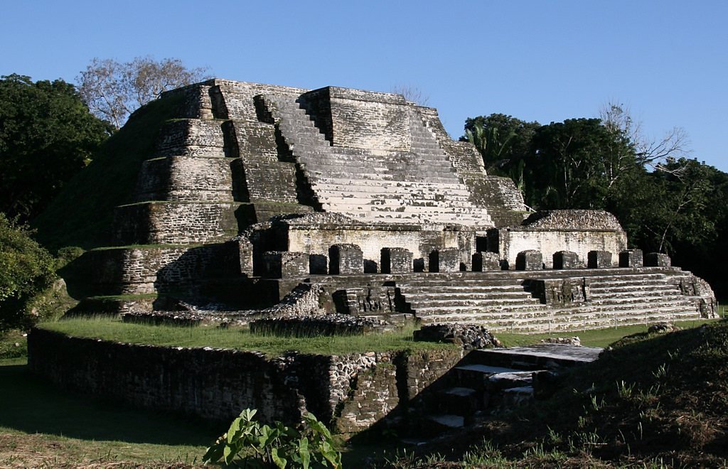
Structure B-4, also called the Temple of the Masonry Altars, stands in Group B and rises 16 meters. Its seventh construction phase dates to approximately AD 600–650. Excavations in 1968 revealed Tomb B-4/7, the seventh and earliest burial in the structure and the most elaborate tomb discovered at Altun Ha.
The tomb contained the extended skeleton of an adult male whose skull faced south-southwest. The individual was approximately 170–171 centimeters tall. Perishable contents included a wooden platform, feline skins, cloth, matting, cordage, rods, stuccoed objects, red pigment, and gray clay. Cloth covered the burial, textile impressions survived on pottery, and red pigment was distributed throughout the tomb, including on most jade objects.
Forty-three non-perishable artifacts included ceramic bowls, shell beads, jadeite anklets, bracelets and beads, pearls, pyrite and hematite objects, and a large carved jade head. The head is approximately 14.9 centimeters high, 45.9 centimeters in circumference, and weighs 4.42 kilograms. It was placed at the pelvis with the face of the jade boulder turned toward the skull.
The jade head was first interpreted as Kinich Ahau, a Maya solar deity associated with the sun and rulership, which led to the burial’s name, the Sun God’s Tomb. Later interpretation suggests that it may depict the Jester God, an early Maya symbol of royal authority, with bird and maize imagery. More than 800 pieces of jade have been recovered from Altun Ha, including more than 60 carved examples. Large quantities of jade also characterize elite Late Classic burials in Structure B-4.
Other ceremonial deposits
An offering from the central ceremonial precinct consisted of an undecorated, lidded limestone vessel. Inside were jadeite objects, two pearls, crystalline hematite pieces, Spondylus shell beads, and a tumbaga bead depicting a jaguar claw. The deposit dates to approximately AD 500 and is comparable to metal objects from Cocle in central Panama.
By about AD 700, alterations in the central precinct became less frequent. Structures B-4 and B-6 in Plaza B continued to be modified regularly, while Plaza A underwent substantial modification. Structure D2, at the edge of the central precinct, dates to the Late-Terminal Classic and produced a stemmed bifacial blade of Pachuca green obsidian in a post-abandonment offering. Its form, size, and manufacture resemble blades from F8, although its date of manufacture remains uncertain.
During the Postclassic, Structures A1 and A5 were used solely for depositing the dead. Lamanai-related Postclassic ceremonial vessels were excavated on top of Structure B-4. These later deposits show that parts of the central precinct retained funerary and ceremonial importance after the city’s main period of occupation.