Cortaccione Aqueduct: Spoleto’s Historic Water-Supply System
Site at a Glance
- Popularity
- Low
- Country
- Italy
- Primary era
- Medieval
- Eras represented
- Classical, Medieval, Early Modern, Modern
- Civilizations
- Italian, Papal States, Roman
- Site type
- Infrastructure
- Remains
- Aqueduct
On this page18 sections
History
The Cortaccione Aqueduct in Spoleto, Italy, was the city’s first hydraulic system for bringing drinking water into its urban centre. The date of the earliest aqueduct is unknown, but the Roman waterworks are thought to belong to the late Republic, the final period of the Roman Republic, or the opening years of the Augustan period, the reign of Rome’s first emperor, Augustus. The system answered the needs of an early city built on rocky ground with few nearby springs. Cortaccione’s springs lay about a kilometre from Spoleto in a straight line.
Roman water supply and land drainage
Spoleto became a Latin colony in 241 BCE, a settlement with a special legal status under Rome, and a municipium in 90 BCE, a town incorporated into the Roman state with local civic administration. As the population grew, the city probably needed to draw water from springs beyond its walls. The Cortaccione springs were tapped first, followed by those at Vallecchia near Patrico. Later links added water from Valcieca and Giunchete. The network carried water across the Tessino valley and supplied the city, while also serving irrigation and providing power to mills.
The Roman waterworks formed part of a longer effort to control water and drain marshy land east of Spoleto. Flooding by the Clitunno and the Marroggia, Tessino, Cortaccione and Spina streams had caused serious damage. Etruscan, Umbrian and Roman interventions contributed to this work. Its success was followed by the construction of the Via Flaminia in 220 BCE, a major Roman road between Rome and northern Italy.
Late antique works and medieval repairs
Further drainage and reclamation took place under Theodoric the Great, the Ostrogothic king who ruled Italy from 493 to 526. Between 507 and 511, work promoted at Spoleto returned extensive marshland to agricultural use.
A manuscript from the 10th century indicates that two separate aqueducts supplied Spoleto. Work on the Cortaccione conduit was underway in 1239, while the Vallecchia conduit was bringing water into the city by 1278. These 13th-century works are understood as substantial repairs that partly replaced Roman construction, rather than as entirely new aqueducts. In the first half of the century, repeated interventions changed much of the older system.
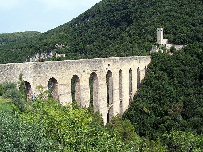
Spoleto also appointed a sworn official to inspect its fountains and aqueducts. Serving for one year, the official could order repairs and report people responsible for making water cloudy or polluting it with rubbish. In 1296, public officials were assigned to oversee the Cortaccione and Vallecchia aqueducts, and springs at Camporeo were connected to the Vallecchia line. A tower, probably built during the Middle Ages, watched over the bridge and aqueducts from the east.
Later additions and repairs
In the 14th century, a new section carried water from Fosso della Maddalena across the slopes of Monteluco to a point above the Rifolta. From there, a pressurized conduit supplied the recently completed Rocca Albornoziana. Part of this conduit was renewed in 1791.
Leaks from the old Valcieca aqueduct were described in 1487 as causing continual dripping over the hermitage of San Leonardo. In 1511, a long stretch of the Cortaccione line was repaired as far as Ponte Sanguineto, and a long wall was built. Rules prohibited agricultural work near the aqueducts and private diversion of their water to prevent further damage. In 1736, Pope Clement XII, pope from 1730 to 1740, financed an important restoration of Spoleto’s aqueducts.
Water from the Vallocchia estate also entered the Cortaccione conduit farther upstream. In 1866, the municipal technical office designed and built a 7,200-metre line from Valcieca that also collected water from Giunchete and joined the Cortaccione system.
Modern supply and continued use
Until 1892, two separate conduits remained active: the older Cortaccione line, which also collected Valcieca water and served a catchment of about 10 square kilometres, and another line from Patrico. Both supplied two reservoirs at the Rifolta. Their outflow powered two municipal mills; one continued operating until late in the 19th century and was abandoned after a new aqueduct was built.
The older supply had serious sanitary and practical limits. During rain, water from three associated streams mixed with spring water, while uncovered basins and conduits were exposed to pollution. Low pressure, waste and interruptions meant that households could not be connected and the city could not use fire hydrants. Spoleto had about 280 wells in 1891.
That year, municipal engineer Pompeo Bresadola began replacing the older arrangement with a pressurized, circulating supply. The new line used the Cortaccione springs alone for drinking water because they yielded more than the other sources; water from the other connections went to uses such as irrigation, public baths and washhouses. Water entered the new system on 10 January 1894, and homes were connected during 1894–95. At first, connections mainly benefited families able to afford them. Chemical and microscopic tests found the water to be of good quality, although its flow varied with rainfall. The works also included sewer repairs, public fountains and washhouses.
In 1928, rising demand after an officers’ training school was established led the municipality to connect the springs at Montefiorello to the old Cortaccione aqueduct. The same period brought enlargement of the Ponte delle Torri reservoir and extensions into newly urbanized parts of Spoleto. Another aqueduct was built at Monteluco in 1939 to serve new villas and a mountain colony. From the early 1970s, the Argentina Aqueduct became the main supply for the wider area, while the 19th-century Cortaccione system continued to serve the historic centre.
Remains
The surviving system combines water-collection works, channels and bridges along a route of about five kilometres. Some stretches ran above ground and others underground. Together, the remains show how spring water was gathered and conveyed while streams and stagnant water were controlled across the surrounding slopes and low-lying land.
Spring works and conduits
Collection works at Arézzola
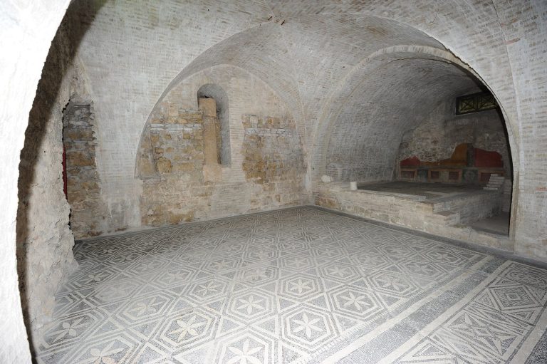
Roman-period remains were uncovered in 1823 and again in 1893 during work on the Cortaccione springs at Arézzola, on the slopes of Mount Borgiano east of Spoleto. The Spoleto archaeologist and historian Giuseppe Sordini investigated the site in 1893. Roman construction survives alongside medieval changes. The water-control works include weirs, drainage tunnels, protective walls, collection basins fitted with successive gates and lead pipes. These features served to manage mountain streams, drain water from low ground and capture spring water for distribution.
Surface and underground channels
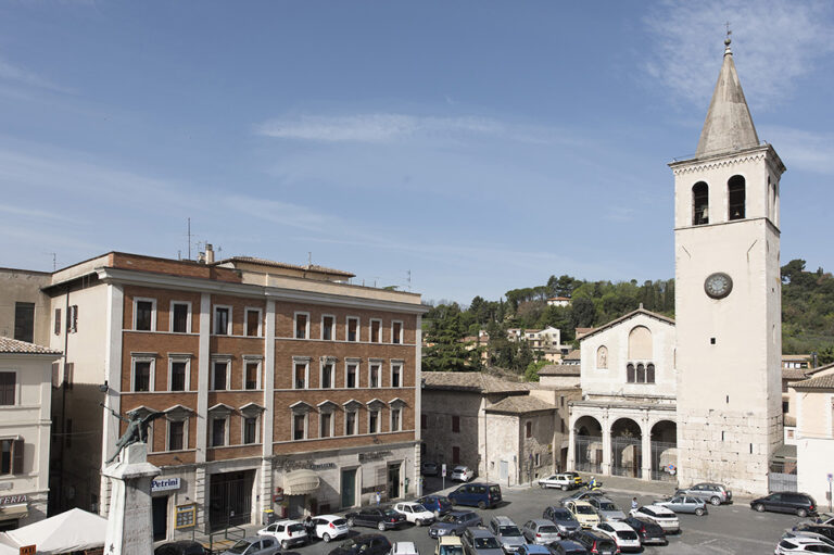
The aqueduct skirted Monteluco and crossed the Tessino gorge before reaching the high part of the city at the summit of Sant’Elia. Sordini described underground channels with rectangular cross-sections, protected by tunnels dug from the surface, and galleries cut into hillsides. These works show extensive rebuilding in the medieval and modern periods. At central Spoleto, a distribution structure known as a castellum aquae received the aqueduct water and directed it into smaller channels. It stood at Piazza Bernardino Campello, where masonry and terracotta branches connected with inspection wells and smaller pipes.
Gorge and mountain crossings
The Tessino crossing
The ancient bridge across the Tessino gorge is thought to have been lower and shorter than the present Ponte delle Torri. It was probably sturdy enough to carry water pipes. A reverse siphon, a closed pipe that descends and then rises under pressure, carried water across the change in elevation. After the ancient bridge was destroyed, probably by earthquakes or other disasters, the medieval Ponte delle Torri took its place. Its greater height and scale likely allowed water to travel in a descending channel under gravity. The bases of its fifth and sixth piers show classical construction and may have been reused from the earlier bridge.
Ponte Sanguineto
The exposed aqueduct section along Monteluco crossed the Valcieca gorge on Ponte Sanguineto. The shallow-arched bridge is about 28 metres long and 10 metres high. Its level upper surface forms a broad path across the mountainside, known as Giro dei condotti, or the Conduit Circuit.
Reservoirs and the mill tower
The Rifolta reservoirs and distribution route
Two reservoirs stood at the Rifolta beside the Fortilizio dei Mulini, a tower also known as the Mill Fort, at the eastern end of Ponte delle Torri. Before the 1890s overhaul, water crossed the bridge in an open channel atop its high wall, then reached a reservoir below the Fontana del Mascherone for distribution through the city. A marble inscription above the fountain commemorates the 1736 restoration of Spoleto’s aqueducts.
The Mill Fort
The tower is now ruined. When the mills no longer needed water for power, water from the southern aqueducts descended into the Rifolta as a waterfall. The municipal mill there had operated until late in the 19th century.
Later aqueduct lines
The 1866 Valcieca conduit
The masonry channel built in 1866 measured 7,200 metres. Along its course it crossed two bridges, each about eight metres high, before joining the Cortaccione line 1,080 metres from the entrance to Ponte delle Torri.
The 1890s pressure system
The 1890s redesign used a cast-iron pressure conduit that followed the old route for about two kilometres, then descended before Ponte Sanguineto toward Porta Ponzianina. Secondary pipes carried water uphill to the higher city. A new reservoir was excavated in rock beside the Mill Fort. At the end of the distribution network, it collected surplus water and returned it to circulation to regulate the flow. The new arrangement no longer used the wall of Ponte delle Torri to carry an aqueduct. The main external conduit from the springs to the Ponte delle Torri reservoir measured 4,606 metres, and the complete network, including internal pipes, extended for about 14 kilometres. The Terni Blast Furnaces, Foundries and Steelworks Company manufactured the cast-iron works.