Castellum at Hinteren Seeberg: A Roman Frontier Fort in Germany
Site at a Glance
- Popularity
- Very Low
- Country
- Germany
- Primary era
- Classical
- Eras represented
- Classical
- Civilizations
- Roman
- Site type
- Military
- Remains
- Fort
On this page7 sections
History
Roman frontier period
The Castellum at Hinteren Seeberg is a small Roman fort near Castell, Germany, beside the Raetian Limes, the Roman frontier line in the province of Raetia. Small forts and watchtowers served as strongpoints for troops stationed just behind the frontier, although the fort’s particular role is unknown. Iron ore may have been worked nearby. The fort had been abandoned by about AD 260 at the latest.
Later history and investigation
The Reich Limes Commission, a German body that surveyed and investigated the Roman frontier, carried out the fort’s first excavation. Later archaeological work established its overall dimensions and opened a few trenches within it. Archaeologists Thomas Fischer and Konrad Spindler proposed that Christian evidence at former Roman sites could point to the survival of a Romanized population before widespread missionary activity, even though the forts had long been deserted.
In 2005, the Raetian Limes became a UNESCO World Heritage Site. The fort is also protected as a registered archaeological monument under Bavaria’s Heritage Protection Act.
Remains
Fort enclosure
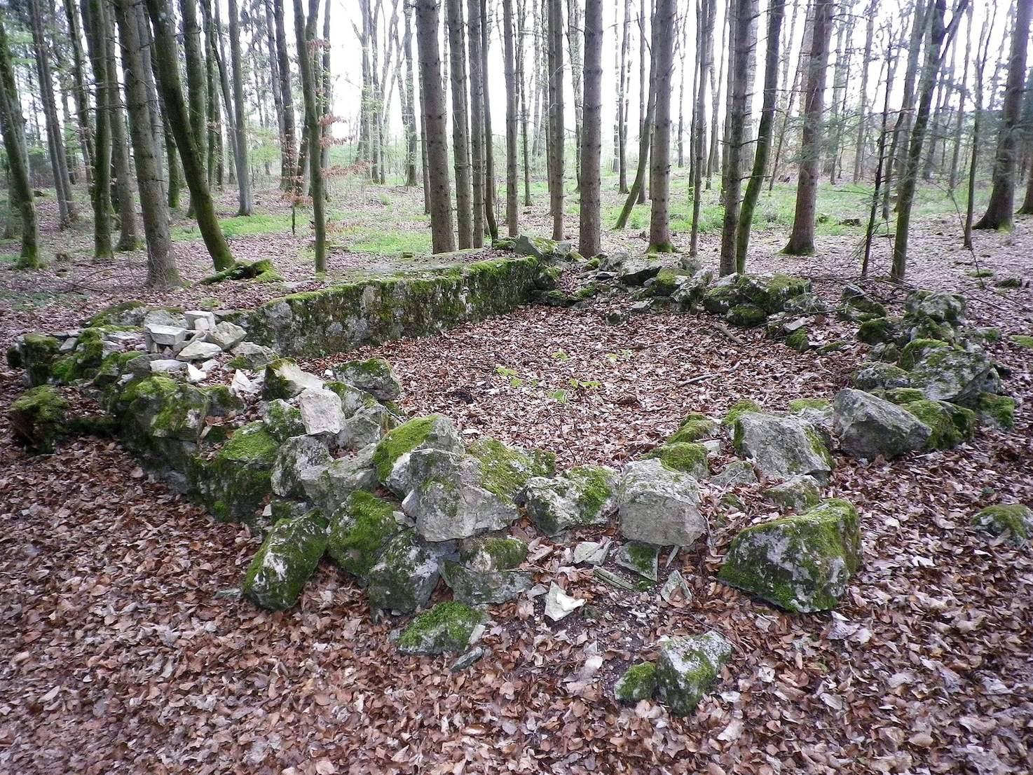
The square fort stands at about 440 metres above sea level on the eastern edge of the Steinsdorfer Grund, a dry valley, roughly 30 metres behind the Limes wall. Its enclosure measures 17 metres on each side. The stone rampart is about 1.5 metres thick and survives as a low rise, between 30 and 60 centimetres high, on the woodland floor. Gates stood on the west and east sides, with cheek walls projecting both inside and outside the enclosure. The buildings within the fort were probably made of timber.
Watchtower positions
A poorly investigated watchtower identified as post 15/22 may have stood a few metres east of the fort, but its location remains uncertain. An alternative position lies about 300 metres higher, at a bend in the Limes on the eastern ascent. There, a Reich Limes Commission official found a rectangular pit about two metres deep. From the lower proposed site, the fort could have had visual contact with the watchtower line only through suspected post 15/21, across the valley to the west at about 480 metres elevation. The higher position would have provided sightlines to the watchtower chain in both directions.
Small finds
Iron crosses from the early medieval period were found at the fort. Comparable crosses from a seventh-century Christian place of worship in the former Roman baths at Bad Gögging provide a basis for dating these symbols.