Cistern of the Hebdomon: A Byzantine Imperial Water Reservoir in Istanbul


Site at a Glance
- Rating
- 3.9
- Popularity
- Very Low
- Country
- Turkey
- Primary era
- Medieval
- Eras represented
- Classical, Medieval
- Civilizations
- Byzantine
- Site type
- Infrastructure
- Remains
- Cistern
On this page12 sections
History
The Cistern of the Hebdomon is a Byzantine water reservoir in Istanbul, Turkey, built in the suburb of Hebdomon outside Constantinople. Its construction date is uncertain, although it is generally placed between the fifth or sixth century and the eighth century. The reservoir formed part of the infrastructure of an imperial resort near the Sea of Marmara, supplying palaces, military facilities, and the ceremonial life of the Byzantine capital.
Hebdomon and the imperial suburb
Hebdomon means “the seventh,” referring to the suburb’s traditional distance of seven Roman miles from the Milion, the Constantinopolitan milestone from which distances were measured. Located beyond the city walls, the area was a well-watered imperial resort with palaces, churches, military grounds, and spaces for official ceremonies.
The cistern supplied the Palace of Magnaura, built by Emperor Valens, who ruled from 364 to 378, and the Palace of Jucundianae, also called Secundianae, built by Justinian I, who ruled from 527 to 565. Both residences stood near the Marmara coast, in the vicinity of the present Ataköy Marina. The reservoir also supplied the Thracian army stationed at the nearby Campus Tribunalis, or Mars Field, a military training and assembly ground in the valley of Veli Efendi.
The Campus Tribunalis was also a place where the army acclaimed several Byzantine emperors. The imperial court visited Hebdomon for military parades, receptions for returning emperors, and worship at local churches. Churches dedicated to Saint John the Evangelist and Saint John the Baptist stood in the area. The latter was traditionally said to contain the head of Saint John the Baptist and the tomb of Basil II, the Byzantine emperor who ruled from 976 to 1025.
Construction and abandonment
The date of construction remains unresolved. The size of the bricks has been taken to favor a date after Justinian I’s reign ended in 565, while the lack of brick stamps is characteristic of buildings constructed after the late sixth century. At the same time, the reservoir’s architectural form and building technique have also been interpreted as favoring a fifth- or sixth-century date. These indications place the cistern within the later Roman and Byzantine development of Constantinople without establishing a precise year of construction.
By the end of the twelfth century, the water-supply system had probably been abandoned, possibly following repeated earthquakes. After the Ottoman conquest of Constantinople in 1453, a replacement system drew on nearer water sources at Halkalı and in the Belgrade Forest. The empty reservoir was then used as a stable for the sultan’s elephants. This function gave it the Ottoman names Filhane and Fildamı, meaning a house or stable for elephants.
Reuse and modern intervention
The former reservoir was later turned into a vegetable garden and became one of Istanbul’s four Çukurbostan, or sunken gardens created in former open-air cisterns or similar depressions. In 1968, earthworks for a planned housing development exposed much of the cistern’s buried walls.
Vegetable cultivation ended in 1996, when the state acquired the site and converted it into an open-air popular-music venue with capacity for up to 12,000 spectators. Concerts stopped in 2003 after their vibrations began damaging the walls and disturbing horses at the nearby racetrack. The Bakırköy municipality later administered the site, which was used intermittently for receptions and other gatherings. A restoration project was announced in 2015, but it remained unfinished.
Remains
Reservoir structure
The cistern is an open-air rectangular reservoir measuring approximately 127 by 76 metres and covering about 9,600 square metres. Its average internal depth is about 11 metres, while accumulated soil has raised the surrounding ground so that the exterior walls appear considerably lower. The eastern walls extend approximately 2.5 metres into the ground, and the reservoir held about 105,000 cubic metres of water.
Walls and masonry
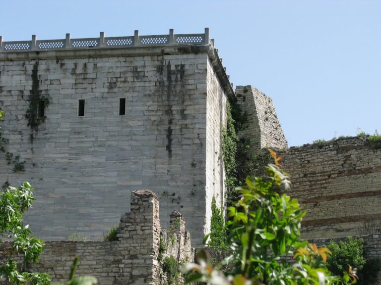
The north and south walls are approximately 4.1 metres thick, while the east and west walls measure about 7 metres across. They were built using opus listatum, a Roman and late Roman technique of alternating horizontal courses of brick and stone. The usual pattern is five brick courses to two stone courses, changing near the top to approximately five brick courses for four or five stone courses. A concrete core was faced with stone, and traces indicate that the inner surfaces were probably coated with opus signinum, a waterproof mortar used in water installations. Comparable brick-and-stone construction appears in the Cisterns of Aetius, Aspar, and Mocius within Constantinople’s walls.
Hillside supports
The outer western wall is embedded in the hillside. The inner western wall and outer eastern wall are reinforced by a row of 21 semicircular niches, which act as buttress-like supports against the pressure of the hillside and, on the eastern side, the stored water. The first niche has a half-dome, and the remaining niches are thought to have had similar coverings. Two opposing stairways were built into the northern and southern sides to provide access to the reservoir interior, although both are partly destroyed.
Water regulation and distribution
Water tower
Outside the southwestern corner, in the second niche, stood a castellum aquae, a regulating tank or distribution structure used in Roman and Byzantine hydraulic systems. Its double-shell construction enclosed a central spiral staircase within a water chamber. Water entered through an inlet at the base, while several outlet channels carried water from the reservoir in different directions.
The tower probably helped regulate the pressure of the aqueduct system. It could release water when the reservoir level fell below a specified point. Its outer walls were about 30 centimetres thick in the lower section and approximately 15 centimetres thick above the cistern’s water level.
Water source
The original water source remains uncertain. Because the cistern stands at a low elevation, it may have received water from nearby springs if their flow was sufficient, or through an artificial channel from the Thracian hinterland.
Valley setting and related cisterns
The reservoir occupies the western side of a small valley that runs south toward the Sea of Marmara and is now completely built over. It lies in the present Osmaniye neighbourhood of Bakırköy, between Fildamı Arkası and Çoban Çeşme Sokak, northwest of the Veli Efendi racetrack and approximately two kilometres west of Constantinople’s land walls.
Three smaller open-air cisterns once stood farther west in the same valley. They were elliptical and aligned from north to south. The central cistern has been destroyed, while the two surviving examples are known as Domuzdamı, or “pig houses,” a name connected with their later use as animal shelters.
Nearby sites