Ruines gallo-romaines des Mazelles: A Gallo-Roman Complex at Tasciaca


Site at a Glance
- Rating
- 3.8
- Popularity
- Very Low
- Country
- France
- Primary era
- Classical
- External website
- Open
- Eras represented
- Classical
- Civilizations
- Roman
- Site type
- Economic
- Remains
- Warehouse
On this page8 sections
History
The Ruines gallo-romaines des Mazelles are the surviving remains of a Gallo-Roman complex at Thésée in France, built during the early second century in the Roman period. They form the most immediately visible part of Tasciaca, a vicus, or secondary settlement within the Roman provincial system, that extended along both banks of the Cher in Thésée, Pouillé, and Monthou-sur-Cher. The buildings stand on the river’s right bank, about 800 metres from modern Thésée and close to the Roman route between Tours and Bourges.
Foundation and successive construction
The complex occupied a strategic position near both the river and the road. Its purpose is uncertain, but proposed interpretations include a mansio, an officially recognized stopping place for travellers and state transport, a warehouse, a public or administrative building, a civil basilica used for legal and commercial business, a wine cellar, or a service centre connected with river and road commerce. A transport and trade function is regarded as the most plausible interpretation.
Construction probably began in the first third of the second century and appears to have accelerated during the reign of Emperor Hadrian, who ruled from AD 117 to 138 and was associated with extensive building and administrative activity in the Roman provinces. The dating remains tentative because the buildings yielded little archaeological material and their unusual form has not produced a settled interpretation. The complex developed through several stages. The southwest building may have been erected first, followed by the main northern building and the beginning of the southeast group. The northern building was then enlarged, the southeast group extended, and a perimeter wall constructed. The intervals between these phases cannot be dated precisely.
Late antique use and later history
Use of the buildings continued into Late Antiquity in a limited or temporary form. A coin from the reign of Arcadius was found in a context associated with possible partial occupation. The evidence points to a changing use of the complex rather than a clearly continuous phase of settlement.
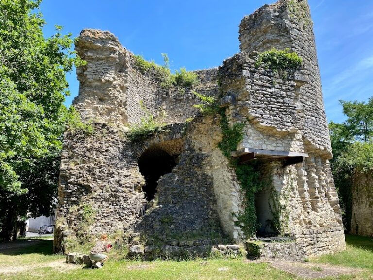
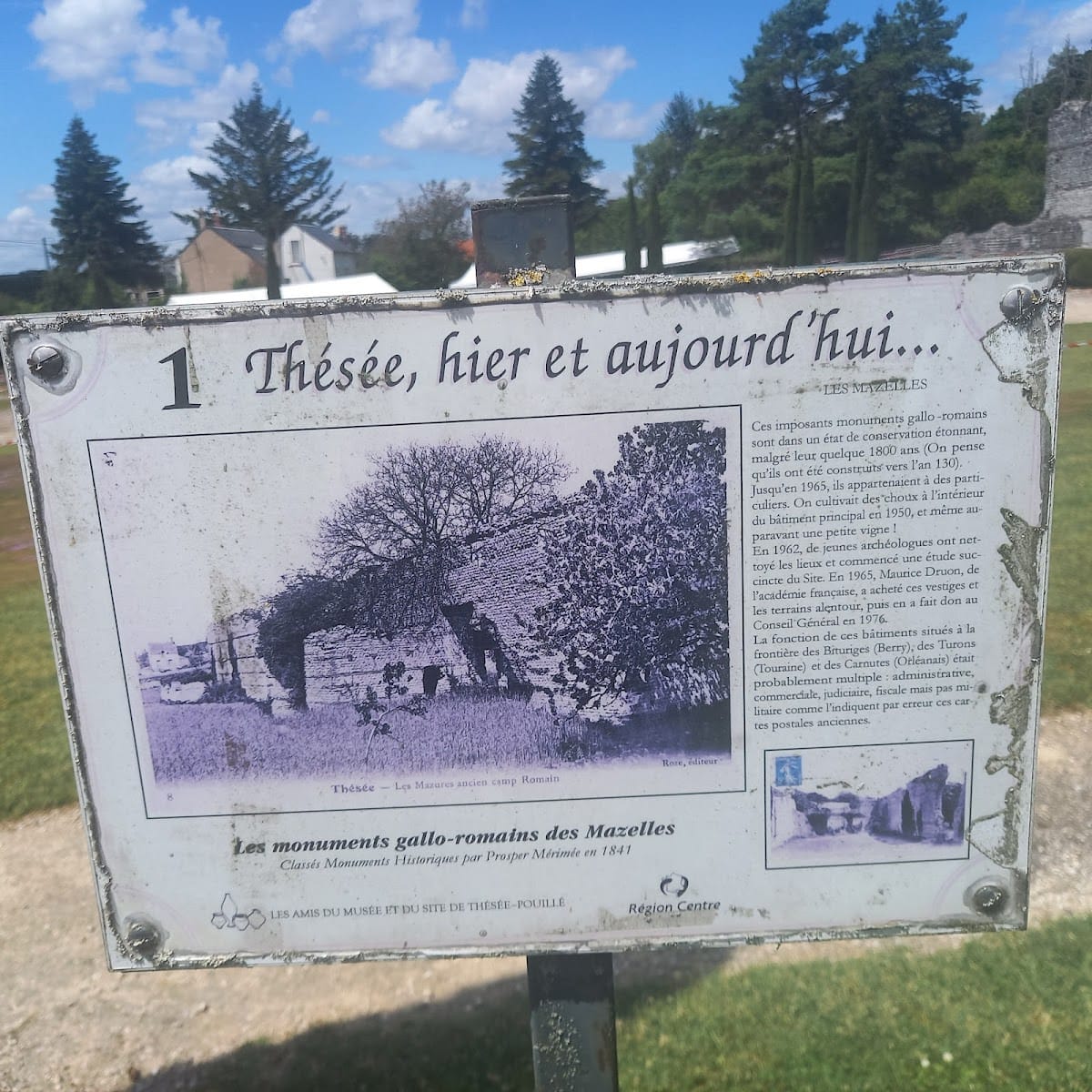
The ruins were placed on the list of historic monuments in 1840. By 1950, the property was privately owned and part of the interior was being used for a small vineyard. Earlier views show the masonry covered by ivy, brambles, and scrub. Clearance and archaeological work began in 1961 under Georges Gaume, with support from the prehistorian André Högström. Between 1962 and 1965, vegetation was removed and exploratory surveys and excavations focused especially on the southeast buildings, with further work continuing into the early 1970s.
The writer and politician Maurice Druon acquired the ruins and surrounding land in 1965. He removed recent constructions and reshaped the grounds to protect the complex from property development while allowing archaeological investigation. In 1976, he transferred the Mazelles to the Loir-et-Cher departmental authority for a symbolic franc. From 1974, excavation responsibility passed to the Institut d’Art et d’Archéologie of the University of Paris-Sorbonne under Claude Bourgeois, and the site became a training excavation for students. An interdisciplinary programme carried out from 2003 to 2007 refined understanding of the buildings and their relationship to Tasciaca, while leaving their exact function unresolved.
The Loir-et-Cher departmental authority owns the complex. The Mazelles are the only part of Tasciaca classified as a historic monument. During the twenty-first century, the grounds were fenced and landscaped, with explanatory lecterns added. The masonry remains exposed, while soil and vegetation periodically cover some areas.
Remains
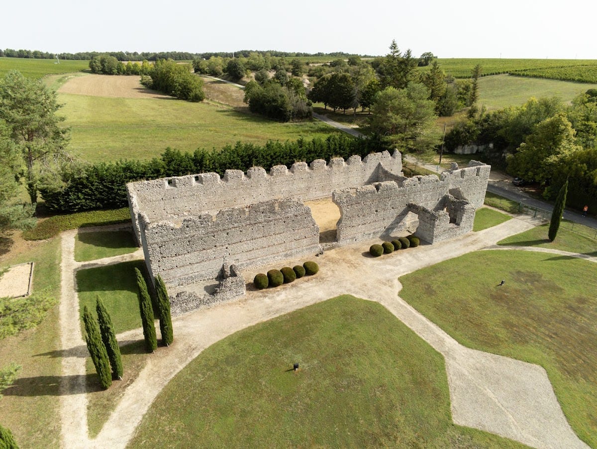
The complex lies at the southern end of a natural drainage hollow descending from the limestone plateau towards the Cher, about 100 metres from the river. Its remains occupy a probable enclosed area described in one assessment as approximately 7,000 square metres, while a broader archaeological assessment gives the wider site an area of about 2.6 hectares and a total built area of about 1,400 square metres. The visible layout consists of a large rectangular building to the north and two groups to the south. The southeast group contains two adjoining constructions, so the site may be understood as either three principal buildings or four separate structures.
Northern building
The principal northern building is oriented east to west and measures about 50 to 52 metres in length and nearly 20 metres in width after its eastern extension. Its walls survive locally to approximately 5.50 metres and in some areas reach 7.40 metres above ground level. Inside are two rooms, including a large hall originally about 38 to 40 metres long. The hall is largely open and unpartitioned, a feature that contributes to the continuing uncertainty over the building’s purpose.
A gallery runs along the south side and is associated with two small rectangular pavilions, probably linked by an open gallery or lean-to structure. Doors open west, east, and south. A regular series of 27 windows is concentrated high in the walls, with most positioned about 4.70 metres above the floor. The floor of the large room, exposed during the 1965 excavations, consists of two layers of small stones bonded with mortar. A wooden truss roof was technically possible, while an earlier interpretation proposed a partial roof with a central compluvium, an opening that admitted light and directed rainwater into an interior space.
An eastern extension measures approximately 8.50 by 14.70 metres. Its later relationship to the main structure can be seen in the exterior of the north wall, where a construction joint, a change in the basal masonry, and a different arrangement of terracotta courses mark the addition.
Southern buildings
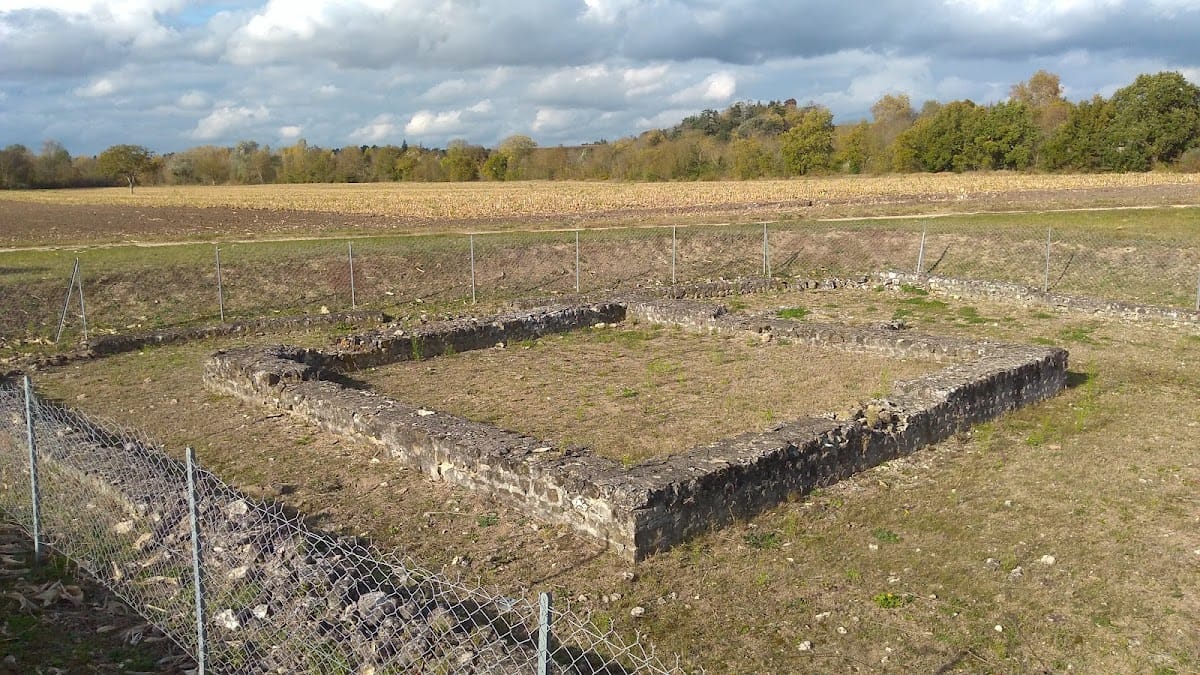
The southwest building is a single room measuring approximately 11.50 by 9.60 metres, although earlier measurements give dimensions of about 12 by 10 metres. Its walls survive only to the third course above the foundations, and the west side may have contained an entrance. Stone samples indicate that its building material came from another part of the same quarry used for the northern and southeast buildings, supporting the possibility that it was the earliest structure in the complex.
The southeast group measures approximately 30.60 by 17.80 metres, with earlier measurements giving about 35 by 18 metres. Its northern part contains two square rooms on the west, probably connected by a gallery. The southern part has two rectangular rooms of different sizes, divided by a wall running from north to south. The walls follow the same general construction principles as those of the northern building but are thinner, about 0.50 metres thick compared with a maximum of 0.80 metres in the northern structure.
Enclosure and construction
Parts of a perimeter wall define the complex. The western side extends for about 82 metres and includes an entrance 3.16 metres wide, with a vestibule projecting into the courtyard. Approximately 18 metres of the northern side survive from the northwest corner towards the main building. Other sections lie beneath the D176 road and beside the northern building.
The northern building rests directly on limestone along its north and west sides, while its eastern and southern foundations lie on sand deposited by earlier courses of the Cher. Its walls have two limestone rubble facings around a rubble core, all bonded with strong pink mortar containing crushed tile. Small rectangular or flat stones are arranged in oblique and herringbone patterns, known as opus spicatum, and alternating courses of brick or tile reinforce the masonry. Tile also appears in round arches, at the corners, and in courses associated with rows of holes for wooden scaffolding. This small-unit Roman masonry, or petit appareil, is one of the complex’s defining surviving construction features.
The limestone used in the northern and southeast buildings probably came from a quarry about 800 metres northeast of the complex. The durable, relatively non-porous blocks were set in very strong mortar, helping the walls remain standing for nearly two millennia and making the stone unsuitable for later reuse as dressed building material.
Archaeological evidence and river setting
Excavations produced pottery and tile fragments, a small number of coins, and the skeleton of a horse buried inside the northern building. These finds provide limited material evidence for the complex’s use. Looting and the removal of large quantities of soil during twentieth-century clearance reduced the archaeological information available from the interiors.
A possible ancient route ran along the right bank of the Cher near the Mazelles. Later aerial and electrical surveys suggested a track or road between the river and the railway. In shallow water downstream, remains resembling a stone quay extend for about 30 metres, although their function remains uncertain. Together with the site’s position near the Cher and the route towards Tours and Bourges, these features form part of the evidence for interpreting the complex as a place connected with transport and commerce.