Dover Western Heights: A British Coastal and Inland Defence System


Site at a Glance
- Rating
- 4.6
- Popularity
- Low
- Country
- United Kingdom
- Primary era
- Modern
- External website
- Open
- Eras represented
- Classical, Medieval, Early Modern, Modern
- Civilizations
- British, Roman
- Site type
- Military
- Remains
- Fort
On this page20 sections
History
Dover Western Heights is a British system of forts and earthworks above Dover in the United Kingdom, developed during the eighteenth and nineteenth centuries to reinforce the town’s defenses and protect its strategically important port from attack by land and sea. The high ground first received earthworks in 1779 during preparations for a planned invasion, then underwent major fortification from 1804 as Britain responded to Napoleon’s intended invasion of the country. By the early twentieth century, the Heights was reputed to be the strongest and most elaborate fortification in the country.
From invasion earthworks to major fortress
In 1804, Lieutenant-Colonel William Twiss was instructed to modernize Dover’s defenses. Twiss was a British military engineer who had already directed improvements at Dover Castle between 1794 and 1803. His work at the Heights included the design of Grand Shaft Barracks and the Grand Shaft, as well as the planning of a larger defensive system incorporating forts, ditches, batteries, and connecting earthworks.
The Citadel and Drop Redoubt were planned as rebuilt versions of the earlier West and East Redoubts. A redoubt was a fortified work intended chiefly to defend itself with troops and artillery within an enclosed perimeter. The two principal forts were to be linked by defensive lines. The Citadel remained unfinished when the Napoleonic Wars ended, and work on completing and facing its ditches resumed in 1853, at the beginning of the Crimean War.
The Drop Redoubt was constructed in two main phases. The first lasted from 1804 to 1808 during the Napoleonic Wars. A second rebuilding followed from 1859 to 1864, after the Royal Commission of 1859 had reviewed Britain’s defenses during a later invasion scare associated with the rise of Napoleon III, the French ruler of the 1850s. The Redoubt’s artillery was directed mainly against an invading force approaching Dover from inland rather than against ships at sea.
Later nineteenth-century changes
The defensive system continued to change as artillery became more powerful. From 1860 to 1874, outworks were added to the Citadel, while the North and South Lines were strengthened after 1858. The North-East Line was rebuilt on a different alignment between the Drop Redoubt and the cliffs. These alterations formed part of the continuing effort to adapt the Heights to new weapons and changing ideas about the defense of Dover.
After 1890, the Citadel ceased to function primarily as a defensive work and became a large barracks and mobilization center. During the First World War, it housed the 3rd (Reserve) Battalion of the Buffs, the East Kent Regiment. The battalion trained reinforcement drafts for units serving overseas. The enclosed ground between the major forts and their defensive lines could hold large numbers of troops in tents, and it was used for large parades and assemblies before embarkation during the war.
Coastal artillery remained part of the Heights’ later military role. The Citadel Battery was built in 1898 at the western end of the Western Outworks and remained operational until Britain’s coast-artillery network was dismantled in 1956. During the Second World War, a commando squad was secretly stationed in the Drop Redoubt. If an invasion occurred, the commandos were to destroy Dover Harbour, and mines were laid around the lines. The sally ports and a short tunnel associated with this deployment survive as evidence of that occupation.
Prison use and later management
The Army withdrew from Western Heights between 1956 and 1961. In 1956, the Citadel was transferred to HM Prison Service. It later served as a Borstal, a youth custody center, a young offender institution, and the Dover Immigration Removal Centre. The center had closed by November 2015, and the freehold site was offered for sale in 2018. Many of the Citadel’s original buildings remain within the former prison complex.
Much of the wider Heights is now a country park and local nature reserve. English Heritage owns the Drop Redoubt, while the council owns the Grand Shaft. The Western Heights Preservation Society opens the staircase annually. The Grand Shaft Barracks also acquired a modern cultural association when Peter Watkins used them as the setting for post-nuclear-attack scenes in his 1965 film The War Game.
Remains
Dover Western Heights retains a connected landscape of forts, dry moats, defensive lines, batteries, barracks, access works, and earlier remains. The Citadel occupies the western end of the Heights, while the Drop Redoubt lies to the east and is linked to it by dry moats. The North Lines run along the ridge between them, the South Lines descend from the Citadel toward the Old Folkestone Road, and the North-East Line extends eastward from the Drop Redoubt. Together, the earthworks enclosed a broad area between the forts and the southern and eastern escarpments.
The principal forts
The Citadel
The Citadel began as a large bastioned fieldwork in the early 1780s. A bastion projects from a fortification line so that troops and artillery can fire along its sides. Three guardhouses with loopholes were built within the early defenses. By 1806, the rebuilt Citadel was surrounded by an unrevetted defensive ditch, meaning that the earth sides had not yet received a supporting brick or stone facing. Temporary barracks huts and the three guardhouses occupied the interior. A well sunk in 1809 supplied permanent water during a siege, and a pumphouse was added in 1860.
Existing Citadel casemates, vaulted protected chambers, were adapted as barracks for 500 men in 1853. Later work from 1860 to 1874 added outworks and arranged barracks, stores, and magazines around a large parade ground. The entrance was on the east, reached by a drawbridge over the ditch. A tunnel through the rampart led to the fort and the main guardroom. The bomb-proof Officers’ Quarters and Mess, built by Major William Jervois in 1860, was designed partly to act as a defensible keep if the Citadel were stormed.
The Citadel’s intended armament consisted of forty-three 18-pounder guns and thirty-one carronades, short naval guns. By the 1860s, the guns comprised eighteen 18-pounder carronades, twenty 12-pounder carronades, and ten 8-inch mortars. The Citadel was later extended westward through the Western Outworks, whose ramparts contained additional casemated barracks. The Citadel Battery, added in 1898, had three emplacements for 9.2-inch Mark X breech-loading guns.
The Drop Redoubt
The Drop Redoubt stands on the site of an eighteenth-century bastioned fort and is linked with the Citadel by dry moats. The first Redoubt was a solid pentagonal structure cut into the hillside and faced with brickwork. It contained barracks and a magazine, with artillery positions above, and was originally planned for 200 troops. That intended strength had fallen to 90 by 1893.
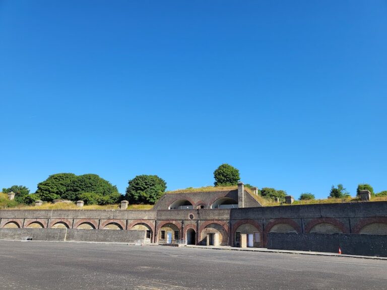
The first-period Soldiers’ Quarters comprise five bomb-proof casemates. Their curved cross-sections and thick covering of earth protected the rooms from mortar fire. Windows at the rear opened onto a trench, reducing exposure to blast. The second construction period added caponiers to four corners of the Redoubt. A caponier is a protected passage or defensive structure projecting into a ditch. Each had a stone staircase to the upper level, and two had adjoining gunrooms for firing along the North and South-East Lines. The original magazine was enlarged and shielded by a substantial earth bank.
The Officers’ Quarters, Guardroom, and cells belong to the second construction phase and have semicircular arches that distinguish them from the earlier work. The Redoubt was entered across a bridge whose inner third could pivot to isolate the fort. The bridge has been removed, but its pivot and the recess into which it swung survive.
The Redoubt was initially designed for twelve smoothbore 24-pounder guns and two carronades. In 1851, three 24-pounders, six 12-pounder saluting guns, and an 8-inch mortar were in place. After the later rebuilding, eleven Armstrong 64-pounder rifled breech-loading guns were installed on traversing carriages. These weapons proved unsatisfactory and were replaced by muzzle-loaders.
Defensive lines and entrances
The North, South, and North-East Lines
From 1804, the outer defenses consisted of the North Lines along the ridge between the Citadel and Drop Redoubt, the South Lines descending toward the Old Folkestone Road, and the North-East Line extending from the Redoubt. The South Lines included a bridge over the defensive ditch, connecting the fortress with the South Military Road and the harbor beyond. The North Entrance, positioned between the Drop Redoubt and North-Centre Bastion, provided access by the North Military Road.
The North-West Bastion was built along the northern edge of the Citadel between 1809 and 1816. The North-Centre Bastion was constructed halfway along the earthworks between the two principal forts. The North-West Bastion formed a tiered bulwark that flanked the northern slope. After 1858, a Detached Bastion was built immediately north of the rebuilt and strengthened North-Centre Bastion to designs by Captain Edmund Du Cane. These bastions enabled muskets and artillery to deliver flanking fire along the North Line.
The entrances
The rebuilt North Entrance was approached by a twisting path through the tenaille, a projecting defensive work in front of a fortification, and by lifting and falling bridges over the ditches. A new South Entrance, also called Archcliffe Gate, was built where the South Military Road crossed the extension of the South Lines near Citadel Road. This monumental stone gatehouse was demolished in the 1960s.
Barracks and military access
Grand Shaft Barracks
Grand Shaft Barracks were begun in October 1804 between the Drop Redoubt and the southern cliff. Designed for 700 men, the complex included a leveled parade ground, stepped terraces, and three parallel ranges of three- and four-story blocks. Officers’ and soldiers’ quarters stood alongside Staff Sergeants’ quarters, Field Officers’ quarters, an Officers’ Mess, a canteen later called the Regimental Institute, a gymnasium, stables, and ancillary buildings. Married quarters were added in the 1860s.
The terraces rose behind the parade ground toward the hillside. A long flight of steps connected them with the far left corner of the parade ground, while the open side of the ground extended toward the cliff top and the harbor. The barracks, like most of the garrison buildings on the Heights, were almost entirely demolished in the 1960s.
South Front Barracks
South Front Barracks were built southwest of Grand Shaft Barracks in the 1860s. Their accommodation was mainly placed in bomb-proof casemates within the ditch of the southern defensive line, above Archcliffe Fort. Three stepped terraces of married quarters and ancillary buildings stood between the casemates and Citadel Road. The casemates accommodated 400 soldiers, while the married quarters housed 120 married soldiers and their families.
By 1912, the casemates were being used as offices by the Royal Garrison Artillery, which operated fixed and coastal artillery. The married quarters remained occupied into the twentieth century. Buildings added west of Grand Shaft Barracks in the 1860s included a Garrison Chapel and School. A Military Hospital, built in 1804 to 1806 and extended in the 1860s, was later used as Royal Engineers headquarters. These buildings were almost entirely demolished in the 1960s.
The Grand Shaft
The Grand Shaft is a vertical military access shaft cut into the cliff beside the Grand Shaft Barracks parade ground. It was intended to connect the Heights with the town defenses and harbor more directly and safely than the steep roads and paths. The shaft is 26 feet, or 7.9 meters, in diameter and 140 feet, or 43 meters, deep. A 180-foot, or 55-meter, gallery connects its base with Snargate Street.
Two brick-lined shafts form the structure. The outer shaft contains a triple staircase, while the inner shaft acts as a light well. Openings in the inner wall illuminate the stairs. Construction was probably complete by 1807.
Batteries and artillery positions
The Drop Battery and St Martin’s Battery
The Drop Battery was built on the slope below the Drop Redoubt in the 1850s as part of Dover’s coastal defenses. It had emplacements for eight 8-inch guns, although the later construction of the North-East Line obstructed part of its field of fire. St Martin’s Battery replaced it in the 1870s farther to the southwest. Three emplacements held 10-inch rifled muzzle-loaders, with ammunition stores between them.
The guns later became obsolete, and St Martin’s Battery remained out of commission until the Second World War, when three 6-inch breech-loading guns were installed. A further South Front Battery was built in 1898 but had a short operational life.
Earlier remains and the Western Pharos
The Roman lighthouse
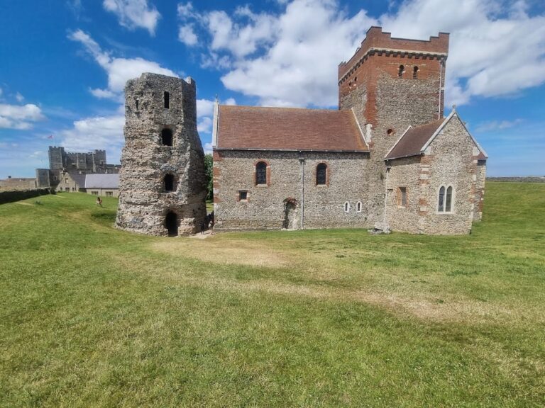
The Western Pharos is the remains of a Roman lighthouse on top of the Drop Redoubt. A pharos is a lighthouse, especially one associated with the ancient Mediterranean and Roman worlds. The Western Pharos and the surviving lighthouse at Dover Castle date from the second century AD and are understood to have illuminated the cliffs on opposite sides of the Roman port of Dubris, present-day Dover.
The lighthouse remains were lost during the first phase of Redoubt construction. They were rediscovered during the second phase and restored to their original position as an irregular mass of masonry. Their foundations survive in the room immediately below. The ruins were locally called the Bredenstone or the Devil’s Drop of Mortar. Until 1804, the site was used for the installation ceremony of the Lords Warden of the Cinque Ports, the medieval confederation of southeastern English coastal ports. The local name for the ruins probably gave the Drop Redoubt its name.
The medieval church
Between the Citadel and Drop Redoubt are the ruins of an eleventh-century church with a round nave. The church remains occupy the same wider defensive landscape as the later forts and earthworks, adding a medieval layer to a site otherwise dominated by military construction from the eighteenth century onward.