Aggersborg: Denmark’s Largest Viking Ring Fortress


Site at a Glance
- Rating
- 4.2
- Popularity
- Low
- Country
- Denmark
- Primary era
- Medieval
- External website
- Open
- Eras represented
- Medieval
- Civilizations
- Danish
- Site type
- Military
- Remains
- Fort
On this page12 sections
History
Aggersborg is a Viking-Age Danish ring fortress in Denmark, near Aggersund on the northern side of the Limfjord. Constructed around 980 during the reign of Harold Bluetooth and possibly his son Sweyn Forkbeard, it was a carefully planned fortified settlement at a strategic waterway and an important crossing of the Hærvejen, the principal north-south army road through Jutland. Aggersborg is Denmark’s largest former Viking ring fortress and one of the country’s largest archaeological sites.
Iron Age settlement
Before the fortress was built, the site contained an Iron Age village. Finds indicate that people lived there from the late eighth century. During the tenth century, the settlement was destroyed or cleared to make way for the ring fortress. It was not resettled after the fortress was abandoned, although objects from the period immediately afterward have been found nearby.
The earlier settlement produced pottery, iron tools and weapons, jewellery, coins, and a small number of imported objects. Most of the imports came from Norway, with others originating in western Europe and the British Isles. Only limited evidence of specialised production has been found, including little evidence for metalworking or bone-working.
The Viking fortress
The fortress was probably built around 980, and its construction may have taken only one or two years. Its period of use was short, perhaps between five and twenty years. The builders created a circular stronghold with an internal road system and regularly arranged houses, reflecting the authority and organisation of the emerging Danish state.
Aggersborg’s exact purpose remains uncertain. It may have served as a defensive stronghold at a strategic trading point, as an administrative outpost, or as both. Its position allowed it to be protected while remaining accessible by ship, and it overlooked a narrow part of the Limfjord. In the Viking Age, the fjord formed an important sailing route between the North Sea and the Kattegat. Ships may also have been carried overland past Løgstørgrunde, where navigation was difficult.
The site stood at one of three ancient crossings of the Hærvejen across the Limfjord. The other crossings lay north of Farstrup and near Lindholm Høje at Ålborg. This combination of water access and control of an established land route helps explain why the location was chosen.
One interpretation connected Aggersborg with barracks or training grounds for Sweyn Forkbeard’s armies, which campaigned in England in the early eleventh century. Dendrochronology, a method that dates timber through its annual growth rings, weakened that interpretation by challenging the proposed chronology. A defensive and administrative role is now more likely, although the fortress’s precise function has not been resolved.
Abandonment and later references
Aggersborg may still have been in use in 1086, when the cleric Aelnoth described its plundering during an uprising against Canute the Holy. Canute was an eleventh-century Danish king who was later canonised. Aelnoth, who was based in Odense and wrote in the early twelfth century, may instead have been referring to a later royal residence already occupying the site.
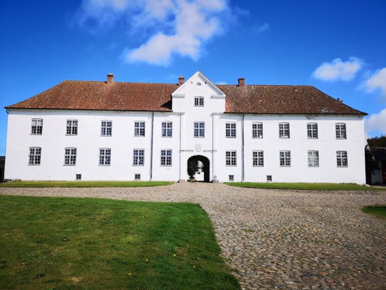
Aggersborggård, positioned directly on the southern part of the ring rampart, was first recorded in 1086 and remained in royal possession until 1579. The present estate building was constructed by Christen Madsen Speitzer between 1756 and 1758. The Nørgaard free-farmer family owned the estate from 1852 to 1989, and Ane Katrine Nørgaard’s great-grandson Hans Kirk, who lived from 1898 to 1962, became known as a writer. The stables were rebuilt after a fire in 1894.
Excavation and heritage
Archaeological investigation began in the twentieth century. The National Museum of Denmark carried out major excavations between 1945 and 1954, followed by additional trenches in 1970 and 1990. Work covered approximately 13,000 square metres, identified about 19,500 individual features, and recovered more than 30,000 artefacts along with numerous animal remains.
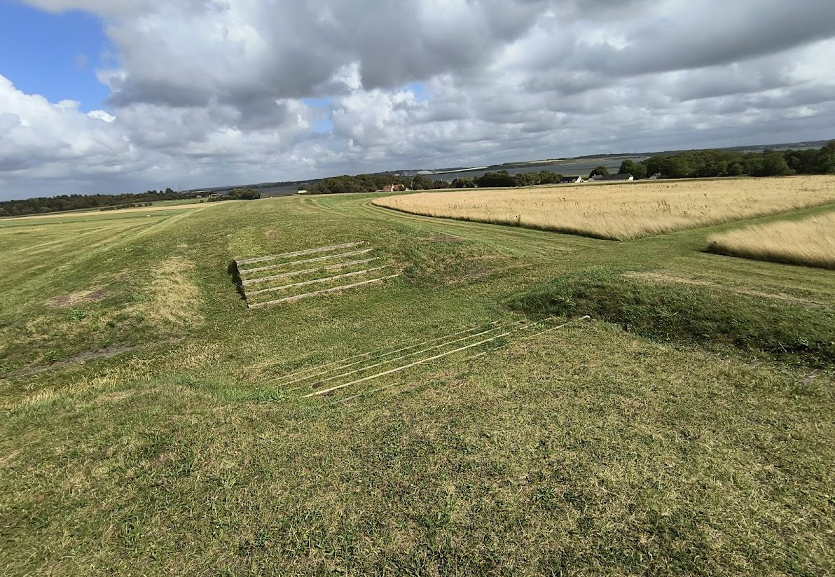
The surface visible today includes a reconstruction. The reconstructed rampart was erected in 1990, and the modern reconstruction dates from the 1990s. It is lower than the original earthwork. In 2023, Aggersborg became part of the UNESCO World Heritage serial property Viking-Age Ring Fortresses, together with Fyrkat, Nonnebakken, Trelleborg, and Borgring. The inscription was made under cultural criteria 3 and 4 during the World Heritage Committee’s 45th session in Riyadh. The listed area covers 99.18 hectares, with a buffer zone of 99.61 square kilometres.
Remains
Aggersborg is organised around a circular earthen rampart and an outer ditch. Four principal roads extend from the centre toward the ring and pass through tunnels beneath the rampart, preserving the circular form of the enclosure. The inner diameter measures approximately 240 metres. The ditch lay about 8 metres beyond the rampart and was approximately 1.3 metres deep, while the rampart itself is estimated to have stood about 4 metres high. Including the outer edge of the ditch, the fortress measured approximately 288 metres across.
Rampart and internal layout
Earthwork and roads
The rampart was built from earth and turf, reinforced and faced with oak timber. A wooden defensive parapet stood along its top. Between the rampart and ditch was a level strip approximately 8 metres wide. Four main roads divided the enclosure into four sectors, and smaller streets and cross-routes organised the spaces within them. Buildings were aligned carefully around courtyards, giving the fortress a strong geometric order.
Longhouses
The four sectors contained 48 longhouses, with 12 in each quadrant. Together they may have accommodated a garrison of approximately 5,000 people. The houses followed north-south or west-east axes. Their walls formed curved sides beneath curved roofs, creating a ship-like outline. Each building measured approximately 32 to 32.5 metres long and 8.5 metres wide, with narrower ends. Inside was a central hall about 19 metres long and smaller rooms at one end.
Complete longhouses have not survived, but the positions of their walls and the stumps of wooden posts remain identifiable. Post placement, dimensions, and inclination have helped reconstruct their form, alongside comparisons with the house-shaped Cammin reliquary, a container made to hold or commemorate religious relics, and house-shaped English tombstones. Building one longhouse required an estimated 66 large oak trees. The fortress as a whole, including its houses and rampart, may have consumed approximately 5,000 large oaks.
Landscape and archaeological finds
Changing coastline
In the twenty-first century, the site lies about 10 metres above sea level and approximately 350 metres from the coastline. The landscape was different during the Viking Age. The coastline and sea level are believed to have changed, and the strait was formerly wider and reached closer to the fortress. This changing relationship with the water forms part of the site’s archaeological setting.
Objects from the fortress
Excavations within the fortress produced imported luxury goods, including mountain-crystal beads and fragments of glass vessels. A damaged gold ring was also recovered, and a replica is displayed at the Aggersborg museum. Together with the artefacts from the Iron Age village, these finds reflect activity at the site before and during its brief period as a fortified Viking settlement.
Nearby sites