Parco Archeologico di Grumentum: Roman City and Archaeological Park in Italy

Site at a Glance
- Rating
- 4.2
- Popularity
- Low
- Country
- Italy
- Primary era
- Classical
- External website
- Open
- Eras represented
- Classical, Medieval
- Civilizations
- Roman
- Site type
- City
On this page24 sections
History
Parco Archeologico di Grumentum in Italy preserves the remains of Grumentum, a Lucanian and Roman city near modern Grumento Nova. Earlier Lucanian settlement in the area dates to the sixth century BC, while the city was established in the third century BC during Rome’s strategic expansion in southern Italy. Its position on routes between Venusia and Heraclea, and later along the Via Herculia, made it an important military and communications centre in inland Lucania.
Lucanian Foundation and Roman Alliances
Grumentum developed in a landscape connected with the modern Lago di Pietra del Pertusillo and the valley of the Agri. The settlement was founded as a Lucanian centre allied with Rome during the Samnite Wars, a series of conflicts through which Rome expanded its control across central and southern Italy. Its location also connected inland routes with the Via Popilia on the Tyrrhenian side.
The city took the Carthaginian side during the Second Punic War, the long conflict between Rome and Carthage from 218 to 201 BC. In 215 BC, the Carthaginian commander Hanno, son of Bomilcar, was defeated near Grumentum by Roman forces led by Tiberius Sempronius Longus. In 207 BC, Hannibal camped near the city walls, but Roman troops from Venusia under Gaius Claudius Nero defeated him and forced his withdrawal.
Destruction and Roman Reconstruction
During the Social War, an uprising by Rome’s Italian allies between 91 and 88 BC, Grumentum supported Rome. Italic forces nevertheless destroyed and plundered the city, beginning a period of crisis and population decline. From the second half of the first century BC, rebuilding restored the city’s importance. Public monuments were added during the Caesarian and Augustan periods, and the settlement was increasingly organized according to Roman urban principles.
Grumentum may have received colonial status during this period or under the Julio-Claudian emperors. A colonia was a Roman settlement with a formally established colonial status, often linked to Roman settlers and land allotment. Ancient evidence also describes Grumentum as a municipium, a self-governing Roman town, or assigns it a lower administrative position. Romanization included the division of agricultural land into regular plots through centuriation. From the mid-first century BC, public, religious, administrative, and recreational buildings transformed the settlement into a monumental Roman city.
Late Antiquity and Abandonment
Grumentum continued to serve as a regional centre into late antiquity. After the martyrdom of the Christian Laverius outside the city, traditionally dated to AD 312, the settlement became a bishopric around AD 370. Its episcopal status is also associated with the fifth and sixth centuries, and the city remained a political and administrative reference point for the surrounding territory beyond the sixth century. Literary, inscriptional, and archaeological evidence indicates activity at least into the fifth century, followed by later religious and funerary use.
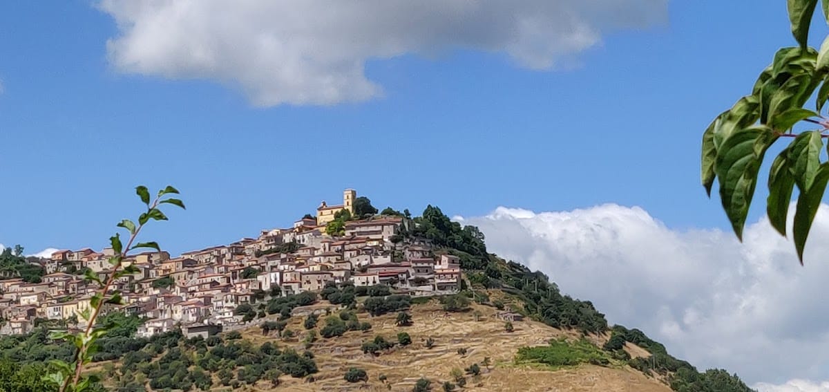
From the ninth and tenth centuries, attacks by Saracen forces contributed to the abandonment of the city and the surrounding valley. The population moved to fortified hill settlements, including Saponara, also called Saponaria, which was founded on the hill above the ancient city in AD 954. The settlement was later renamed Grumento Nova in reference to ancient Grumentum. A seventh-century necropolis near the suburban church of San Marco shows that the area continued to be used after the Roman city declined. From the sixteenth or seventeenth century, parts of the archaeological area were occupied again by vineyards and rural buildings.
Rediscovery and Archaeological Work
Historical and archaeological investigation began in the sixteenth century, when Giovanni Antonio Paglia brought ancient inscriptions to light. Carlo Danio undertook clearance work in the eighteenth century, assembling finds and inscriptions that were later studied and partly dispersed. Nineteenth-century activity included descriptions of visible remains, epigraphic research by Theodor Mommsen, and fieldwork by officials connected with the Museum of Potenza.
Systematic investigation expanded during the twentieth century. A campaign begun in 1951 exposed part of the theatre but was interrupted by limited funds, while a small antiquarium was established for objects from Grumentum. The theatre, baths, and amphitheatre received formal protection as areas of important archaeological interest in 1961. The archaeological superintendency of Basilicata then continued the investigations, and Dinu Adameșteanu directed work and restoration at the theatre between 1964 and 1968.
The amphitheatre had been visible to local scholars since at least the eighteenth century. Its excavation began in 1981 after the 1980 earthquake increased the danger of collapse. Excavation, restoration, and later interventions have made substantial parts of the archaeological area available for interpretation, while the restored theatre has also returned to use for performances. The site is managed as an archaeological park by Italy’s cultural-heritage authorities.
Remains
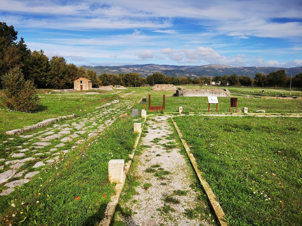
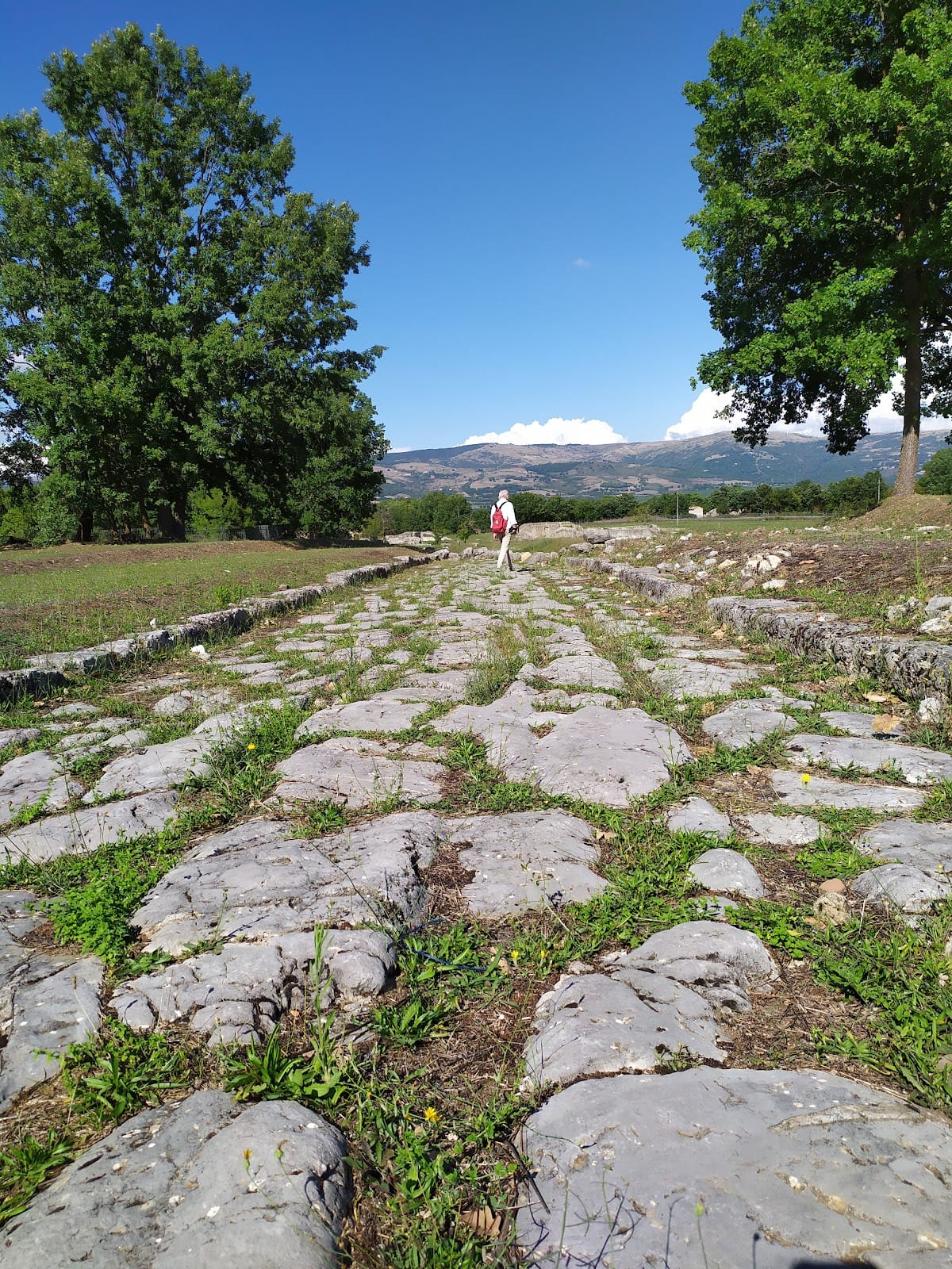
The archaeological area lies on a ridge on the right bank of the Aciris, now called the Agri, at about 600 metres above sea level and below the hill occupied by Grumento Nova. It extends between the Agri and Sciaura rivers within the landscape of the Appennino Lucano National Park and the Lago di Pietra del Pertusillo. The ancient city followed the ridge’s elongated form. Three principal parallel streets were crossed by secondary streets at right angles, producing regular urban blocks. The principal paved street, known as the plateia and conventionally called the decumanus, passed through the main public areas.
Urban Walls and Water Supply
City Walls
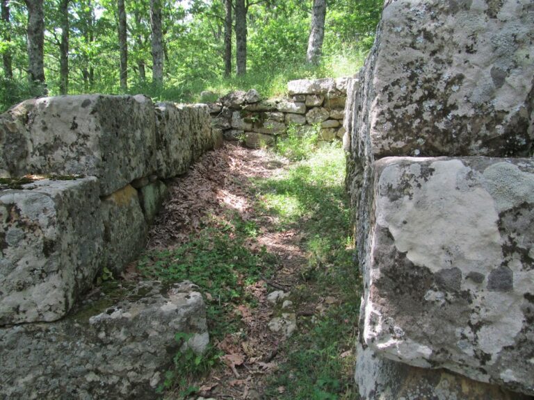
A circuit of walls about 3 kilometres long enclosed roughly 25 hectares. Six gates provided access through the surrounding fortifications, of which only about one-tenth of the ancient urban area has been excavated. Some sections used opus reticulatum, a Roman masonry technique with regular diamond-set facing blocks. Inscriptions record repairs to the walls in 57 BC.
Aqueduct
The aqueduct began about 5 kilometres south of the city and entered from the southern side of the plateau. It was carried on arches before discharging into a castellum aquae, a water-distribution tank. Parts of this structure survive, together with evidence for the system that supplied the city’s public and private buildings.
Public and Religious Buildings
The Theatre and Temple A
The theatre was built in the first century AD and extensively renovated during the second and third centuries. It is a freestanding structure raised above the surrounding ground, with a cavea, or seating area, an orchestra for the chorus and distinguished participants, and a stage building. The stage was arranged around three large curved recesses and three doors that connected it with a colonnaded space behind the stage, known as a porticus post scaenam. Modern restoration has returned the theatre to use for performances.
Near the theatre are the remains of Temple A, a small building on a high platform that opened towards a piazza and was approached from the principal street. Its cult is traditionally connected with Egyptian religious practice because a statue attributed to Harpocrates was found nearby. Harpocrates was the Greek form of the Egyptian child deity Horus. The statue is treated as evidence for a possible cult of this eastern deity, rather than as a certain identification of the temple’s dedication.
The Forum and Temples
The Forum formed the city’s principal public centre. Its monumental arrangement belongs mainly to the Augustan and Julio-Claudian periods, especially the first half of the first century AD. The plateia crossed the paved square, which was enclosed on three sides by a colonnaded walkway. Civic and administrative buildings occupied the western side, while religious buildings stood along the southern and northern sides.
Temple C on the southern side was the oldest monument in the Forum and is identified as the Capitolium, the temple of Jupiter, Juno, and Minerva, the principal gods of the Roman state cult. A fountain and service rooms stood beside it. A marble head of Livia Drusilla, the wife of Augustus, was found near these rooms. It probably belonged to a sculptural group representing members of the imperial family.
Temple D stood opposite Temple C and was probably dedicated to the imperial cult, the worship of the emperor and his household. A circular temple with a single surrounding colonnade stood east of it. The western side of the Forum also contained a basilica, a tripartite building, and a circular-plan building. The basilica was rectangular and divided into several aisles. It opened onto the Forum, where public meetings took place and justice was administered. A curia, the meeting place of the city council, was also associated with the western Forum buildings.
Private Residence
Domus con mosaici
The Domus con mosaici, also called the Domus degli Stasii, occupied a complete urban block measuring about 30 by 60 metres and faced the principal street through its main entrance. It was a high-status private house, probably belonging to an important local notable. Its principal phase dates to the second century AD, and the residence remained in use at least until the middle of the fourth century.
The house followed a Roman plan. Shops opened onto the street, leading internally to an entrance passage and an atrium with an impluvium, a basin that collected rainwater. Beyond it were a dining room, a colonnaded courtyard, a garden, and a large reception room. The dining room had polychrome mosaics with plant and floral designs, while the large hall had black-and-white geometric paving.
An apsidal lararium, or household shrine, occupied the atrium and had a polychrome geometric mosaic. It probably held an image connected with the protective household gods, the Lares. Three further reception rooms northeast of the atrium had mosaics and inlaid marble floors made with opus sectile, a technique using shaped pieces of stone or marble. One room contained a basin or fountain.
The northern part of the house contained service rooms reached by a carriage road, including storerooms, kitchens, servants’ rooms, and bedrooms. Water from the aqueduct reached the residence through lead pipes called fistulae. Inscriptions on the pipes identify a manufacturer and probably one of the owners, Titus Stasius.
Temple B
Several dozen metres northeast of the domus, Temple B stood on a high platform. Two inner chambers survive, but the deity worshipped there has not been identified.
Bath Complexes
Forum Baths
The Forum Baths lay immediately south of the Forum and were partly incorporated into later rural houses. Their rooms followed the Roman sequence of cold, warm, and hot spaces. Geometric and floral mosaics belong to several phases of construction, and the complex probably remained in use from the first through the fifth century AD.
An earlier bath building near the Forum, constructed in opus reticulatum, included a hot room divided into two spaces by masonry seats. Both rooms had mosaic floors, including white and polychrome decoration with meanders and a two-strand braid on a dark ground. The floors were raised on suspensurae, supports that allowed heated air to circulate beneath them, and remains of the furnace were found.
The circular cold room of this earlier complex had side seats. In the modern and contemporary periods it was reused for grape pressing and the fermentation of grape must. Its water supply came from the Augustan aqueduct and a cistern, which were also reused. The rooms later served facilities connected with the archaeological park.
Greater Baths
The Terme Maggiori, or Greater Baths, contained 16 rooms decorated with coloured marble and figured mosaics. Their preservation reveals the Roman methods used to heat rooms and distribute water. The route through the complex began in an entrance hall with a mosaic floor and continued to a cold room decorated with a marine scene showing Scylla, Giants, and aquatic animals. Side pools opened from this room, and four Roman statues were found in its apsidal pool.
The heated rooms used an hypocaust, a system that circulated hot air beneath raised floors. Three praefurnia, or furnace chambers, supplied the heat. Air moved beneath floors supported by suspensurae and through wall channels called tubuli. The sequence included a passage room, a warm room, a laconicum for intense dry heat, and a hot room with an apse and two side basins. An eastern corridor led to a latrine and a room containing the furnaces.
Two large channels brought water from a cistern southwest of the complex, which itself was supplied by aqueduct pipes. A sewer carried away waste water. The Greater Baths date to the second half of the second century AD and partly replaced earlier Republican and early imperial houses with mosaic floors.
Amphitheatre
Structure and Access
The amphitheatre stands on the eastern terrace at the edge of the ancient city, beside the walls and near an access route from the valley. It was built around the middle of the first century BC and underwent repairs and rebuilding that indicate use at least into the fourth or fifth century AD. Its position allowed spectators to approach from outside the city without crossing the urban centre, and its main axes followed the street system.
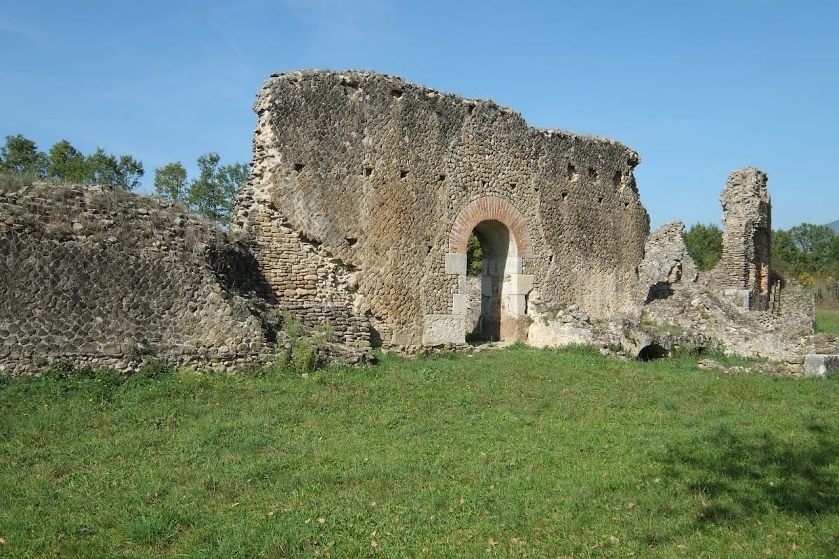
The western side was built against the hill after the slope had been cut and levelled, while the eastern side rested on artificial substructures. The seating area used mostly regular opus reticulatum, with some opus incertum, a Roman technique using irregular stone facing. Rubble foundations and corners built with local stone supported the structure. The building had two seating levels. The upper seats were probably wooden in the first phase, while the lower seats were made of masonry and protected by a balustrade.
Arena and Later Reinforcement
Structural failures, possibly connected with an earthquake, led to the addition of radial walls in the northeast sector to support the vaults carrying the seats. Two principal entrances opened on the major axis, while galleries and exterior stairways with double flights served the building. Some of these arrangements resemble those at the amphitheatre of Pompeii.
The central arena was created by cutting and levelling the hill and measures about 55 by 35 metres. A corridor for animals surrounded it, and six partly preserved openings with surviving thresholds allowed animals to enter through grilles. The area had previously served as a necropolis, probably before it was incorporated into the city. Monumental tombs have also been found beyond the city walls.
Early Christian and Medieval Remains
Santa Maria Assunta
The basilica of Santa Maria Assunta stood in the northern part of the Roman settlement on the principal street, near the amphitheatre. It was probably the city’s first cathedral after Grumentum became a bishopric. The original building had three aisles, three apses, and a narthex, or entrance hall. It was later reduced to two aisles.
A small underground chamber beneath the central aisle served as a crypt and contains burial remains. Ceramic material from its excavation ranges from the Roman period to the nineteenth century, while medieval burials without grave goods were found beside the eastern side of the church in 1978. The building preserves fragments of a painted cycle. One shows the head of a praying saint, and another depicts a saint beneath a much larger Madonna. The church remained in use during the thirteenth and fourteenth centuries, although its foundation date and later building phases remain uncertain.
Streets, Buildings, and Finds
Other surviving elements include paved streets, foundations, wall sections, and additional public and private structures. Inscriptions, coins, jewellery, small artefacts, and sculptures have been recovered from the site. Many of these objects are preserved or displayed at the nearby National Archaeological Museum of the Alta Val d’Agri, where they help illuminate the civic, domestic, religious, and economic life of ancient Grumentum.