Fort de Roovere: An Earthen Water-Line Fortification in the Netherlands


Site at a Glance
- Rating
- 4.4
- Popularity
- Medium
- Country
- Netherlands
- Primary era
- Early Modern
- External website
- Open
- Eras represented
- Early Modern, Modern
- Civilizations
- Dutch
- Site type
- Military
- Remains
- Fort
On this page12 sections
History
Fort de Roovere is an earthen fort in the Netherlands near Halsteren, built by the Dutch in 1628 as part of the Dutch Water Line during the Eighty Years’ War against Spanish attackers. The Water Line used controlled flooding to obstruct invading armies while keeping fortified routes and settlements defensible. Fort de Roovere belonged to the West Brabant Water Line and the Line of Steenbergen, a regional and local network that included Het Laag, Fort Moermont, and Fort Pinssen.
The Dutch Water Line
The fort stood within a landscape that could be deliberately flooded through a sluice near Steenbergen. An earthwork and line wall connected it with Fort Pinssen along the route now called Ligneweg. This arrangement linked Fort de Roovere to a wider defensive system in which inundated ground and fortified positions worked together.
Eighteenth-century strengthening
Menno van Coehoorn, a Dutch military engineer and fortress designer, improved Fort de Roovere in 1727. A line wall was added on the southern side, and the outworks were improved in 1784. The main rampart on the northern side was also constructed in 1784.
French forces besieged the fort in 1747 during the War of the Austrian Succession, a European conflict over the succession to the Habsburg monarchy. After Bergen op Zoom fell, the siege of Fort de Roovere was abandoned. During the Napoleonic Wars, when English forces besieged Bergen op Zoom while pursuing the French, the fort appears to have received some upkeep but was not attacked.
Abandonment and renovation
After the Napoleonic conflict, Fort de Roovere was abandoned and formally discontinued as a fortification in 1816. The Friends of Fort de Roovere foundation was later established to prevent the neglected site from being forgotten. Large-scale renovation began in 2010, removing overgrowth and deepening the old moat so that the earthwork became more recognizable.
The clearance prompted substantial local protest. Little or no archaeological research accompanied the work, despite the expected presence of traces from the 1747 French siege. Local metal-detector users continue to recover grapeshot believed to come from that siege.
Remains
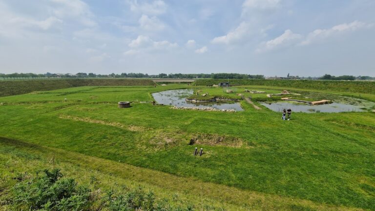
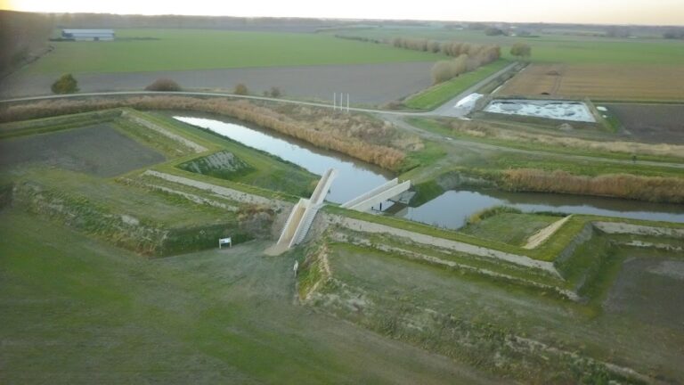
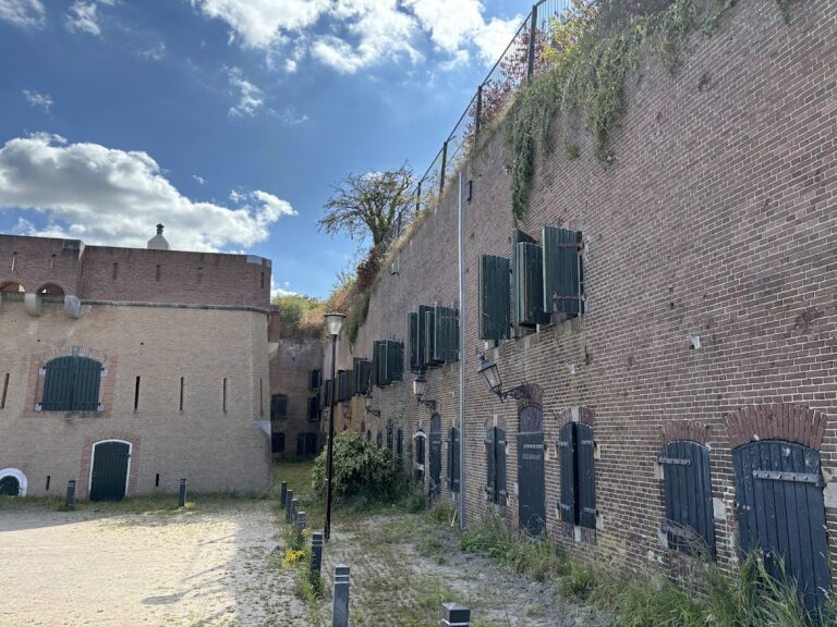
Fort de Roovere survives as an earthen defensive work on a high sand ridge. Its front is formed by two bastions, projecting parts of a fortification that allowed defenders to fire along the faces of adjoining walls, while the rear is open. A dry moat surrounds the earthwork, and Fort Pinssen remains connected to it by a line wall.
Main fortifications
Bastions and ramps
The terreplein, the level area inside a fortification behind the ramparts, has a ramp leading to the southeastern bastion and another leading to the northeastern bastion. The salient of the southeastern bastion, meaning its projecting angle, is associated with the moat and the eastern field of fire, which is now wooded. From this position, the northeastern bastion, moat, modern bridge, and eastern outwork can be seen.
Curtain walls and moat
The southern curtain wall, the rampart section between projecting defensive works, can be seen from the parking area on Ligneweg at the location of the former southwestern bastion. The western moat is dry there. The northern curtain wall remains associated with its moat, preserving the relationship between the rampart and defensive ditch.
Eastern defenses
Outwork and bridge
An eastern outwork stands beyond the main fort. The modern bridge connects the eastern curtain wall to this defensive position and includes a section sunk into the curtain wall. The wooded surroundings to the east include the remains of a tenaille, a low outwork placed in front of a curtain wall.
Lunet and line wall
A lunet, a detached or projecting fieldwork often shaped roughly like a crescent, occupies the line east of the fort. It provides views southward across the inundation area of Halsters Laag, the moat, and the line wall. The line wall also extends an eastward view toward the same deliberately flooded defensive area.
Contemporary additions
In 2010, RO&AD Architecten designed the partially submerged bridge across the moat known as the Moses Bridge. Its form appears to divide the moat’s waters while providing access without disrupting the fort’s original design. The same architectural practice designed the Pompejus watchtower, which incorporates seating for an open-air theater. The renovated site also includes cycling and hiking routes.
Nearby sites