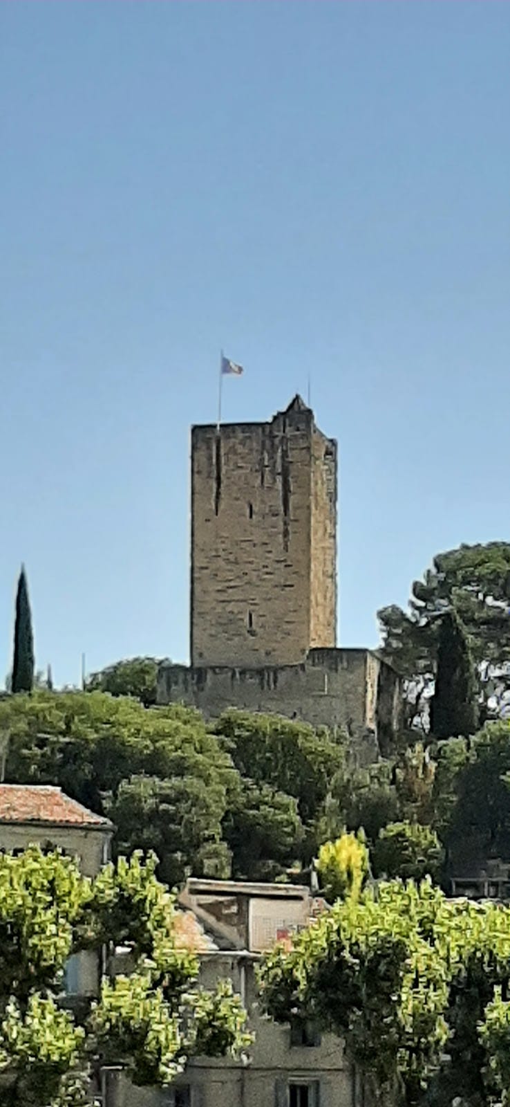
Ambrussum: A Pre-Roman Oppidum and Roman Road Station in France

Site at a Glance
- Rating
- 4.5
- Popularity
- Medium
- Country
- France
- Primary era
- Classical
- External website
- Open
- Eras represented
- Iron Age, Classical
- Civilizations
- Celtic, Roman
- Site type
- City
On this page19 sections
History
Ambrussum is a pre-Roman and Gallo-Roman fortified settlement and road station in France, near Villetelle, built first by the Volcae Arecomici and later reorganized under Roman rule. Occupied from the late Neolithic through late antiquity, it stood beside the Vidourle crossing of the Via Domitia, the principal Roman road linking Italy and the Rhône valley with the Pyrenees and the Iberian Peninsula.
Pre-Roman Settlement
The earliest occupation at Ambrussum dates to approximately 2600–2200 BC, during the late Neolithic. Settlement continued through Protohistory, the period between prehistory and fully documented history, and the Bronze Age. Material from the first Iron Age also shows that activity continued before the foundation of the fortified hilltop settlement.
The Volcae Arecomici, a Celtic people whose territory covered much of Languedoc, established the oppidum in the fourth century BC, probably during the late fourth or early third century BC. An oppidum was a fortified settlement that could include homes, workshops, public areas, storage facilities, and defensive works. At Ambrussum, the settlement occupied more than five hectares on the Devès hill above the river and the Lunel plain.
During the second Iron Age, a cemetery with at least seven cremation burials was established in the lower, flood-prone part of the site. The burials included children, adolescents, and adults of both sexes. Ancient Gallic weapons found near the bridge may indicate that the cemetery extended toward the river.
Roman Reorganization
Rome conquered southern Gaul between 125 and 120 BC to connect its territories in Italy and the Iberian Peninsula. The Via Domitia was then developed as a military and commercial route, and Ambrussum became one of its crossings over the Vidourle. The road gave the settlement a new role within Roman communications while the hilltop community was progressively reorganized.
By the first century BC and the first century AD, the upper settlement contained private houses, a paved principal street, a forum, a porticoed public square, and a civil basilica. A forum was a Roman public square used for civic, administrative, commercial, and sometimes religious activities. A basilica was a large public building commonly used for legal, administrative, or commercial purposes. Earlier native dwellings were replaced or overbuilt by residences following Roman arrangements, including a large house of the first century BC constructed over a dwelling dating to the first half of the third century BC.
A lower road station was established beside the Via Domitia at the foot of the hill in the late first century BC, probably within the road and communications policies associated with Augustus. It provided accommodation, baths, facilities for vehicles and animals, metalworking, food preparation, and postal services. One large building has been identified as a station of the cursus publicus, the Roman imperial courier and transport service. Its rooms and logistical facilities served authorized officials, representatives of cities or the imperial administration, and travelers carrying permission to use the imperial network.
Decline and Late Antiquity
The upper town began to decline from the second century AD. The movement of urban elites toward larger Roman cities contributed to the abandonment of the hilltop settlement by about the end of the first century or during the second century AD. The lower station continued in use into the fourth century, although its buildings were altered and partly reorganized. Repeated flooding by the Vidourle led its occupants to raise and embank the lower quarter several times.
By late antiquity, other river crossings had become preferred, and Ambrussum was abandoned no later than the fifth century. The Via Domitia continued to serve as a route after the Roman settlement declined, but routes south of the hill, including the Camin Roumieu, later took over its role in this area.
The Bridge and Medieval Use
The Pont Ambroix remained in use during the Middle Ages. The monumental crossing was progressively dismantled for building materials and damaged by floods. A notarial act dated 15 July 1390 records accusations that inhabitants of Gallargues had destroyed the “Pont Ambrueys.” A church called Sancte Marie de Ponte Ambrosio, located south of the bridge, is recorded in 1156. Buildings found during early excavations may represent a late medieval community of nuns established in 1254, although that identification remains uncertain.
Archaeological Investigation and Conservation
The Pont Ambroix was recognized as a historic monument in 1840. The first excavation of the oppidum ramparts took place in 1835, and the Archaeological Society of Montpellier surveyed the fortifications in 1857. Between 1910 and 1914, Dr Émile Marignan excavated along the southern part of the hill and the ramparts, recovering rich Neolithic material together with pre-Roman and Roman remains. The finds were later reburied, and archaeological work at the site paused until the twentieth century.
Marc Fenouillet surveyed the Devès hill and the Sablas vineyards beside the Vidourle in 1964. Excavations resumed from 1967 under Jean-Luc Fiches and continued for more than 35 years. They examined two residential sectors, three Roman houses, the civil basilica, the main paved street, and the fortifications. From 1984 to 2012, work concentrated on the lower road station, where the limited later alteration of the buildings preserved clear evidence for its Roman phases. Since 2016, campaigns directed by Maxime Scrinzi, an associate researcher of France’s CNRS, have focused on the public quarter of the oppidum and the political and social life of the settlement around the beginning of the Roman era.
The oppidum was classified as a historic monument in 1974, while the bridge retained its separate protection from 1840. In 1983, Jean-Luc Fiches, Jean-Claude Bessac, and their team recovered 112 bridge blocks from the bed of the Vidourle for study, inventory, and numbering. The blocks were moved to a secure location between 6 and 20 June 2017 because erosion threatened their original storage area, while their identification system was retained. Consolidation of the Pont Ambroix took place in November 2019 and November 2020. The work removed vegetation, including a fig tree whose roots had displaced a bridge stone, and the temporarily removed stones were returned after observation confirmed that the tree had not regrown.
Remains
Ambrussum is arranged in two principal zones, the hilltop oppidum on the Devès and the lower settlement beside the Vidourle. The hill rises above the river and the Lunel plain, while the lower quarter occupied the river crossing and was repeatedly affected by flooding. The surviving remains include dry-stone limestone fortifications, a terraced upper settlement, the paved route through the hill, public and residential buildings, the lower Roman road station, and the surviving arch of the Pont Ambroix.
Hilltop Fortifications and Streets
Ramparts and Gateways
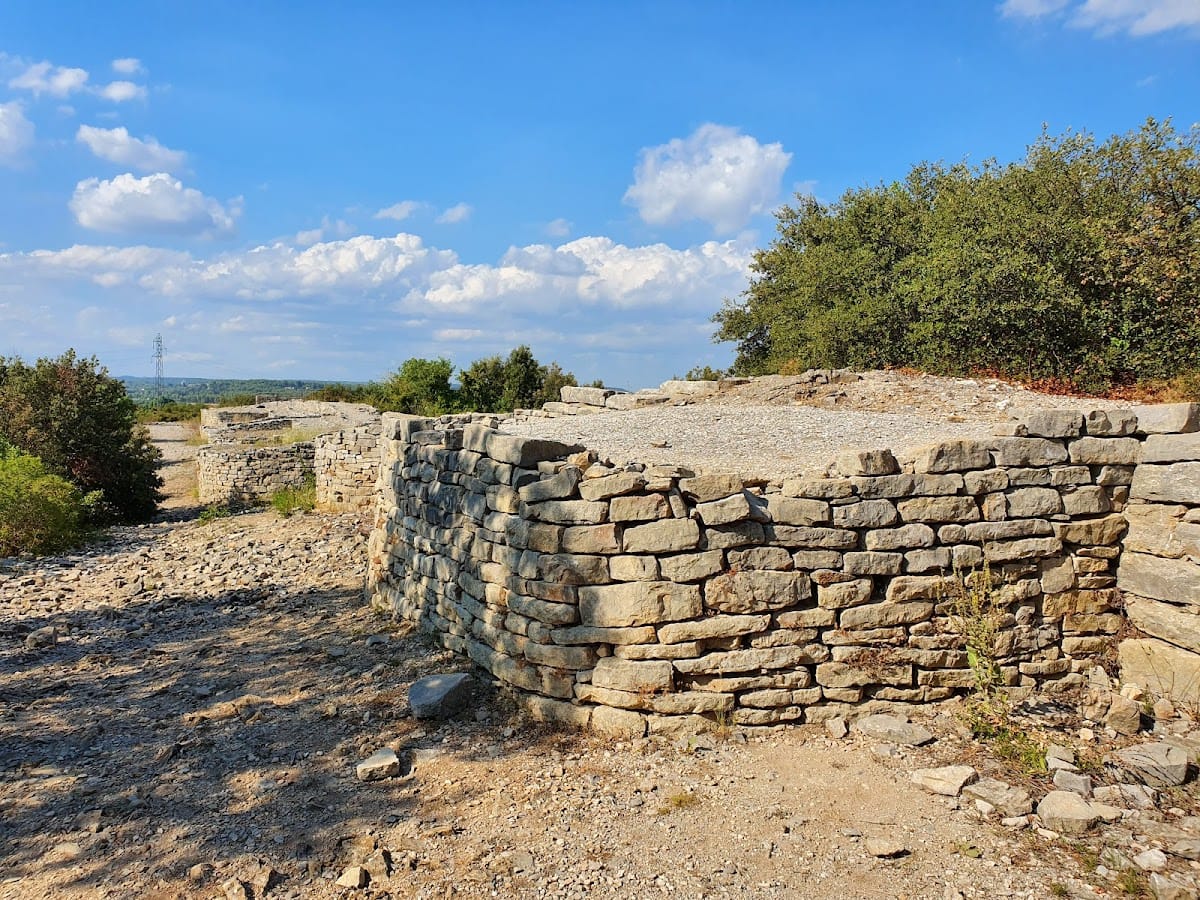
The oppidum was enclosed by a dry-stone limestone rampart surrounding more than five hectares. The western fortification measures approximately 635 metres in the excavated section. Its earliest towers were quadrangular. In the mid-third century BC, rounded towers replaced or supplemented them, and the rampart was restored twice during the second century BC. Some towers were substantially higher than the adjoining wall and served as watchtowers and prestige structures. Rounded towers occur at intervals of roughly ten metres along the surviving fortification.
Northern, southern, and eastern gateways formed entrances through the defensive circuit. The southern gate was later enlarged. A further gateway once allowed the road to descend toward the bridge, but its surviving remains are not described as part of the present fortification.
Principal Street and Houses
The upper settlement contains a paved principal street approximately 200 metres long. It follows the curve of the hill, measures about 3.05 metres wide, and is steep enough to prevent vehicles from passing one another. Wheel ruts remain visible in the paving. Walls, entrances, lanes, houses, and shops bordered the street on terraces. It led toward the forum and continued to the southern exit of the oppidum. Its precise relationship to the Via Domitia is uncertain, since the main road also passed around the hill.
Three courtyard houses of approximately 400 square metres each have been identified in two western residential sectors near the rampart. They were occupied from the second half of the first century AD until the abandonment of the upper settlement and followed the general plan of a Roman domus, an urban courtyard house divided into domestic, reception, and service areas. Earlier native dwellings survive beneath later Roman residences, including the large first-century-BC house built over a dwelling from the first half of the third century BC.
Public Quarter of the Oppidum
Forum and Basilica
The forum stands near the southern entrance and dates to the first century AD. It was partly paved and enclosed by a portico and public buildings. A civil basilica stood beside the square. Some stones from the basilica were later reused in the lower road station, linking the altered remains of the upper settlement with the later development of the river crossing.
Painted Plaster and the Earlier Domus
A painted-plaster panel was found in place against a wall in a Roman domus beneath the forum. The house was apparently demolished between 20 and 10 BC to make way for the public monument constructed above it. The fragmented, cracked panel was removed in August 2019 for conservation because winter deterioration threatened its condition.
Lower Road Station
Roadside Blocks and Lodging Houses
The lower settlement developed along a second stretch of the Via Domitia that bypassed the steep hill. Parts of the ancient road and adjoining buildings lie beneath a modern road whose alignment is similar to the Roman route. Four blocks occupied the area northeast of the road between it and the river, with lanes separating them. Three appear to have been roadside lodging establishments arranged around central courtyards and entered through carriage gates. One had a covered gallery at its entrance.
The northeast wall of one block was approximately 1.5 metres thick, providing resistance against flooding. The lower quarter was raised several times to protect it from the Vidourle. The northern block had a central courtyard with carriage entrances to the southwest and northeast. Communal rooms occupied its eastern side, while a northern building contained three small central rooms and two larger rooms at the ends.
One room opened directly onto the courtyard and contained 38 coins, personal ornaments, brooches, nails, a mirror, harness fittings, pins, a horseshoe, seal boxes, and a one-ounce Roman weight. These objects may indicate activities involving storage, accounting, and commercial exchange. Other rooms included three chambers and a living room connected by a gallery. A hand mill, a large hearth near a water source, a circular oven structure, and animal hoofprints point to a mixture of lodging, food preparation, farming, and possibly metalworking.
The southern block differed from the other inns. Its small rooms followed a regular rectangular plan, and the building may have been residential. It was constructed between the middle of the first century and the end of the second century AD. Rougher structures and a well represent reoccupation during the second half of the fourth century, before the area was finally abandoned.
Bathhouse and Service Installations
A probably public bathhouse stood across the road from the lodging blocks, partly beneath the modern road. Four wells supplied its water. Its surviving heating chamber belonged to a system that sent hot air beneath floors, hot water to the caldarium, the hot room of a Roman bath, and steam to the laconicum, a heated or steam room.
The lower quarter also contained a forge, ovens, wells, domestic rooms, and other service installations associated with travel and roadside commerce. A small stone votive altar from the early Roman Empire was found there. Petale Antonia dedicated it to Fortuna, the Roman goddess associated with fortune, luck, and changing circumstances.
Wheelwright’s House and Imperial Station
The “wheelwright’s house” was a smithy specializing in repairing or constructing vehicles. Weapons found there may indicate the presence of a garrison responsible for controlling people and goods. Its industrial function formed part of the practical infrastructure supporting movement along the road.
A separate building in the northern lower settlement measured approximately 1,000 square metres. Built around a central courtyard, it contained rooms for travelers and domestic activities, a paved courtyard, painted decoration, and probably an upper storey. Its plan and facilities distinguish it from the other inns, and it has been identified as a station of the cursus publicus. The building probably accommodated officials, city or imperial representatives, and authorized messengers, whose use of the imperial postal system required more restricted arrangements than those provided by ordinary inns.
Another inn had a courtyard for animals and carts, five guest rooms, and an adjoining building with a bread oven. Its arrangement remained substantially unchanged from approximately 30 BC to AD 125. Two further inns near the water included parts dating from approximately AD 200–250. Ceramics and other archaeological objects recovered from the excavated areas add to the evidence for the station’s varied roadside activities.
Pont Ambroix
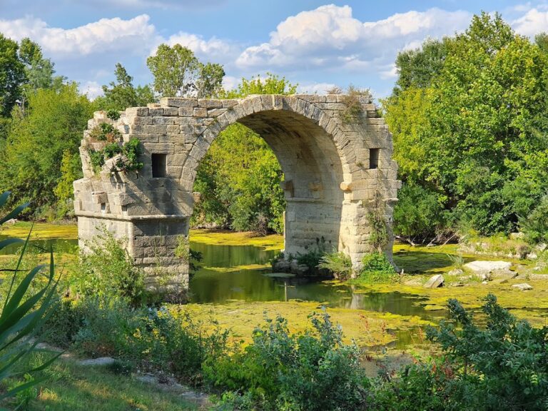
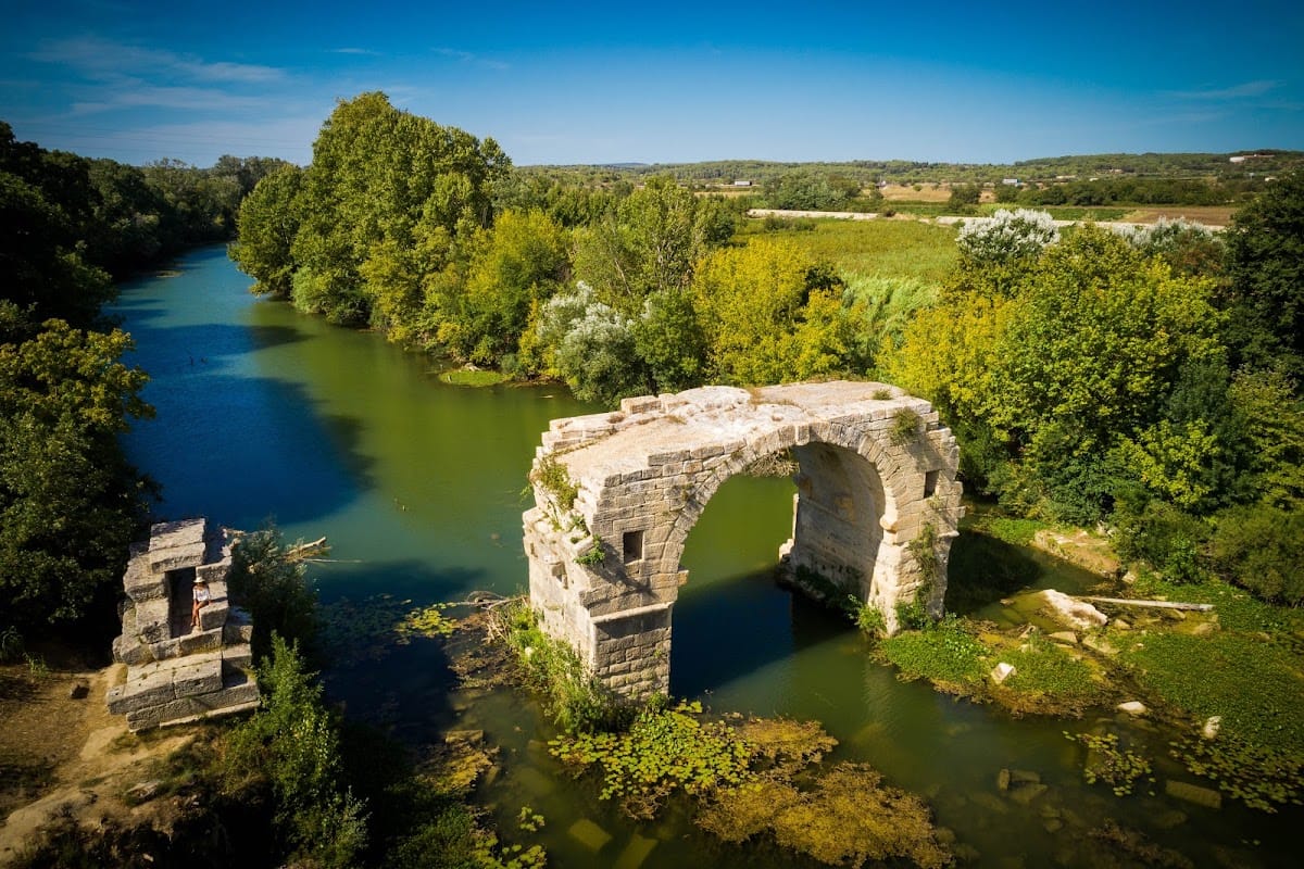
The Pont Ambroix carried the Via Domitia across the Vidourle. It was a monumental stone bridge originally built with 11 arches and measured approximately 150 metres in length, although it may have replaced an earlier wooden crossing. The surviving masonry was constructed without mortar, with carefully cut stones placed directly against one another and held together by the weight of the blocks.
The surviving bridge consists of one arch standing in the river. It is approximately 10 metres wide and 9 metres high. The bridge blocks weigh between approximately one and two tonnes. In 2019, three stones weighing more than 1.5 tonnes each were temporarily removed so that a fig tree growing in the masonry could be eradicated. They were returned to their original positions in 2020 after a year of observation confirmed that the tree had not regrown.
Historical images trace the bridge’s progressive reduction through dismantling and floods. Anne de Rulman depicted four arches in the seventeenth century, while Gustave Courbet painted two arches in 1857. The flood of 1933 destroyed another arch. Together with the recovered numbered blocks from the Vidourle, the surviving arch preserves evidence of the scale and construction of the Roman crossing.
Landscape Setting
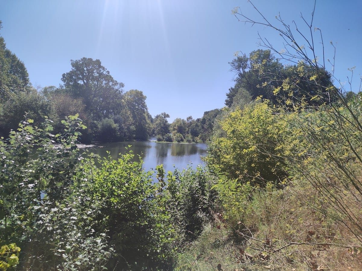
Ambrussum lies between the wet banks of the Vidourle and a limestone hill covered in dense garrigue, a Mediterranean scrubland that grows on dry limestone terrain. The contrast between the flood-prone lower settlement and the elevated oppidum shaped the construction and repeated raising of the road station. From the hilltop, the surrounding landscape includes views toward the Mediterranean, the Cévennes, Pic Saint-Loup, and the Nîmes area.