Novhorod-Siverskyi Fortress: A Kyivan Rus Frontier Stronghold in Ukraine


Site at a Glance
- Rating
- 4.4
- Popularity
- Very Low
- Country
- Ukraine
- Primary era
- Medieval
- Eras represented
- Medieval, Early Modern
- Civilizations
- Kievan Rus, Polish–Lithuanian Commonwealth, Russian
- Site type
- Military
- Remains
- Fortified Town
On this page8 sections
History
Novhorod-Siverskyi Fortress in Ukraine was a Kyivan Rus frontier stronghold founded in the late tenth century, probably by Grand Prince Vladimir of Kyiv, to defend against nomadic raids. Tradition dates its foundation to 988, while archaeological evidence places construction of the fortified inner citadel, or detinets, in the late tenth century. The site occupied a steep hill above the Desna River, where several settlements of the Romny-Borshchevo archaeological culture had existed before the fortress was established.
The Kyivan Rus citadel
The original fortress consisted of the detinets, the fortified inner part of a medieval East Slavic town, together with an adjoining outer town. The citadel contained the main administrative and elite residences. Its northwestern area held the princely court, where the princes of Novhorod-Siverskyi lived. A nearby stone church, probably dedicated to St Michael, probably served as the burial church of Prince Oleg Sviatoslavich.
The outer town developed around the turn of the eleventh and twelfth centuries, after Novhorod-Siverskyi acquired a princely seat in the political reorganization associated with the Congress of Liubech in 1097. The citadel’s defenses were reconstructed in the late eleventh or early twelfth century, almost doubling the strength of its earthworks. In 1152, a siege led by Prince Iziaslav Mstislavich tested these defenses. A chronicle describes Novhorod-Siverskyi as a large and powerful fortress whose garrison resisted the assault.
In 1185, Prince Igor Sviatoslavich left Novhorod-Siverskyi for his campaign against the Cumans, a steppe people who opposed the princes of Kyivan Rus. The fortress’s military strength formed part of the historical setting for that campaign and for the prince’s departure.
Early-modern fortification
In 1584, the Gdansk merchant Martin Gruneweg described Novhorod-Siverskyi as a town enclosed by a wall with numerous clay-plastered towers, a deep ditch, and a further barrier of upright stakes. He also described a wooden castle with massive towers and a walkway along the top. Clay covered the castle down to the ground, adding protection to its timber construction.
On 26 October 1604, forces supporting False Dmitry I besieged the fortress. The garrison, commanded by the voivode Petr Basmanov, initially resisted, but Prince F. I. Mstislavsky surrendered the fortress later that year. During its incorporation into the Polish-Lithuanian Commonwealth, the state formed by the union of the Kingdom of Poland and the Grand Duchy of Lithuania, authorities sought to make the town a dependable frontier stronghold against Russia. This effort gained urgency after Russian troops captured and briefly occupied the town during the Smolensk War.
In 1648, the French military engineer and cartographer Guillaume Le Vasseur de Beauplan directed the reconstruction and modernization of the urban fortress. An underground passage was dug beneath the town during the same year, although its location was later forgotten. At the beginning of the Khmelnytsky Uprising, the revolt led by Bohdan Khmelnytsky against Polish rule in the Ukrainian lands, the Polish garrison was expelled. Novhorod-Siverskyi then became a sotnia town, a Cossack administrative and military center subordinate to a regiment, first in the Nizhyn Cossack Regiment and from 1663 in the Starodub Cossack Regiment.
Restoration and later decline
A Crimean raid severely devastated Novhorod-Siverskyi in 1662. In 1679, the Russian government sent fortification specialists to restore the defenses. They built stone walls and six towers, with four towers at the corners and two at the town entrance. By the beginning of the eighteenth century, Novhorod-Siverskyi was among the most heavily fortified towns in the region.
The defenses were strengthened during the period associated with Ivan Mazepa, a Cossack hetman, or senior Cossack leader. Peter I’s army nevertheless took the fortress with ease while it was defended by Mazepa’s supporters. An inventory from 1781 placed the fortress on elevated ground above the Desna, on a high riverbank described as 40 sazhen high, and surrounded by deep ravines. It identified an outer enclosure and an earthen citadel, called an “earthen castle,” in the northwestern corner.
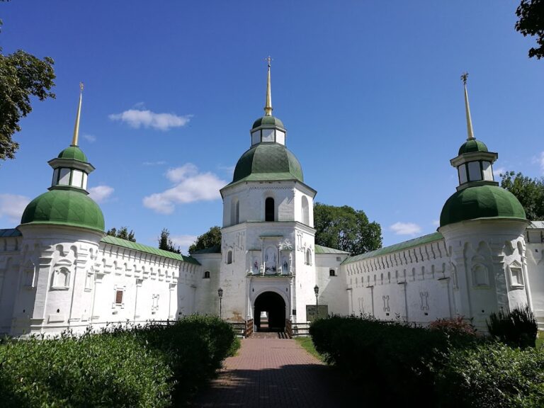
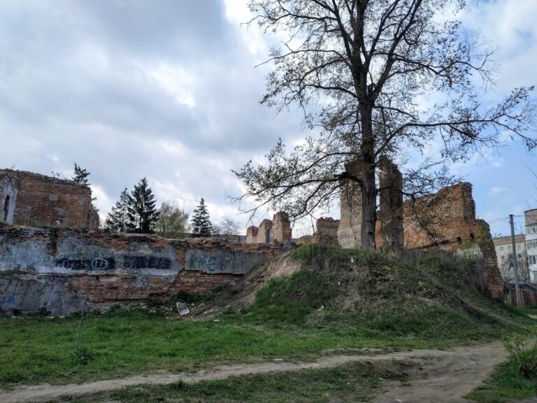
The fortress is now ruined. Its surviving remains lie within the territory of the Spaso-Preobrazhensky Monastery fortress, and its walls appear on the coat of arms of Novhorod-Siverskyi. Archaeological investigation began in 1907 under S. A. Gatsuk. Further work followed under F. V. Luchitsky in 1938, M. V. Voevodsky in 1945, and O. N. Melnikovskaya in 1965. An expedition of the Chernihiv Historical Museum worked at the site in 1959 and 1960 under I. I. Edomakha. Expeditions led by R. S. Orlov and A. V. Kuza investigated Novhorod-Siverskyi and its surrounding area from 1979 to 1984, while excavations on Zamkova Hill continued from 2011 to 2015 under I. S. Kedun and E. E. Chernenko.
Remains
The fortress occupied a separate, steep-sided residual hill known as Zamkova Hill beside a bend of the Desna River. The hill rises as much as 50 metres above the surrounding area, and deep ravines and the high riverbank formed part of the defensive landscape. The fortified inner citadel covered approximately 3 hectares, while the adjoining outer town extended over approximately 30 hectares to the east and south. Together, the natural slopes and constructed ramparts, walls, towers, ditches, and palisades created a layered defensive system.
The citadel
The citadel had a rhomboid plan and was enclosed by an earthen rampart as much as 12 metres wide at its base. Wooden walls, towers, and several gates stood above or alongside the earthworks, with the principal entrance on the southern side. Fragments of the earthen rampart survive. The citadel connected with the outer town through the Ostrozhny Gates, preserving the relationship between the fortified inner area and the larger inhabited settlement.
The outer town
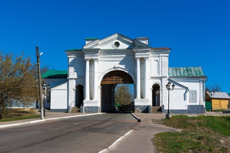
The outer town adjoined the citadel on its eastern and southern sides and contained most of the population. In the first half of the twelfth century, an earthen rampart and a palisade of pointed logs protected it. Two gates served the settlement: the Kursk, also called the Hlukhiv Gate, and the Chernihiv, also called the Water Gate. The later eighteenth-century outer enclosure had a polygonal plan, with its northern and southern sides longer than its eastern and western sides.
Later defensive enclosure
The eighteenth-century fortress had four principal gates. The Water Gate led toward the Desna, while the Ostrozhny, or Chernihiv, Gate and the Kursk, or Hlukhiv, Gate connected the enclosure with routes through the town. The Nativity Gate formed the fourth entrance. Later defenses also included stone walls and six towers, four at the corners and two flanking the town entrance.
The underground passage dug beneath the town in 1648 remains part of the fortress’s recorded defensive system, although its precise location is unknown. The surviving earthworks, ruined walls, and the fortress area within the monastery complex preserve elements of a site that changed repeatedly from a late tenth-century Kyivan Rus citadel into an early-modern fortified town.