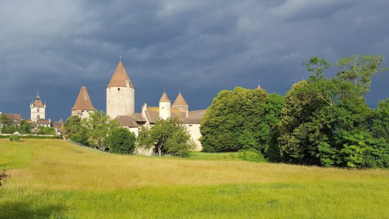
Rochefort Castle: A Medieval Stronghold Above the Val de Travers


Site at a Glance
- Rating
- 4.7
- Popularity
- Very Low
- Country
- Switzerland
- Primary era
- Medieval
- External website
- Open
- Eras represented
- Medieval
- Civilizations
- Holy Roman Empire
- Site type
- Military
- Remains
- Castle
On this page11 sections
History
Rochefort Castle is a medieval castle in Switzerland, built on a rocky promontory above the Neuchâtel lakeshore and the eastern entrance to the Val de Travers. Its medieval fortifications developed between the eleventh and fourteenth centuries, although the site had earlier prehistoric and Roman occupation. Rochefort controlled a route linking the Saône plains with the Swiss plateau and the Neuchâtel lakeshore, giving the castle strategic importance over several centuries.
Before the medieval castle
Bronze Age ceramics indicate occupation on the promontory, while a stone bearing cup-marks is probably protohistoric. Earlier Neolithic or Paleolithic use remains unconfirmed. Coins and Roman roof tiles show that the site was occupied during Antiquity, and a Roman structure has been identified, although its function is uncertain.
The location offered a commanding position over the trans-Jurassic route through the Val de Travers, a valley connecting the Saône plains with the Swiss plateau. The passage was especially useful to military forces and to the transport of salt. Rochefort probably became a fortified refuge during the Early Middle Ages, perhaps in connection with the important ancient and medieval settlement of Colombier below the site. By the late first millennium, the area lay within the lower Areuse basin, which had been incorporated into the Kingdom of Burgundy and Arles under the Rodolphian dynasty, the ruling house associated with that medieval kingdom.
The medieval lordship
A castle was erected at Rochefort and altered or enlarged at least three times between the eleventh and fourteenth centuries. The name Rochefort has been interpreted as meaning a fortified place on a rock. Its form, together with the possibility of occupation and fortification before the year 1000, has contributed to that interpretation, although the earliest written reference to the castle dates from 1294.
Humbert, a knight of Rochefort, is the first recorded member of the local lordly lineage. He appears as a witness to an act of 1180 associated with Montheron Abbey and seems to have been close to Ulrich II, lord of Neuchâtel. The genealogy of the Rochefort family remains uncertain, and people bearing the Rochefort name had disappeared from the record by 1268.
The lords of Neuchâtel had long been interested in Rochefort because of its position above the route. Their regional power was expanding, and they took control of the castle before 1294. Horseshoes, harness buckles, pieces of mail, and crossbow bolts, mostly dating from the thirteenth and fourteenth centuries, indicate that armed men were strongly represented at Rochefort during this period.
Coin production and the Neuchâtel succession
Around 1300, Rochefort was associated with the production of counterfeit coins. Blanks and a die intended to strike coins in the name of Philip IV of France, also known as Philip the Fair, were found at both the castle and Cotencher Cave below it. Philip IV ruled France from 1285 to 1314. The distribution of these objects suggests that Rochefort was probably the place where the imitations were made, while the cave served as a hiding place.
Near the end of his reign, Count Louis of Neuchâtel undertook major works at Rochefort, including the construction of a new residential building on the northern side of the enclosure. In his will, he created the lordship of Rochefort and Les Verrières. The lordship and castle ultimately passed to his illegitimate son, Vauthier.
A lengthy dispute then developed between Vauthier and his half-sister Isabelle, Louis’s legitimate daughter and the new countess of Neuchâtel. The conflict later involved Conrad, Isabelle’s heir. Conrad was the son of Egon of Fürstenberg, count of Freiburg im Breisgau, and Varenne, Isabelle’s sister, who had died childless. The Duchy of Burgundy and the city-state of Bern became involved because control of Rochefort was an explicit issue in the dispute.
Isabelle, envoys of the Duke of Burgundy, and later Conrad each seized the castle by force. Vauthier lost the conflict in 1411, was stripped of his possessions, and was arrested and executed at Neuchâtel in 1413.
Decline and rediscovery
After the succession dispute, Conrad made Rochefort a comital bailiwick, an administrative district governed on behalf of a count. The castle continued to be maintained because of its strategic position, but it was only lightly occupied until the middle of the fifteenth century. In 1470, during the Burgundian Wars, it was said to guard the passage of La Clusette. Its fortifications lacked adaptations for artillery, however, suggesting that it could not serve as a major military position in that period.
During the fifteenth century, Môtiers Castle received major military investment and became the principal defensive point for the Val de Travers and the Burgundian road. Rochefort consequently lost its castle-fortress functions and was abandoned during the century. A document describes it as ruined in 1512.
The location of the castle remained known after abandonment. It appeared on an eighteenth-century map, and David-Guillaume Huguenin discussed it in his 1843 book on the castles of Neuchâtel. Local treasure seekers carried out the first field operation in 1861, exposing the ruins with help from villagers. Pastor James Lardy conducted an initial excavation in the summer of 1862. Later investigations, extending from the late nineteenth into the twentieth century, often concentrated on clearing the site or searching for objects rather than on systematic architectural study.
Since 2017, the Association of Friends of Rochefort Castle has supported a project to enhance and investigate the site. Official archaeological excavations took place in 2018 and 2019 in collaboration with the universities of Neuchâtel and Lausanne and the Neuchâtel Office for Heritage and Archaeology. The campaigns also served as training excavations. They examined the castle’s origins, the sequence of construction visible in the masonry, and the functions of its rooms. Study of the remains continues, so the reconstruction of the castle’s phases remains open to revision.
Remains
Promontory and fortifications
The ruins occupy the summit of an oval rocky promontory at an altitude of 805 metres, above the Neuchâtel lakeshore and at the top of the cliffs of the Areuse Gorge. The position provided both natural defense and a level area for a fortified complex. The surviving masonry belongs to medieval buildings, and the reconstructed plan shows an initial arrangement that was modified and enlarged in the thirteenth century and again in the fifteenth. Several building phases remain visible in the ruined walls.
Enclosing wall
An enclosing wall surrounded the castle buildings, following an irregular line imposed by the shape of the promontory. Its full course and thickness are difficult to determine because sections of the outer facing collapsed down the slope. The wall’s orientation, together with the internal access route, restricted a flanking approach. The northern walls are more readily visible and form an advanced defensive line associated with a later construction phase, identified through differences in workmanship.
Before clearance began ahead of the recent excavations, only a few stones belonging to a tower could be seen. Further work exposed numerous stretches of masonry and revealed the extent of the fortifications. Removing the earth and rubble left many walls unstable, particularly in rain and frost. A restoration specialist secured the standing elevations and stabilized the remains while attempting to retain the original appearance of the ruins as they were uncovered.
Entrance and internal arrangement
The castle had a south-facing entrance. From the first major modification onward, a walled forecourt appears to have stood before the main gate. The gate opened onto the principal courtyard, with the seigneurial stronghold immediately to the right. A residential building and chapel occupied the rear of the courtyard, while a viorbe, an architectural feature whose precise function is not specified, stood at the northern end.
An internal route ran from north to south along the eastern face of the promontory and was partly cut into the rock. This route formed the main circulation line within the irregular enclosure and worked with the enclosing wall to limit access along the exposed sides of the site.
Seigneurial stronghold
The seigneurial stronghold occupied the highest point of the promontory. This was the part of the castle reserved for the lord, containing principal residential and defensive spaces. Its quadrangular plan measured 14 by 17 metres, and walls about 1.2 metres thick enclosed the interior. Partition walls divided the space.
The stronghold contained an aula, the principal hall of a medieval lordly residence, a lord’s courtyard, and a square refuge tower. The tower measured 6.5 metres on each side and had walls approximately 1.6 metres thick. A refuge tower provided a strongly built place of retreat within a fortified complex. The arrangement resembles strongholds at Grandson, Môtiers, Gorgier, Colombier, Vaumarcus, and Boudry. An earlier layout opened onto a court and was later replaced by a roofed construction, a change indicated by additional partition walls that remain visible.
Northern residence and chapel
A second residential building stood at the northern end of the enclosure. Its walls were thinner than those of the seigneurial stronghold. By the end of the fourteenth century, the remains indicate two separate residential buildings, one intended for the lord and the other for the castellan, the official who administered or defended a castle for its lord.
The northern residence included a chapel. The counts also had a viorbe built there, an arrangement interpreted as an indication that this building served as the count’s residence.
Nearby sites