Doonagore Castle: A Sixteenth-Century Irish Tower House in County Clare
Site at a Glance
- Rating
- 4.6
- Popularity
- Very Low
- Country
- Ireland
- Primary era
- Early Modern
- Eras represented
- Early Modern
- Civilizations
- Irish
- Site type
- Military
- Remains
- Castle
On this page7 sections
History
Doonagore Castle is a sixteenth-century Irish tower house near Doolin in County Clare, Ireland. Its present structure probably dates from the middle of the sixteenth century, although the site had earlier phases of use and construction. Standing in the townland of Doonagore, in the parish of Killilagh, the castle is one of only three cylindrical tower houses associated with the Burren, alongside Newtown Castle and Faunarooska Castle near Fanore.
Earlier origins and O’Brien ownership
The name Doonagore may come from an Irish expression meaning either “fort of the rounded hills” or “fort of the goats.” During the fourteenth century, Tadhg, or Teigue, MacTurlough MacCon O’Connor built a castle on or near an earlier ringfort, a circular fortified settlement or enclosure common in early medieval Ireland. The existing tower probably followed or replaced these earlier building phases.
In 1570, Doonagore belonged to Sir Donald, or Donnell, O’Brien. Brian MacCahill O’Connor occupied the castle in 1582. The following year, the Crown took control of much of the surrounding property and granted it to Turlough O’Brien of Ennistymon. The castle later passed to the MacClancy, or Clancy, family, whose members were hereditary brehons, traditional Irish legal authorities, of the O’Brien dynasty.
The Spanish Armada and the 1641 rebellion
In September 1588, a ship from the Spanish Armada was wrecked below the castle. The Armada was the large Spanish naval expedition sent against England that year. Boetius Clancy, the High Sheriff of Clare, captured 170 sailors and soldiers who survived the wreck. They were hanged at the castle or on the nearby Iron Age barrow known as Hangman’s Hill.
During the rebellion that began in 1641, the flag of the Irish Confederation was raised over Doonagore. The Confederation was a Catholic political and military alliance formed during the conflict. After Cromwellian forces suppressed the rebellion and seized the castle, it was granted to the army officer John Sarsfield under the Cromwellian settlement, the redistribution of Irish land and property after the Parliamentarian campaigns.
Gore ownership and twentieth-century restoration
The Gore family acquired Doonagore in the late seventeenth or early eighteenth century, giving rise to the alternative name “Gore’s Castle.” The family repaired the building in the early nineteenth century, but it had fallen into disrepair again by 1837.
Architect Percy Le Clerc restored the castle during the 1970s for John C. Gorman, an Irish-American purchaser. Gorman’s family continues to own the property, which is maintained as a private holiday home and is not open to the public.
Remains
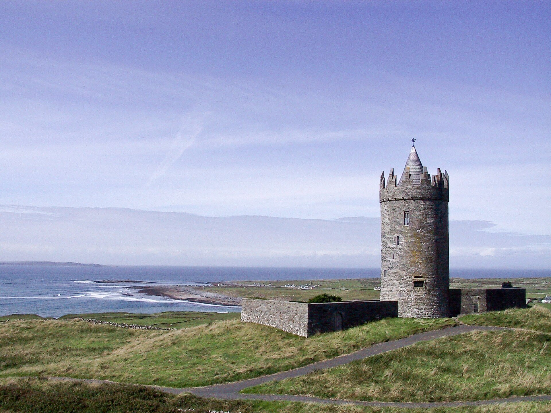
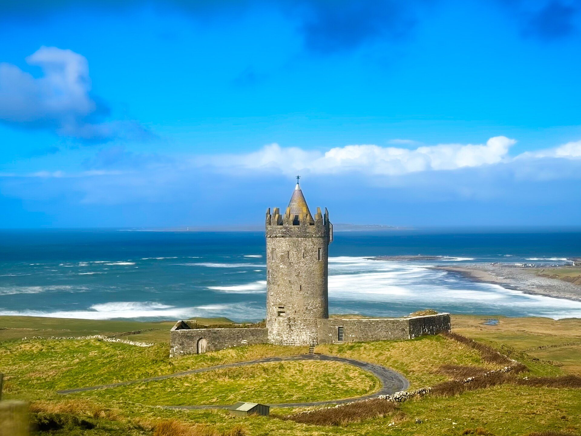
Doonagore consists of a round, cylindrical tower house accompanied by a small walled enclosure, or bawn. The tower rises above a hill overlooking Doolin Point and the coastal village of Doolin. Its restoration preserved the surviving tower and a fragment of the surrounding wall, while the property remains privately maintained.
The cylindrical tower
The tower has four floors above ground and a cellar. Stone vaults separate the levels, including a beehive vault between the first and second floors. The entrance was defended by a machicolation, a projecting opening through which missiles or other materials could be dropped onto attackers below. This defensive feature connected with the wall walk.
Unlike the limestone commonly used for tower houses in the region, Doonagore is built mainly from sandstone. The sandstone came from the Trá Leachain quarry, also known as Flaggy Beach, about two kilometres away. Some decorative elements were carved from limestone.
The bawn and coastal setting
A small bawn surrounds the tower, with a surviving fragment of its wall forming part of the remains. The castle’s elevated position overlooks the coast and makes it visible from the Atlantic. Together with a nearby higher radio mast, it serves as a navigational landmark for boats approaching Doolin Pier.